Poznań is Poland’s fifth largest city, located in the west of the country. Established in the 10th century, the original settlement was on the island of Ostrów Tumski, which sits between branches of the Warta River.
Friday, 4th July 2014
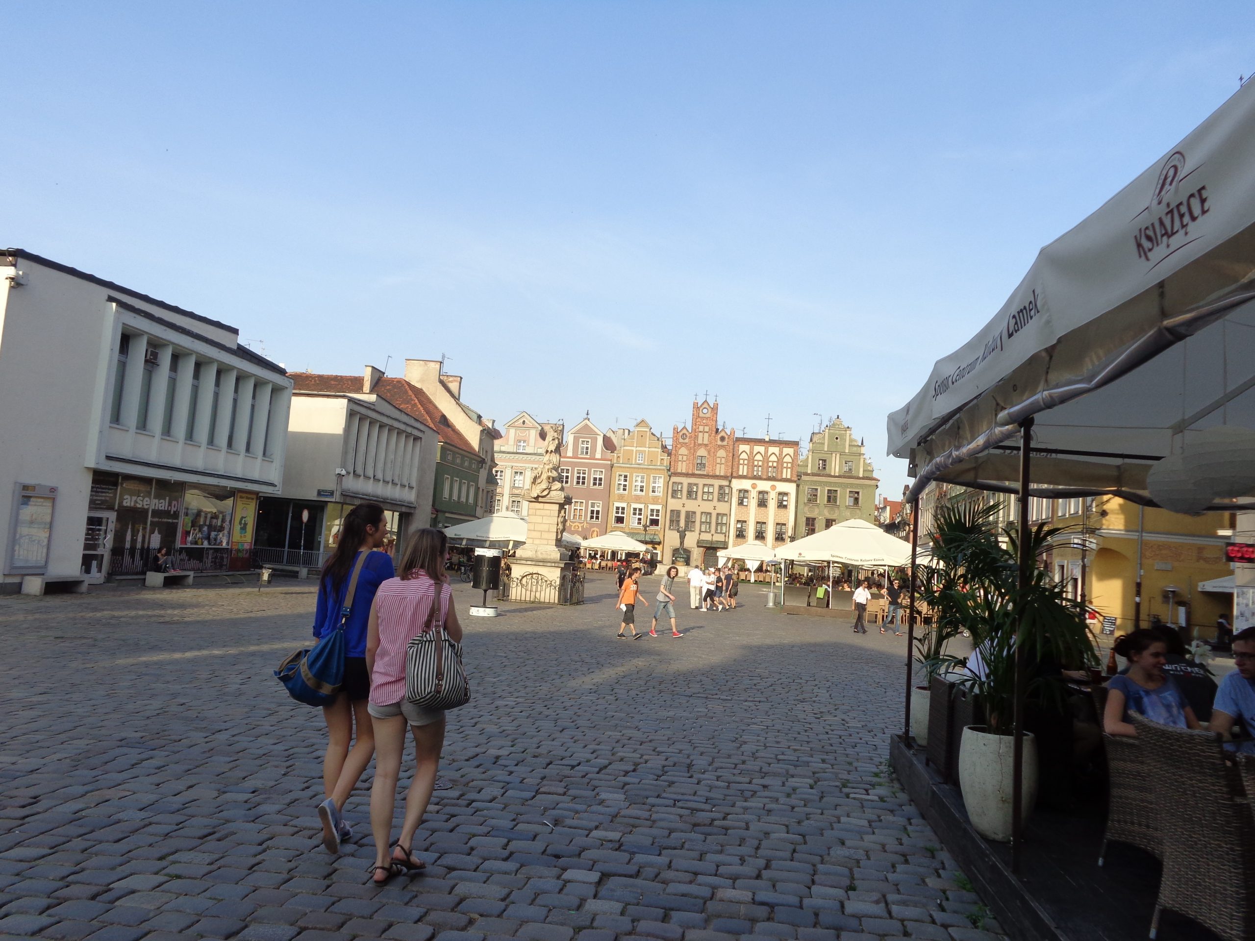
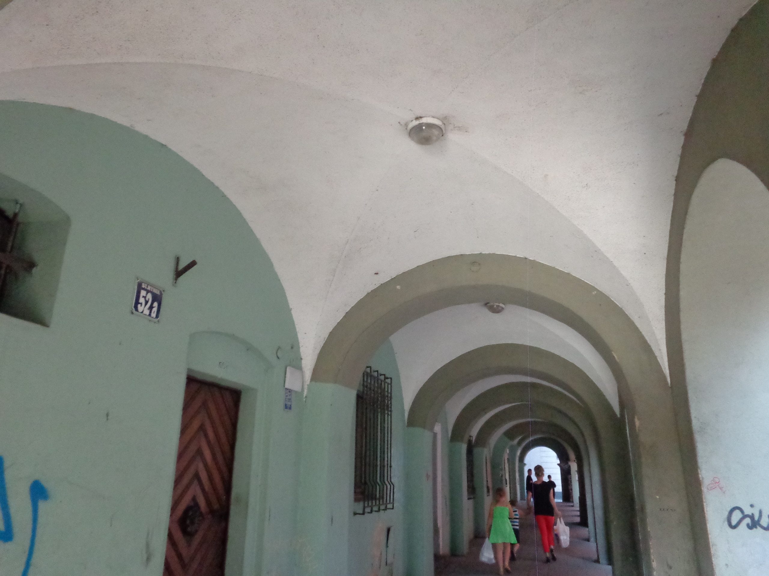
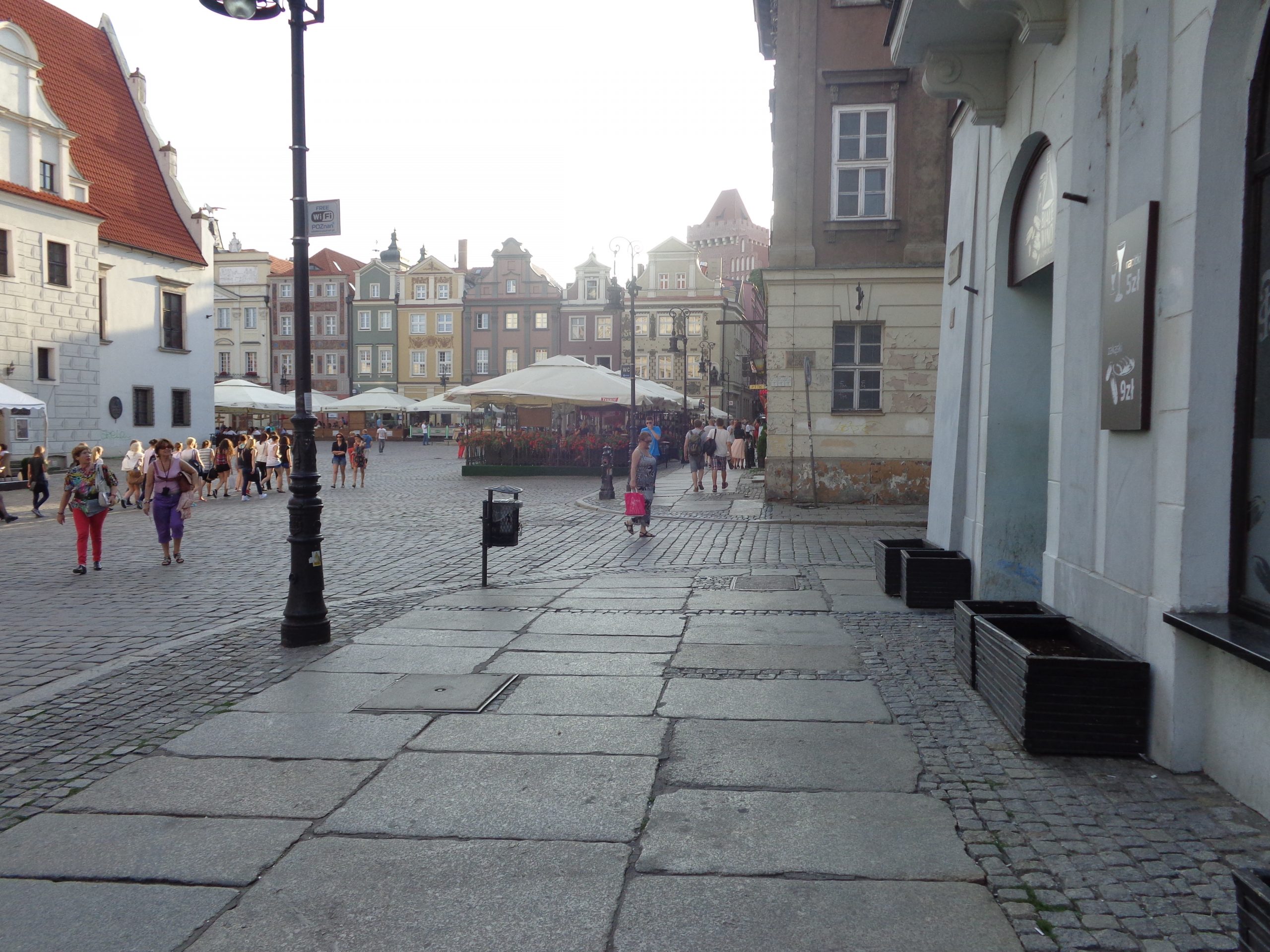
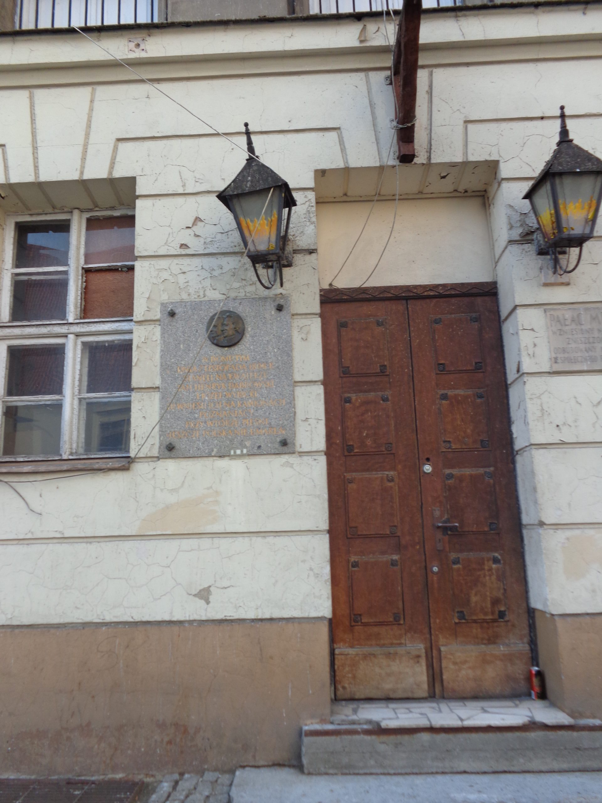
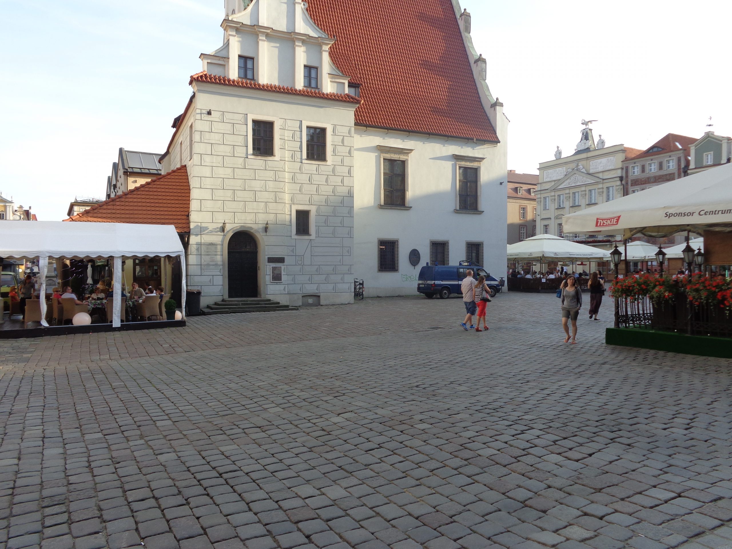
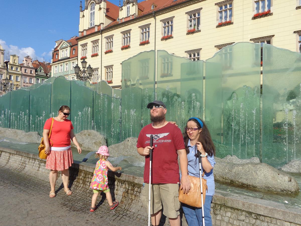
View from an upper storey window or balcony across the roofs of Poznań’s historic Old Town neighbourhood, which dates back to 1255. A courtyard down below. In the middle distance, the main tower of Poznań Fara church (also known as St Stanislaus Church). This large church was built between 1651 and 1701 in Baroque style.Looking along Ludgardy street on the west side of the Old Town. To the right is the monument to the 15th Poznań Lancers Regiment. This regiment fought the Bolsheviks in 1920 and also during the Second World War as part of the Poznań Army. The original monument was unveiled in 1927, but was later destroyed during the Nazi occupation. A replacement was erected in 1982. The stone monument consists of a stone column topped with a soldier on horseback slaying a dragon using a lance. Further to the right part of the Franciscan Church can be seen. This Baroque church was built between 1674 and 1728. Also in view, away in front, is a crenellated stone tower, part of the 13th century Royal Castle. The castle was largely destroyed during the Second World War but has since been partly rebuilt.Another part of the yellow-painted Franciscan Church visible to the left of this picture. The exterior of the church is relatively plain, while the interior is much more elaborate. In the centre, a more modern building housing a clothes shop.The south side of Old Market Square (Stary Rynek). This large square is located in the Old Town neighbourhood. There is a substantial block of buildings situated in the centre of the square, including the Old Town Hall, which is considered by locals to be the centre of the city. The sides of the square all measure approximately 140 metres (460 feet) in length. In front is a statue of St. John of Nepomuk dating from 1724. St. John of Nepomuk (c.1345 to 1393) is the saint of Bohemia. It is said that he was drowned in the Vltava River, on the orders of King Wenceslaus of Bohemia, because he refused to divulge details of the queen’s religious confessions. The statue was built in the hope St. John would protect the city from flooding.Under a long colonnade running down the front of a building on Wodna street. The street runs east-west from the south-west corner of Old Market Square.Tony next to a near life-sized model of a bull standing outside a restaurant.In Old Market Square looking towards the front façade of the Old Town Hall. This impressive building has a substantial tower in the centre of its roof along with three domed turrets along the front. The edge of the roof has ornamental crenellations. Lower down there is an ornately decorated three-storey arcade loggia (a covered gallery within the building but open to the square in front). There is a central clock with a display of mechanical fighting goats above (not clearly visible in the photo). The building was originally built in the 13th century after the founding of the medieval town in 1250. It was rebuilt in its present form between 1550 and 1560 by Giovanni Batista di Quatro. It served as the seat of local government until 1939 and today houses the city museum.View down a side street (Wielka street) heading into the north-east corner of Old Market Square. The central tower of the Old Town Hall visible above. Underfoot are large cobble stones (setts).At the north-east corner of Old Market Square. Part of the Old Town Hall is in view along with an adjoining row of former merchants’ houses, dating from the 16th century, and now painted in a range of colours and patterns. Many of these narrow but quite tall buildings (mostly three storeys) now contain souvenir shops.Again in Old Market Square with the old town Weighing House (Waga Miejska) on the left. It is located behind the Old Town Hall in the centre of the square. The Weighing House was first built in 1532 to 1534, reconstructed in 1563, and later demolished as unsafe in 1890. It was then replaced by a Renaissance-style “New Town Hall”, which was used by the city government until it was heavily damaged in 1945. It was again rebuilt in its former style in 1950–1960, based on surviving prints, and is now used for weddings and other events. It is a two storey building with a very high gable roof.View along the north edge of Old Market Square. A block of outdoor café and restaurant tables in front. The building immediately to the right (only the ground floor visible) is the Mielżyński Palace. It dates from 1795 to 1798 and is in the classicist style. The three-storey front façade is relatively plain.The front door of the Mielżyński Palace. It has a simple geometric design with rectangular panels on the two wooden doors. Like the rest of the building, it is classicist in style, drawing on the architecture of ancient Greece and Rome.Looking into Old Market Square with the side of the Weighing House directly in front.Old buildings down the west side of Old Market Square painted in various subdued colours. In front, and just visible, one of four fountains that stand in each corner of the square. This one depicts the Roman god Mars.Freedom Square (Plac Wolności) with Freedom Fountain directly in front. Freedom Square is a large rectangular shape (85 by 205 metres) and is located just west of the historic Old Town. The Freedom Fountain has two 10-metre long metal wings raising over a shallow pool. A footbridge passes between the wings through the centre of the circular pool. The fountain was completed in 2012.
Saturday, 5th July 2014
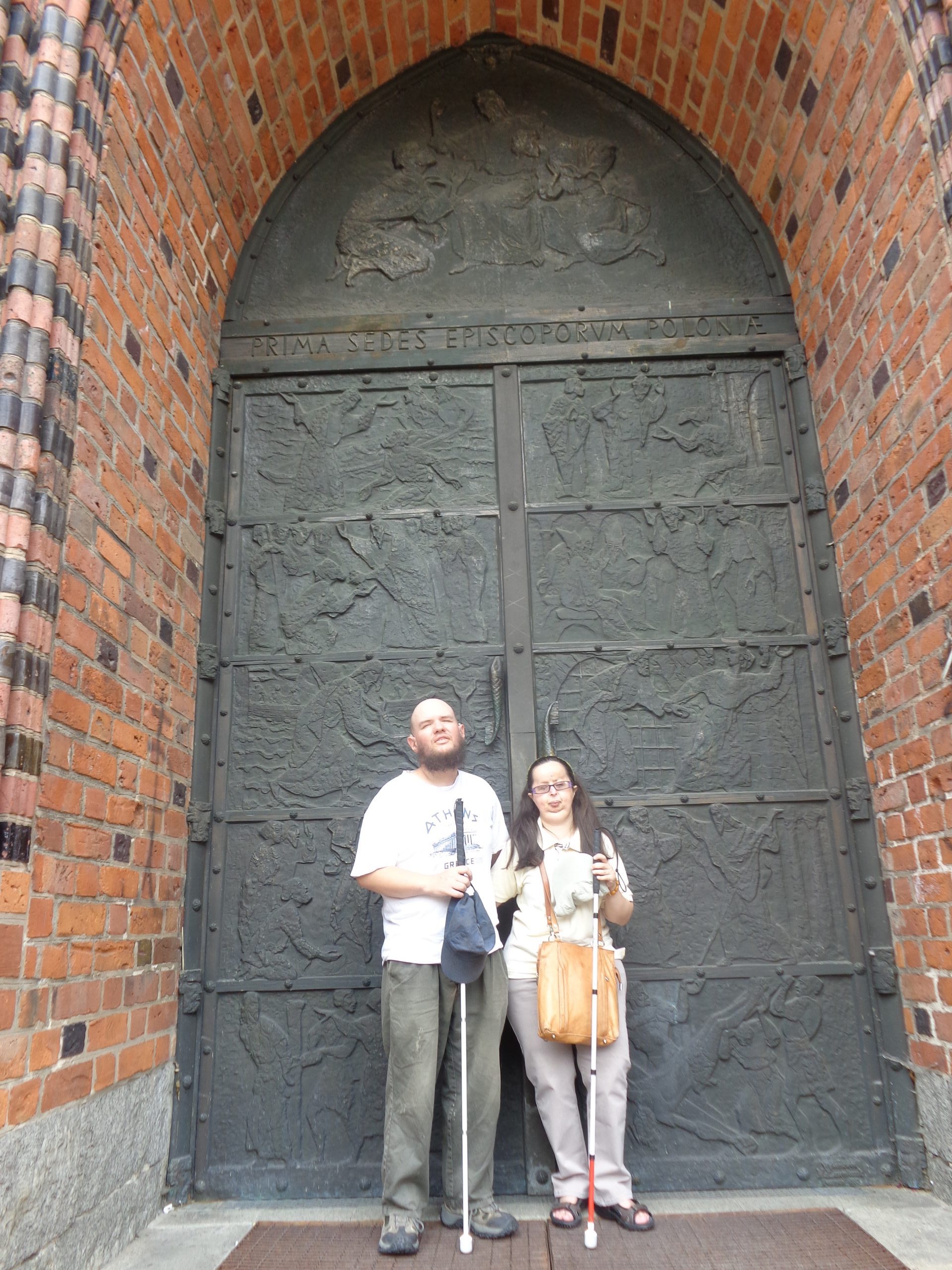
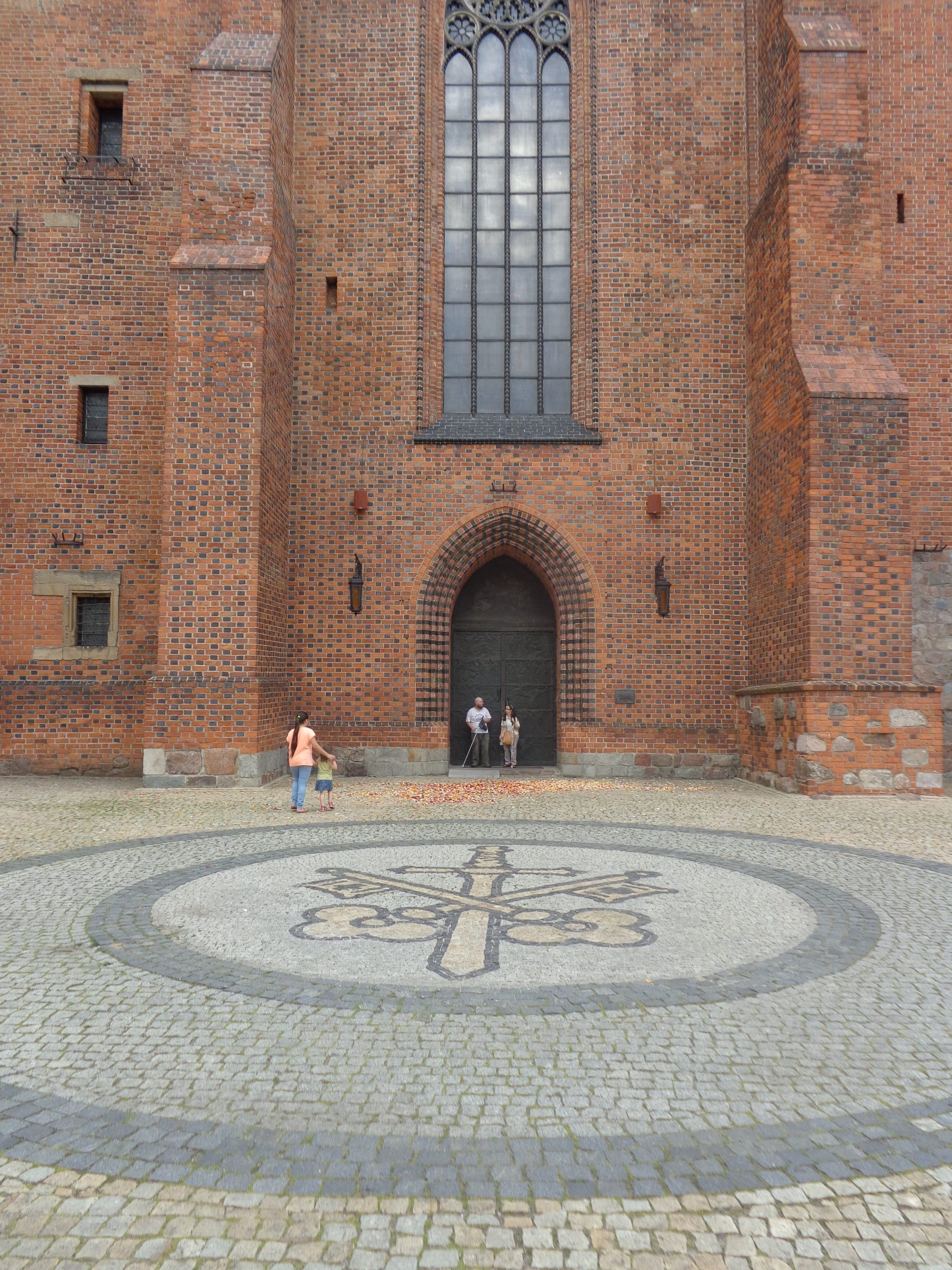
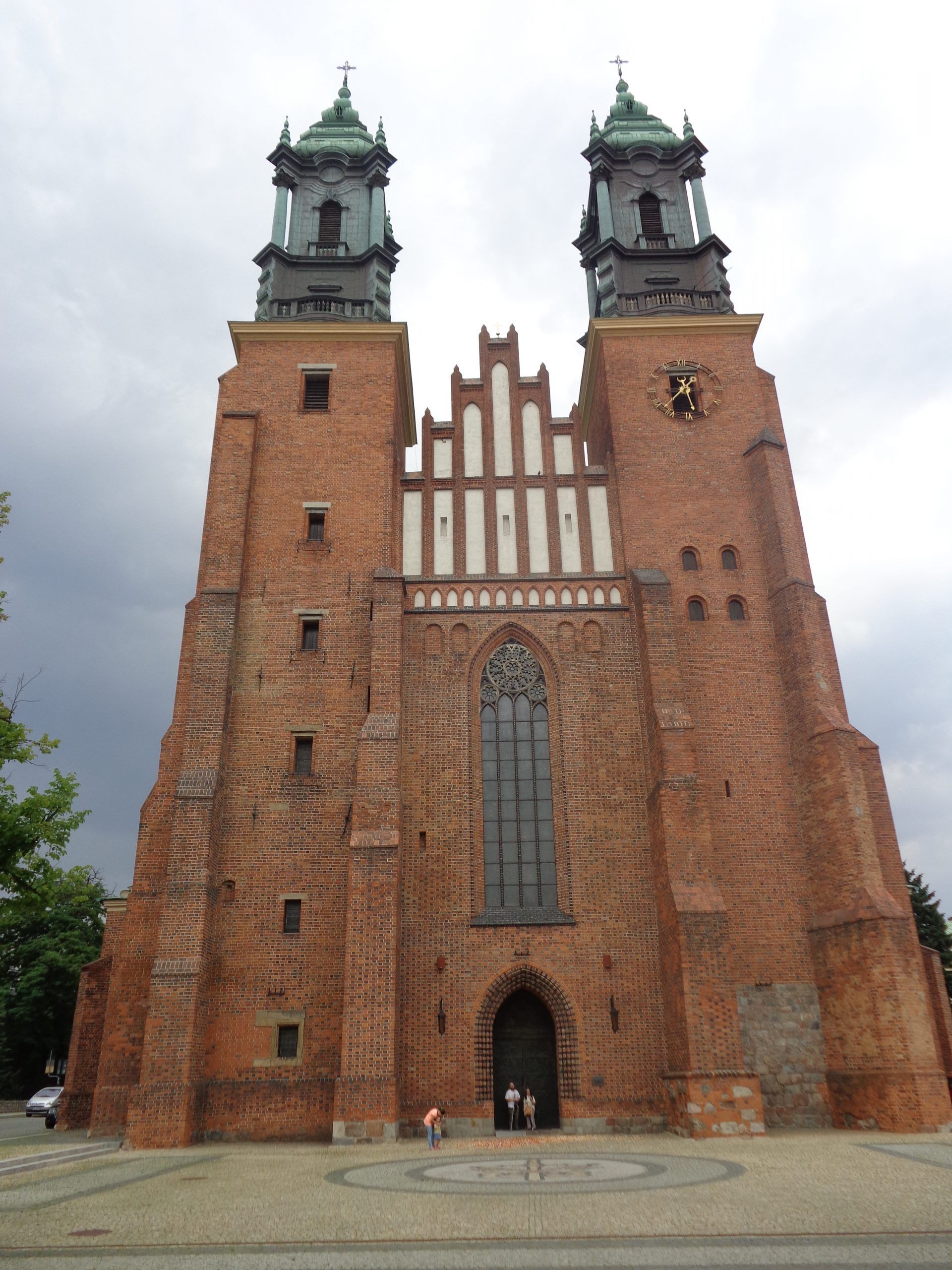
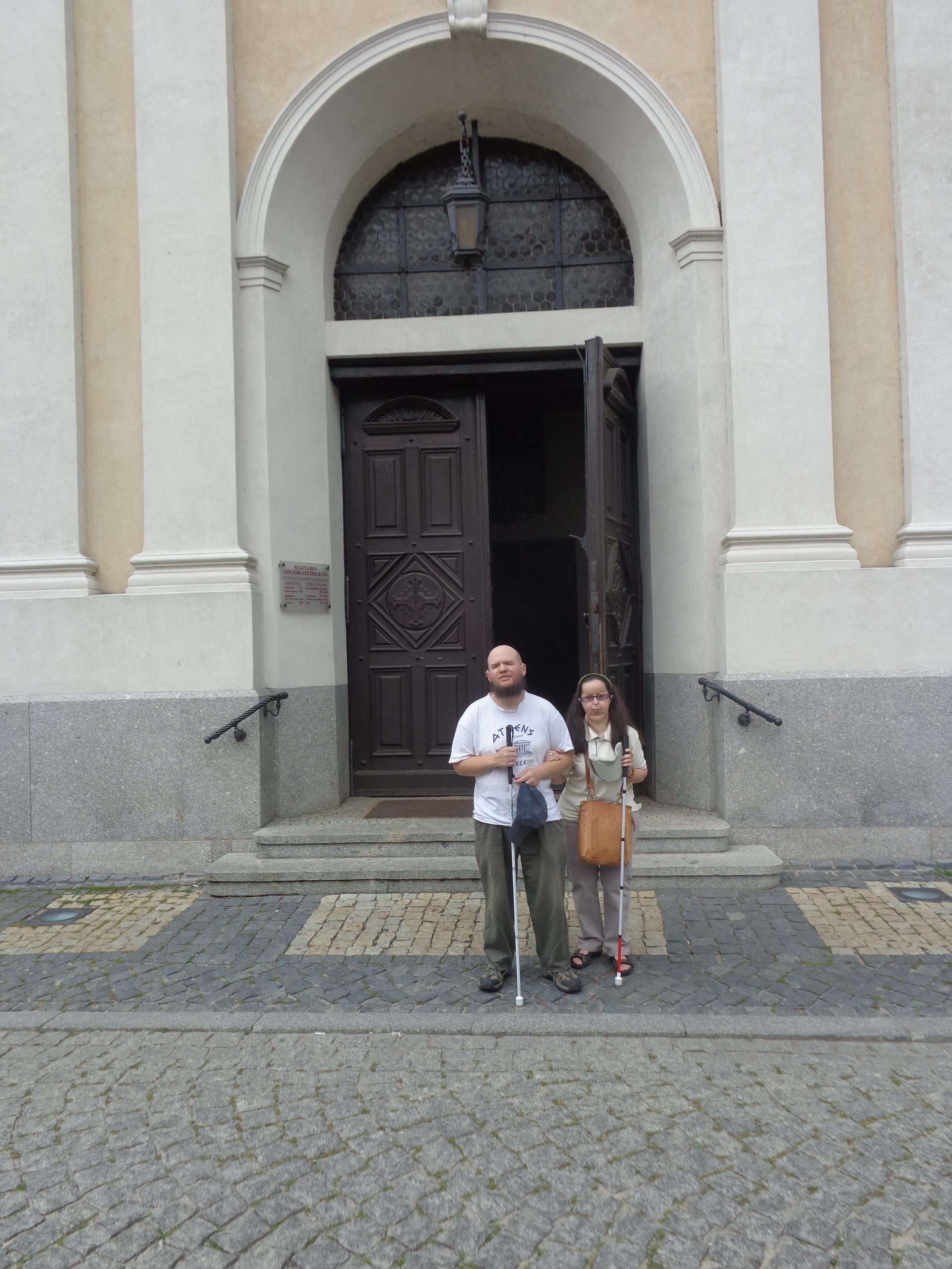
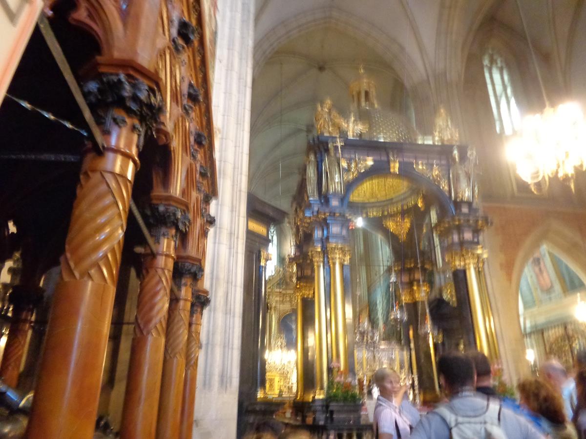
View across the east side of Old Market Square. On each side of the square are tall rows of former tenement houses (kamienice), many of which have been colourfully painted and converted into restaurants, cafés and bars. In the foreground, a pair of horses pulling a cart are emerging from the left, and to the right a row of outdoor café tables.Another view of the former merchants’ houses in the centre of the square showing the various colours and patterns in which they have been painted. The ornate Old Town Hall part visible to the right.The tower of the Old Town Hall dominating the centre of the square. The tower is topped by an eagleThe west side of Old Market Square. In the foreground, another of the square’s four fountains. This one has a bronze sculpture of Neptune in the centre. It was unveiled in 2004 replacing an older lost fountain.Another view of the Old Town Hall and surrounding buildings in the centre of Old Market Square.Tony and Tatiana outside the large main doorway to Poznań Cathedral (officially named the Archcathedral Basilica of St. Peter and St. Paul). The pair of metal doors are embossed with Biblical scenes. The cathedral is located on Ostrów Tunski “Cathedral Island”, north-east of the city centre, and the location of the city’s original settlement.The lower part of the cathedral’s red brick front (west) façade. A cathedral first stood on this site in the second half of the 10th century. The church was subsequently damaged or destroyed and then rebuilt several times over the following centuries. The last destruction was caused by a serious fire in 1945 during liberation of the city from the Germans. It was then restored in Gothic style and reopened in 1956.Full view of Poznań Cathedral’s front façade. A pair of substantial towers on either size and the entrance in the centre. Tony and Tatiana just visible away in front of the entrance doorway.Tony and Tatiana outside another entrance on the south side of Poznań Cathedral. Wooden doors with a white and cream rendered surround.Another view of Old Market Square during the evening. Lots of people dining at outdoor tables.
Gdansk
Gdansk is Poland’s principal seaport and fourth largest urban area. Located on the Baltic Sea in the north of the country, the city is at the mouth of the Motława river on the southern edge of Gdansk Bay.
Monday, 7th July 2014
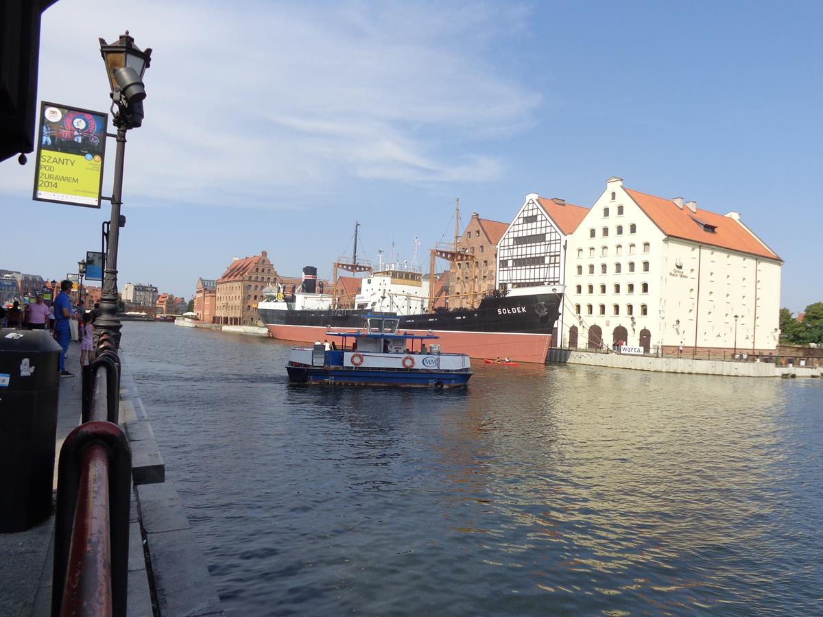
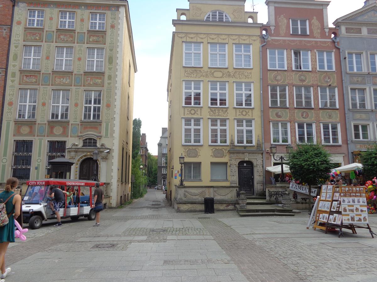
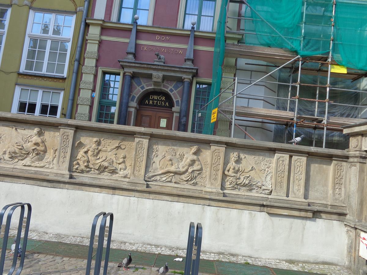
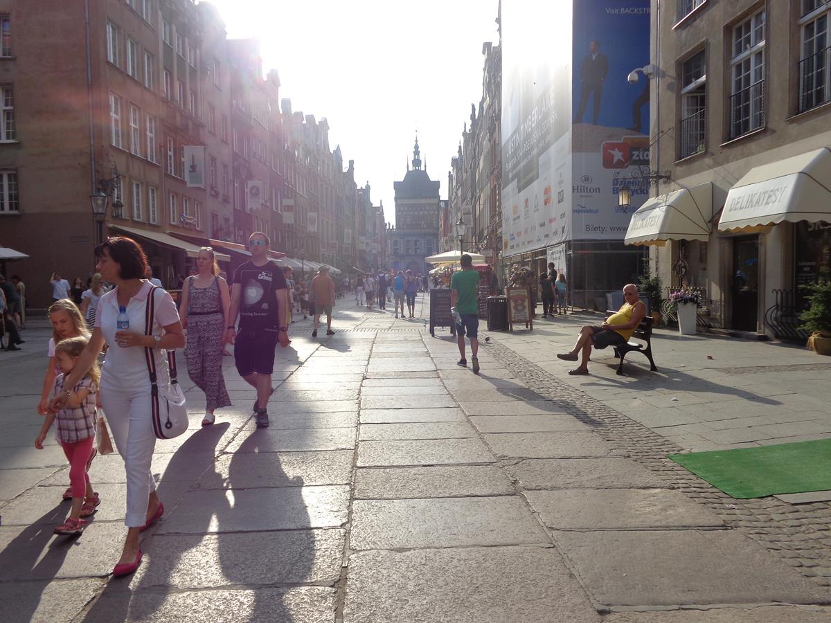
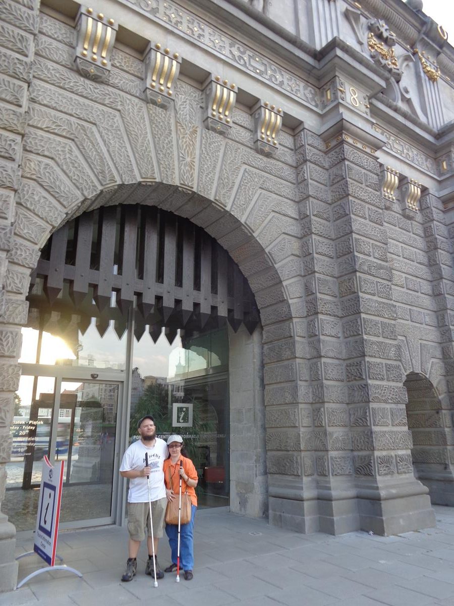
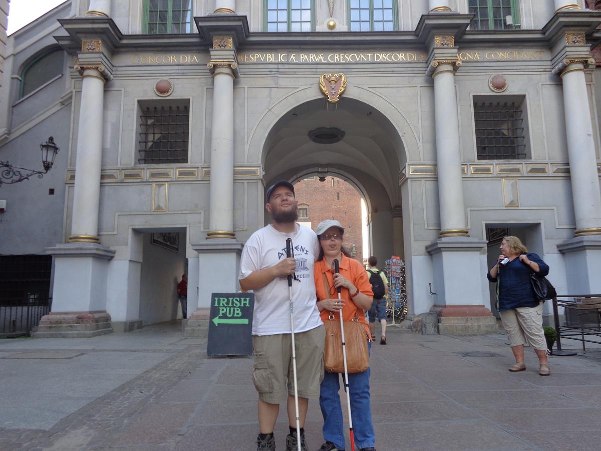
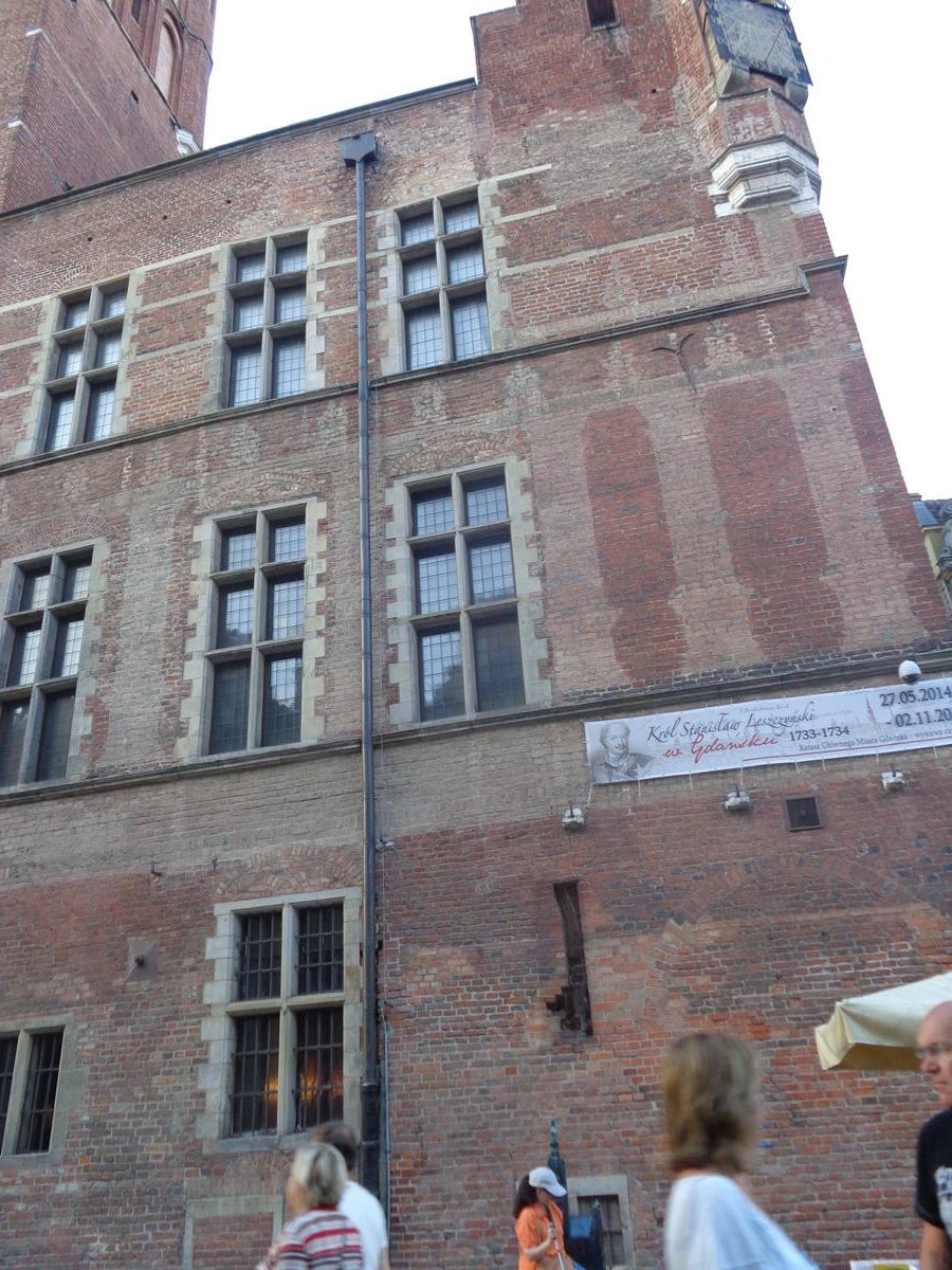
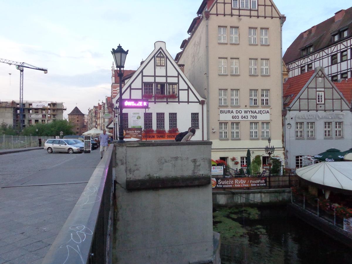
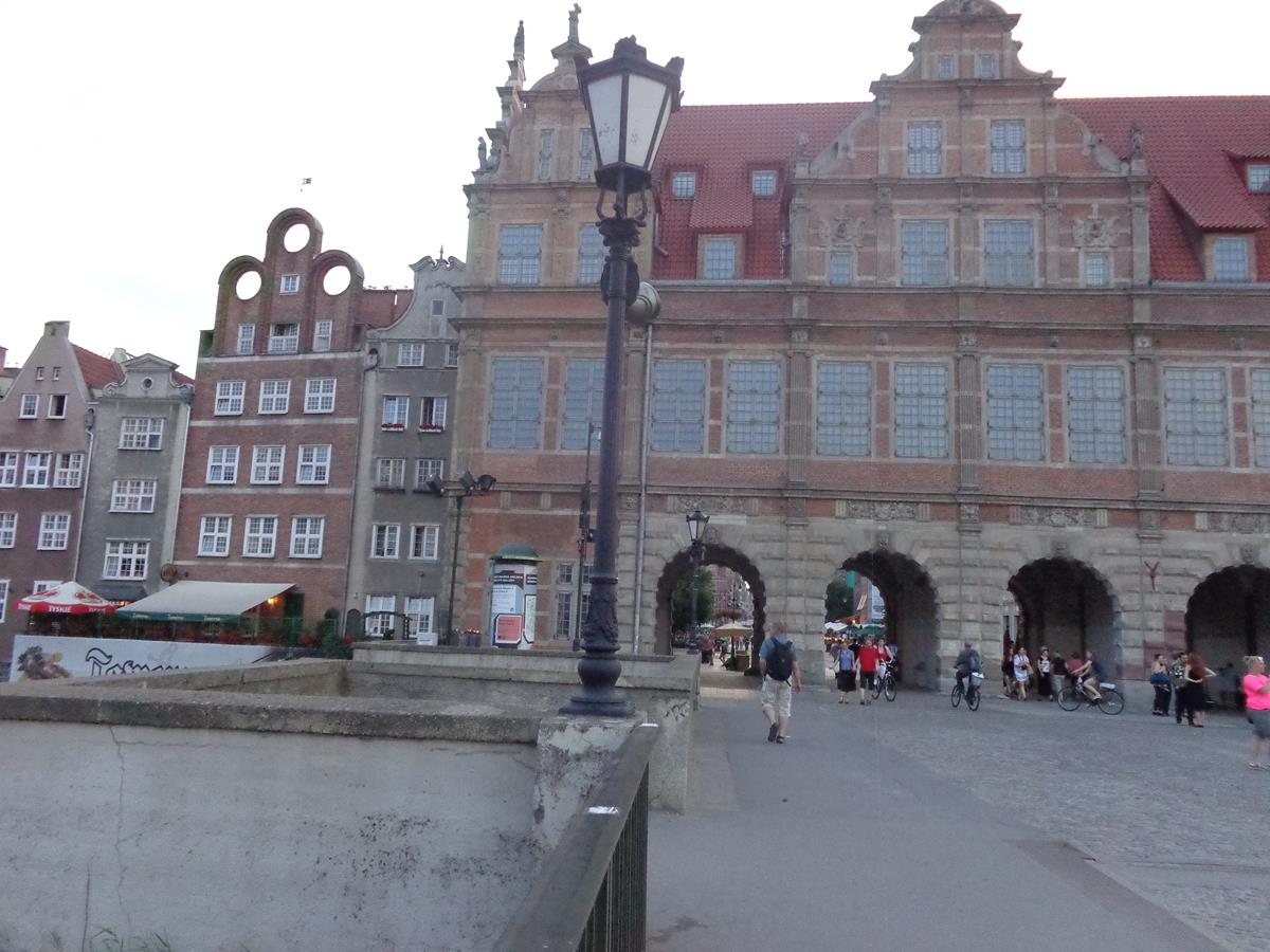
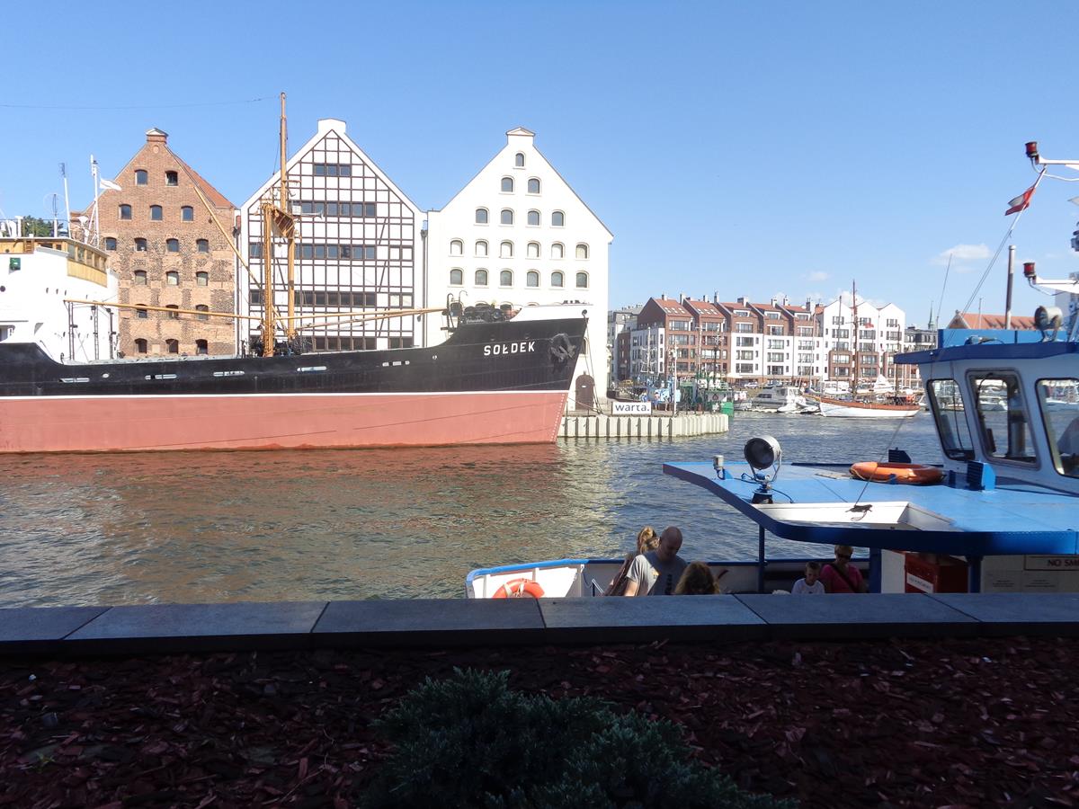
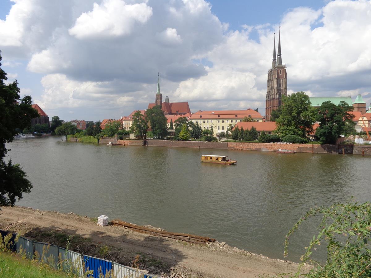
View across the Motława river with two prominent buildings on the opposite bank. On the left is the Polish Baltic Philharmonic, a concert hall, which is housed in a former power station. It was constructed in 1897-1898 with a brick neo-Gothic facade. It closed as a power station in 1996. On the right, a historic granary dating from the 17th-century, and now converted into a hotel. It is built of brick with lots of small windows. These buildings are located on the island of Ołowianka, which is formed by the Motława river and the Stepka channel.More historic buildings visible across the Motława river on Ołowianka island. These are old granaries that are now part of the National Maritime Museum. In front, with only the bow end in view, is the SS Soldek. This was the first ship built in post-World War II Poland. It is a cargo ship built for transporting coal and ore, which is today preserved here, again as part of the National Maritime Museum.St John’s Gate (Brama Świętojańska). This is one of Gdansk’s historic water gates, originally built at the end of the 14th century, but rebuilt in the 19th century, and then destroyed during World War Two. It was rebuilt again during 1976-1978 in the classicist form of the previous 19th century gate. The entrance to the central arched passage through the gate is in view.View through St John’s Gate with the Motława river and part of the SS Soldek visible at the far end.Again the façade of St John’s Gate. The walls are a mixture of brick and red-painted rendering. The building is three-storeys high with a tall tiled roof. An interesting wooden doorway can be seen with carved wooden panels and decorative metalwork in curved geometric patterns.Looking across the Motława river with the SS Soldek opposite. Beyond is a marina where lots of small vessels are moored.The Crane or Crane Gate (Brama Żuraw). This interesting riverside building is a water gate but with a medieval port crane attached to the front. It is the largest and oldest surviving port crane in Europe. It is made up of two substantial brick towers with the wooden lifting mechanism in between. The oldest documented mention of the crane is in 1367. The present structure dates from the middle of the 15th century following a major fire. More recently there was extensive restoration due to damage inflicted during World War Two. The structure is now part of the National Maritime Museum.View back north along the Motława river with the historic granaries and SS Soldek on Ołowianka island in clear view.Walking along the riverside promenade known as Długie Pobrzeże (Long Embankment). On the right is the 15th century St Mary’s Gate (Brama Mariacka). This is one of the grandest of Gdansk’s city gates, built in Late Gothic style, with octagonal towers at both ends of its river-facing east façade. Its arched gateway leading from the riverside promenade to Mariacka street is asymmetrically placed towards the south side of the building.A little further along the riverside promenade with the red brick St Mary’s Gate still in view. Closer to the camera is part of the House of the Natural Society. This tenement house was built between 1597 and 1599 in Mannerist style for merchant Hans Koepe. Its impressive river-facing east façade includes a five-storey bay window and a cuppola-topped tower rising to around 36 metres.Now approaching Green Gate (Brama Zielona). This wide four-arched riverside city gate was built between the years 1564 and 1568 in Dutch Mannerist style. It connects the Long Market (Długi Targ) with the Green Bridge over the Motława river. It is at the end of the Royal Route so-called because it was formerly the route of royal processions. Today Green Gate houses the National Museum in Gdansk.Looking under one of the arches of Green Gate with Long Market at the far end.At the Long Market side of Green Gate. Lion’s heads decorate the top of the arches. A row of large windows in the storey above.Looking from the south-east end of Long Market (Długi Targ). This long narrow square was formerly the main city market. It is lined with historic buildings, many dating from between the 16th and 18th centuries, once the homes of the most wealthy city residents. Most buildings here today were destroyed during World War Two and have been rebuilt in their original styles.View up Long Market with Gdansk Town Hall standing prominently at the far end: its 81-metre high clock tower dominates the surrounding area. The town hall is Gothic-Renaissance in style. It was first built in the late 14th century with much expansion and rebuilding over the proceeding centuries. Like many buildings in the city it was heavily damaged during World War Two. The subsequent reconstruction was completed by 1952.An alleyway off Long Market with attractive historic tenement houses at either side.The lower stone part of Neptune’s Fountain located in Long Market (Długi Targ) with surrounding metal railings. Constructed around 1633, this Mannerist-Rococo fountain is one of the city’s main landmarks. The stone base was designed by Abraham van den Blocke while the bronze figure of Neptune is by sculptors Peter Husen and Johann Rogge.Another view of the stone base belonging to Neptune’s Fountain. The carvings that can be seen include fishes and cherubs. The bronze sculpture of the Roman sea god is out of shot, but the stone pedestal beneath is visible.A wall with stone panels depicting classical scenes close to Neptune’s Fountain. Behind is Artus Court (partly obscured by scaffolding). This Dutch Mannerist building dates from the 14th century with the current façade constructed between 1616-1618 by Abraham van den Blocke.Tony and Tatiana outside the main west entrance to St Mary’s Church, officially known as the Basilica of the Assumption of the Blessed Virgin Mary. Built during the 15th century in Gothic style, this imposing structure is the second or third largest brick church in the world.Another view of the west entrance of St Mary’s Church showing part of the large bell tower that rises directly above to a height of 80 metres.An old wooden doorway: a side entrance into St Mary’s Church.A tactile model of St Mary’s Church. The model shows the main tower and five smaller spires that also adorn the church.View along the aisle inside St Mary’s Church with wooden pews at the sides. The main altar is at the end with a colourful stained-glass window above. A raised pulpit is also visible to the left.Looking down Long Street (Długa), a busy pedestrian street, with Golden Gate (Złota Brama) and Prison Tower (Wieża Więzienna) both just in view at the far end. The turret on top of the tall Prison Tower is the most visible feature.View along Tkacka street (Weavers’ street). A top-hat wearing man is in the foreground playing a barrel organ. At the far end of the street, one of the corner towers of the Great Armoury can be seen. The tower is topped with a green cupola. The Great Armoury is one of the finest examples of Dutch Renaissance architecture in Poland.Shot through the central arch of Golden Gate (Złota Brama). This Dutch Mannerist gate was designed by architect Abraham van den Blocke and was constructed between 1612 and 1614. It replaced an older 13th-century Gothic gate. It forms part of the old city fortifications and is part of the Royal Route.In front of Prison Tower. This tall tower was originally built in the 14th century as part of the city fortifications. It was rebuilt around 1594 by Antoni Van Obberghen. When it lost its defensive importance in the 17th century it was converted into a prison. Today it houses the Amber Museum.On the left, High Gate (Brama Wyżynna), also known as Upland Gate, located beyond Prison Tower when approaching from Long Street (Długa). This 16th-century gate was the original start of the Royal Route. It is built of stone in Italian Renaissance style.Tony and Tatiana at the main entrance to High Gate, which today houses the Tourist Information Centre.A building belonging to the National Bank of Poland opposite High Gate. An interesting doorway is just visible. Above the doorway is a stone lintel apparently supported by a pair of carved mythological figures: one male and the other female (an atlas and caryatid).Tony and Tatiana with Golden Gate behind.A closer view of Gdansk Town Hall. Details in view include a Gothic spire in the far visible corner of this very large brick building and high up in the nearest corner a sundial.Looking up at Gdansk Town Hall. The building has three main storeys, but above this there are towers, turrets and spires, including the massive main clock tower rising to 81 metres.Tony and Tatiana standing next to a large tactile metal model of Gdansk Town Hall.A street stall possibly selling sweets on Long Market (Długi Targ). The area beyond is busy with people.The lower part of Long Market taken at dusk with Green Gate ahead. There are historic buildings along both sides, some painted in pale pastel colours. The buildings are mostly around five storeys high and in some cases have statues or other ornamentation at roof level.A closer view of Green Gate showing the row of four arches that allow people to pass through the building. The gate is constructed out of stone and there are red tiles on the roof. There are four storeys including the ground floor arches and two levels incorporated into the tall and steep-sided roof.Looking through one of Green Gate’s arches with Long Market at the other end. A carved lion’s head immediately above and slightly higher a stone relief with an historic coat of arms.Green Bridge (Most Zielony) spanning the Motława river in front of Green Gate. The bridge was constructed in 1564.Looking back at Green Gate from the middle of Green Bridge. Green Bridge is around 50 metres in length.
Tuesday, 8th July 2014
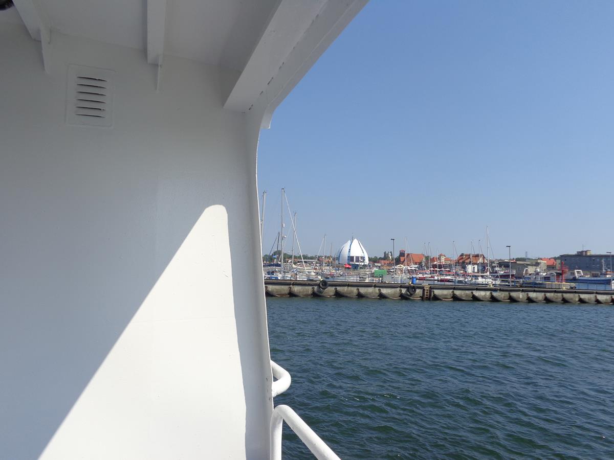
A cargo ship and harbour cranes seen from a ferry during a day trip from Gdansk to Hel.The ferry approaching the harbour in Hel. The small town of Hel is located at the end of a 35-kilometre long sand bar peninsula (Hel Peninsula). The town was previously important for fishing and became a significant naval base in the mid-1930s. During the German invasion of Poland at the beginning of World War Two, the Hel Peninsula was one of the longest-defended pockets of Polish Army resistance.Ferry passengers leaving Hel Harbour. Small boats visible and the town beyond.Entrance to Gothic St Peter’s Church, now used for the Museum of Fishery. The church is brick with a wooden tower (mostly out of shot) above. It was originally built in 1417.The other side of St Peter’s Church (Museum of Fishery). Small old wooden boats, anchors and other nautical artefacts in the museum’s grounds.
Wednesday, 9th July 2014
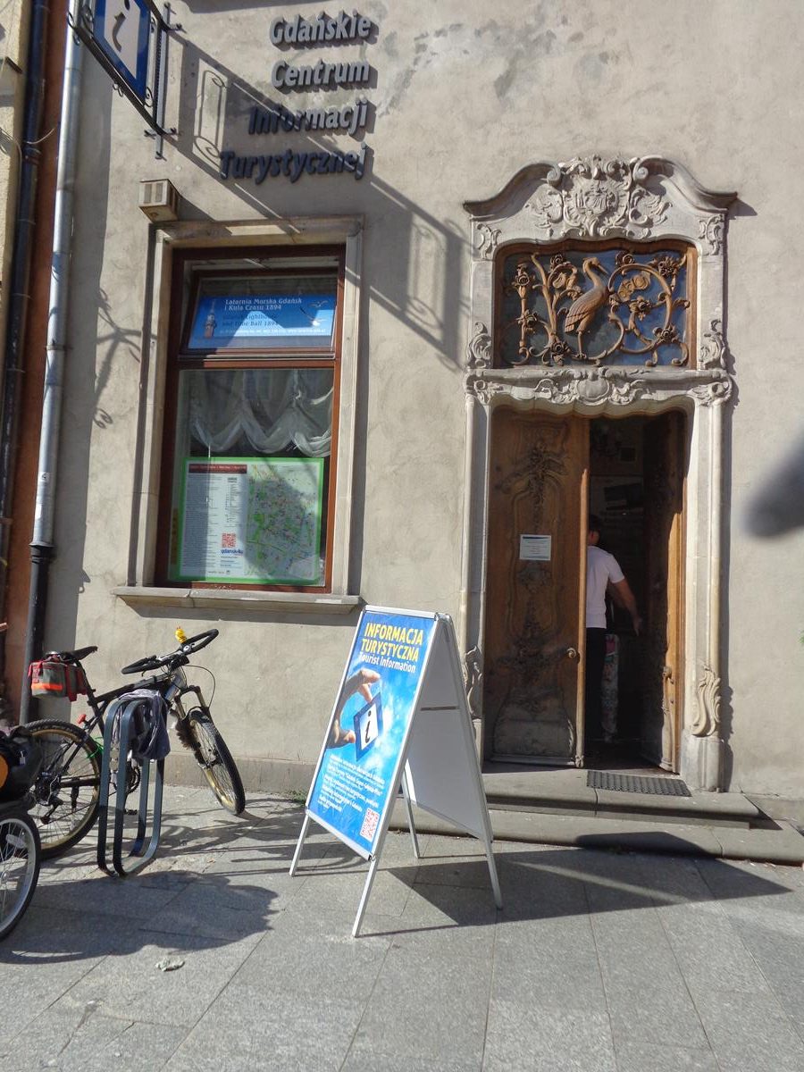
Back in Gdansk with a good view of the SS Soldek and the historic granary buildings behind.A tactile model of Crane Gate.Interesting doorway to tourist office on Long Market (Długi Targ). Decorative carved wooden doors and surrounding stone work (curvy and naturalistic design). A skylight above with overlaid wooden carving, including a stork in the centre.Another view along busy Long Street (Długa) with the main entrance to Gdansk Town Hall on the right.Golden Gate (Złota Brama) with Prison Tower (Wieża Więzienna) immediately behind seen from Long Street (Długa).Attractive geometric decoration on the exterior of 11 Long Street (Długa). The ground floor is used as a café, although was closed when this photo was taken.View inside Prison Tower. An arched brick passageway with heavy wooden doors down one side. Originally built for defensive purposes, Prison Tower became a prison in the 17th century, and is today a museum.A large metal-bar doorway at the base of Prison Tower.Standing inside Golden Gate (Złota Brama), with a vaulted ceiling above, and looking up Long Street (Długa).Another view of Green Bridge (Most Zielony) lit up in semi-darkness.
Wrocław
Wrocław is a city in southwestern Poland. It is the largest city in the historical region of Silesia. It lies on the banks of the River Oder in the Silesian Lowlands, roughly 350 kilometres (220 miles) from the Baltic Sea to the north and 40 kilometres (25 miles) from the Sudeten Mountains to the south.
Friday, 11th July 2014
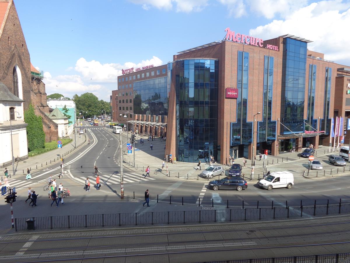
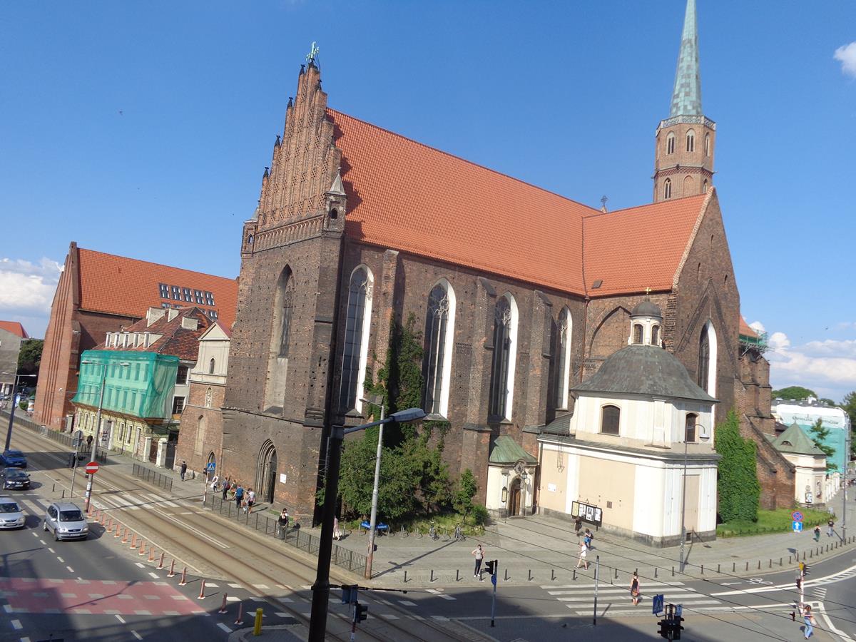
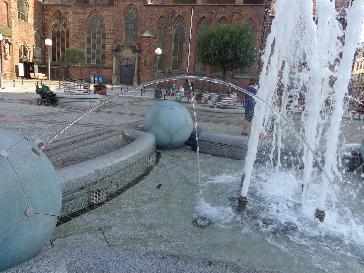
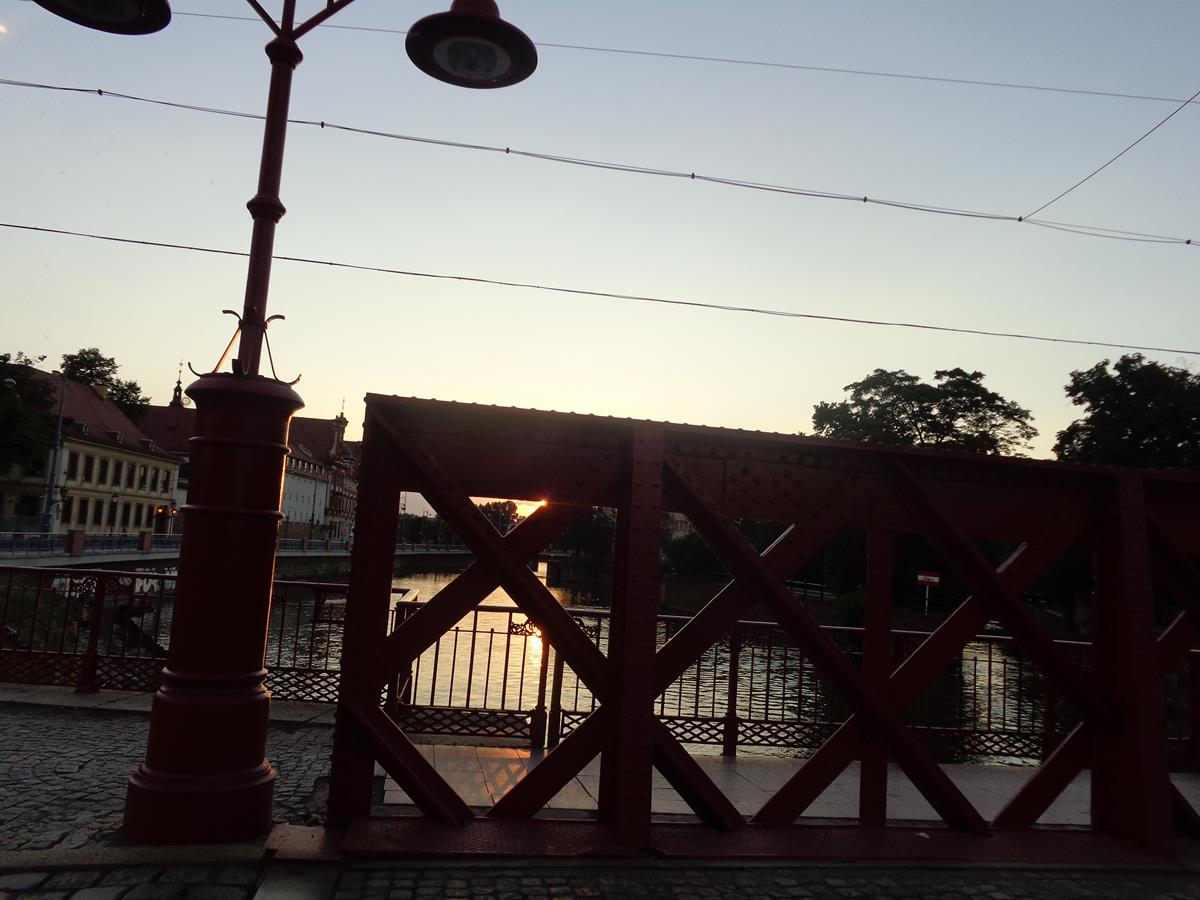
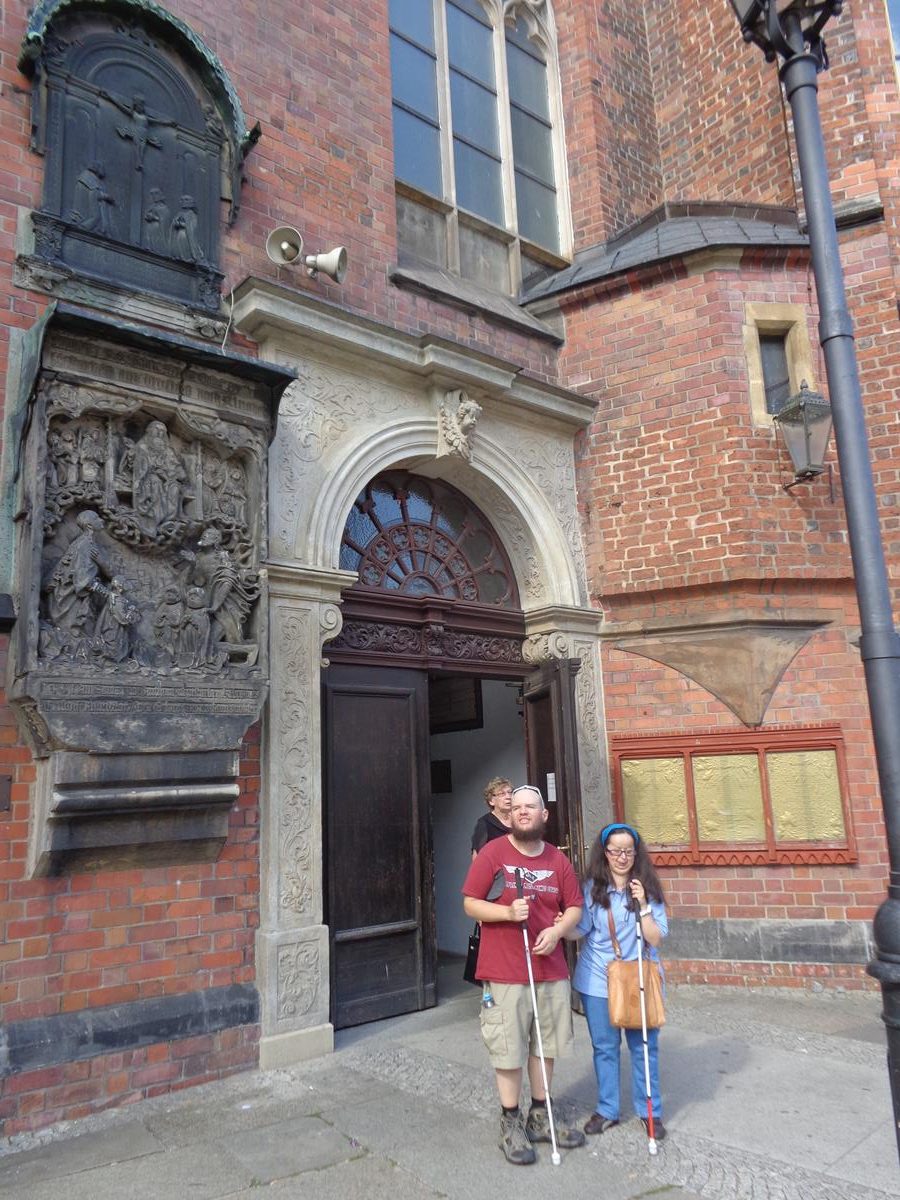
View across a road with tram tracks running in the foreground. The large modern Mercure Hotel, built of brick and glass, is opposite. To the left, a small part of St Adalbert’s Church can also be seen. These are located on the east side of Wrocław’s historic centre.Looking towards St Adalbert’s Church, which was founded in 1112, and was the first church on the left bank of the Oder river. It was destroyed in the 1241 Tartar invasion and again during the 1945 Siege of Wrocław at the end of World War II. The first stage of reconstruction took place between 1953 and 1955. It is built of brick in Gothic style. It has a red brick roof and at the rear a slender octagonal tower topped with a spire.Square on the north side of St Mary Magdalene Church next to Stwosza and Szewska streets. A few people sitting on benches and pigeons wondering about.Football Fountain (Fontanna pilkarska) in a square to the north of St. Mary Magdalene Church. The fountain is a concave square shape enclosing a shallow pool. Jets of water rise from the centre and on the corners are four football-like spheres also having single jets of water spraying into the centre. The fountain is of Polish granite from Strzegom, including four decorative crystal balls of 90 cm in diameter.Close-up of Tony sitting at the edge of the fountain.Outside a side doorway into St. Mary Magdalene Church. This large brick-built church dates from the 13th century. During the Reformation (1523) it became a Lutheran Protestant church, but today is Polish Catholic. In style it is a mixture of Gothic and Romanesque. It was badly damaged during World War Two and has since been restored.
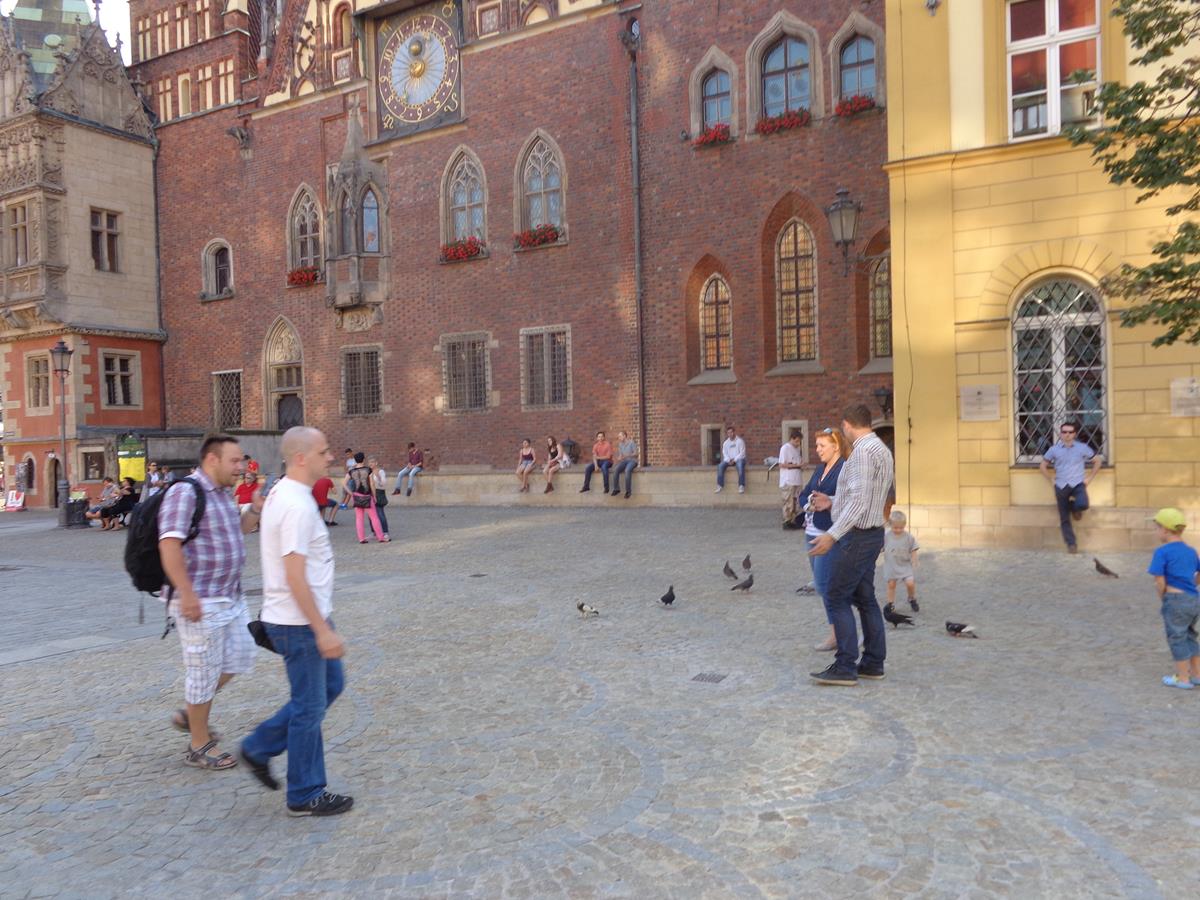
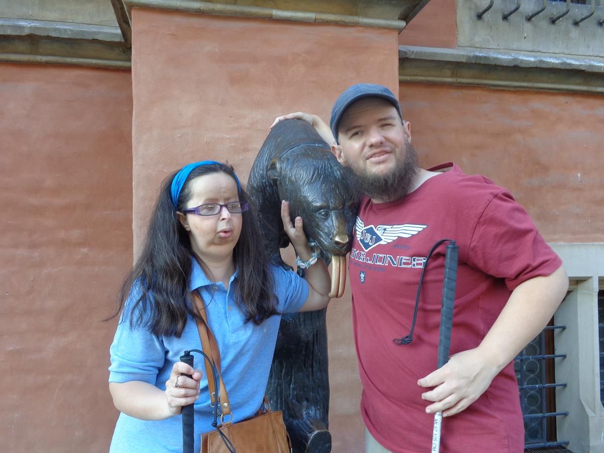
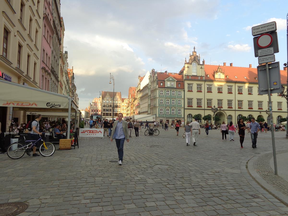
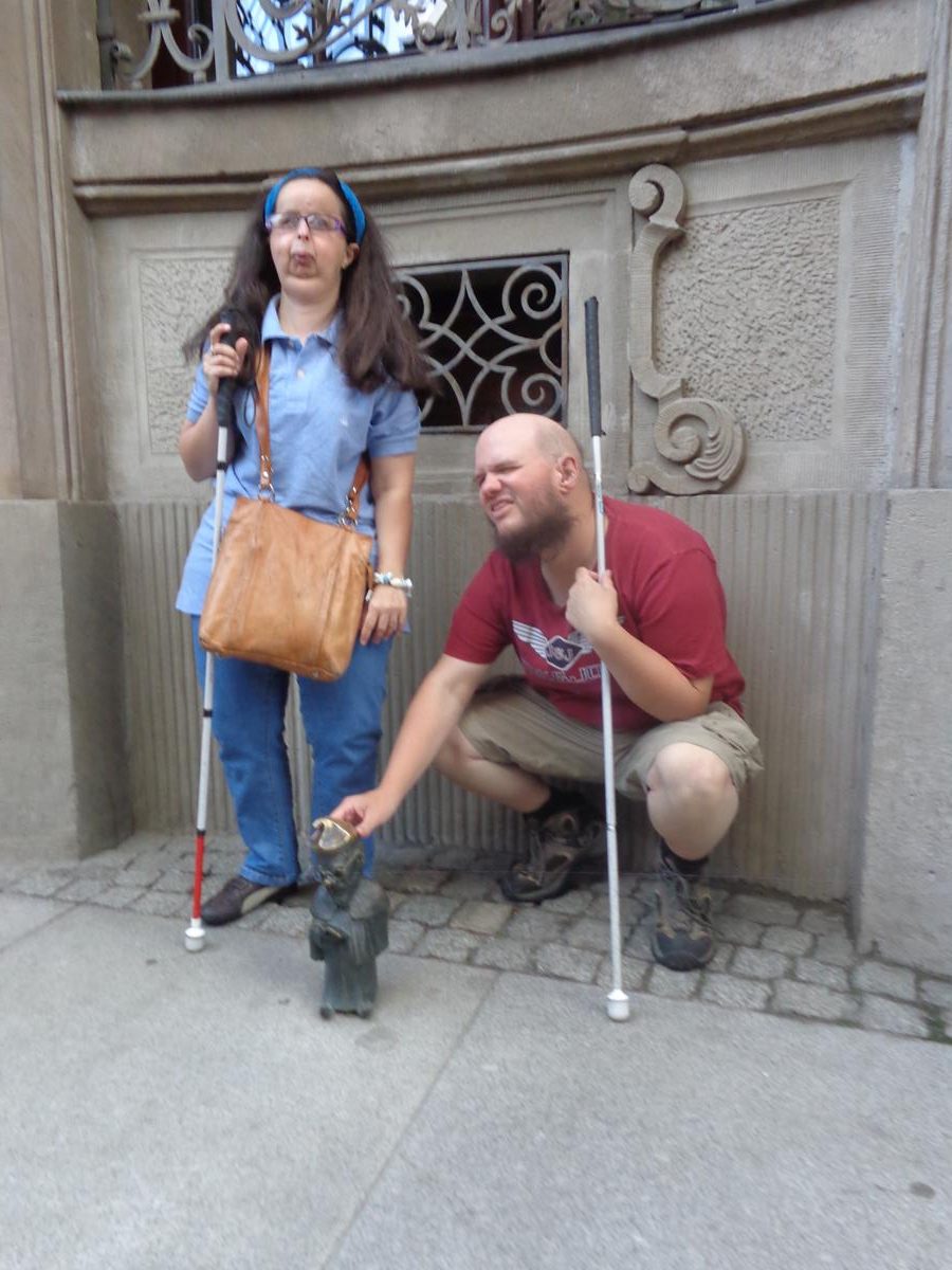
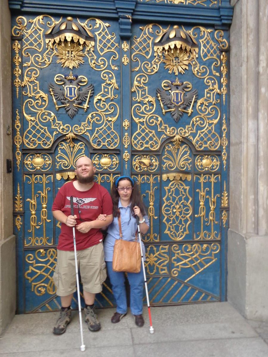
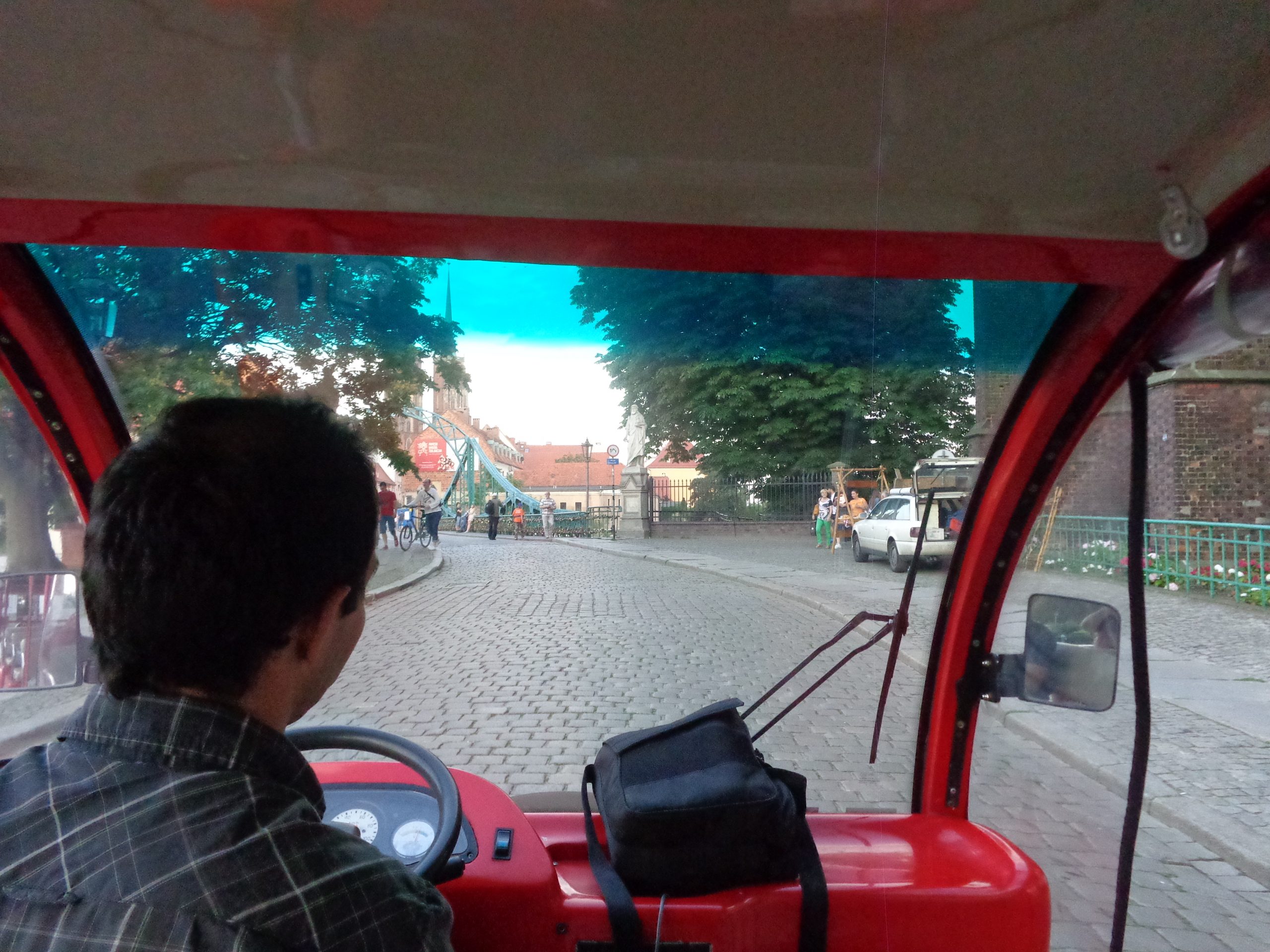
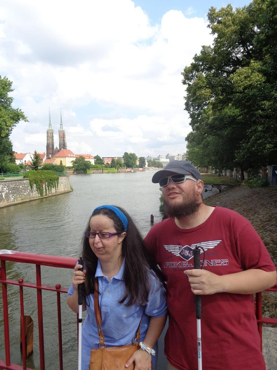
The church’s most interesting architectural parts are its two towers with the ‘Bridge of Penitents’ between the two towers and the Romanesque main portal from the demolished abbey in Olbin, northern Italy, that is located in the south façade. The Bridge of Penitents faces west and looks towards the Market Square. Its name comes from the legend that after dark, the penitent souls of travellers or vain girls who died in the city were to appear on the bridge. Although, that’s only one story!Another view of the side doorway into St. Mary Magdalene Church with a stone Romanesque surround and Gothic windows above and along side.Now in the main historic Market Square (Rynek) looking towards the impressive east facade of the Old Town Hall, which features an astronomical clock. The late-Gothic Old Town Hall is located in the middle of the large rectangular square along with several other buildings.Looking towards the south-east corner of Market Square. On the left, a stone pillory can partially be seen. This was formerly used to flog people. The pillory was first constructed in 1492. The one standing here today is a faithful reconstruction of that original structure, which was built in 1985, the former structure having been badly damaged during World War Two.A horse and cart used for carrying tourists passing by in the foreground with the south façade of the Old Town Hall partly visible beyond.View along the south side of Market Square. Historic buildings line the edges of the square, many of which were originally tenement houses. A mixture of architectural styles are in view, including Baroque. The ground floors are today mostly occupied by businesses such as shops, cafes and bars.Tony and Tatiana in front of the Old Town Hall. Part of the south façade can be seen immediately behind. The Old Town Hall was mostly built between the 13th and mid-16th centuries. It is today one of the city’s main landmarks.Tony and Tatiana touching the bronze statue of a bear that stands by the south wall of the Old Town Hall. The bear is sitting on a log with its tongue sticking out. It is apparently a fountain with water flowing from the thirsty bear’s mouth to a pool below, but this appears to be turned off in the photo. The original statue was created by Ernst Moritz Geyger in 1902. This was lost during World War Two and this replacement was unveiled in 1998.Tatiana and Tony outside St. Elizabeth’s Church (Bazylika Sw. Elzbiety) with its 91.5 metre (300 foot) high tower visible above. This red brick Gothic church dates from the 14th century. From 1525 until 1946 it was a Lutheran Church, but it is today again Roman Catholic. The tower contains an observation deck.Another shot of Tony and Tatiana outside St. Elizabeth’s Church, which is located at the north-west corner of Market Square.Looking into Market Square from the north-west corner. Some of the buildings in the centre of the square can be seen, including the New Town Hall, built between 1860 and 1864.Tony and Tatiana sitting inside an open-sided electric minibus used to transport tourists around the old parts of the city on a guided tour for a fee.Closer view of Tatiana and Tony inside the red minibus.Tony touching a bronze dwarf. Over 600 /1000 of these small bronze figurines can be found across the city, on pavements, walls and lamp posts. Seeking out these dwarfs (krasnale) is an interesting and fun way to explore the city. Maps are available to help in attempting to locate many of the dwarfs and can be obtained from various outlets in the ‘old town’ and also from the internet.Close-up of the bronze dwarf. He is located outside Wrocław University and appears to depict a scholar: he’s a bearded and bespectacled figure wearing a gown and pointy hat and reading a book.Tatiana and Tony in front of an ornate doorway that is part of Wrocław University. The doors are blue with embossed gold decoration. The University of Wrocław (Uniwersytet Wroclawski) is a public research university in Wrocław. It was founded in 1945, replacing the previous German University of Breslau that, alongside Austrian-Hungarian ownership, roughly dates back to 1702.Fencer Fountain on the University Square. A fountain and sculpture depicting a naked man holding a sword. This is located outside Wrocław University’s main building. It was designed by Hugo Lederer and was erected in 1904. At the base there is a circular marble pool, above this there are two kneeling naked female figures, who are supporting an upper pool and the sculpture of the naked man above. The upper pool has gargoyle-like heads around the side from which water is spraying from their mouths. It is said the naked man represents a student, possibly Hugo Lederer himself, who lost all his possessions while gambling. He is left only with his sword to symbolise his nobility.Again riding in the electric minibus with Wrocław Market Hall visible behind. The Market Hall was built between 1906 and 1908 when the city was part of the German Empire. Today the hall still contains hundreds of stalls selling fresh food and flowers.Crossing Piaskowy Bridge (Most Piaskowy). This steel bridge was built in 1861 replacing an older wooden structure. It crosses the Oder River connecting Wyspa Piasek (Sand Island) with the old town. It was designed by Ernest Uber.Tram tracks running in front of a blue and white Baroque building on Wyspa Piasek (Sand Island). The building was formerly a tenement house and is now a shop. The island has an area of about 5 hectares and is one of several islands in the Oder River north of the old town.The minibus approaching Tumski Bridge (Most Tumski). This bridge joins Wyspa Piasek (Sand Island) with the larger Ostrów Tumski (Cathedral Island).Tony and Tatiana on Tumski Bridge, a steel bridge constructed in 1889 to replace an older wooden structure. The side of the bridge has hundreds of so-called love locks (padlocks) attached to the railings. The twin towers of Wrocław Cathedral (St. John the Baptist) can be seen in the distance. These towers stand at 98 metres (322 feet).View from Tumski Bridge along a branch of the Oder River towards another steel bridge crossing from Wyspa Młyńska (Mill Island) to Ostrów Tumski (Cathedral Island).A stone monument dedicated to St. John of Nepomuk in front of the Collegiate Church of the Holy Cross and St Bartholomew on Ostrów Tumski (Cathedral Island). The monument is 9.5 metres in height and dates from 1730-1732. The upper part that depicts St. John of Nepomuk is out of view. St. John of Nepomuk is a Roman Catholic saint who lived in the 14th century. It is said he was drowned in the Vltava river at the behest of King Wenceslaus IV of Bohemia and because of the manner of his death he is a protector from floods and drowning. In front of the monument, a male busker is playing a guitar.A man in a cloak and top hat lighting a gas lantern on Ostrów Tumski (Cathedral Island). There are still 102 original gas street lights on Ostrów Tumski. These are manually lit each evening.Tony and Tatiana exploring a tactile model of Wrocław Cathedral, which is officially known as the Cathedral of St. John the Baptist. A pair of stone pillars behind, outside the cathedral’s main entrance. A church has stood here since the 10th century and the present brick Gothic structure was constructed in the 13th century. The cathedral was severely damaged during World War Two with initial reconstruction lasting until 1951.Tatiana and Tony outside the main entrance to Wrocław Cathedral. Tony is touching what appears to be a large stone head.A brick archway with a narrow cobbled street passing underneath. The archway is part of St. Giles Church, the oldest surviving church in the city, and the only one to survive the Tatar invasions. It stands opposite Wrocław Cathedral.
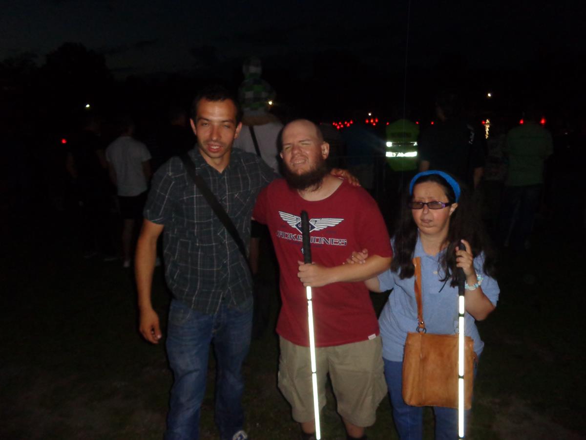
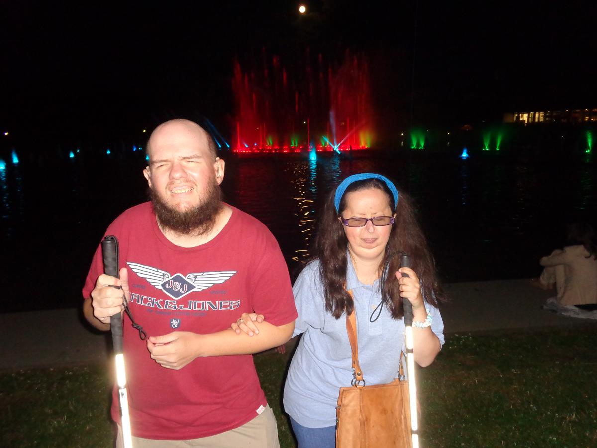
The church was first built in the 1220s as a Romanesque church on the initiative of the dean of the cathedral chapter in Wrocław. It was destroyed by fire in both the 17th and 18th centuries, thus perhaps leading to the construction of baroque volt in the nave. Most of the baroque additions on the church were removed after the end of World War II, leaving a modest building as seen at present.Tatiana, Tony and a Polish guy at Wroclaw Exhibition Grounds during the evening. A large ornamental pond is mostly hidden in the darkness behind. The pond contains a musical fountain and light show built in 2009. It is one of the largest operating fountains in Europe with over 300 jets. The Polish guy was our minibus driver and guide.The pond now lit-up as the multimedia light and music show takes place. Some of the fountains illuminated in blue light.Tony and Tatiana with the animated water show taking place behind.A needle-like monument, standing at 96 metres in height, illuminated and part visible in the darkness. Known as Iglica, meaning spire or needle, this monument stands close to the Centennial Hall in Wroclaw Exhibition Grounds. It was erected in 1948.
Saturday, 12th July 2014
Tony and Tatiana at a monument to the victims of the Katyn massacre. It remembers 22,000 Polish military officers, policemen, intelligentsia and POWs who were murdered by the Soviet secret police on Stalin’s orders in 1940. The memorial was unveiled in 2000. The part in view shows a female figure holding the body of a murdered prisoner. The female figure (Katyń Pieta) is intended to be symbolic of the Virgin Mary cradling the dead body of Jesus.Exterior of the building housing the Racławice Panorama, a 114-metre (374-foot) long painting depicting the 4 April 1794 Battle of Racławice, fought between a combined Polish and Lithuanian force that included peasants, and a component of the Russian army. The painting, the concept of Polish artist, painter Jan Styka and created through the work of several Polish artists, dates from 1893–1894 and was originally displayed in Lviv (now in Ukraine) and was moved to Wrocław after World War Two. The building is a circular concrete structure.
The Battle of Racławice, that resulted in a Polish victory, was one of the first battles of the Polish-Lithuanian Kościuszko Uprising against Russia. The battle occurred near the village of Racławice in Lesser Poland. The battle site is one of Poland’s official National Historic Monuments.View across the Oder River with a good view of the towers and spires of Wrocław Cathedral and the Collegiate Church of the Holy Cross and St Bartholomew on the opposite bank.Tatiana and Tony on Piaskowy Bridge (Most Piaskowy) with another view over towards Wrocław Cathedral. A tree-lined riverside path immediately behind with Wyspa Piasek (Sand Island) opposite.View from a footbridge connecting Wyspa Piasek (Sand Island) and Wyspa Słodowa (Malt Island). In front the channel separating the islands forks with Wyspa Młyńska (Mill Island) sitting in between. Buildings visible include modern riverside apartments and older concrete mill buildings.Looking west along the Oder River from leafy Wyspa Słodowa (Malt Island). A large building operated by Wroclaw University on the far bank.A bronze dwarf, one of over 600 to be found around Wroclaw. They are typically 20 to 30 centimetres (8 to 12 inches) in height. This one has a pointed hat and shoes and is holding a heart. This is called WrocLovek (WrocLover).Tony and Tatiana touching another pair of dwarfs. This pair are firemen (Pożarki) with one carrying a hose and the other a ladder. They are located near st. Elizabeth’s Church on św. Elżbiety 1. The dwarfs originated as a symbol of the Orange Alternative anti-communist movement of the late 1980s. The first dwarf statue was placed on Świdnicka Street in 2001, where the group’s gatherings used to take place.Tony and Tatiana outside an entrance to St Elizabeth Church.Another view of St Elizabeth Church’s 91.5 metre high tower. The tower once had a spire rising to 130 metres.Tony and Tatiana embracing under an arched gate. This gate connects two small medieval houses and it once led into the churchyard of St Elizabeth Church. The two connected houses are known as “Jaś i Małgosia”, named after the children’s fairy tale characters from Hansel and Gretel, by the Brothers Grimm and first published in 1812.The Zdrój Fountain (Fontanna “Zdrój”), located in Market Square. This long narrow fountain is made from vertical glass sheets and granite in which water runs down. It was erected in 1996, with the consent of Wroclaw Mayor, Bogdan Zdrojewski. The fountain’s name “Zdrój” comes from the Mayor’s surname. Apparently, its design and installation was controversial! Its lack of acceptance was caused by the fountain’s modern design which, arguably, doesn’t fit into the monumental atmosphere of the city. Opponents call it the “soap dish” or more mockingly “urinal”.Tatiana and Tony with a set of three dwarfs. The one on the right is sitting in a wheelchair, the middle one is blind and is wearing glasses and holding a cane, and the left one is hearing impaired and is holding a hand behind one ear.Tony sitting on a granite ball. There are dwarfs on either side, apparently attempting to push the ball in opposite directions.
Kraków
Kraków is the second-largest and one of the oldest cities in Poland. Situated on the Vistula River, the city dates back to the 7th century AD. Kraków was the official capital of Poland until 1596 and retains many historic buildings from this period. Kraków has traditionally been one of the leading centres of Polish academic, economic, cultural and artistic life. Often considered one of Europe’s most beautiful cities, its Old Town was declared amongst the first UNESCO World Heritage Sites in 1978.
Monday, 14th July 2014
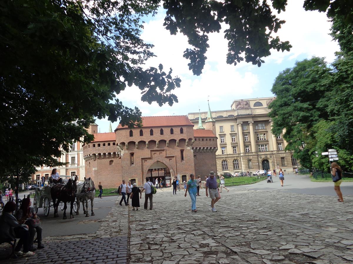
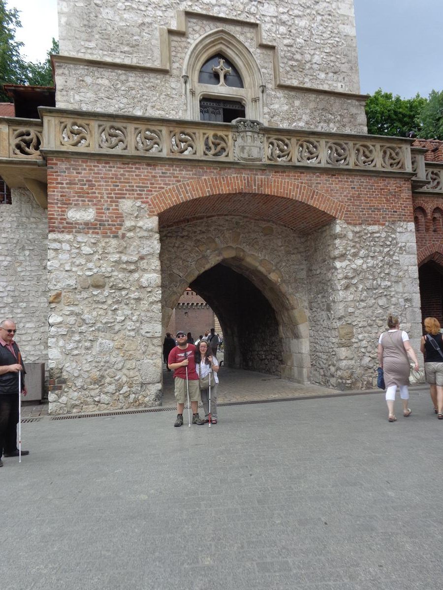
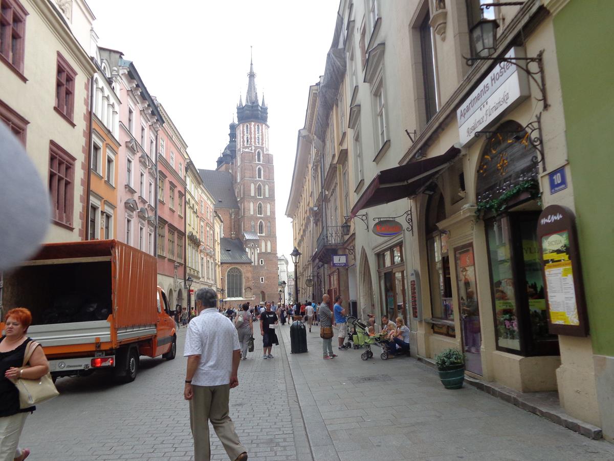
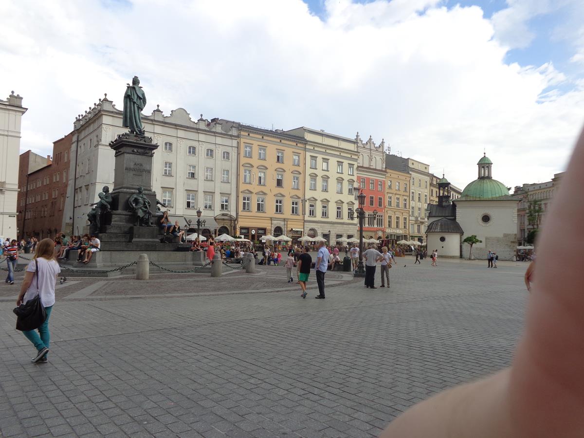
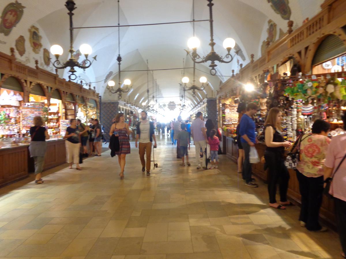
View from the west side of Main Square (Rynek Glówny) towards the Cloth Hall in the middle. Main Square is located in the centre of Kraków’s Old Town. It is apparently the largest medieval market square in Europe. The Cloth Hall was originally built in the 14th century as the centre of the cloth trade. It was rebuilt in 1555 in Renaissance style. This large and impressive building includes arcades around the outside supported by colonnades and decorative parapets at roof level.The Town Hall Tower, a free-standing brick and stone clock tower located in Main Square. This is the only surviving part of the historic Town Hall which was demolished in 1820. It is 70 metres (229.7 feet) in height and today houses the Kraków Historic Museum and an observation deck on the top floor.Another view of the Cloth Hall. The parapets along the roof are topped with decorative carved gargoyle masks.Buildings along the north side of Main Square. These are historic town houses, now mostly neoclassical in style, but often with older structures behind the façades. Many outdoor café and restaurant tables around the edge of the square.A decorative turret window at the north-west corner of the Cloth Hall. Beyond more historic town houses can be seen around the edge of Main Square.View of Feniks House, located on the north side of Main Square. This Art Deco building was built from 1928 to 1932 and was designed by architect Adolf Szyszko-Bohusz. It replaced three medieval tenement houses demolished in 1914. Presently, the building houses several businesses on the ground floor and apartments on the upper levels.St. Mary’s Basilica standing prominently in the north-east corner of Main Square. St. Mary’s Basilica (Kosciól Mariacki) is a Brick Gothic Roman-Catholic church, which was completed in 1347. Its front façade features a pair of bell towers topped with decorative domes and spires. The north tower (on the left in the photo) is taller than the south tower at 80 metres (262 feet) in height. The historic centre of Krakow, including this church, has been listed as a UNESCO World Heritage Site since 1978.Looking along ulica Florianska (Florianska Street or St. Florian’s Street), a busy and important pedestrian street that runs roughly north from Main Square. This street is part of the historic grid layout of the Old Town, which was drawn up in 1257, after the destruction of the city during the Tatar invasions of 1241. St. Florian’s Gate is just visible at the far end. This 14th century rectangular stone tower is part of the city’s historic fortifications.In front of Kraków Barbican (Barbakan Krakowski), which is located just beyond St. Florian’s Gate. The Barbican now stands as a fortified outpost, but was once connected to the city walls. It is built of brick with 3-metre (9.8-feet)-thick walls. It dates from around 1498. At present, it is a branch of Krakow History Museum and visitors can explore it’s interior.
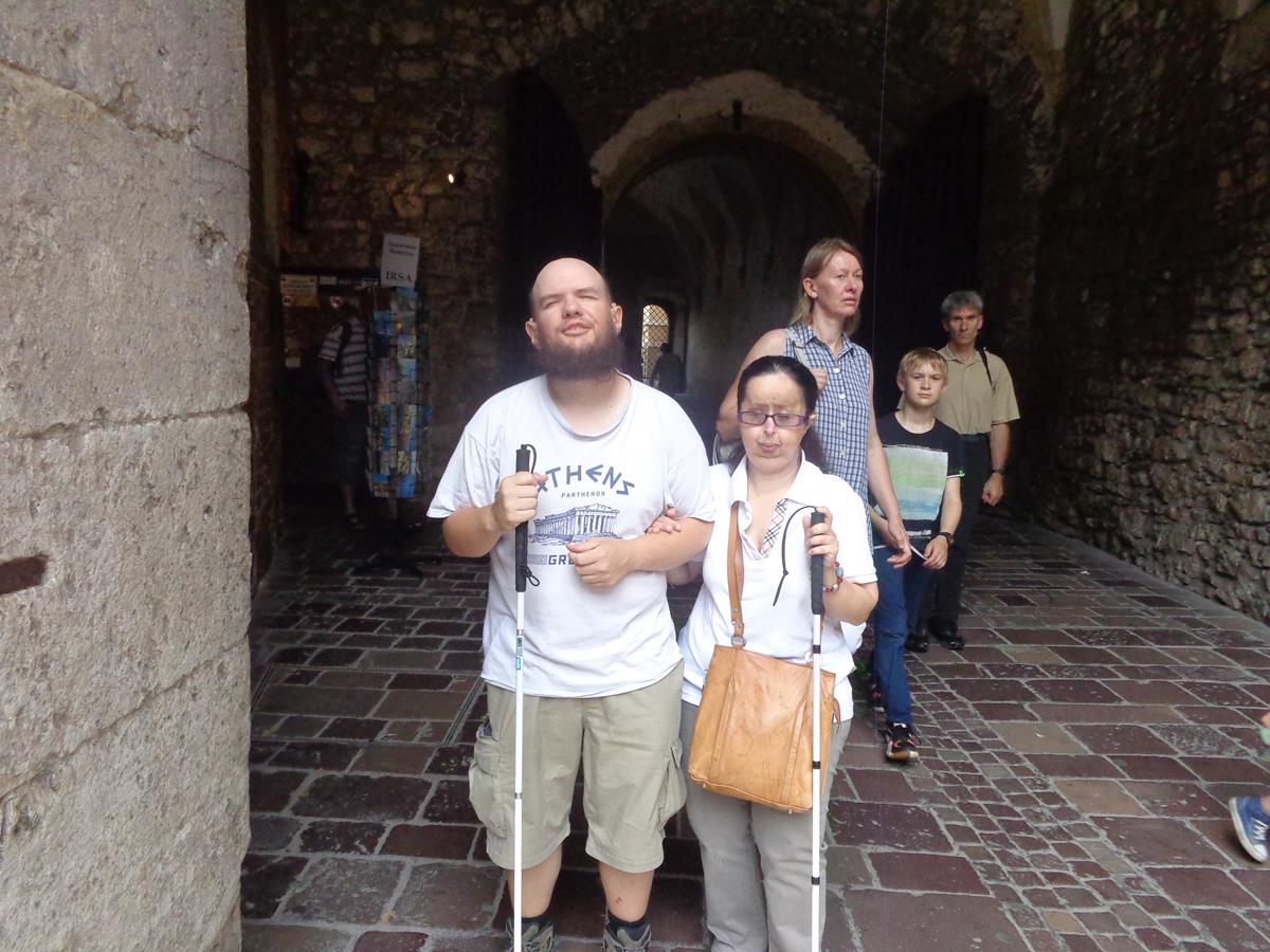
The barbican is one of the few remaining relics of the complex network of fortifications and defensive barriers that once encircled the Royal city of Krakow. The barbican was originally linked to the city walls by a covered passageway that led through St. Florian’s Gate and served as a checkpoint for all who entered the city. Today, the Gothic-style Barbican is one of only three such fortified outposts still surviving in Europe, and is the best preserved.Tony next to a tactile model of both Kraków Barbican and St. Florian’s Gate. It shows the Barbican’s shape with a roughly semi-circular outer wall topped with seven turrets or watch towers, connected to a smaller rectangular part jutting out towards St. Florian’s Gate. The smaller rectangular object may have been the Kleparz Gate, which was protected by a large, semi-circular moat.Tatiana and Andrej touching a tactile model of the Old Town, showing its street layout, fortifications and principal buildings. Many of the major Kraków city landmarks have tactile models located close to them. Andrej is a friend of Tony and Tatiana, now Polish, he is originally from Ukraine, which was then part of Russia.Tony and Tatiana in front of St. Florian’s Gate. The arched passageway passing through the centre of the tower is behind them.View along ulica Florianska with the north tower of St. Mary’s Basilica standing prominently at the far end. The height of the north tower was raised in the 15th century so that it could serve as a watch tower over the city.Part of the south-east façade of St. Mary’s Basilica. A side entrance with a doorway and porch and tall narrow Gothic windows above.In Plac Mariacki (Mary’s Square), a small square to the south of St. Mary’s Basilica and adjoining Main Square. A small part of St. Mary’s Basilica in view to the left along with other surrounding buildings.Another view across busy Main Square with the Cloth Hall to the right and the Church of St. Adalbert part visible away in front. The small 11th century Church of St. Adalbert stands in the south-east corner of the square.At the foot of the north tower of St. Mary’s Basilica. Tony and Tatiana’s friend Andrej in the foreground. He is totally blind and is using a white cane.A tactile model of St. Mary’s Basilica in Plac Mariacki.The east façade of the Cloth Hall. The building is rectangular in shape: its dimensions are about 110 metres (361 feet) long and 36 metres (118 feet) wide. Today the Cloth Hall contains many small shops and stalls selling food, crafts and souvenirs. The upper floor houses the Sukiennice Museum, which displays 19th-century Polish painting and sculpture.The Adam Mickiewicz Monument in Main Square. This bronze statue on a stone pedestal depicts Adam Mickiewicz (1798-1855), who is arguably the greatest Polish Romantic poet of the 19th century. It was unveiled in 1898 on the 100th anniversary of his birth. There are more bronze figures at the foot of the statue, these allegoric groups symbolise the Motherland, Science, Courage and Poetry. The statue was destroyed by the Nazis in 1940 and was reconstructed in 1955.Buildings on the north side of Main Square, including on the left, Kamienica Zacherlowska, a tenement house rebuilt in neoclassical style in 1878. A female statue decorates a corner of the roof.Tatiana and Tony outside an entrance to the Cloth Hall.
Thursday, 17th July 2014
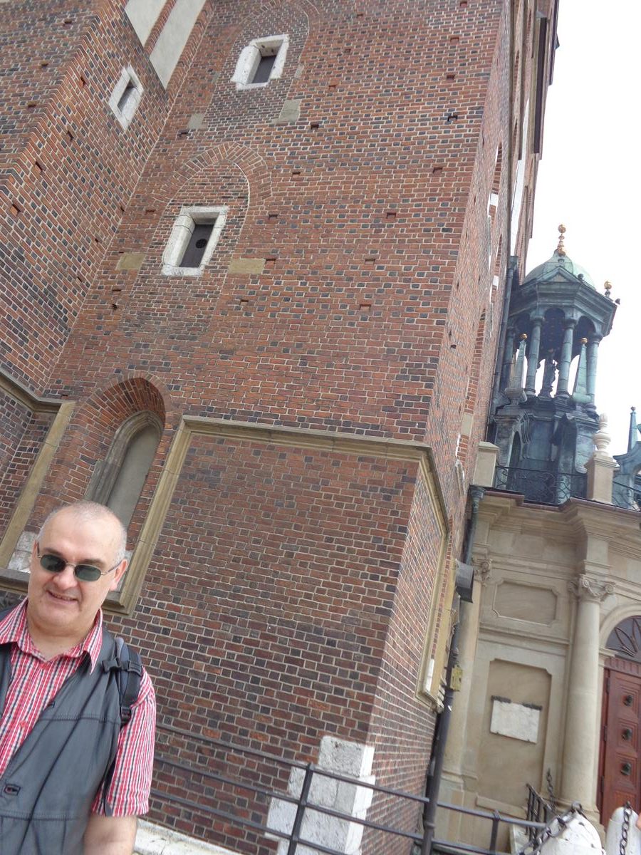
A cobbled street leading up to Wawel Hill and Wawel Royal Castle. A crenellated brick outer wall to the right, the historic Bernardynska Gate in front and Sandomierska Tower beyond. Sandomierska Tower is one of the large circular brick artillery towers at Wawel Castle. It dates from the 15th century and was built to defend the castle’s southern side.
Wawel Royal Castle is located on the south-west edge of Kraków’s Old Town. Built at the behest of King Casimir III the Great in the 14th century, it consists of a number of structures from different periods situated around a large Italian-styled main courtyard. The castle, being one of the largest in Poland, represents most European architectural styles of medieval, renaissance and baroque periods. The site is the most historically and culturally significant site in Poland. The castle is part of a fortified architectural complex erected atop Wawel Hill, a limestone outcrop next to the Vistula River.
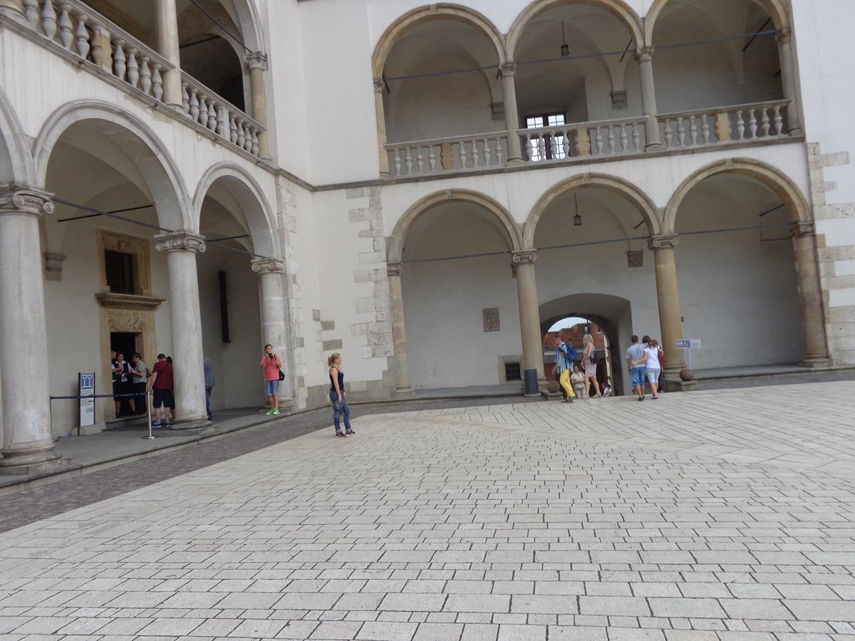
Looking into Wawel Royal Castle’s Italian Renaissance style main central courtyard. The surrounding palace buildings feature three tiers of arcades looking into the courtyard.Tony and Tatiana inside a passageway leading into the main courtyard.The ground floor level of the arcade around the main courtyard. The arcade is constructed as a colonnade supported by arches and stone columns.Another view of the large main courtyard of Wawel Royal Castle showing the surrounding buildings including the arcades.A doorway off the main courtyard with an ornate carved stone surround. The carving is comprised of geometric patterns.Arched neoclassical gateway leading through the palace buildings, decorated with imitation Ionic columns.Outside Wawel Cathedral, which is contained inside the Wawel Castle grounds. Part of the gold dome of Sigismund’s Chapel can be seen. A church has stood here since the 11th century. The current Gothic cathedral was constructed in the 14th century. Officially known as the Royal Archcathedral Basilica of Saints Stanislaus and Wenceslaus, this Roman-Catholic cathedral is the Polish national sanctuary, and traditionally has served as the coronation site for Polish monarchs.The Vicar’s House located opposite Wawel Cathedral with the main entrance doorway in front. The building dates from the 15th century with many later additions. It is three storeys in height. A small statue, perhaps of the Virgin Mary, can be seen in an alcove at first floor level.A short flight of steps leading up to a gateway with decorative iron gates and a stone surround outside Wawel Cathedral. The gate leads to a small courtyard outside the main entrance.At the side of the nave inside Wawel Cathedral. To the left, part in view, is the tomb of King Wladyslaw III of Varna (1424-1444). Four red-brown stone columns can be seen supporting a structure over the tomb. Mostly out of view, King Wladyslaw III is depicted lying on top of the tomb, dressed in full armour. Also in view in front, the black and gold columns and dome of the Mausoleum of St. Stanislaus.A better view of the Mausoleum of St. Stanislaus, which stands in the centre of the nave inside Wawel Cathedral. St. Stanislaus is the Patron Saint of Poland. He lived between 1030 and 1079 AD (CE) and at his death he was bishop of Krakow. He excommunicated King Boleslav II and was subsequently murdered by him. The mausoleum is in the form of a dome supported by four columns with a large silver sarcophagus beneath. The sarcophagus dates from the 17th century.Tony and Tatiana outside the west gate and doorway of Wawel Cathedral. This is a large iron door. Hanging on the left side of the west gate door, suspended from a chain, are large prehistoric animal bones that were found on the site during the excavation process. It is said that the bones hold magical powers and as long as they are there the cathedral will remain!Looking through Waza Gate (Brama Wazów). This is the oldest surviving gate in the fortifications surrounding Wawel Hill. It was built in 1591 replacing an older Gothic structure. It is located between the chapter house and the Cathedral House on the north side of the hill and adjoining the Old Town.Brick walls, part of the fortifications around Wawel Hill and Wawel Royal Castle. A cobbled street in front leading up to Waza Gate.
Friday, 18th July 2014
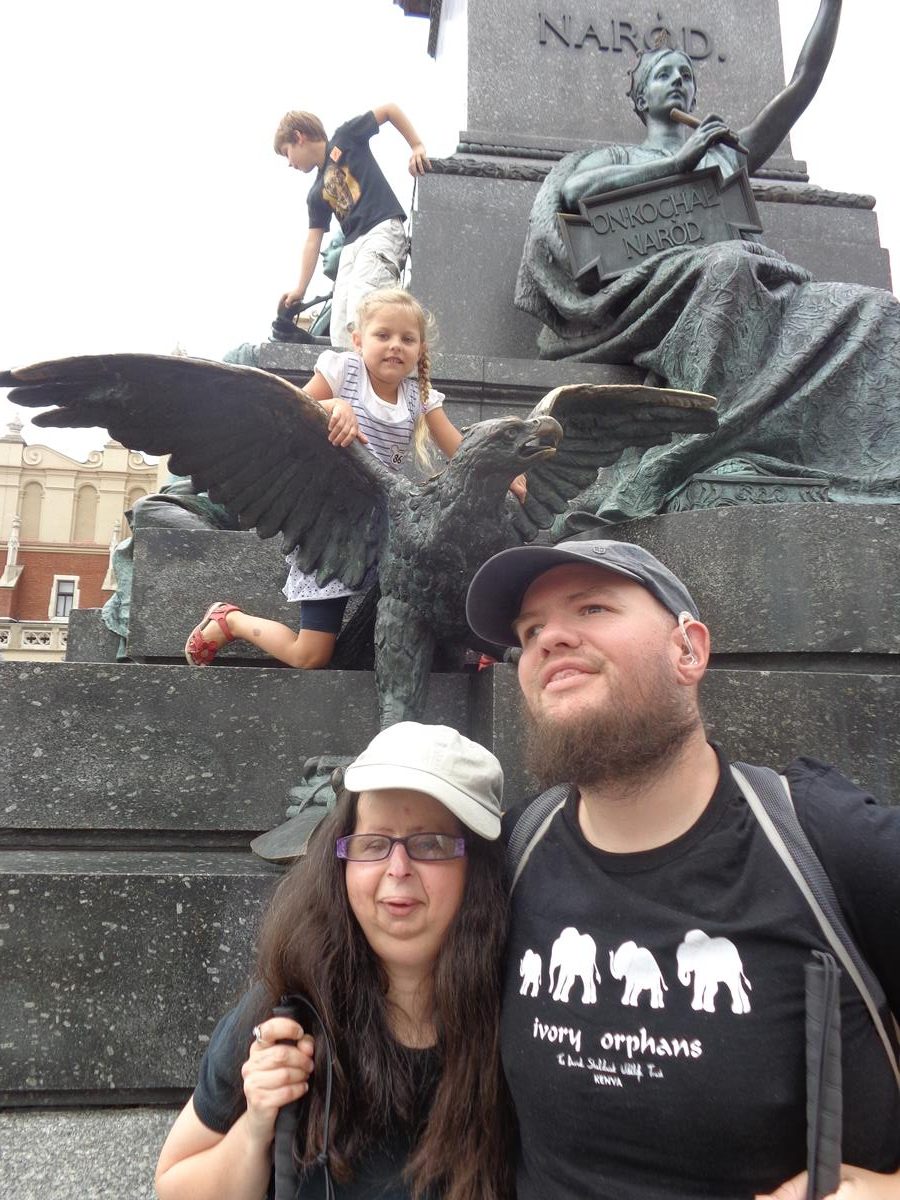
Close-up view showing a tactile model of the Town Hall Tower located in Main Square (Rynek Glówny).View of the Town Hall Tower. The 70-metre-high tower has a square base with a clock face towards the top of each side. The façade in view has a few irregularly positioned windows with steps leading up to an entrance at the base. It is mostly built of brick with some stone used at the corners and around the windows.Tony next to a reclining stone lion, one of a pair, which sit on top of retaining walls at either side of steps leading up to the entrance of the Town Hall Tower.Inside the Cloth Hall looking along a wide passage that runs the whole 110 metre (361 feet) length of the building at ground floor level. The sides are lined with stalls selling a variety of goods: the stalls in view are mostly selling craft items.Tony and Tatiana at the base of the Adam Mickiewicz Monument in Main Square. Immediately behind a bronze eagle and a little higher up a female figure wearing a crown and with one arm raised pointing to the sculpture of Adam Mickiewicz above. She is also holding a plaque bearing the words ‘On kochal narod’ (‘He loved the homeland’). The sculptures on this side of the statue are intended to symbolise the Homeland.Another view of the Adam Mickiewicz Monument showing the allegorical figures representing Homeland. The sculpture of Adam Mickiewicz on a pedestal above. People standing and sitting around the base, including Tony and Tatiana.Tatiana and Tony in Main Square (Rynek Glówny). View towards the south-east corner of the square with the small 11th century Church of St. Adalbert visible.Looking up at the front façade of St. Mary’s Basilica with the two towers at the top. Tony and Tatiana in the foreground.Tony and Tatiana outside the main west entrance to St. Mary’s Basilica. The entrance is a Baroque porch with doorways on three sides.The impressive Gothic main altar inside St. Mary’s Basilica. It was carved between 1477 and 1489 by the German-born sculptor Veit Stoss. It is divided into three folding sections that together are 13 metres (42.7 feet) high and 11 metres (36 feet) wide. It depicts several Biblical scenes with the figures and other detail illuminated in gold. Behind are three tall narrow stained-glass windows. The altar was dismantled by the Nazis in 1941 and transported to Germany. It was later recovered in the basement of the heavily bombed Nuremberg Castle and following restoration was put back inside the Basilica.Tony and Tatiana sitting on the side of Zaka Fountain (Fontanna Pomnik Żaka) in Plac Mariacki (Mary’s Square). This small fountain has a male bronze figure on a pedestal in the centre and a pool beneath. The fountain was designed by Jan Budziłło and unveiled in 1958. The pedestal is a tribute to Wit Stwosz made by Krakow craftsmen. The Żaczek figure is a copy of one of the figures in the altar of Wit Stwosz in St Mary’s Church.The south-east corner of Main Square leading into Grodzka street. Historic Grodzka street connects the Main Square with Wawel Castle. The square and street are lined with historic town houses, most around five storeys in height, with many outdoor cafes and restaurants at ground level.Outside the Church of Saints Peter and Paul (Kosciól SS Piotra i Pawla) on Grodzka street. This Baroque church was built between 1597 and 1619 by Giovanni Maria Bernardoni who perfected the original design of Józef Britius. Part of the front façade can be seen with the large main doorway and statues in alcoves above.All Saints’ Square (Plac Wszystkich Swietych) located between Grodzka street and the Church of St. Francis of Assisi. The square contains a small park. Part of the 13th century Church of St. Francis of Assisi can be seen at the far side.Looking in the opposite direction across All Saints’ Square with the Basilica of Holy Trinity away in the distance. This gothic church and monastery of the Dominican Order dates from 1223.
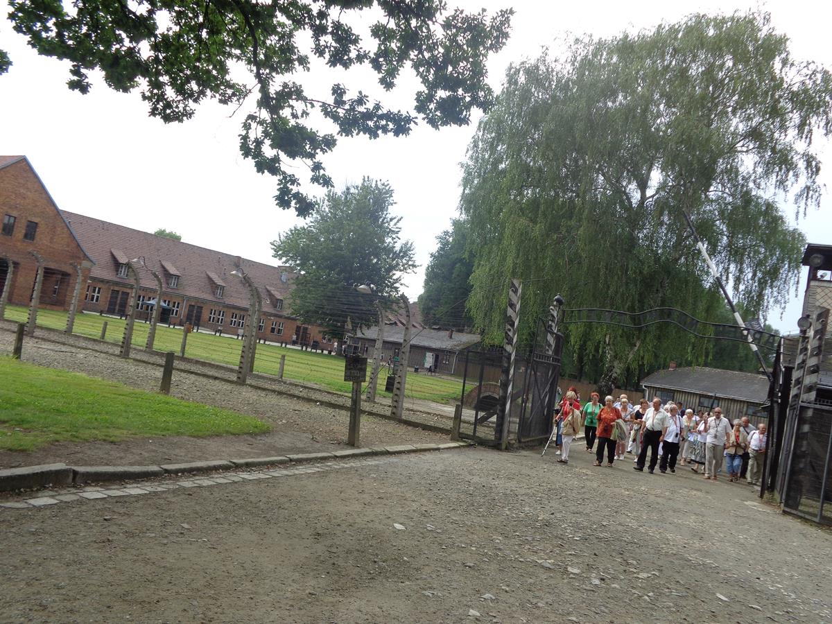
Auschwitz concentration and extermination camp
Warning: some people may find this information and these photos upsetting.
Auschwitz concentration and extermination camp was operated by Nazi Germany in occupied Poland between May 1940 and January 1945. Of the at least 1.3 million people sent to Auschwitz, 1.1 million died. The death toll includes 960,000 Jews (865,000 of whom were gassed on arrival), 74,000 ethnic Poles, 21,000 Roma, 15,000 Soviet prisoners of war, and up to 15,000 other Europeans.
Auschwitz concentration camp was a complex of over 40 sites. Auschwitz I, the main camp, opened May 1940 on the site of former army barracks. The first executions by gassing, of Soviet and Polish prisoners, took place in block 11 of Auschwitz I around August 1941. Construction of Auschwitz II-Birkenau began in 1941. From 1942 until late 1944 freight trains delivered Jews from all over Nazi occupied Europe to the gas chambers here as part of the Holocaust. There was also Auschwitz III (Buna or Monowitz), primarily and enforced labour camp and used until January 1945.
The site is today preserved as a memorial and museum, known as National Museum of Auschwitz-Birkenau – a memorial to the victims of the Holocaust. Tony and Tatiana visited on a day trip from Kraków. Visiting Auschwitz concentration and extermination camp is not an easy experience and can be upsetting. It is often very emotional. It is about education and reflection. The memorial and museum has been left as a reminder of the evil that humans can inflict on others and is there to remind people to never forget the victims of Nazi atrocities and that another holocaust must never ever happen again.
Tuesday, 15th July 2014
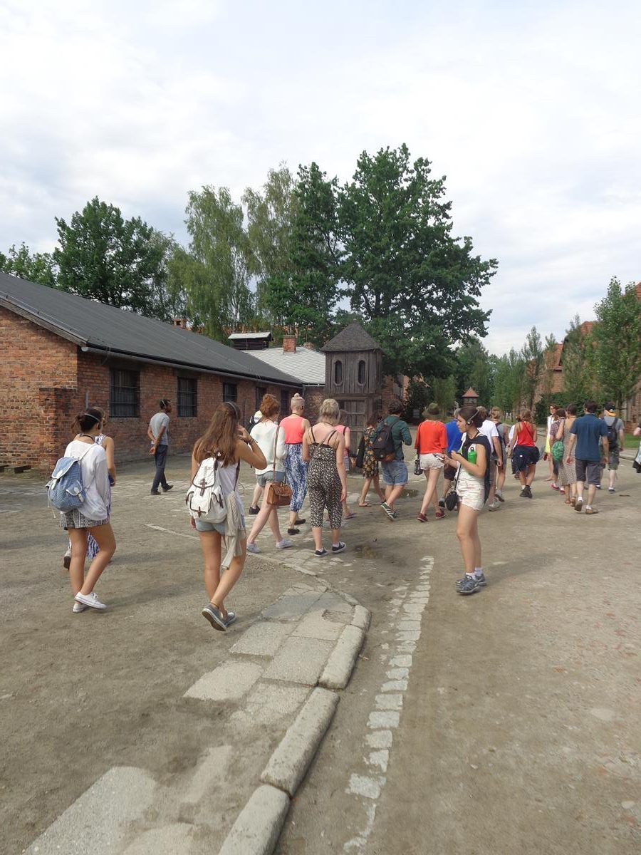
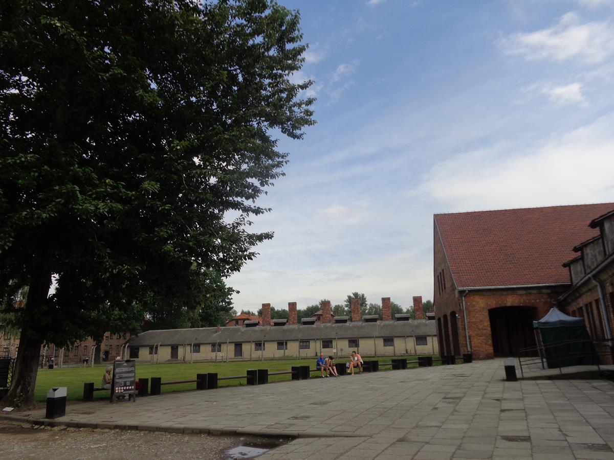
Buildings at the entrance to Auschwitz I concentration camp. The single storey brick building on the right was used for prisoner registration. Today it contains visitor facilities. The building further away to the left was the kitchen. It is another single storey building with a row of chimneys along the roof. There are groups of visitors in the foreground.
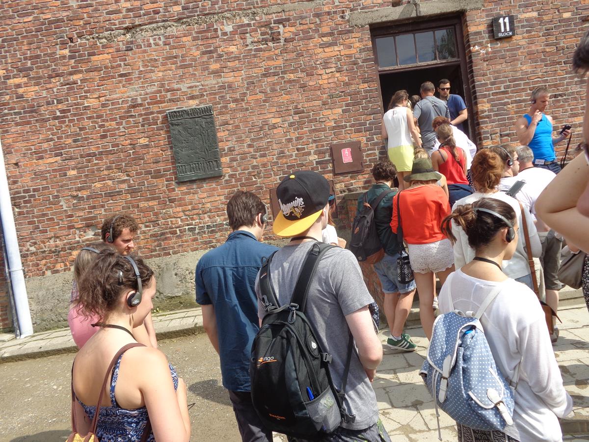
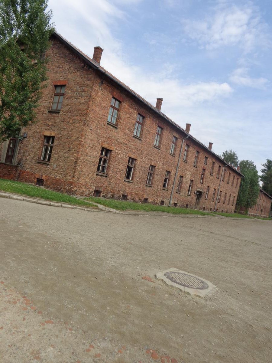
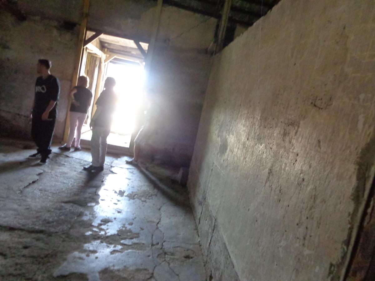
Prisoners who weren’t immediately gassed were registered in the camp (that is, tattooed with camp numbers on their left forearms) and sent to work in the various Auschwitz Concentration Camp labour details or sub-camps; thousands of others were transferred to camps in the depths of the Third Reich, to labour for the sake of the German war machine.Again outside the former prisoner registration building.A group of visitors walking through the main iron gates of Auschwitz I with the sign “Arbeit macht frei” (“work sets you free”) above. There is barbed wire fencing extending from the gate and buildings in the background. In actuality, the opposite of the sign above the gate “work sets you free” was the reality. Labour became another form of genocide that the Nazis called “extermination through work.” Escape from Auschwitz was almost impossible. Electrically charged barbed-wire fences surrounded both the concentration camp and the killing centre.Rows of prison blocks within Auschwitz I camp. These rectangular blocks are two storeys in height and are built of brick with tiled roofs. They are arranged in a grid layout with gravel roads running between.A group of visitors entering through a door into Block 4. This block now contains museum displays documenting the mass extermination of prisoners that was perpetrated at Auschwitz – both Jews and non-Jews. Row upon row of peoples’ personal items collected by the Nazis are on display as a stark reminder that it was actual people who were dehumanised and exterminated. Bags, suit cases, items made of the hair of prisoners, and shoes; so many shoes. A humbling sight. According to scientists hair taken from prisoners at Auschwitz that can be seen inside glass cases in Block 4, contain Zyklon B which was used to kill prisoners in gas chambers.Outside Block 11 in Auschwitz I (the Stammlager) or main camp of the Auschwitz concentration camp network. This punishment block was used for interrogation, torture and executions. The building’s basement was used as the camp jail. It was at Block 11 that the first attempts to kill people with Zyklon B were implemented in September 1941. Zyklon B was the trade name of a cyanide-based pesticide invented in Germany in the early 1920s.
The “Death Wall” (reconstructed after the war) where thousands of prisoners were lined up for execution by firing squad, stood between Block 10 and Block 11.A group of visitors passing by the kitchen building to the left. Beyond, prison blocks partly obscured by trees.Two more prison blocks. These large blocks are approximately 45 metres in length by 15 metres wide. Before World War Two these buildings were used as barracks by the Polish army.Gallows within Auschwitz I camp where Rudolf Höss was executed on 16 April 1947. Rudolf Höss was commandant of Auschwitz concentration camp from 4 May 1940 to November 1943, and again from May 1944 to January 1945. He was sentenced to death by the Supreme National Tribunal, a Polish war crimes tribunal, in 1947.Outside the crematorium and gas chamber at Auschwitz I. Tens of thousands of people were killed in the gas chamber here during 1941 and 1942. It was possible for over 700 people to be executed at once. This gas chamber was replaced in 1942 by new gas chambers at Auschwitz II (Birkenau) camp. The concrete building has a single storey above ground and a brick chimney.More buildings at Auschwitz I. The two single storey buildings on the right were used for administration.A double barbed wire fence around Auschwitz I camp. This fence would have been electrified. Some prisoners killed themselves on the electrified fence to avoid the cruel punishments and torture handed out at the camp.Another view of the kitchen block. A long single storey building with a line of chimneys along the roof.The gatehouse at Auschwitz II-Birkenau camp. A train track runs through its central gateway. The track then continues directly to the gas chambers. Birkenau had 4 gas chambers.Inside Auschwitz II-Birkenau camp. Barbed wire fencing with surviving buildings in the distance. There would have originally been rows of barracks here: 174 in total with each one measuring 35.4 by 11 metres. The foundations of the buildings are still preserved, showing their locations. Each building was intended to hold 550 prisoners, but this was later increased to 744.
Auschwitz II Birkenau was the largest of the more than 40 camps and sub-camps that made up the Auschwitz complex. During its three years of operation, it had a range of functions. When construction began in October 1941, it was supposed to be a camp for 125 thousand prisoners of war. It opened as a branch of Auschwitz in March 1942, and served at the same time as a centre for the extermination of the Jews. In its final phase, from 1944, it also became a holding centre for prisoners before they were transferred to labour in German industry in the depths of the Third Reich. It seems the majority of the victims of Auschwitz concentration camp died at Birkenau.
Prisoners were housed in primitive barracks that had no windows and were not insulated from the heat or cold. There was no bathroom, only a bucket. Each barrack held about 36 wooden bunk beds, and inmates were squeezed in five or six across on the wooden plank. As many as 500 inmates lodged in a single barrack.A railway wagon. These were used to transport prisoners from various regions and countries of occupied Nazi Germany to concentration and extermination camps such as Auschwitz-Birkenau.
Holocaust trains were railway transports run by the Deutsche Reichsbahn national railway system under the control of Nazi Germany and its allies, for the purpose of forcible deportation of the Jews, as well as other victims of the Holocaust, to the Nazi concentration, forced labour, and extermination camps. Hence, the existence of railway tracks at Auschwitz II Birkenau.View across the remains of Auschwitz II-Birkenau camp. A railway track running in a straight line across the site to the gatehouse away in the distance. Trains pulling cattle trucks of Jewish and other prisoners would have gone directly to the gas chambers on arrival. These trains often travelled thousands of miles/kilometres and there was no comfort for the prisoners, who were packed in like cattle.The International Memorial to the Victims of Auschwitz Camp. This memorial is at the end of the railway line in Auschwitz II-Birkenau concentration camp between the remains of two of the gas chambers and crematoria. In the foreground, a row of stone memorial plaques, all written in different languages but with the same text. The one in view is written in Ukrainian. The English one reads:
For ever let this place be a cry of despair and a warning to humanity Where the Nazis Murdered about one and a half million men, women and children, mainly Jews from various countries of Europe. Auschwitz-Birkenau 1940-1945Another view of the memorial plaques at the International Memorial to the Victims of Auschwitz Camp. Behind are stone sculptures, mostly abstract in form, extending for 50 metres, with horizontal and vertical shapes with rough and smooth surfaces. This monument was designed by Italian architects Andrea and Pietro Cascella, and created in collaboration with Polish and Italian artists Jerzy Jarnuszkiewicz, Julio Lafrente and Giorgio Simoncini. It was completed in 1967.Single storey brick barracks at Auschwitz II-Birkenau. These were part of the Women’s Camp.A wooden bunk bed inside one of the barrack blocks. These small bunks were designed for three people but often held many more.The bare interior of one of the barrack blocks.
Warsaw (Warszala) has been the capital of Poland since 1596. It is Poland’s largest city, located in the east-central part of the country, with a population of around 1.8 million people (this increases to 3.1 million people if the surrounding metropolitan area is included). The River Vistula (Wisła in Polish) flows through Warsaw from the south-east to the north-west dividing the city into two parts referred to as the left bank and right bank. The central district, called Śródmieście and including the old town, lies on the left bank.
Monday, 21st July 2014
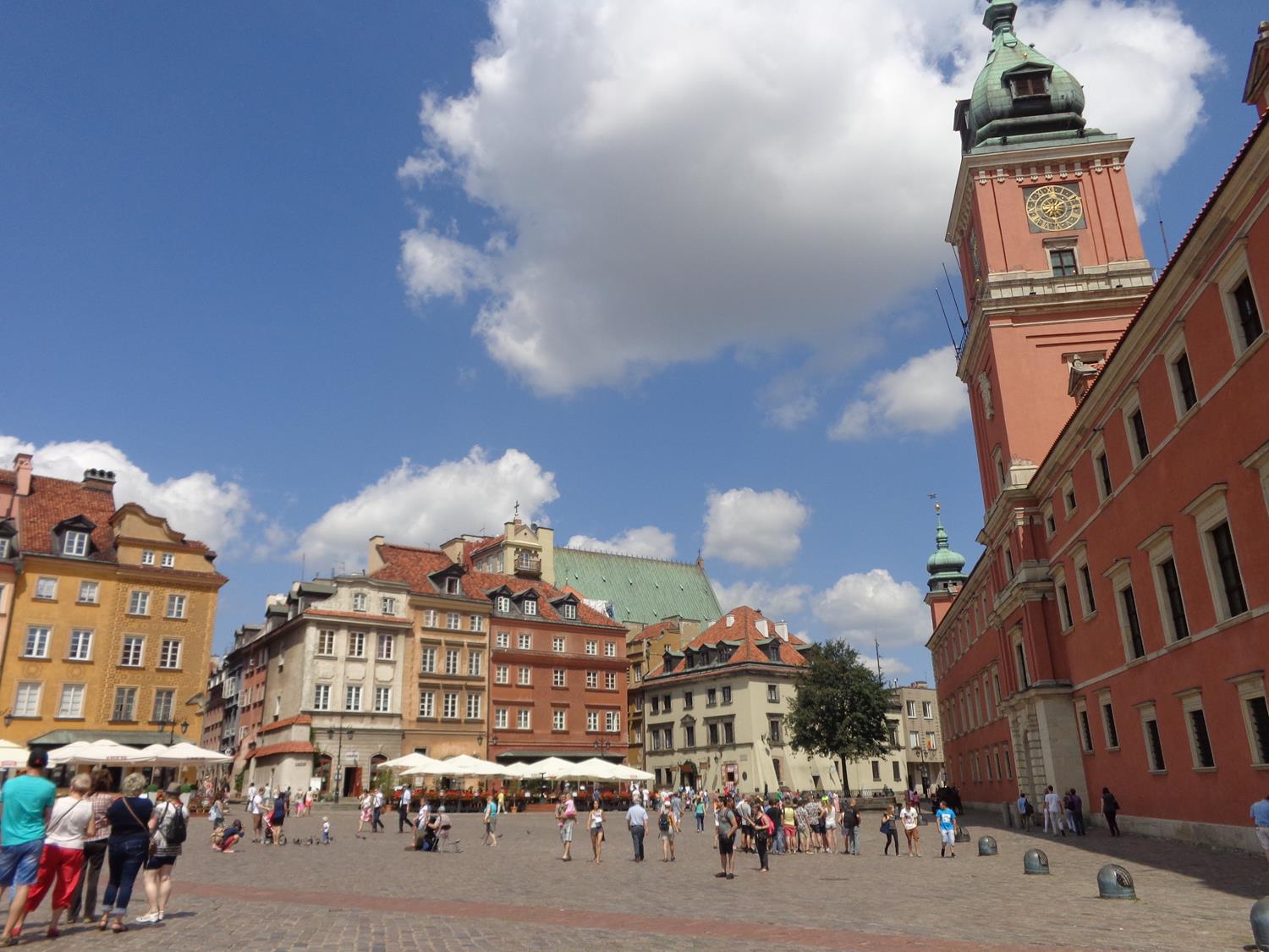
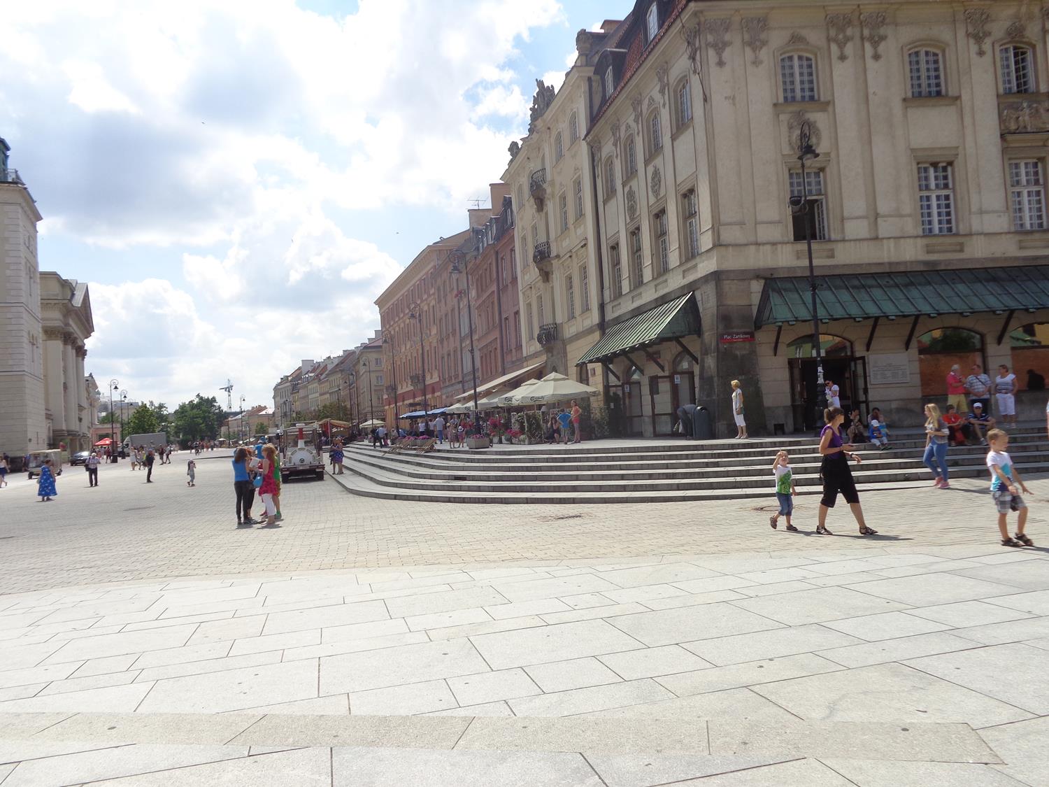
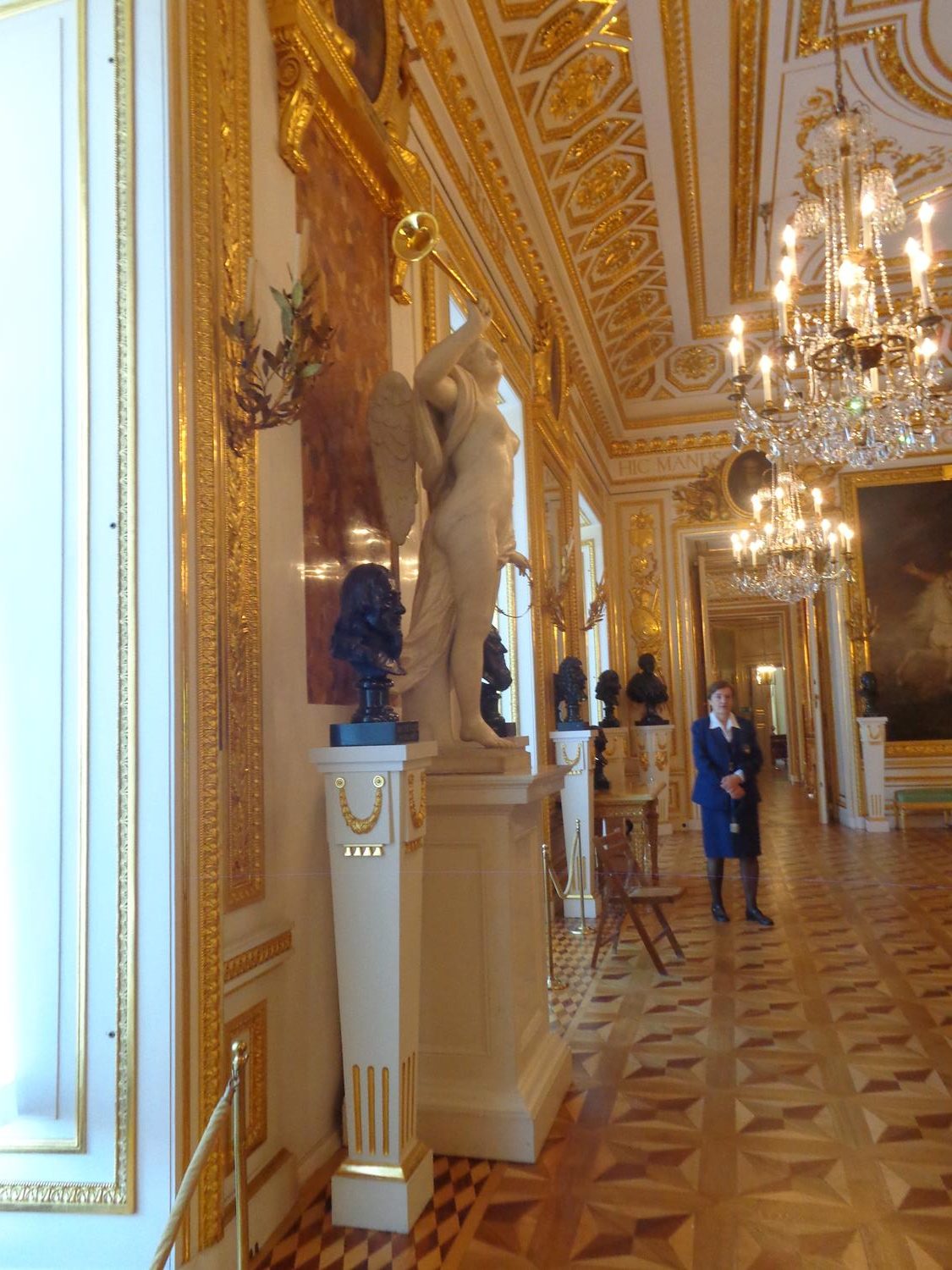
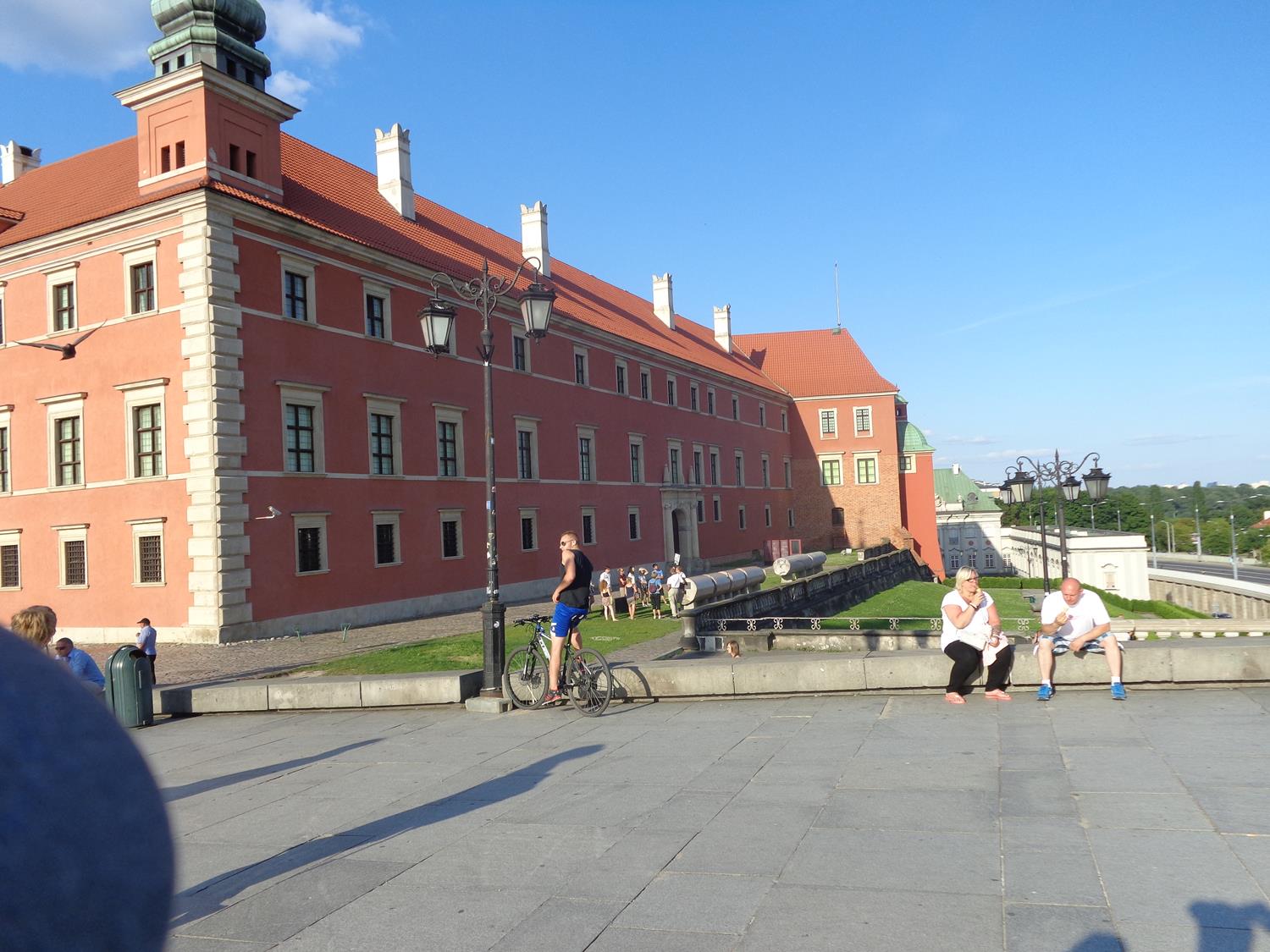
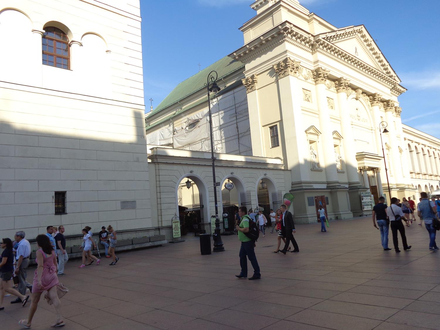
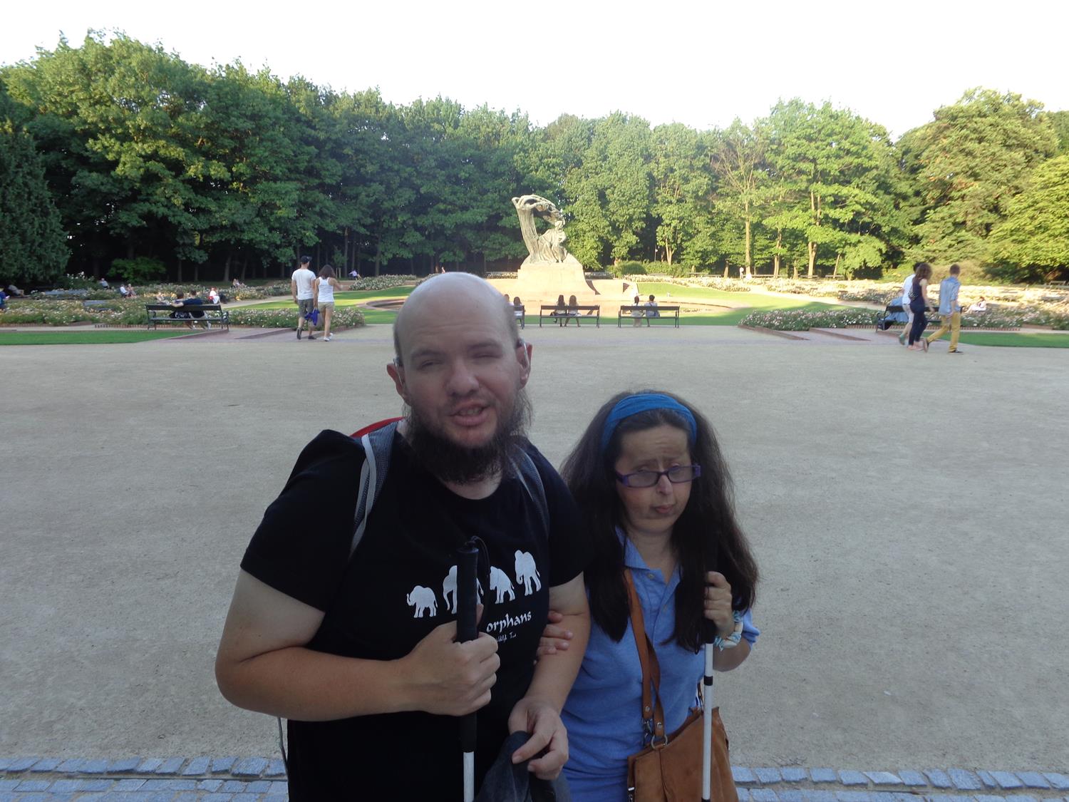
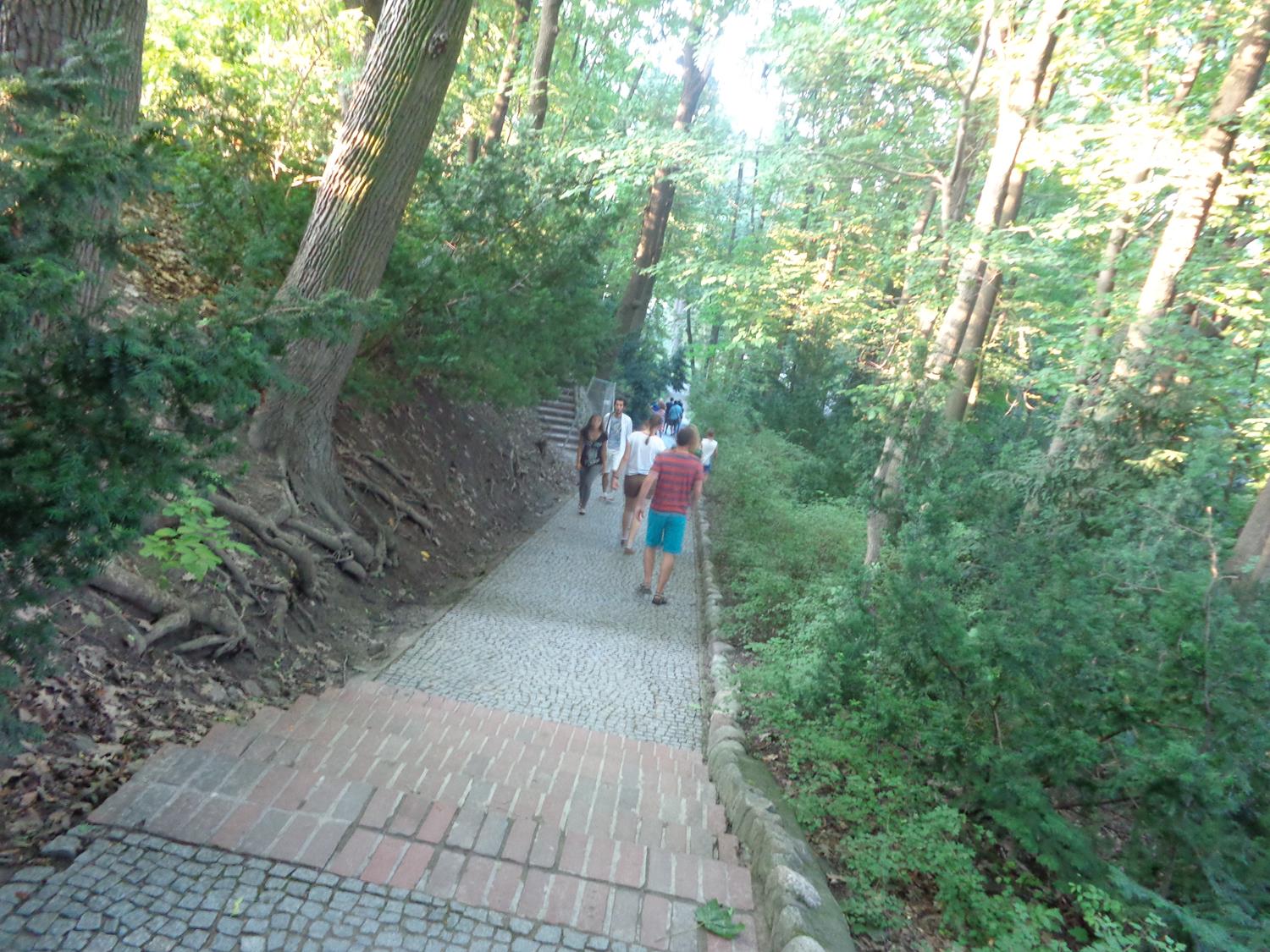
View across Castle Square with the Royal Castle, including its clock tower, in view on the right, and historic houses on the edge of the Old Town at the far side. The imposing main façade of the Royal Castle extends for 90 metres (300 feet) along the east side of Castle Square. It is three storeys in height with a large central clock tower rising to 60 metres (200 feet). The castle was an important royal residence from the 16th century until the final partition of Poland in 1795. Architecturally it is Italian Mannerist in style but with some older Baroque elements remaining. The palace was almost completely destroyed by the Nazis in 1944 but was rebuilt in its original 17th century form between 1971 and 1984. Today it is open to the public as a museum.The granite base of Sigismund’s Column in Castle Square. The column was completed in 1644. It commemorates King Sigismund III Vasa who in 1596 moved Poland’s capital from Kraków to Warsaw. He was King of Poland and Grand Duke of Lithuania from August 1587 to April 1632. A bronze statue of the king stands on top of the 22-metre high column. The photo shows steps around base and bronze plaques on the sides of the pedestal above.A closer view of one of the bronze plaques attached to the base of Sigismund’s Column. The inscription dedicated to King Sigismund III Vasa is in Latin. At the top of the pedestal and at the foot of the Corinthian column above is a bronze eagle with its wings spread. There are four of these eagles on each side of the pedestal. Sigismund’s Column was destroyed by the Germans during the Warsaw Uprising in 1944 and was rebuilt in 1949.View south from Castle Square along a wide pedestrian street called Krakowskie Przedmieście. This is one of the most well known and most prestigious streets in Warsaw. The sides are lined with historic palaces, churches and town houses. It is the northernmost part of Warsaw’s Royal Route.Looking north-west from Castle Square along the remains of the city walls that surround Warsaw’s Old Town. Two lines of walls and a moat can partly be seen. These walls were originally raised between the 13th and 16th centuries but much restoration took place during the 1930s and 1950s.View south-east from Castle Square. Away in the distance Warsaw’s National Stadium (Stadion Narodowy) can be seen on the far side of the River Vistula. Close by on the right is the neoclassical bell tower of St. Anne’s Church.A replica steam train used to transport tourists parked in Castle Square.Another view along Krakowskie Przedmieście from Castle Square. On the right is a row of large historic tenement houses.The Knight’s Room inside the Royal Castle. In view is a large gold gilded mirror and a bust of Adam Naruszewicz (1733-1796). He was a Polish-Lithuanian nobleman, poet, historian and Roman Catholic bishop.Again the Knight’s Room inside the Royal Castle. The room is lavishly decorated with gold gilded plaster work on the walls and ceiling. It is adorned with statues, busts and paintings.The Knight’s Room inside the Royal Castle showing several chandeliers hanging from the ceiling.View of Castle Square showing the whole of Sigismund’s Column. A bronze statue of King Sigismund III Vasa stands at the top of the column. He is dressed in armour and is holding a large cross in one hand and wields a sword in the other. There is also a good view of the Royal Castle with its red walls and roof. Copper domes topped with spires sit on towers in the palace’s corners along with a larger domed spire atop the central clock tower.The cobbled surface of Castle Square in the foreground with Sigismund’s Column and historic tenement houses visible beyond.The south façade of the Royal Castle on the left. On the grass alongside fragments of the original Sigismund’s Column destroyed in 1944 can be seen. This original column was made from red marble, while the current column is granite.The neoclassical front façade of St Anne’s Church and part of the separate bell tower visible on the left. Construction of the first church here began in 1454, while the present structure dates from 1788. The building was badly damaged by German air raids in 1939 and fire in 1944 and has since been restored.Another view of St. Anne’s Church showing the attractive square-based bell tower and the church itself behind.Grass covered terraces at the south side of the Royal Castle. At the foot of the terraces is a main road, heading across the River Vistula, with trams running along it.Tony and Tatiana in Royal Baths Park (also known as Łazienki Park) with the Chopin Monument visible away in the background. The Chopin Monument is dedicated to famous Polish composer Frédéric Chopin who lived from 1810 to 1849. The statue was designed in 1907 by Wacław Szymanowski but was not completed until 1926. It depicts Chopin seated beneath a stylised willow tree. In front is a circular pool of water.A busy path through mature woodland in Royal Baths Park.
Tuesday, 22nd July 2014
View of the Wilanów Palace in the distance seen through the palace’s main gateway. The gateway includes a pair of large stone pillars with attached iron gates and with classical statues on the top. One of the statues depicts a soldier standing by a cannon.Outside the Baroque Wilanów Palace looking towards a main doorway in the North Wing. The doorway’s stone surround is decorated with statues: a pair of classical male figures half-way up and a pair of cupids at the top. There are more statues in alcoves along side.
The Wilanów Palace is a former royal palace located in the Wilanów district of Warsaw. It was built between 1677 and 1696 and is one of Poland’s most important cultural monuments. It survived Poland’s partitions and both World Wars largely intact. Since 1805 the palace has been open to the public as a museum.
Another view showing the exterior of the Wilanów Palace. The walls are yellow and cream in colour. Exterior decoration includes statues in alcoves, stone relief panels depicting classical scenes above the windows, decorative columns embedded in the walls with Corinthian capitals at the top, plus balustrades and more statues at roof level.Again the elaborately decorated exterior of the Wilanów Palace showing the main central part and north wing.The gardens of the Wilanów Palace. Looking along a wide cobbled path with people sitting on benches. There is a formal lawn to the right and colourfully planted flower beds backed by trees on the left.
Wednesday, 23rd July 2014
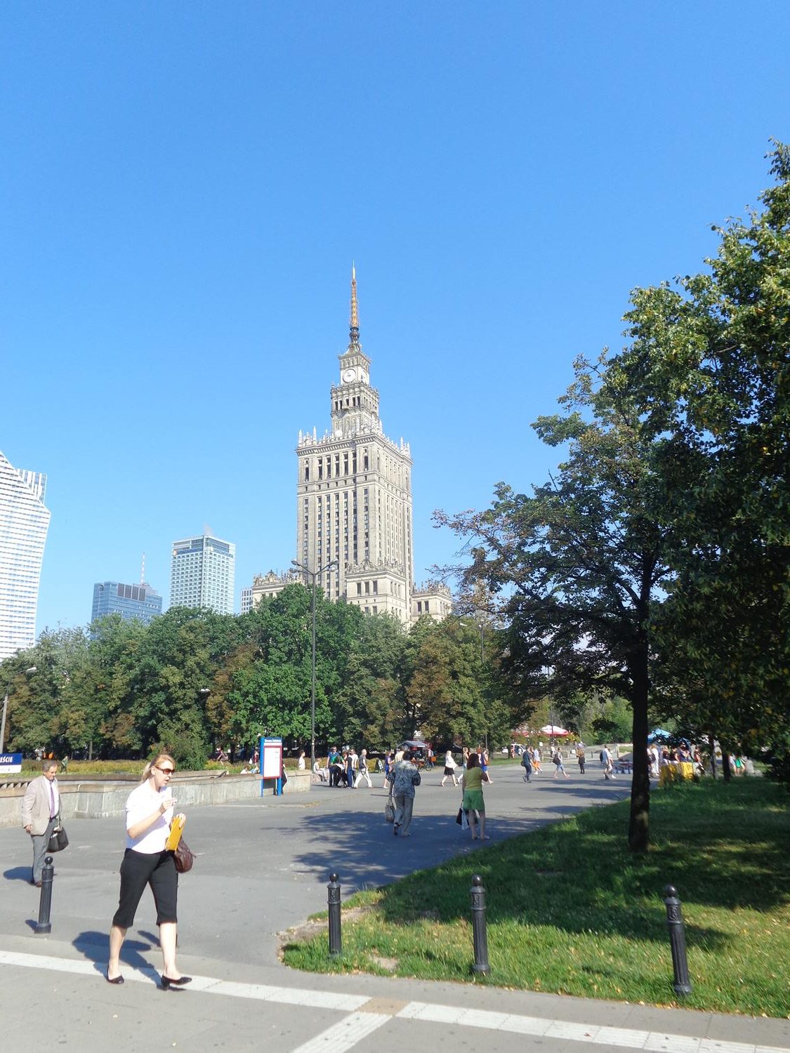
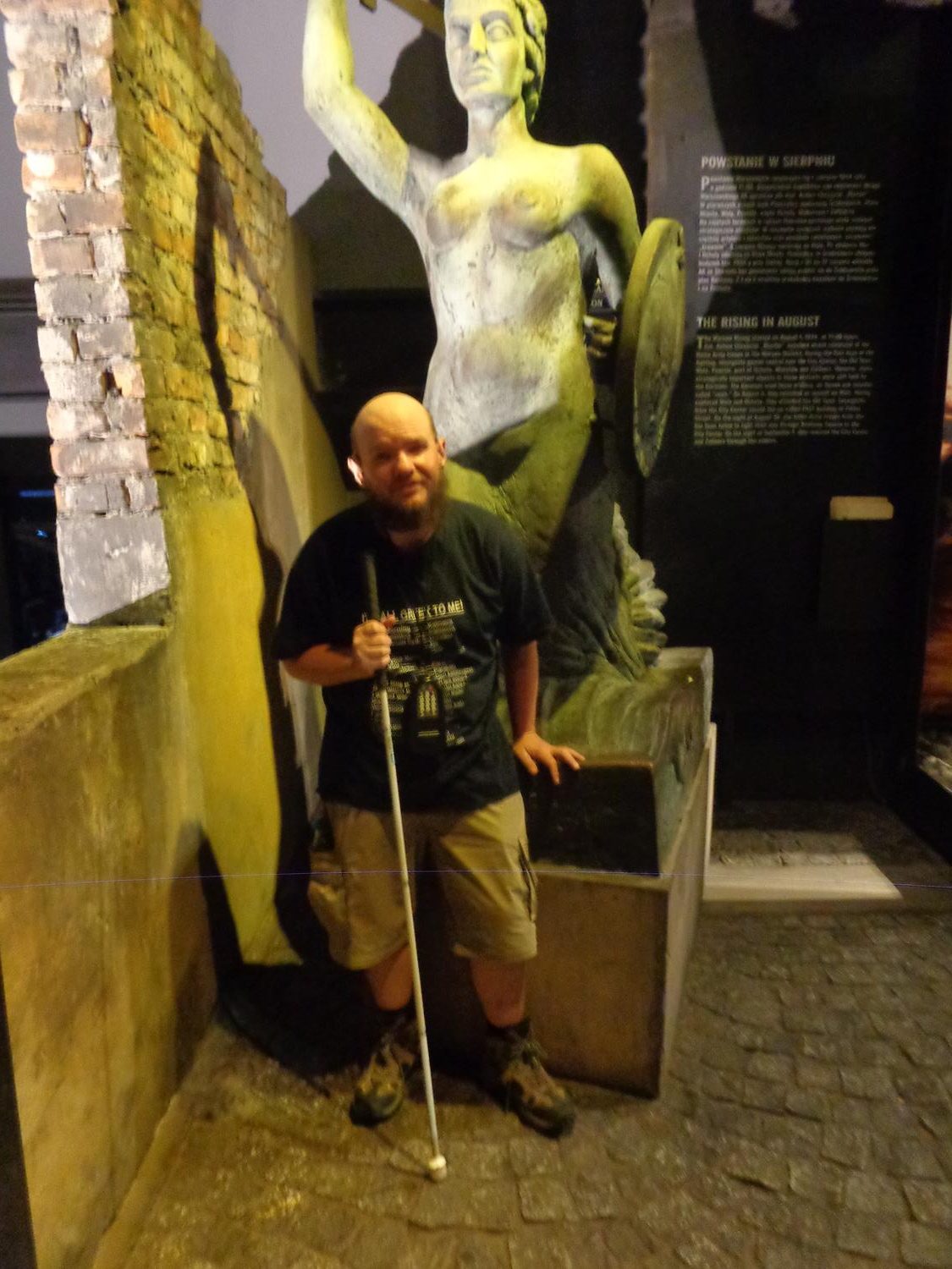
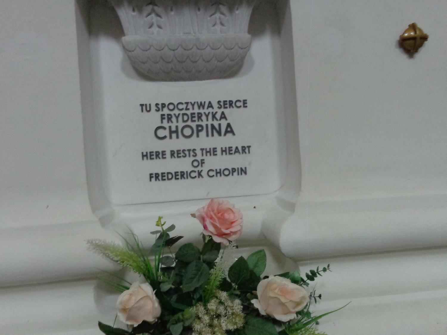
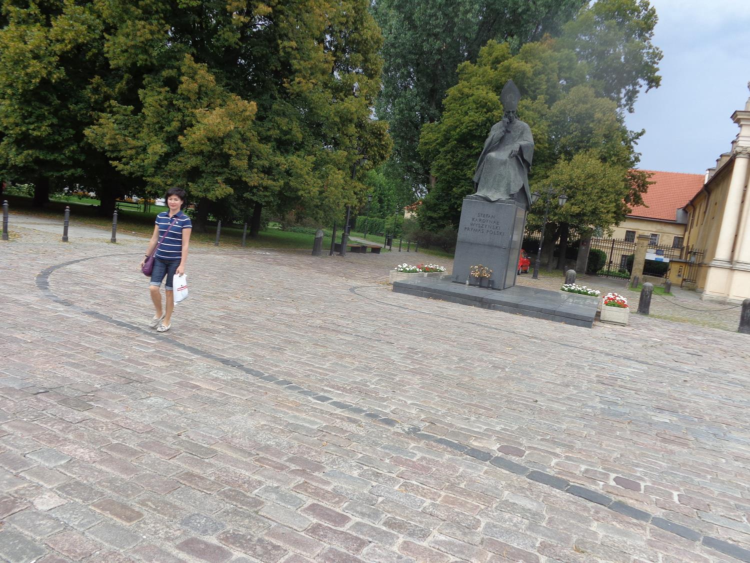
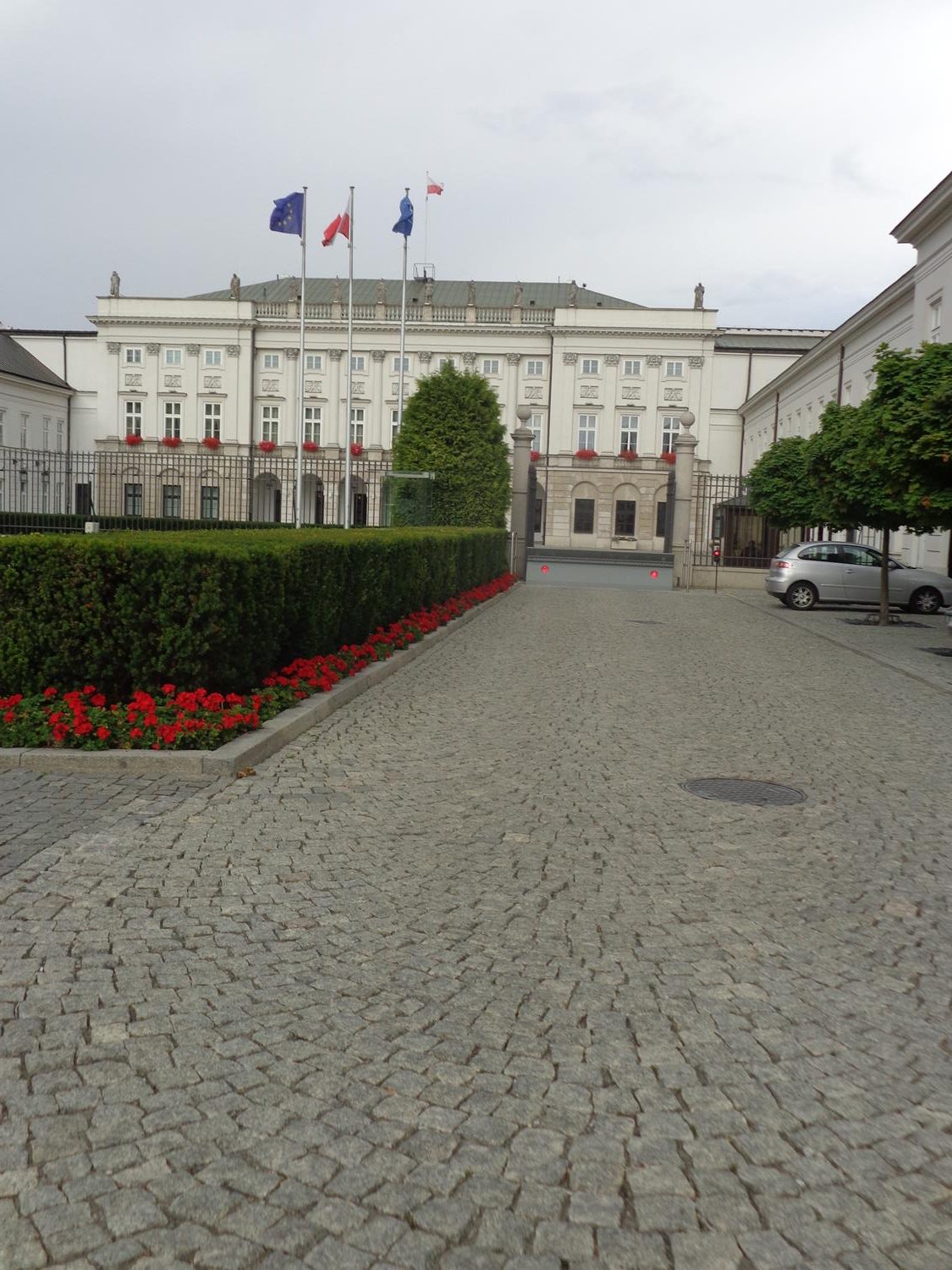
The monolithic Palace of Culture and Science (Pałac Kultury i Nauki) in the middle distance. This building is the second tallest in both Warsaw and Poland standing at 237 metres (778 feet). It was constructed from 1952 to 1955 to house various public and cultural institutions such as cinemas, theatres, libraries, sports clubs, university faculties and the Polish Academy of Sciences. The building is topped with a large spire, and beneath this, the top section of the tower incorporates a clock on each of its four sides: this made it the tallest clock tower in the world until the beginning of the 21st century.A slightly closer view of the monolithic Palace of Culture and Science. The building was designed and built as a gift from the Soviet Union to the people of Poland. Its architectural styles include Socialist realist and art deco.Tony inside the Warsaw Rising Museum in front of a stylised sculpture depicting a woman holding a sword and shield. The Warsaw Uprising was a major World War II operation by the Polish underground resistance to liberate Warsaw from German occupation. It occurred in the summer of 1944 and was led by the Polish resistance Home Army. The Uprising was fought for 63 days with little outside support.View of the south end of Krakowskie Przedmieście, a main street in the centre of Warsaw, with Holy Cross Church to the right and the Staszic Palace ahead. The Staszic Palace was originally an Eastern Orthodox chapel built by King Sigismund III in 1620. In 1818 the building was purchased by Stanisław Staszic – a Catholic priest, philosopher and leading figure in the Polish Enlightenment – who redesigned it as a palace in neoclassical style. Staszic then donated the building to the Society of Friends of Science. Today it is the seat of the Polish Academy of Sciences. The palace was nearly razed during the 1944 Warsaw Uprising and was rebuilt in its original neoclassical form from 1946 to 1950.Outside Holy Cross Church. In front of the main entrance is a bronze statue of Christ Bearing His Cross. Holy Cross Church is one of the most notable Baroque churches in Warsaw. It was built between 1679 and 1696. Its main designer was Józef Szymon Bellotti, the royal architect at the Royal Court of Poland.The central aisle inside Holy Cross Church with the large golden main altar at the far end. The main altar was reconstructed between 1960 and 1972 following its destruction by the Germans during World War II. The church itself was rebuilt between 1945 and 1953.A pillar containing composer Frédéric Chopin’s heart inside Holy Cross Church. The inscription written in Polish and English reads ‘Here rests the heart of Frederick Chopin’. Frédéric Chopin (1810-1849) died in Paris and his body is buried there. His heart was removed, preserved in alcohol, and returned to his native Poland, in line with his wishes.Tony with a Polish guy outside the main entrance to Holy Cross Church.A bronze statue of Cardinal Stefan Wyszyński (1901-1981) outside the Visitationist Church. Stefan Wyszyński was archbishop of Warsaw and Gniezno from 1948 until 1981. Here he is depicted seated and wearing ceremonial cardinal’s dress including robes and a mitre (a tall fabric hat rising to a point in the front and back centre).The cobbled square outside the Visitationist Church. A small part of the front facade can be seen. The church’s formal name is the Church of St. Joseph of the Visitationists (Kościół Opieki św. Józefa w Warszawie). This Roman Catholic church is one of the most notable rococo churches in Poland’s capital. It was constructed from 1664 to 1761.Tony in front of a large stone lion. This is one of four lions situated outside the Presidential Palace.The front of the Presidential Palace. This is the official residence of the Polish head of state. An aristocratic mansion has stood here since 1643. The present neoclassical palace was completed in 1818. The photo also shows railings and gates in front. There are three flag poles flying the Polish and EU flags.Part of the Adam Mickiewicz Monument. This monument was constructed from 1897 to 1898 by sculptor Cyprian Godebski and is dedicated to Adam Mickiewicz (1798–1855). Adam Mickiewicz was a Polish poet, dramatist and essayist. He is regarded as national poet in Poland, Lithuania and Belarus. The photo shows steps leading up to a terrace around the base and a pedestal above. The 4.2 metre tall bronze statue of Mickiewicz at the top is out of view.View of St Alexander’s Church located within Three Crosses Square. This neoclassical Roman Catholic church was designed by renowned Polish architect Chrystian Piotr Aigner and was built between 1818 and 1825. The building was enlarged and remodelled in the late 19th century, but was destroyed during World War II, and then reconstructed in its original simpler form. The main central part of the church is circular with a domed roof. The structure extends out at the front and rear with large porticos supported by Corinthian columns.Part of Three Crosses Square, the sides of which are occupied by busy roads. This important square is on the south side of the city centre and lies on the city’s historic Royal Route. A pair of crosses on stone columns can be seen ahead. These are two of the three crosses that the square is named after: the third is located on top of the dome of St Alexander’s Church.