Located on Anatolia’s south-west coast and bordered by the Taurus Mountains, Antalya is Turkey’s eighth most populous city and its largest on the Mediterranean Sea. The city was first settled around 200 BC by the Attalid dynasty of Pergamon, which was quickly subdued by the Romans. From the 13th century AD the city was invaded and occupied by the Ottomans. Ottoman rule brought relative peace and stability for the next five hundred years. Today the city is a popular sea resort attracting millions of tourists each year.
Monday, 30th September 2019
View of Lower Düden Falls from Düden Park. The waters of the Düden River can be seen crashing dramatically over a cliff directly into the Mediterranean Sea. The falls are located on the eastern edge of Antalya, about 5 miles (8.5 km) along the coast from the old centre of the city.Tony and Tatiana at a viewing area next to the Lower Düden Falls. In the background, a view along the rocky cliff-lined coastline, out east from Antalya. A pile of large green melons for sale at a stall. A view of the Düden River near the Upper Düden Falls. There is a café amongst trees on the opposite bank of the river with a cliff behind. The Upper Düden Falls are located north of the city, a roughly 30 minute drive or an hour by public bus from the centre.A tree trunk carved with people’s initials with the river visible below. Tony and Tatiana in front of the Upper Düden Falls. Several separate cascades of water pouring over a vegetation covered cliff into a pool.Another view of Tatiana and Tony at the Upper Düden Falls. Tony in the mouth of a cave with the Upper Düden Falls behind. A curtain of water seen from inside the cave. The light illuminating droplets of falling water. Plant stems and leaves, lit almost as silhouettes, in the foreground. Illuminated shops on Atatürk Caddesi (Ataturk Boulevard) seen during the evening. This tree-lined boulevard runs outside the perimeter of the Kaleiçi or old walled city.
The Kaleiçi is the old walled centre of Antalya. A network of small, narrow, cobbled passages and streets wind in and out creating a protective system that was difficult to penetrate. The cobbled streets contain historic Ottoman-era buildings.
Hadrian’s Gate seen at night. The three central entry arches are in view. This gate is at the entrance to the old walled city and today is the only surviving gate in the walls. It was constructed in the 2nd century AD by the Romans in honour of the Emperor Hadrian, who visited the city in the year 130.A stone tower at the north side of Hadrian’s Gate. The lower part of the tower is Roman, but the upper section was rebuilt in the first half of the 13th century during the reign of Seljuk sultan. There is another Roman tower on the south side of the gate.Tony in front of Hadrian’s Gate Tony by one of the columns that stand in front of the entry arches at Hadrian’s Gate.Tony touching a small plastic/metal sculpture, probably a drinking fountain, close to Hadrian’s Gate. It has a square-shaped central column with lion’s heads on three sides. Tony in front of a large carved block of stone, likely of Roman origin, with Hadrian’s Gate behind.
Tuesday, 1st October 2019
A varied selection of souvenirs for sale at a stall opposite the café, including pottery, carved wooden cats, small models of bicycles and old typewriters.A mural on a wall depicting a stylised face with four eyes and large purple lips. On a quiet narrow street in the old city. Looking down into a small square within the old city. The square contains a pair of palm trees and a circular fountain (with no water). Traditional Ottoman-style buildings beyond. A row of cafés and restaurants with extensive outdoor seating. A shisha water-pipe on the pavement in front. Karaalioglu Park in the evening. This park is located by the sea on the southern edge of the old city. Hidirlik Tower standing illuminated within Karaalioglu Park. The tower has a square-shaped base and a circular upper section. It is believed to have been built by the Romans in the second century AD. It is 14 metres (46 feet) in height. There is an entrance gate on the east side.
Antakya
Antakya is the capital of Hatay, which is Turkey’s most southern province. The city is located in a well-watered and fertile valley on the Orontes River, approximately 12 miles (20 kilometres) from the Levantine Sea. The present city stands partly on the site of ancient Antioch, founded in the 4th century BC by the Seleucid.
Thursday, 3rd October 2019
View from a steep road leading to the rock-cave church of St Peter. The eastern edge of the city can be seen where it meets the lower slopes of the adjoining mountains.
St Peter’s Cave Church is composed of a cave carved into the mountainside of Mount Starius with a depth of 13 metres (42 feet), a width of 9.5 metres (31 feet) and a height of 7 metres (23 feet). It is believed by some to be one of Christianity’s oldest churches, used by the very first Christians. The oldest surviving parts date from at least the 4th or 5th centuries: these include some pieces of floor mosaic and traces of frescoes on the right side of the altar. Crusaders of the First Crusade who captured Antakya in 1098 lengthened the church by a few metres and connected it with two arches to the façade, which they constructed. Having been abandoned, it was restored in the 19th century.
Tony and Tatiana entering through the main doorway of St Peter’s Cave Church. A roughly circular window, edged with geometric patterns, can be seen directly above the doorway. Close-up of Tony and Tatiana inside the church. A bare rock wall behind. Tatiana and Tony standing to the side of the main altar. Looking directly at the main altar. It is constructed from carved stone blocks with the natural rock of the cave behind. Above the altar is an alcove cut into the natural rock, it contains a marble statue of St Peter that was placed here in 1932. To the left of the altar is an opening, apparently originally leading into a tunnel, which could be used by early Christians for evacuation of the church in case of sudden raids. View of a section of floor mosaic believed to date from the 4th or 5th century AD. The mosaic tiles are in two colours forming a geometric pattern made-up of diamond shapes. Tony and Tatiana standing just inside the church’s doorway. A courtyard outside St Peter’s Cave Church. The steep slopes of Mount Starius can be seen beyond. Looking out over Antakya from the courtyard. The city’s buildings disappearing into a haze with the surrounding mountains visible in the distance. Tony and Tatiana sitting on a low wall with the vista over the city behind.
Saturday, 5th October 2019
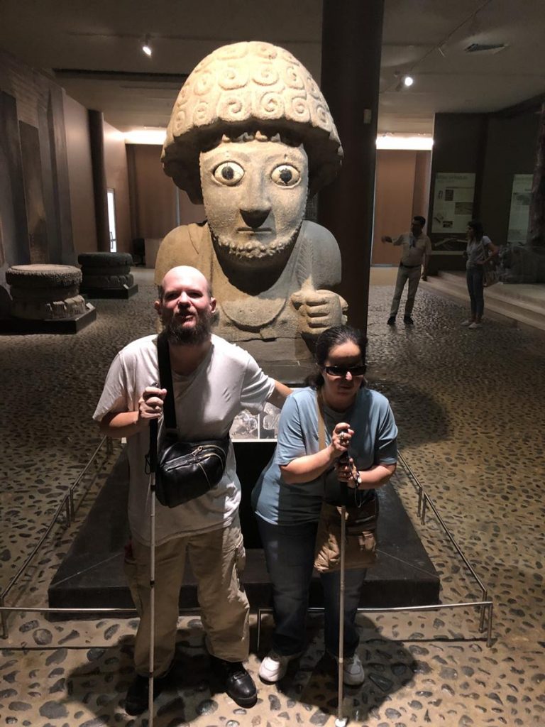
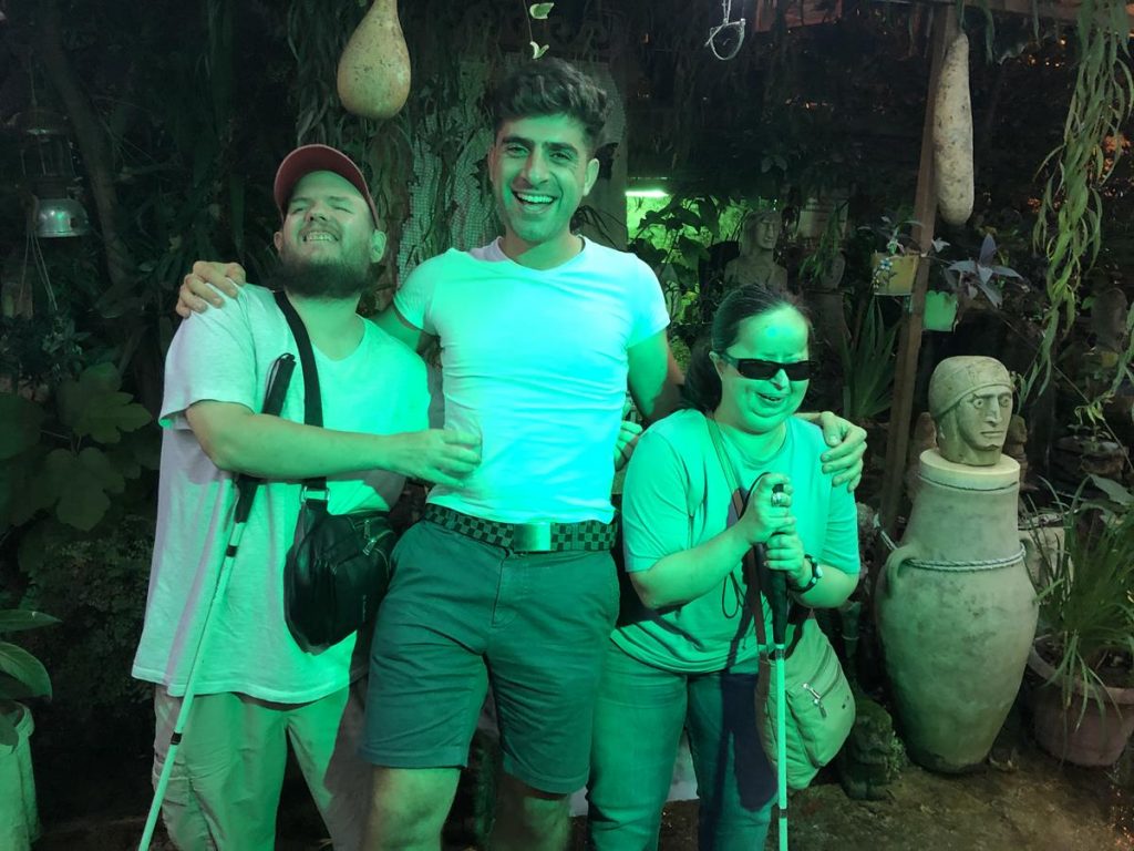
Tony and Tatiana sitting in a café with Sam and his sister who are from the Antakya area. Tony and Tatiana in Hatay Archaeology Museum. Behind is a recreated stone-age scene depicting a man in a cave with a dead ibex (wild mountain goat). Tatiana and Tony in front of a striking 3000-year-old statue of Hittite King Suppiluliuma. It was unearthed at Tell Tayinat, an ancient site in the Hatay region. It is 1.5 metres in height, although the statue only survives from the waist up, so it was once taller. The stylised face has very large staring eyes and a beard. Another view of Tony and Tatiana in front of the King Suppiluliuma statue. A large mosaic depicting a mythological scene with human figures, fish and other sea creatures. Hatay Archaeology Museum is noted for its extensive collection of Roman and Byzantine era mosaics which were found in the ancient cities of Daphne, Seleucia Pieria (Samandag), Antioch and Tarsus. A walkway providing views over a number of large mosaics. Tony and Tatiana in the foreground. Tatiana and Tony in front of a reproduction of mosaic showing a reclining skeleton, a pitcher of wine and a loaf of bread. There is an inscription in Ancient Greek above which has been translated as ‘be cheerful and live your life’. Tony, Tatiana and Sam in front of the skeleton mosaic. Tony and Tatiana in front of a large stone sarcophagus, probably from the Roman period. Another view of Tony, Tatiana and the sarcophagus. Tatiana and Tony outside Hatay Archaeology Museum. The museum’s present building opened in 2014. There is a large decorative metal waterwheel standing in front, which is in the style of waterwheels that historically stood alongside the Orontes River. Tony, Tatiana and Sam outside Hatay Archaeology Museum. Tony and Tatiana at Harbiye (Daphne) promenade in the evening. Various reproductions of ancient artefacts in the background, including a small mosaic, vase and small statues. Tony and Tatiana with Sam at Harbiye (Daphne) promenade. A pool of water with a small fountain. Plants at the side. Tall vases at the far end. Harbiye (Daphne) promenade.
Göreme, Cappadocia
Göreme is a town and tourist hub in Cappadocia, a historical region of Turkey. It is noted for its natural rock formations, cave dwellings and ancient rock-cut churches.
Wednesday, 9th October 2019
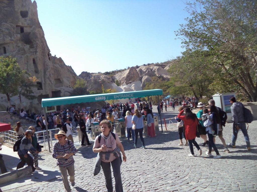
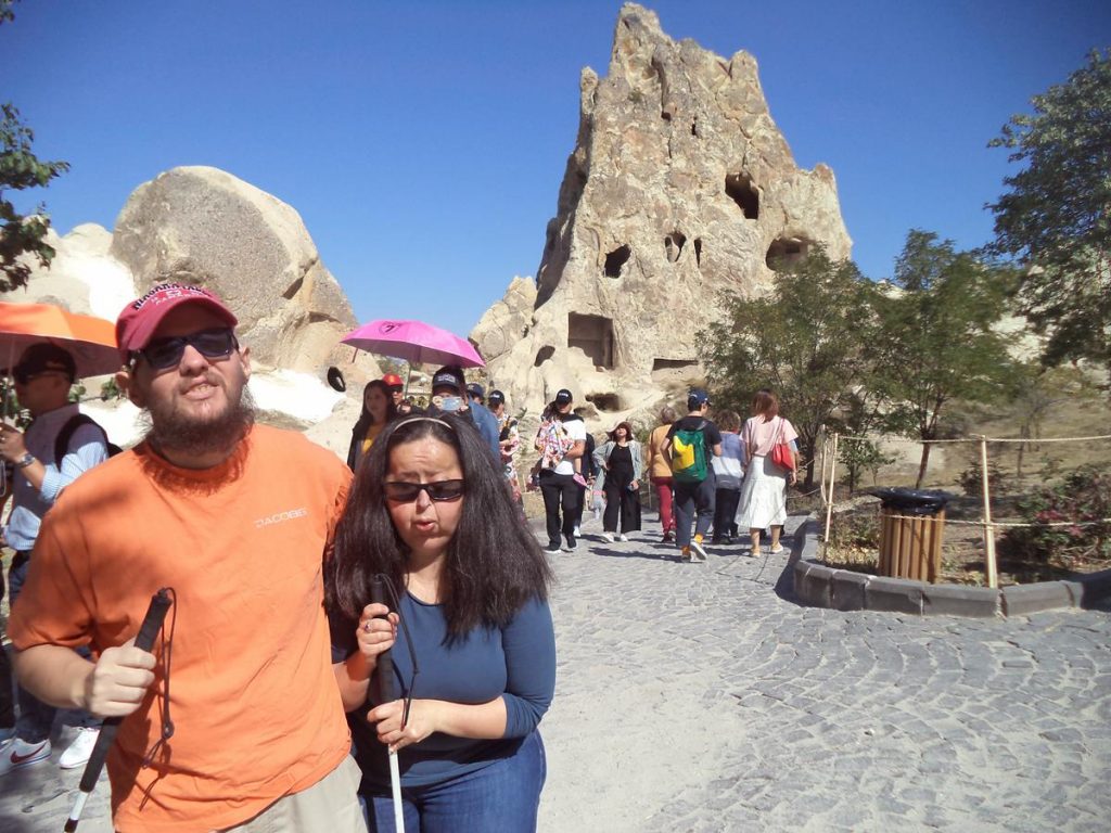
Tatiana and Tony in the distinctive rocky landscape at Göreme. A cliff in the background with caves cut into the soft rock, as well as modern buildings above. Souvenir stalls and a café below. The entrance turnstiles at Göreme Open-Air Museum with caves visible in an outcrop of rock behind. This complex includes a series of ancient cave buildings cut into a roughly ring-shaped rock formation. It is most famous for its painted cave churches carved out by Orthodox monks. Located only 1.5km (1 mile) from Göreme village centre. The site has been a UNESCO World Heritage Site since 1984. The exterior of St Barbara cave church. A group of visitors queuing to go inside. This church dates from the second half of the 11th century. It has a cross-shaped internal layout. The north, south and west arms of the interior are barrel vaulted, while the centre, the east arm are domed. Two frescos inside St Barbara church photographed inside a book, because no photography is allowed inside the church itself. One fresco shows St George and St Theodore on horse back, while the other depicts Christ Pantocrator, a full body representation of Jesus Christ as ruler of all things. Exterior of Snake (Yilanli) Church. This church has a linear plan, consisting of two chambers. The front section is barrel-vaulted, while the back part has a flat ceiling. Tony and Tatiana at Göreme Open-Air Museum. In the background a pinnacle of rock with caves cut into it: a common sight around Göreme. View across part of the Göreme Open-Air Museum site. The foreground slopes upwards covered with parched patches of grass and occasional small bushes and trees to a towering outcrop of rock with various doors and windows visible cut into it. Tony and Tatiana on one of the paths through the Göreme Open-Air Museum site. Entrance to another cave building. As well as churches, there is a rectory, various dwellings, and a religious school. Tony and Tatiana at a view point looking over Love Valley. In the foreground, a seat under an arch, decorated with pottery jugs. A sign for Aşk Vadisi Salıncak Café above.Another wonderful view overlooking the series of rocky ridges and valleys that surround Göreme, with numerous interesting rock formations, and then out beyond out into the far distant horizon. Tony and Tatiana at Devrent Valley. A distinctive rock formation, which looks vaguely like a camel, can be seen in the middle distance. This valley is also known as Imaginary Valley or Pink Valley due to the colour of the rock. It is known for its interestingly shaped rocks, some of which are said to resemble animals. Tatiana and Tony at Urgup (Ürgüp). Groups of fairy chimneys can be seen in the background. These towering conical formations, often noted for their phallic appearance, are commonly seen in the Cappadocia region. They have formed due to their protective cap of erosion-resistant basalt rock, which has allowed them to remain standing while the surrounding soft volcanic tufa rock has been weathered away. Tony, Tatiana and their local guide with fairy chimneys in the background at Urgup. Tony and Tatiana are on the ‘Red Tour’ day trip. Pigeon Valley vista point. Excellent view down into the valley. The valley’s name comes from the thousands of pigeon houses that are carved into the rock, some of which can be seen in this photo. Zoomed in on rock formations on the opposite side of Pigeon Valley. Protruding ridges of weathered natural rock with man-made openings cut into the sides. Tatiana and Tony at the Pigeon Valley vista point. Spectacular view along Pigeon Valley and out far beyond across the rocky landscape of Cappadocia.
Thursday, 10th October 2019
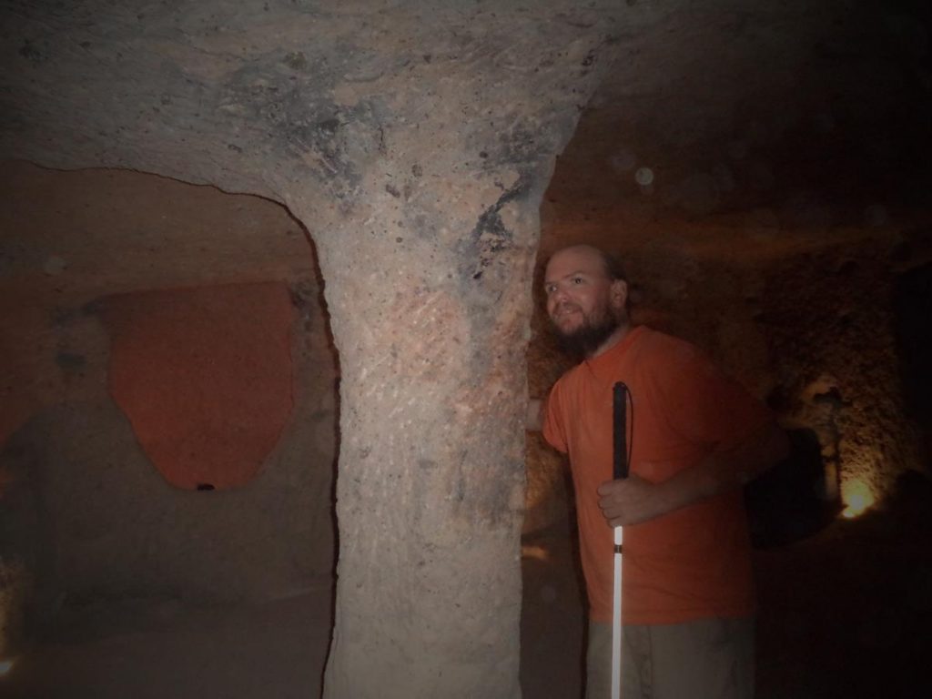
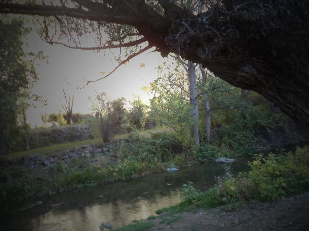
Tony and Tatiana inside a small cave room, part of the underground city of Kaymakli. Kaymakli is one of up to 40 underground settlements in Cappadocia, ranging in size from villages to cities. The first tunnels of these settlements may have been cut into the soft volcanic rock by the Phrygians, an Indo-European people, in the 8th–7th centuries BC. The settlements were greatly expanded and deepened in the Byzantine era, when they were used for protection from Muslim Arab raids during the four centuries of Arab–Byzantine wars (780-1180). Kaymakli consists of eight floors below ground, only four of which are open to the public today. The rooms are arranged around ventilation shafts. The site was opened to visitors in 1964. Tony touching a stone pillar in one of Kaymakli’s many underground chambers. These rooms are connected by narrow and sloping passages. Tony and Tatiana emerging out of a dimly lit rock chamber through a stone doorway. Tatiana inside a church located on Kaymakli’s second floor. It has a single nave and two apses. In front of the apses is an altar and on the sides are seating platforms. Tatiana and Tony next to a large stone. This is possibly a block of andesite stone, which is located on the underground city’s third level. This contains 57 holes which were used for moulding copper ore. Looking down into a hole in the stone floor, perhaps a well or part of ventilation shaft. Tony touching the ceiling in one of Kaymakli’s narrow passageways. A chamber with a low ceiling supported by stone pillars. Tony touching another stone pillar. Tony, Tatiana and a Turkish guide walking down a path in Ihlara Valley. Looking up the side of a cliff in Ihlara Valley. Openings cut into the rock can be seen high above. Tatiana on a path next to Melendiz Stream, located in Ihlara Valley. Melendiz Stream shaded by trees. A Turkish woman selling dried fruit, displayed in plastic bags on a wall. Tony touching one of a pair of a miniature fairy chimneys, the distinctive rock formations found around Göreme. These ones are located in a village and appear to be man-made rather than natural. Belisirma restaurant offering a variety of Turkish foods. In view a series of dining tables located on platforms in the middle of Melendiz Stream.