Tony by a sign post at Lizard Lighthouse. The signs all point to other historic lighthouses around the British Isles. The two signs in view point to Bishop Rock Lighthouse 88.5 kilometres (55 miles) to the west off the Isles of Scilly and Sark Lighthouse 209.2 km (130 mi) roughly south-east at the Channel Islands.View out to sea from the top of Lizard Lighthouse. Lizard Lighthouse is located at Lizard Point in Cornwall. Lizard Point is at the southern end of the Lizard Peninsula and is the most southerly point on mainland Britain. The first lighthouse was constructed here in 1619, whilst the current lighthouse dates from 1751. At first the light was lit using coal burners. These were replaced by oil lamps in 1812, and again by an electric light in 1874, which was initially powered using hot air engines and dynamos. The lighthouse has been fully automated since 1998. A Heritage Centre opened on the site in 2009.Another view through the windows at the top of Lizard Lighthouse. This time looking north-east over Lizard Point towards rocky Housel Bay with high cliffs at the far side of the bay.Tony at the top of Lizard Lighthouse. The reflectors and surrounding windows part visible behind him.The lights and reflectors inside the Lizard Lighthouse tower. The light currently has a range of around 30 miles (26 nautical miles or 48 kilometres).View of the lighthouse tower from ground level. The white-painted octagonal tower is 19 metres (62 feet) in height. The tower is joined to a row of cottages, formerly providing accommodation for the lighthouse keepers. A second octagonal tower stands out of view at the far end. This provided a second light until 1903.View north from Lizard Lighthouse with a communications mast in front. The nearby landscape is predominantly grass with Lizard village visible about 800 metres away. The village is mainland Britain’s most southerly settlement.Another view of Lizard Lighthouse with perimeter stone walls and a car park in the foreground.Tony sitting at Lizard Point. A National Trust ‘Lizard Point’ sign attached to a rock behind. The English Channel extending to the horizon beyond.Tony’s friend Will at Lizard Point.A steep concrete path leading down to the sea at Lizard Point. There is a small beach and an old lifeboat station at the bottom.
Newquay, Cornwall
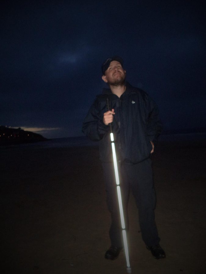
Newquay Beach taken in the evening twilight. Sandy beach in the foreground with the sea and lights on the headland beyond. Newquay is a seaside town on the north coast of Cornwall.Tony in near darkness on Newquay Beach with his white cane illuminated in the foreground.
Dartmouth, Devon
Tuesday, 11th August 2020
Dartmouth and Kingswear are small historical towns on the banks of the River Dart in South Devon. Dartmouth is known for its naval and boating history.
Tony touching an old canon located on the Embankment at Dartmouth. It points into the River Dart estuary, which is visible behind, with Kingswear on the far bank.Tony next to a memorial plaque commemorating the 50th anniversary of D-Day. Boats in the River Dart can be seen behind.Tony in Dartmouth Community Garden. A small park located next to the river. He is next a memorial flower bed remembering naval cadets killed in World War II.Close-up of large artificial poppies in the memorial flower bed. They show the names and ages of naval cadets killed in World War II.
Totnes, Devon
Thursday, 13th August 2020
Tony on the circular stone keep of Totnes Castle. The castle is one of the best preserved examples of a Norman motte and bailey castle in England. The present keep dates from the 14th century. The castle occupies a prominent position overlooking the town of Totnes and surrounding area.Tony with his friend Will on Totnes Castle’s keep.Tony in front of an information board titled The Shell Keep. The motte of Totnes Castle is behind with steps leading up to the keep. The motte is a large steep-sided earth mound covered with grass.Another view of Tony at the foot of the motte with the keep part visible at the top.
Axminster, Devon
Friday, 14th August 2020
Tony in front of the main doorway to Axminster Guildhall. This cream painted building was built in 1931. It is today an events and entertainment venue and is also home to the town council.View of St Mary’s Church. This is Axminster’s parish church and the oldest building in the town. The building has Norman origins, although most of it dates from the 13th to 15th centuries. It has a substantial central stone tower topped with a crenellated parapet.Tony outside the Old Registry Office on Silver Street, Axminster. This narrow two storey stone building dates from the 19th century but looks older. It is Early English Gothic in style with Gothic arches above the door and windows. A faded Register Office sign painted above the door.
Beer, Devon
Tony sitting on steps outside the doorway to the parish church of St Michael in Beer, Devon. This stone church was consecrated in 1878, the present building replacing a 16th century chapel.
Land’s End, Cornwall
Saturday, 15 August 2020
Land’s End is a headland and holiday complex in western Cornwall, England. It’s situated on the Penwith Peninsula, roughly 8 miles (13 kilometres) west-southwest of Penzance. The English Channel is to the east and the Celtic Sea is to the west. Land’s End is the most westerly point of mainland Cornwall and England. However, it’s not the westernmost point on mainland Britain, as this title narrowly goes to Corrachad Mòr in the Scottish Highlands.
The actual Land’s End, or Peal Point, is a modest headland compared with nearby headlands such as Pedn-men-dhu overlooking Sennen Cove and Pordenack, to the south. Land’s end headland is comprised of granite, an igneous rock that is resistant to weathering. The present hotel and tourist complex is at Carn Kez, 200 metres south of the actual Land’s End.
Land’s End is the start/finishing point of ‘end to end’ journeys with John o’ Groats, the northernmost town in mainland Scotland and Britain. These journeys are usually accomplished on foot or by bicycle. End to end journeys appear to have begun in the late 1860s or early 1870s. There’s a sign at the Land’s End headland where tourist can have their photo taken for a fee. The wooden letters can be rearranged to name the place where the individual lives.
Tony touching a signpost at Land’s End: it points to the Isles of Scilly, New York and John O’Groats. This signpost is located indoors with a large printed view of the rocky shore and sea seen from Land’s End on the wall behind.Tony outside the First and Last House, a souvenir shop and café at Land’s End, which has existed since the 19th century. This is the most westerly house in mainland England.Another view of the First and Last House.View of the rocks and sea at Land’s End. This maybe the Longships, a group of rocky islets slightly over 1 mile (1.6 km) offshore. The islets support the Longships Lighthouse – originally built in 1795, first lit in 1875 and has been automated since 1988.Tony with the Land’s End Hotel behind. A stone sculpture called The Gentle Wave by Max Barrett stands on grass in front. In the late 19th century there was a small house at Carn Kez, owned by the First and Last Inn, where the horses were kept whilst visitors explored the cliffs. This house eventually developed into the present hotel.View inland from Land’s End. Fields in the foreground with the tower of Sennen Parish church visible in the distance.