Douala is the largest city in Cameroon and its economic capital. It is home to Central Africa’s largest port. The city and its surrounding area had an estimated population of 5,768,400 in 2015. It sits on the estuary of Wouri River.
Wednesday, 1st March 2023
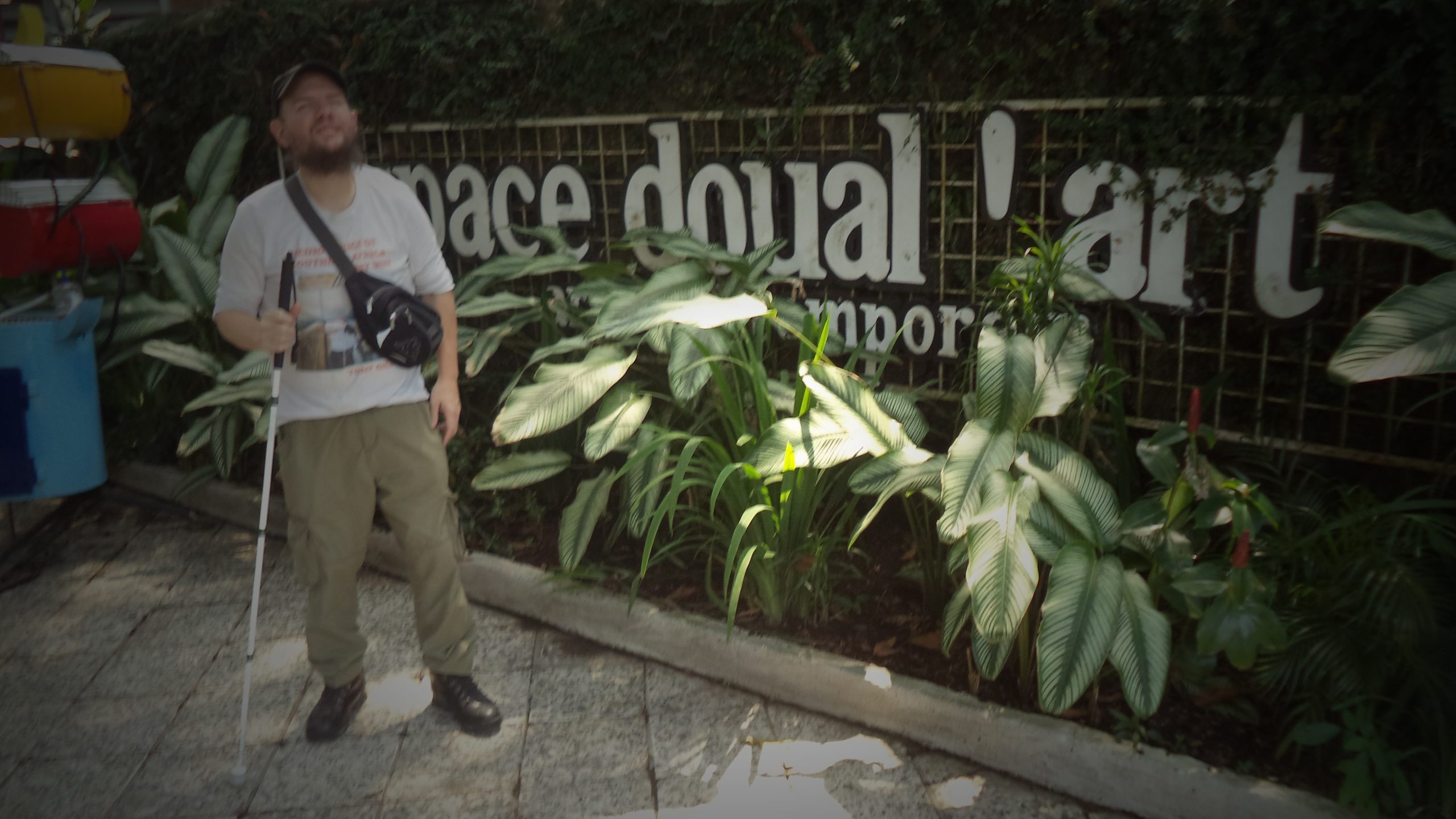
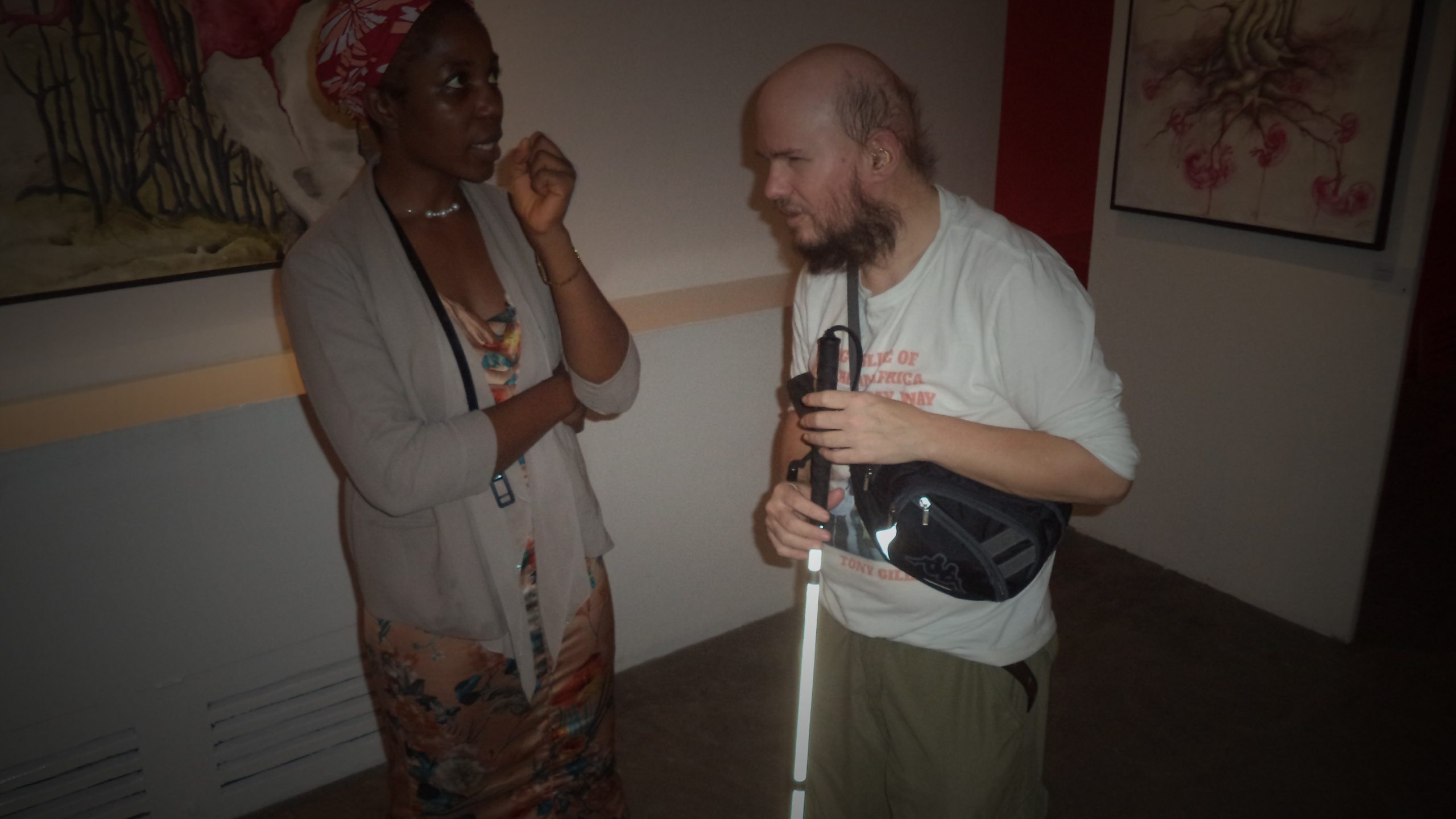
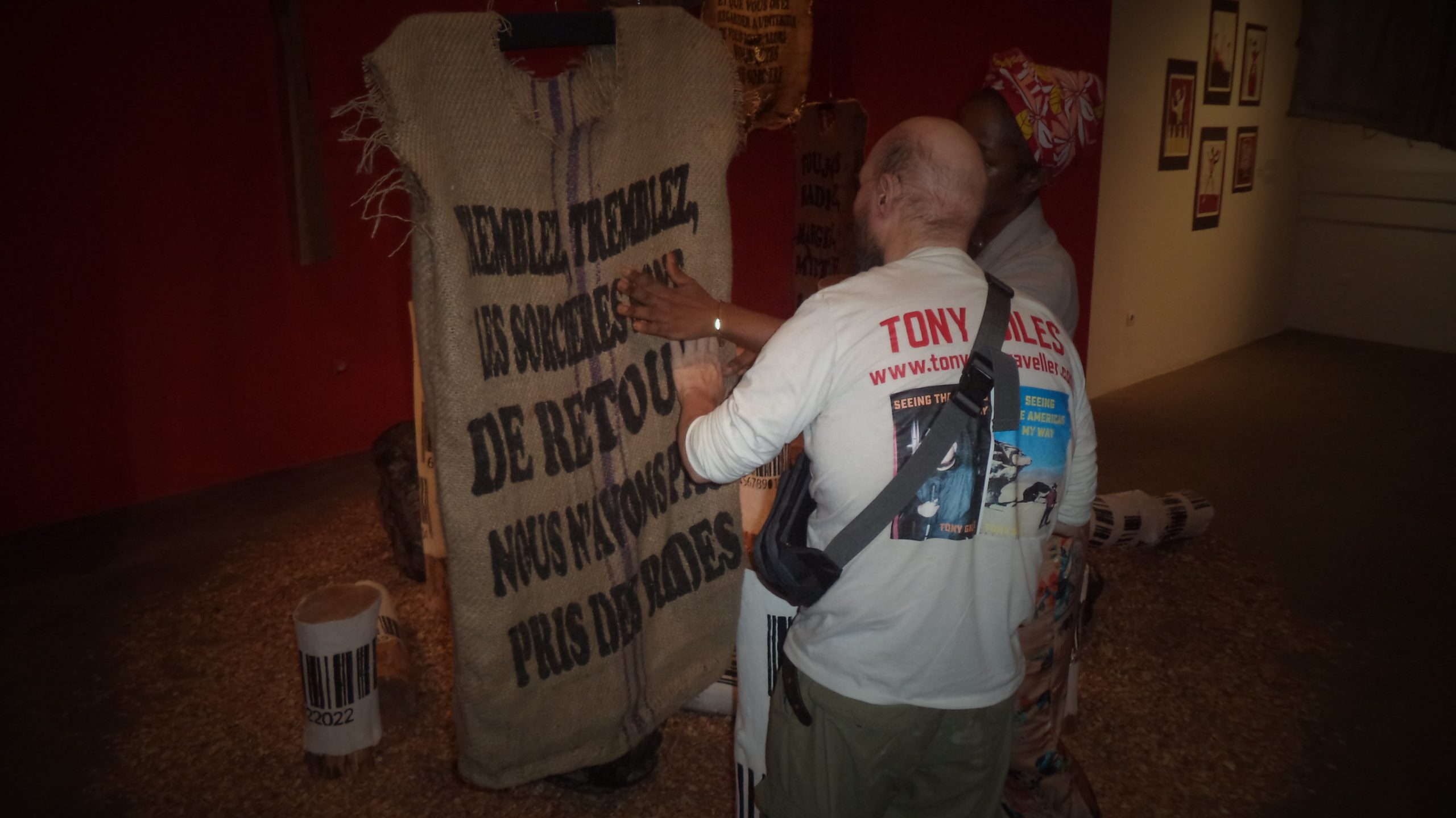
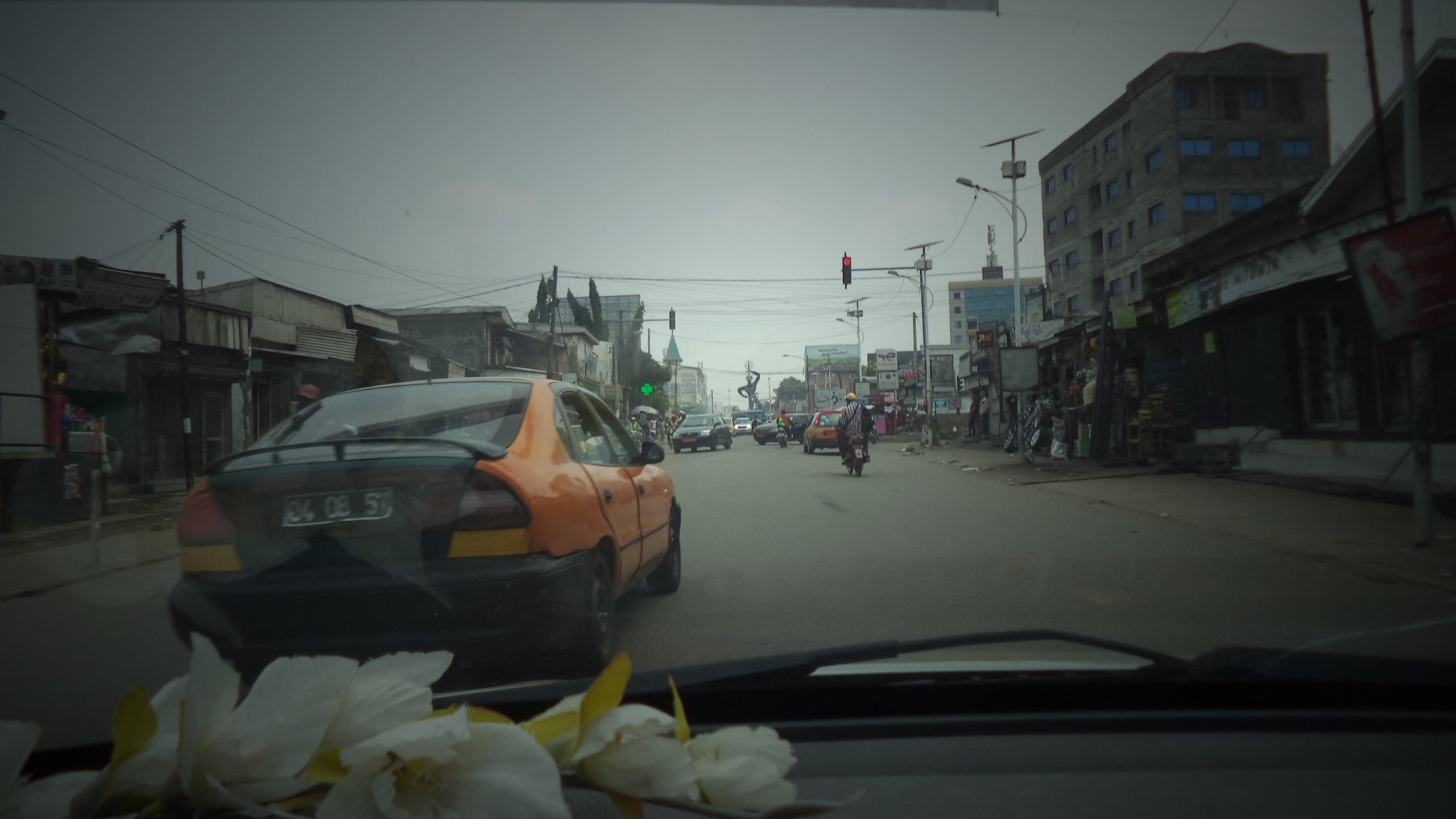
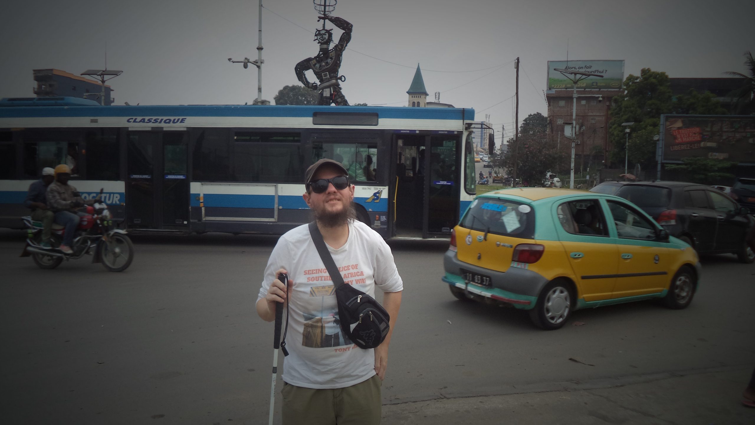
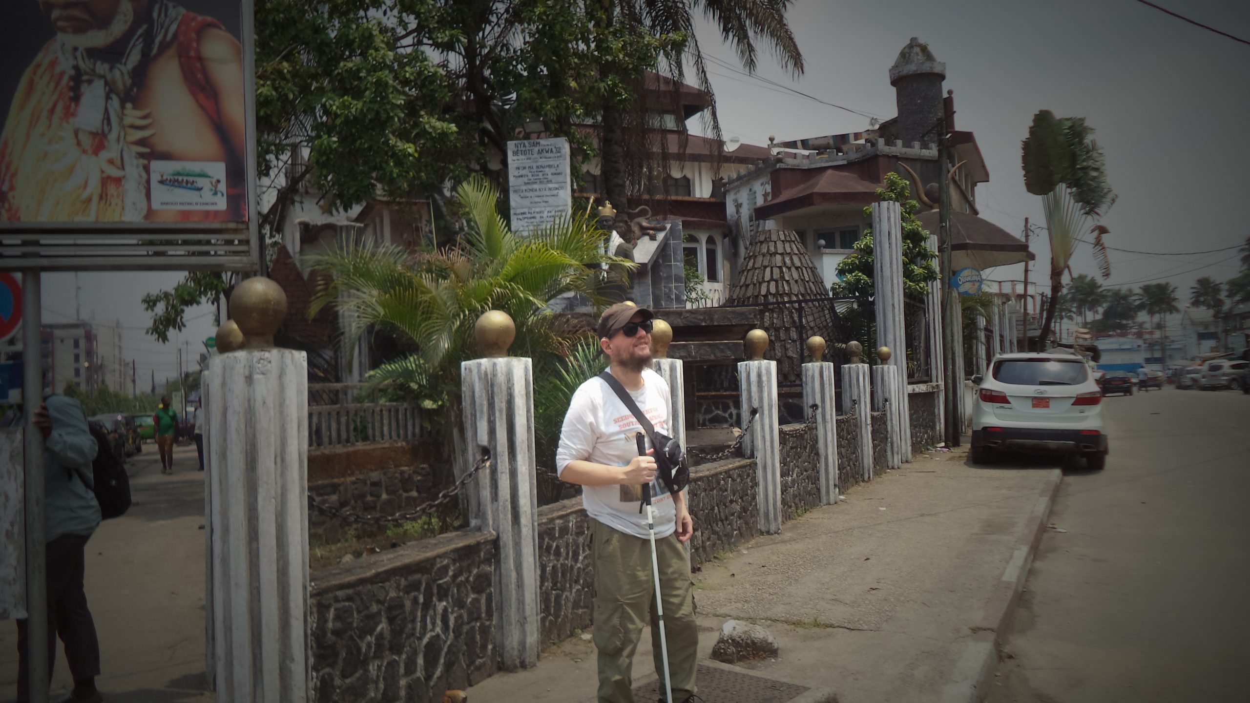
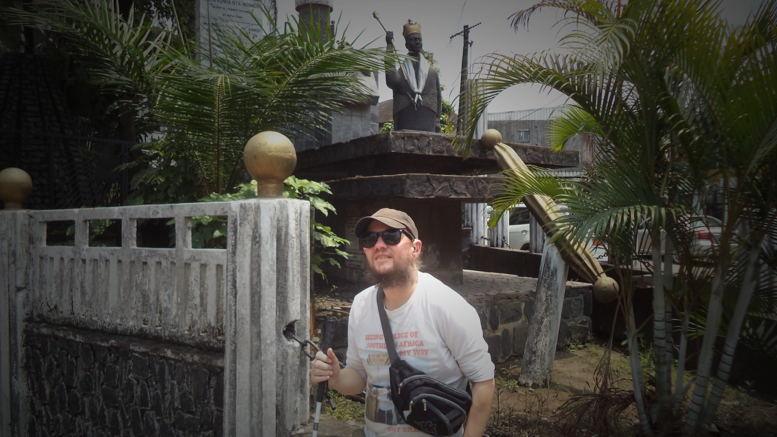
Tony stood outside the Cathedral of Saint Peter and Paul in Bonadibong, Douala. This Roman Catholic cathedral was completed in 1936. It is painted white and incorporates plain columns and domes.Tony stood in front of a life-sized sculpture of Jesus Christ on the cross near to the Cathedral.Tony stood in the shaded and leafy courtyard of Espace Doual’art. Doual’art is an arts centre and non-profit cultural organisation which was established in 1991. The current building opened in 1995 in a former cinema. The centre mostly produces and displays contemporary art by Cameroonian artists.Another shot of Tony outside Espace Doual’art.Tony by a large Espace Doual’art sign displayed on a wall outside the arts centre. There is a flower bed planted with succulent plants in front of the sign.Tony inside Espace Doual’art talking to the guide. Artworks can be partially seen on the wall behind. They appear to depict abstract natural scenes.Tony touching a sack cloth t-shirt or gown with writing in French on the front. It is part of an art installation. The lady guide is explaining what the words mean.Again the guide describing the art installation to Tony. The installation includes cardboard tubes with large bar codes attached.Tony talking to the guide. Various artworks can be seen around the room including paintings on a wall and a phallic sculpture.Tony in another room at Espace Doual’art which has red walls with writing on. The writing is mostly indistinct in the photo, although the words ‘Must Survive’ can be read.View from inside a vehicle passing along a busy main road in Douala. The road is lined with mostly single storey buildings housing shops and other businesses.Another view of the main road full of cars and mopeds.Traffic going round the Deido Roundabout with a large metal artwork in the centre. Known as La Nouvelle Liberté, the sculpture depicts a human or robot-like figure, which is standing on one leg and has one arm aloft holding a sphere. The sculpture is made from scrap metal, stands at 12 metres tall and weighs 5 tons. It was created by Joseph-Francis Sumégné in 1996.Tony stood on the pavement next to the busy Deido Roundabout with the distinctive La Nouvelle Liberté sculpture visible behind.Tony in the foreground with the Deido Roundabout jammed with traffic behind. The top of the La Nouvelle Liberté sculpture can be seen behind a bus.Tony stood outside the Mukanda Palace. This distinctive building was built in 1990 according to Wikipedia. It incorporates a mix of styles including traditional Cameroonian. Parts of the building resemble a pagoda with layers of overhanging roofs.Tony sat on the wall outside the Mukanda Palace. A statue of Prince Dika Akwa Nya Bonambella and a sculpture of a lion are among the objects visible in the grounds of the palace behind.Again Tony outside the Mukanda Palace with the statue of Prince Dika Akwa Nya Bonambella in the background. Prince Dika Akwa Nya Bonambella is a Cameroonian anthropologist and politician.Tony in front of the chain link topped wall outside the Mukanda Palace.
Friday, 3rd March 2023
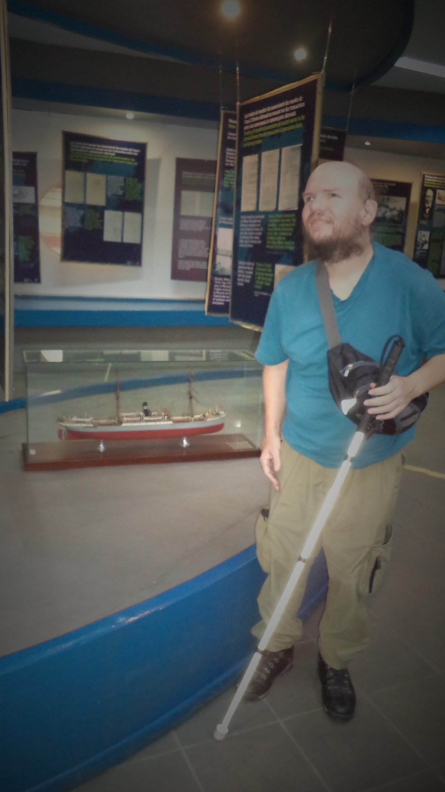
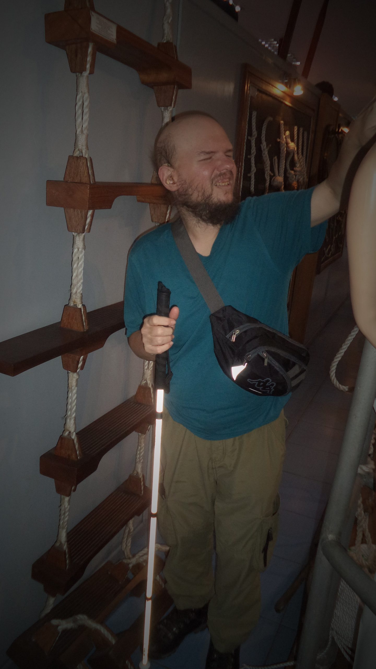
Tony stood at the entrance desk at Douala Maritime Museum. The desk has a decorative wooden ship’s wheel attached to the front.
Douala Maritime Museum (Musée Maritime de Douala) opened in 1986 with the purpose of exhibiting the maritime history of Cameroon. The current building opened it 2013 and covers 600 square metres over three floors. The exterior is designed to resemble the stern of a ship.
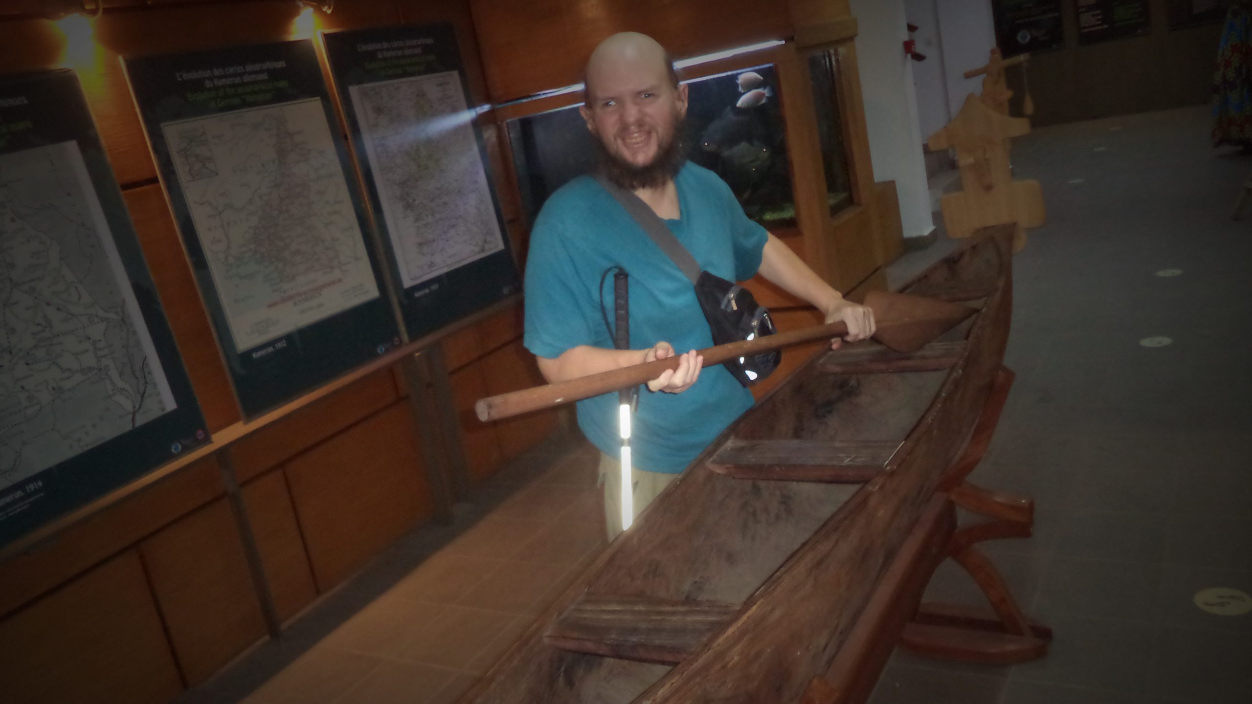
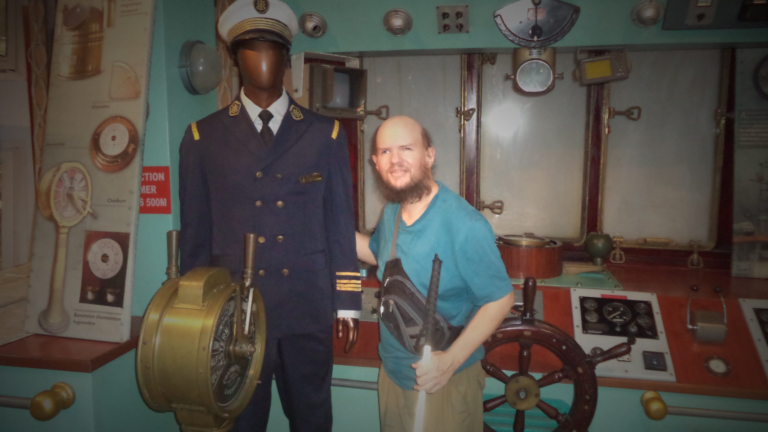
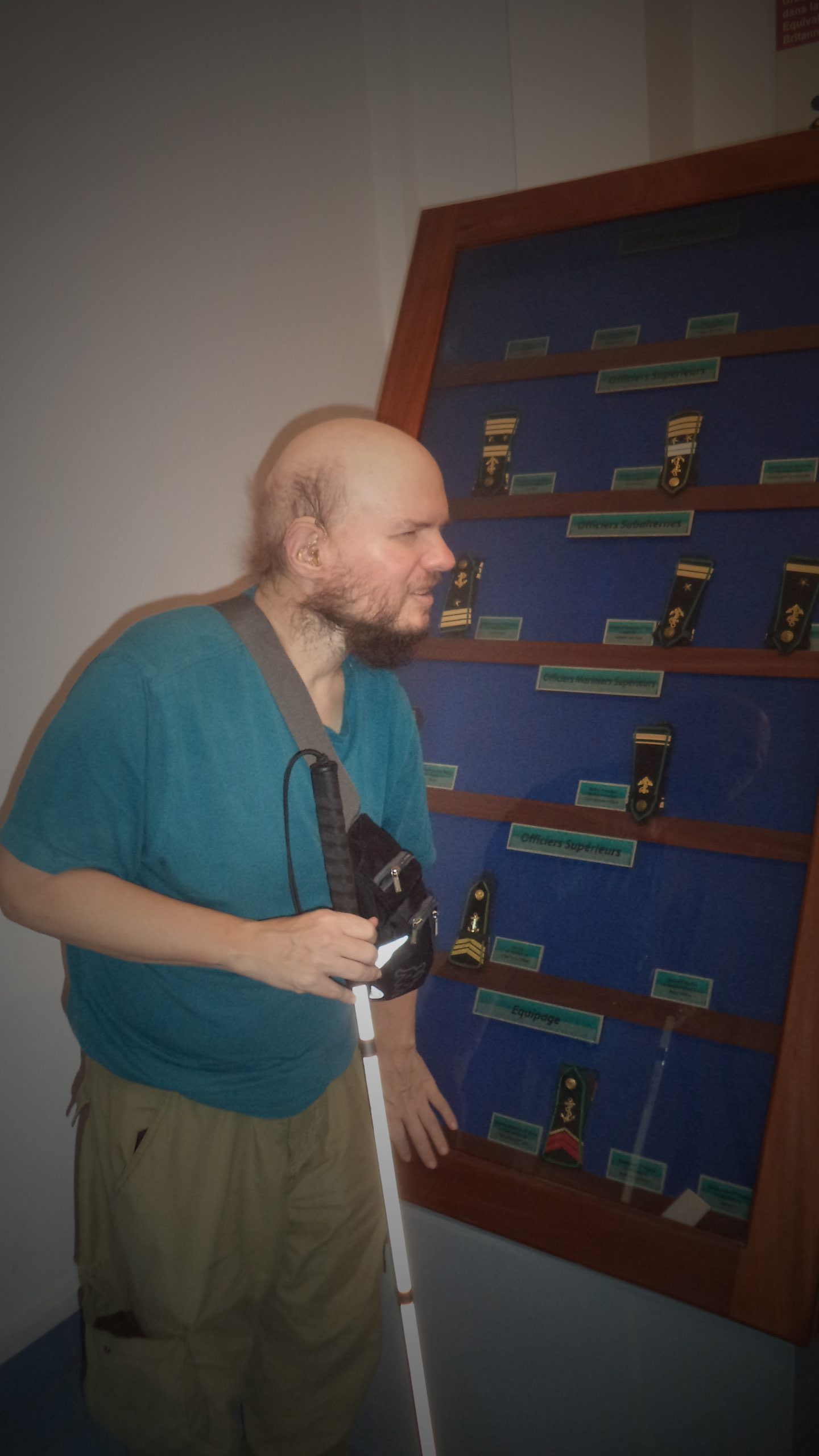
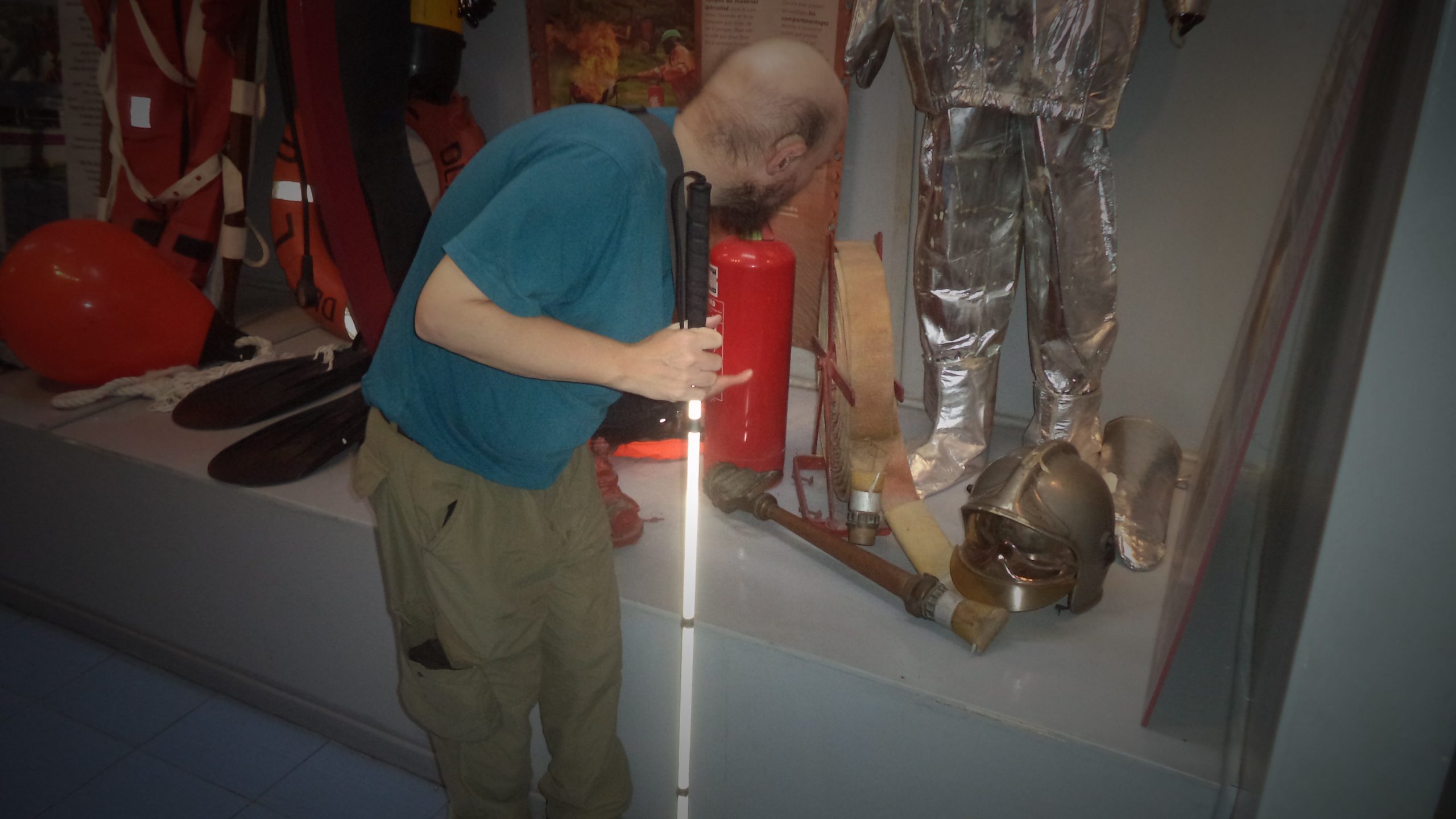
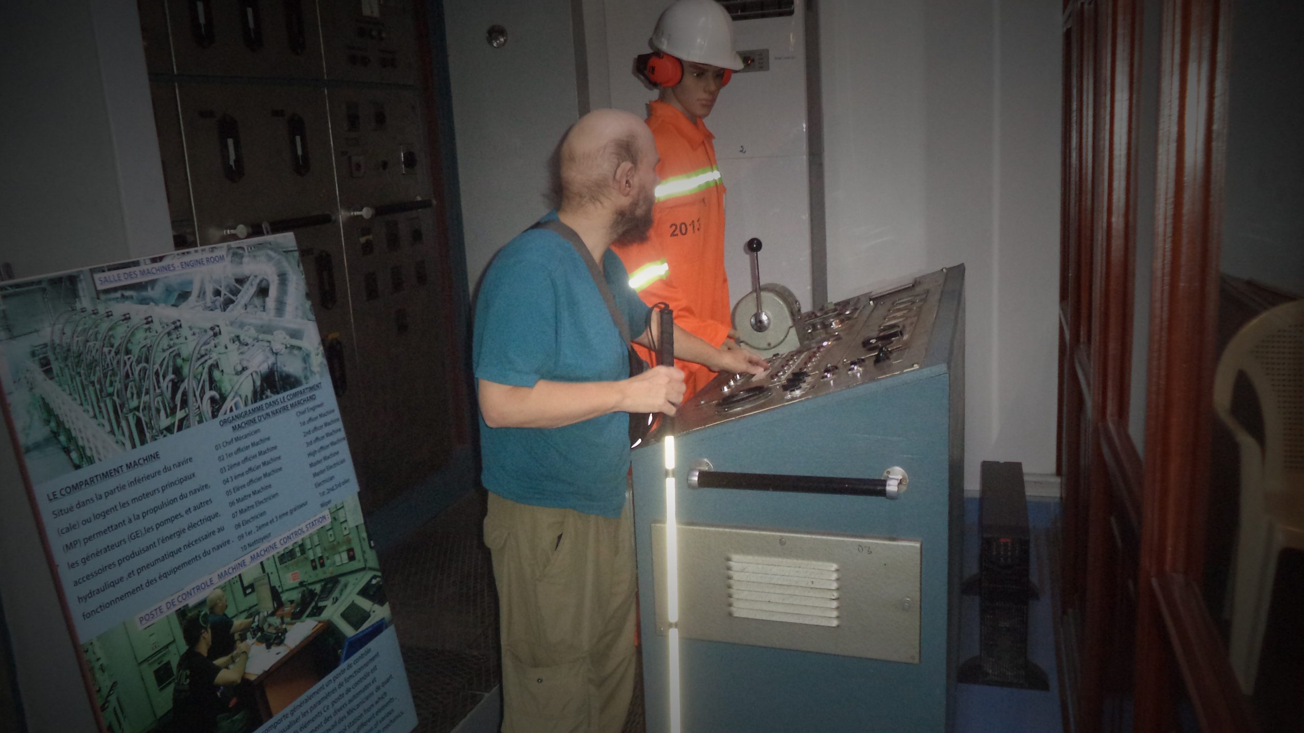
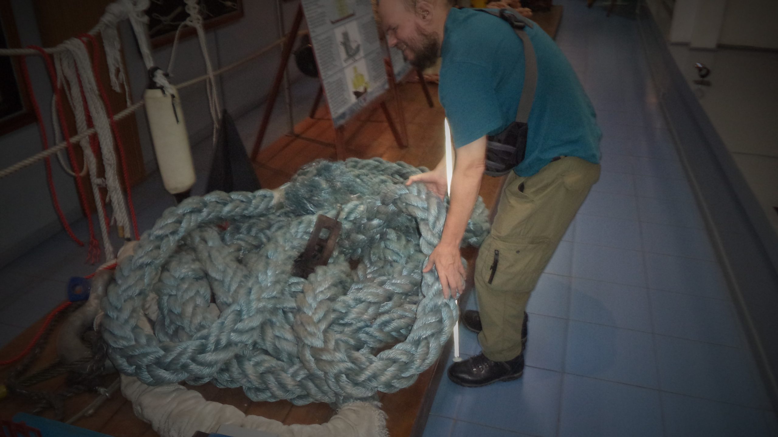
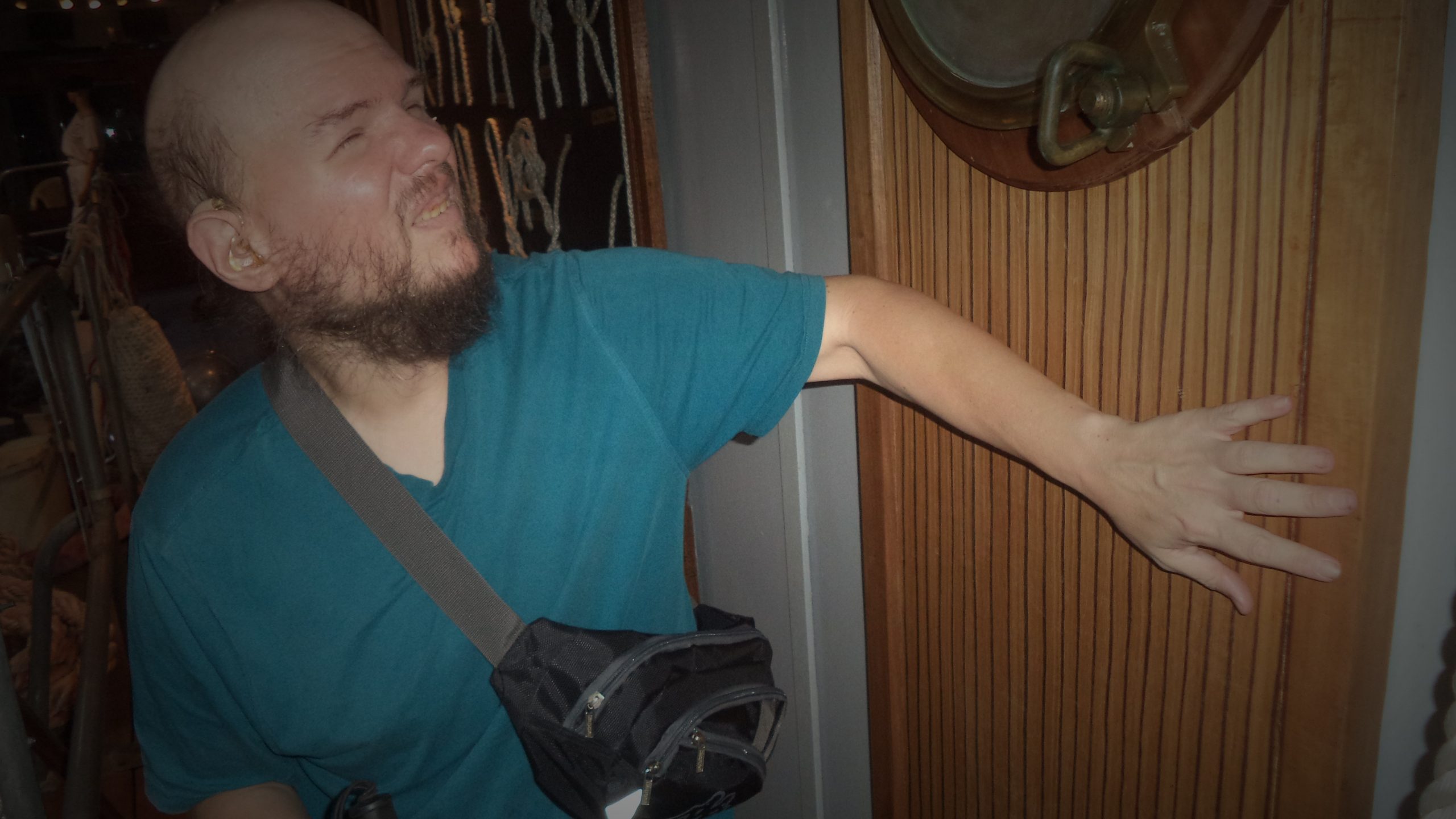
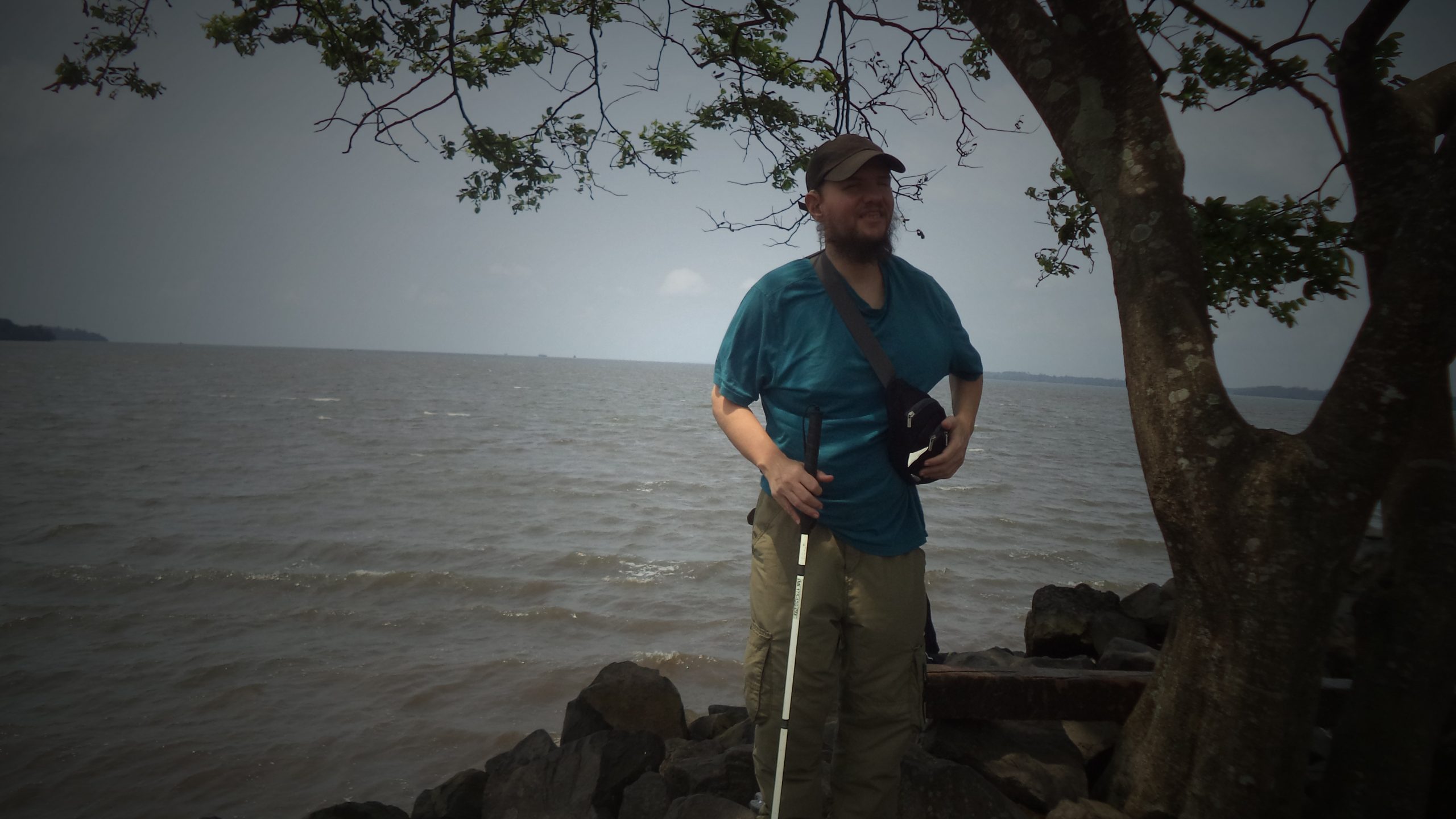
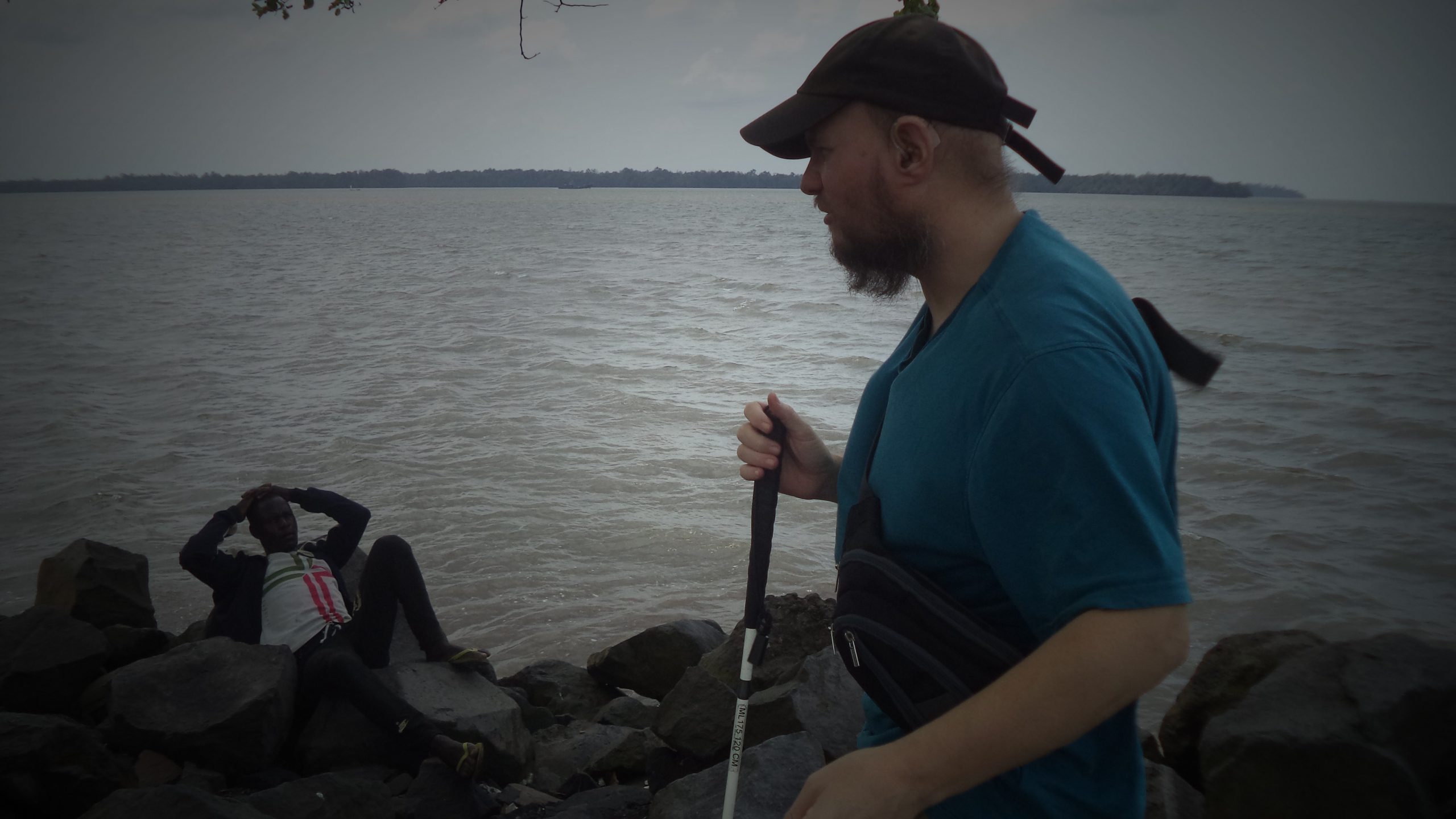
A manikin of a local man with Tony alongside holding his hand. The man is wearing a mixture of modern and traditional dress including a shirt, a woven hat and a shell necklace. There are photos and maps on the wall in the background.Tony touching a hand-made wooden drum. The drum is quite small with a zigzag pattern decorating the sides. It stands on wooden legs and is topped with some sort of animal hide.Tony feeling a small model of a dugout canoe sat on a table. The model contains about 25 rowers holding oars, most of them are sitting in pairs.A close-up view of the wooden dugout canoe model. The small rowers are painted in red, yellow and green dress.Tony stood in front of a model of a historic three-masted galleon on a table. Galleons were multi-decked heavy square-rigged sailing ships of the 15th to early 18th centuries used for war or commerce especially by the Spanish.Tony next to a model of a 19th century steamship. It is displayed under protective glass on a platform.Tony by a photo of King Dika Mpondo Akwa, who was chief or king of the Duala people (Akwa lineage). The photo is dated 1878-1916, which are the years he was King. Dika Mpondo Akwa died in 1916, while in exile in the town of Campo, having been sent there by the French colonial authorities.Tony alongside a photo of Chief Betote Akwa (1930-1974). He was another King of the Duala people. Betote Akwa was part of the Akwa lineage: there are other Duala lineages with different Paramount Chief or Kings. This is part of an exhibition about traditional institutions and their destruction in the colonial era.Tony at the side of another photo of a tribal king. This one is labelled in French ‘Majeste Mpondo Akwen Roi du Vieux Cameroun’ (Majesty Mpondo Akwen, King of Old Cameroon). He was King from 1852 to 1878 according to a label on the photo.Tony feeling the butt end of two old-fashioned muskets. Muskets are guns with a long barrel which are loaded by inserting the projectile and propellant directly into the muzzle or firing end of the gun.Tony feeling an old ship’s cannon resting on a wooden frame. It is a small cannon, less than one metre long.Tony holding the wooden oar of a traditional dugout canoe in Douala Maritime Museum.Another shot of Tony trying out the dugout canoe’s paddle.Tony holding the paddle over the top of the dugout canoe with the end of the paddle almost breaking the glass on a fish tank, which is full of lovely fish!Tony playing a tune on a slit drum (or slot gong). He is using drum sticks to hit a small hollowed-out log. This is a traditional percussion instrument in Cameroon and several other African countries.Tony holding the wooden drum sticks over the slit drum. The drum is stood on a trestle.Tony stood next to a life-sized model of a lady wearing a colourful traditional Cameroonian outfit. She is carrying a woven basket on her head.Tony turning the wheel in a mock-up of a ship’s bridge in the Douala Maritime Museum. He is stood next to a model of the ship’s captain dressed in formal uniform.Tony steering the wheel on the model ship’s bridge. Various dials, buttons and navigation equipment can be seen in front. The age of the equipment on display appears to vary with some historic and some modern.Tony stood next to the Captain in the wheelhouse with his right arm around the Captain. Thank goodness it’s only a model – the blind leading the blind!Another view of Tony stood by the ship’s captain manikin. In front is a chadburn, a device used to control a ship’s speed by sending messages to the engine room. It has a lever that can be set to various speeds from stop to full speed.Tony feeling a yellow and blue vertically striped flag. This is an international maritime signal flag. This one can be used to indicate the letter G or the message “I require a pilot.” Another flag alongside is diagonally half yellow and half red. This one indicates the letter O or the message “Man overboard!”.Tony touching a life jacket.Tony feeling the epaulettes that sailors wear on their uniforms. They are fastened in rows on a large board.Tony stood by a print of the Cameroonian Navy emblem. It is yellow and black with two crossed swords beneath an anchor and rope. There are also the words ‘Honour and Loyalty’ in English and French.Tony stood next to a white life raft, which can be thrown from a ship in an emergency. It is made by French company Zodiac. This is part of a display about maritime rescue equipment.Tony holding a torch while stood by the Zodiac life raft.Tony feeling protective clothing and equipment kept in case there is a fire on ship. Items in view include a metal helmet, fire hose and a fire extinguisher.Tony stood near an embarkation ladder, which is also called a Jacobs Ladder. It is made from rope with wooden steps.Tony feeling the controls found on the bridge of a merchant ship.Another view of Tony at the ship’s control panel.Closer view of the ship’s bridge control panel. There are lots of buttons and dials as well as a big lever, probably to control the ship’s speed.Tony trying to lift a bundle of heavy braided rope off the floor in the museum.Tony touching ropes knotted on a board. They are displayed on the side wall of the model ship.Tony examining a collection of ropes showing different knots used by sailors.Tony feeling a wooden wall panel with a porthole above.Tony outside Douala Maritime Museum. Although not clear in this photo, the building’s exterior is designed to resemble the stern of a ship.Tony stood holding his cane next to a tree with a good view across the Wouri River estuary behind. He is enjoying the cool air on his body. The Wouri (also Vouri or Vuri) is considered the largest but not the longest river in Cameroon. The Wouri forms at the confluence of the rivers Nkam and Makombé, 20 miles (32 km) north-east of the city of Yabassi. It then flows about 99 miles (160 km) south-east to the Wouri estuary at Douala, the chief port and industrial city in the south-western part of Cameroon on the Gulf of Guinea.Tony looking very happy sitting on a large boulder on the rocky shore of the estuary.Again Tony relaxing on the boulder looking out over the Wouri River estuary in Douala.Tony facing the river estuary with his local driver guide relaxing lying back on the rocks.Tony with the Wouri River estuary in the background. The camera is pointed roughly south-west in the direction of the open ocean. The estuary mouth into the Gulf of Guinea is about 18 miles (30 km) away. The estuary is about 1.5 miles (2.4 km) wide here but can be seen opening out more in the distance.
Lake Tison, near Ngaoundéré
Monday, 13th March 2023
View looking over Lake Tison (Lac Tison), which is located about 5 miles (8 kilometres) from the city of Ngaoundéré in central Cameroon. Lake Tison sits in an ancient volcanic crater at an altitude of 1,160 metres. The lake is 300 metres in diameter and has an average depth of 48 metres. The steep slopes surrounding the lake are covered with rich vegetation including dispersed trees, scrub, grasses and flowers.
Ngaoundéré is the capital of the central Adamawa Region of Cameroon. The city had a population of 152,700 at the time of the 2005 census but this number is believed to have grown considerably since then due to mass migration from the Central African Republic and northern Cameroon.
Looking along a pleasant path following the edge of Lake Tison. The shore of the lake and slopes above are covered with vegetation.View over Lake Tison. An old looking man-made stone pillar on top of a natural rocky outcrop can be seen in the foreground. This may date from the period when Germany controlled this region from 1884 to 1916 and the German governor had his residence near the lake.Tony standing with his guide Jude with a view over Lake Tison behind.
Bénoué National Park
Tuesday, 14th March 2023
Tony outside a circular stone building, which possibly provides tourist accommodation. The surrounding landscape is covered with wooded grassland. This is part of Bénoué National Park located north of Ngaoundéré city.
Bénoué National Park is a UNESCO designated Biosphere Reserve covering 180,000 hectares. The Bénoué River forms the reserve’s eastern boundary for over 62 miles (100 km). The main habitat type is wooded grassland.
Tony being guided by Jude along a stony path in Bénoué National Park.Tony with Jude and two men with guns, park rangers, standing by a river. The river’s water level is low and they are standing on the sandy river bed. Vegetation of trees, scrub and grasses can be seen in the background. It still the dry season, hence why the water level is low.Tony drinking from a bottle of water next to a local guy, one of the rangers. Bare rock and small stones are underfoot, perhaps on the edge of the river bed.Several outcrops of rock protruding out of the water. A ranger sitting on one of the outcrops. The sun low in the sky behind. Taken in Bénoué National Park.Tony next to a ranger holding a large gun and wearing a uniform emblazoned with the green, yellow and red colours of the Cameroonian flag. Scrubby vegetation behind them.Tony sitting on a man-made stone platform with the two rangers and another guy, possibly the cook, sitting along side. There are trees in the background with the sun setting. Bénoué National Park.Tony next to a sign saying ‘Buffle Noir’ (Black Buffalo). Trees in the background.
Wednesday, 15th March 2023
A baboon standing amongst trees and scrub in Bénoué National Park. This is an olive baboon (one of six baboon species, which are all found in Africa). Olive baboons are one of the largest species of monkey with males being on average 70 cm (28 in) tall when standing and females on average 60 cm (24 in) tall.Another shot with the baboon looking towards the camera.
Garoua
Garoua is a city in the North Region of Cameroon located on the Benue River. The city had approximately 1,285,000 inhabitants in 2020.
Tony with Jude, his Cameroonian guide and driver, outside a mosque. The doorway to the colourful red, green and yellow painted mosque is in the background. Taken in Garoua on evening of 15 March.Another view of Tony outside the mosque.Looking across a wide tarmaced road with another mosque on the opposite side. The mosque is painted blue and white with a pair of domes on the roof. It has a minaret topped with a small crescent moon. Taken in Garoua.
Lagdo town
Thursday, 16th March 2023
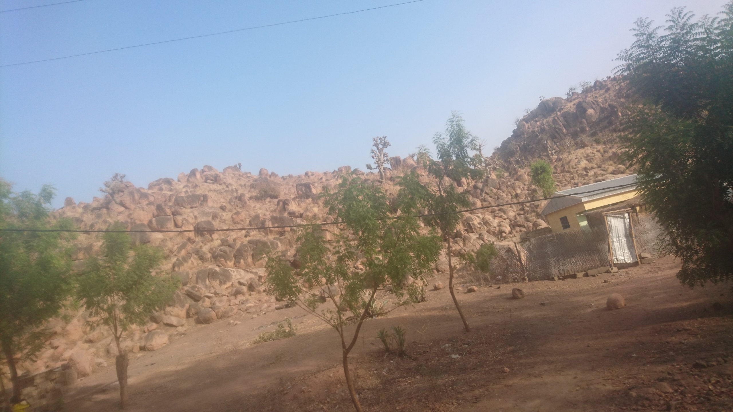
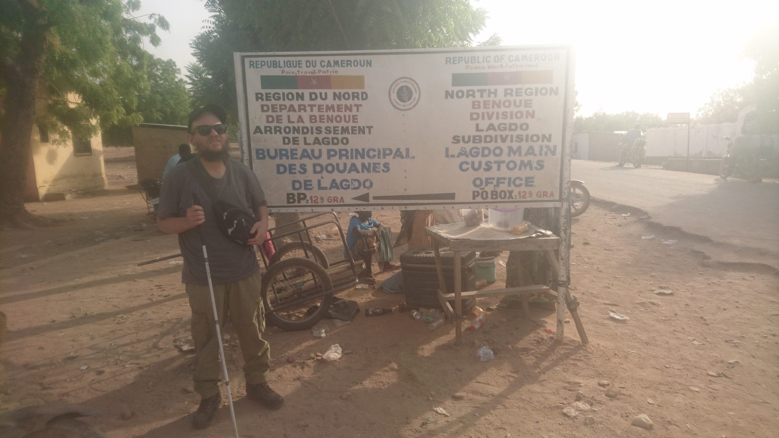
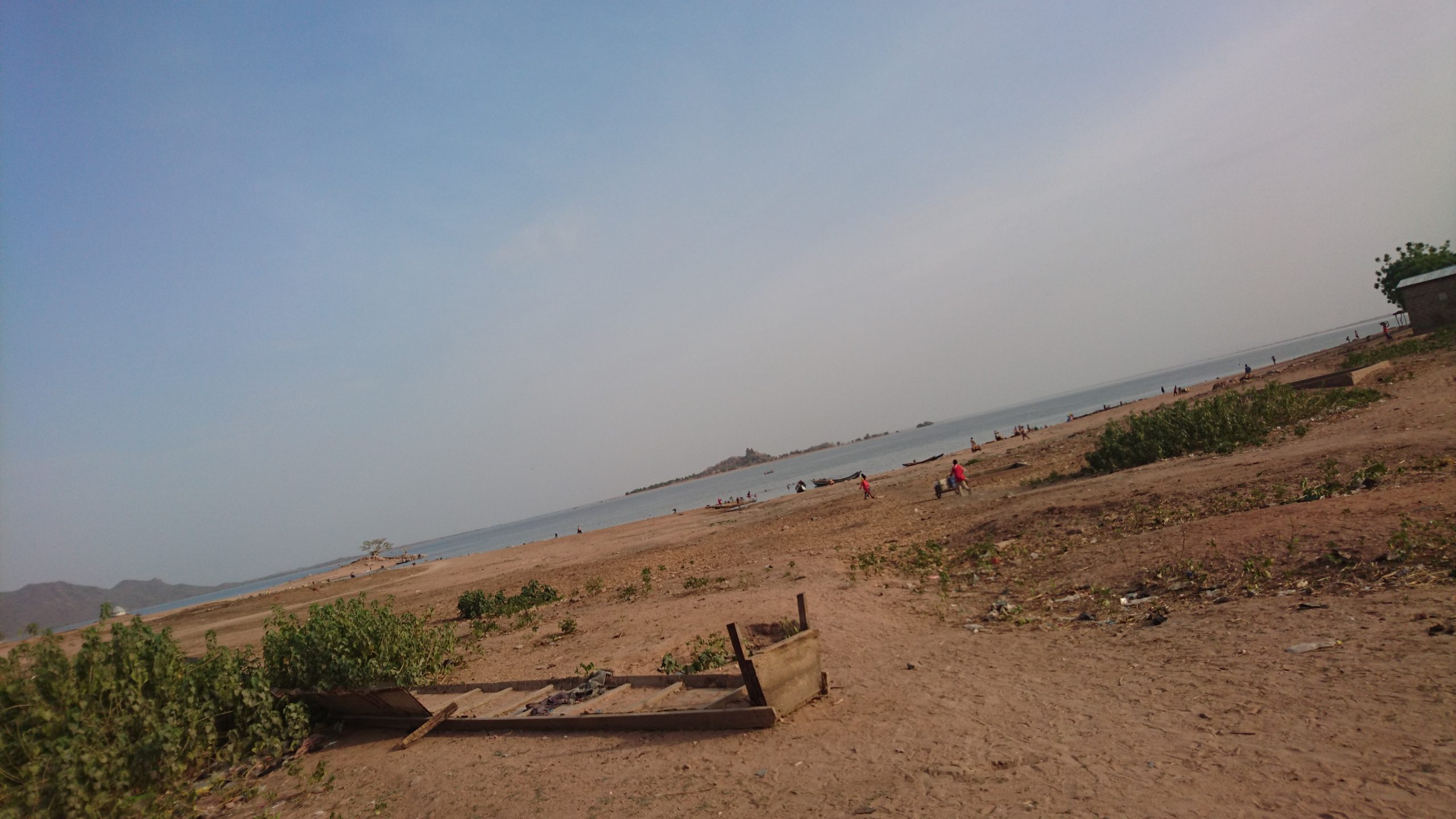
View of the natural sandy rocky landscape in Lagdo town. There is a small hill made up of rugged bare rock in the near distance with a few small trees and a house in the foreground.Tony next to a sign by a road. The sign is in English and French and says ‘North Region, Benoue Division, Lagdo Subdivision, Lagdo Main Customs Office’. There is a stall selling food and drinks part visible behind the sign.A mosque in Lagdo town. It is housed in a substantial rectangular black and cream painted building. It has a tall pitched olive green roof and there are minarets attached to two corners of the building.View of Lake Lagdo from Lagdo town. A rocky island can be seen in the middle distance. In the foreground, there is a beach made up of sand and shingle. There are a few small boats moored on the shoreline as well as people bathing in the water. These local boats with a motor are used to take tourists around the lake to spot hippos and other nature.
Lake Lagdo, also known as Lagdo Reservoir, is a man made lake in Cameroon’s Northern Province. It covers 226 square miles (586 sq.km.). It was created between 1977 and 1982 by building a dam across the Benue River. The dam, located east of Lagdo town, is 308 metres long and 40 metres high.
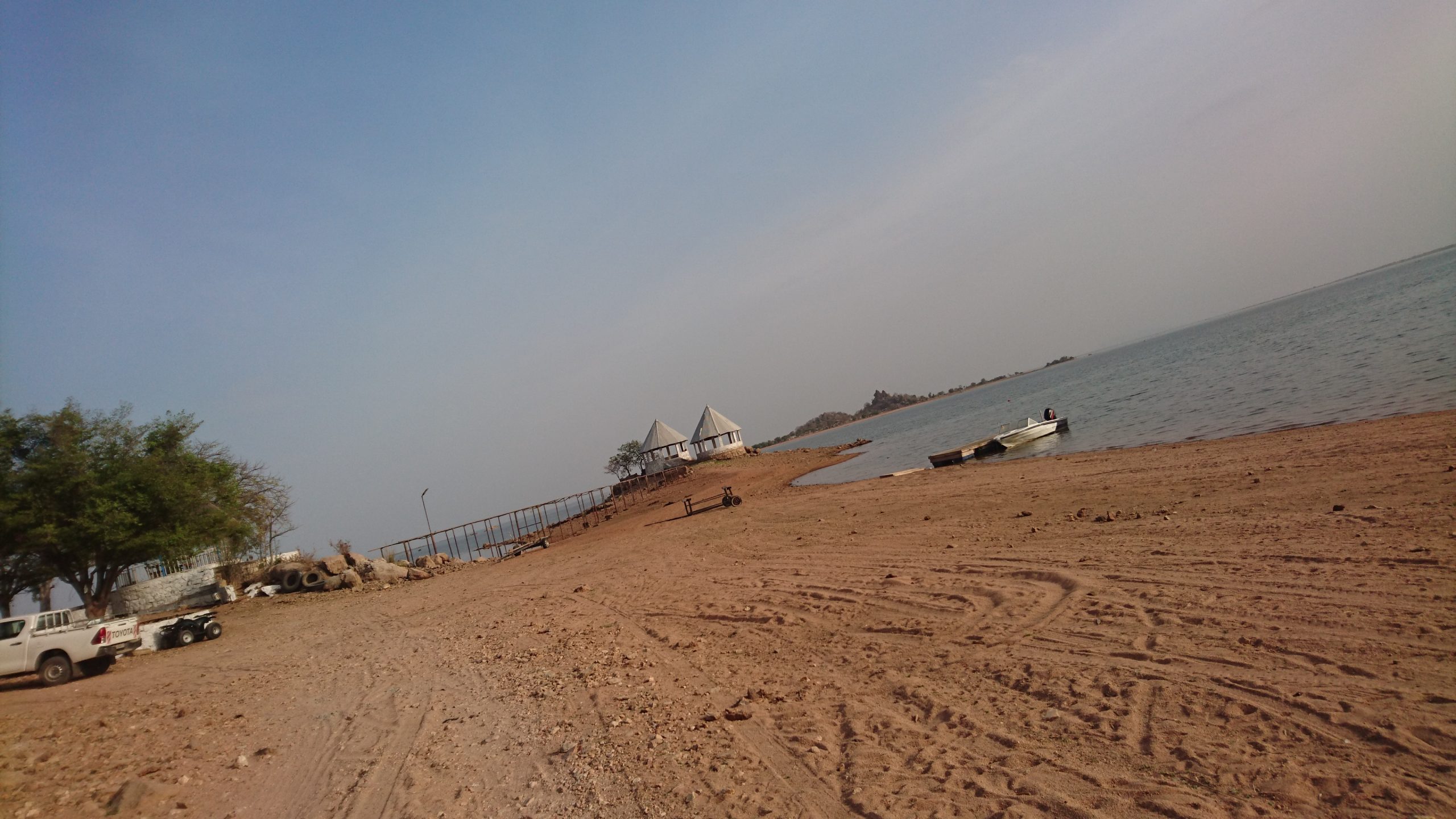
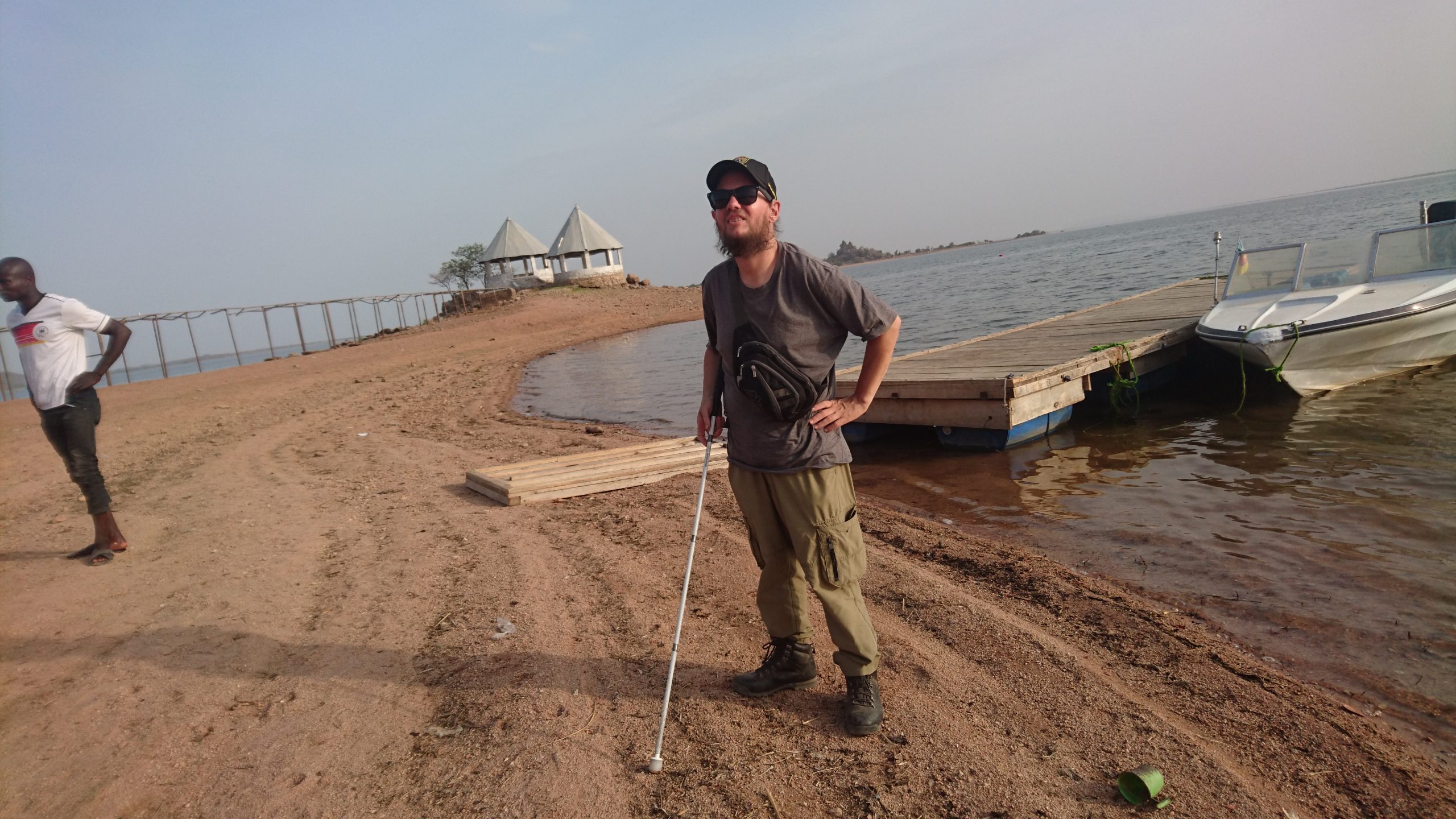
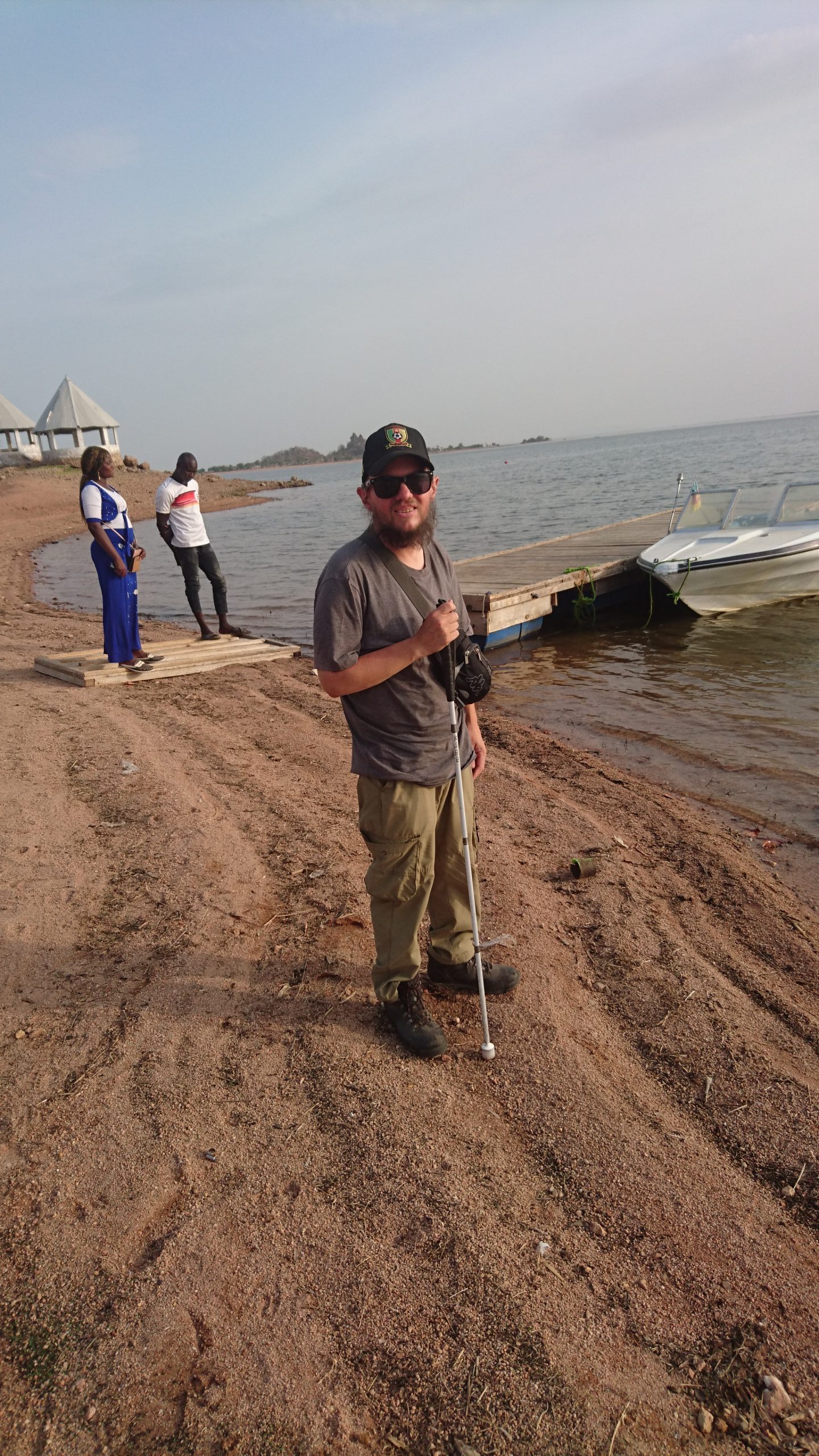
On the edge of a sandy beach on Lake Lagdo. In front a driveway: a sign indicates it leads to Le Lagon Bleu. Le Lagon Bleu is a small resort located on the shore of the lake in Lagdo town.View along the sandy shore of Lake Lagdo. In front a pair of stone huts overlooking the lake. The huts are round and open at the sides. They appear to be part of the Lagon Bleu resort. When the water level of the lake is higher, the land around the huts becomes a small island, accessed by a rickety looking wooden bridge.Tony on the shore of Lake Lagdo. Behind a small motor boat attached to a wooden jetty.Again Tony by Lake Lagdo with the small motor boat along side.View along the shore of the lake. Tony in the foreground and a Cameroonian man, Jude, Tony’s guide, and Claudia, a Cameroonian woman from Garoua, friend of Jude, behind.Tony in a local bus. Tony is in one of the back seats with the driver visible in the foreground. The two other passengers are Jude and Claudia.
Gorges de Kola
Saturday, 18th March 2023
Tony and Jude by a sign pointing to the Gorges de Kola tourist site, which says it is 5.2 kilometres away.View along a road in the town of Guider. A row of single storey buildings are opposite. A man is passing by on a motorbike with a large bundle of twigs and branches, perhaps firewood, balanced on the back. Guider is located in Cameroon’s North Province and has a population of around 65,000.Welcome signs at the entrance to the Gorges de Kola (Kola Gorge). This site is a small canyon where the rock has been carved into distinctive shapes by the powerful flow of the Mayo Kola river. In places the gorge is over 20 metres deep. It extends for around 4 kilometres in length. Visits are only possible when the river level is low.Tony inside the deep narrow gorge touching one of the steep rocky sides with his white cane. There is wet sand and pools of water underfoot.Tony in the Gorges de Kola. View of the distinctive shapes of the gorge’s rocky sides The patterns vary but here there are lots of small outcrops with semi-flat sides separated by sharp edges.Tony with his guide Jude inside the Gorges de Kola.Again Tony in Gorges de Kola with curious rock formations behind.
Moutourwa village
In the village of Moutourwa with a traditional round hut with mud brick walls and a thatched roof in the foreground. In the near distance behind, natural rock formations: boulders are piled on top of each other forming interesting shapes with one tall narrow boulder protruding up into the air at the top. The village is located in Cameroon’s Far North region.Tony in the foreground with more piles of boulders amongst dispersed trees and bushes behind. The ground is dry and parched.Tony and guide Jude near Moutourwa village with the distinctive rocks again visible behind.Tony next to a donkey in Moutourwa village. A long mud brick wall enclosing round huts can be seen behind.A Christian monument in Moutourwa village with Tony standing in the foreground. The base of the monument is made up of uneven layers of bricks, which in design is similar to the natural boulders around the village. A blue painted block sits at the top, with a large alcove containing an icon, probably depicting Jesus Christ. There is also a small cross on the very top.
Rhumsiki
Sunday, 19th March 2023
Tony outside Campement de Rhumsiki (Rhumsiki Camping Lodge), where he stayed. The site’s name is painted on the perimeter wall behind and there is a gate on the right side.
Rhumsiki is a village in Cameroon’s Far North Province. It is located in the Mandara Mountains close to the border with Nigeria.
Tony at Rhumsiki Camping Lodge with a group of round huts behind. These huts are of the type traditionally built by the Kapsiki ethnic group, who live in this part of northern Cameroon, as well as across the border in north-east Nigeria. The huts are built with stone walls, and traditionally have thatched roofs, but the ones here use corrugated plastic for the roofs.Looking from near Rhumsiki village across a barren landscape with Rhumsiki Peak (or Kapsiki Peak) in the middle distance. The landscape has an almost lunar appearance with the ground covered with sand and small rocks, although one small tree does stand towards the foreground. Rhumsiki Peak is a large phallus-like pillar of rock. It is a volcanic plug made of basalt rock originally formed in the vent of a volcano; over time the surrounding softer rock has eroded away leaving the pillar of hard rock exposed.Tony with Rhumsiki Peak behind. The peak stands at 1224 metres above sea level with the surrounding plateau at Rhumsiki village around 1050 metres in elevation. Traditionally women who were unable to have children made sacrifices at the foot of the peak, probably due to its phallic appearance.Tony next to his guide Jude with Rhumsiki Peak as the backdrop.Tony on the edge of Rhumsiki village with the distinctive Rhumsiki Peak in the background. At least three other more distant peaks can be seen, these are again towering pillars of rock formed from volcanic plugs. There are scattered trees in the foreground, but otherwise the landscape is dry and parched with little vegetation. This photo is taken during the dry season, and the landscape does become greener during the wet season, when grasses and other small plants sprout.
Pouss village
Tuesday, 21st March 2023
Tony in Pouss village in northern Cameroon. He is sitting outdoors on a seat made from dried mud. There are more of these chairs along side, which look very comfortable with moulded seats and backrests. Traditionally all the village buildings would have been constructed using this material: made using an adobe technique, which involves mixing earth, water and thatch that is moulded and compressed, and then left to harden in the sun. This area of northern Cameroon is inhabited by the Musgum people who also live across the border in Chad.Tony with two men from the village sitting on the adobe chairs.Tony and Jude exploring a group of traditional buildings in Pouss village. Behind is a wall made from dried mud and decorated with a simple design that includes several circles.A view of three traditional Musgum huts in Pouss village. These huts, which are made from dried mud, have a very distinctive domed shape. They have a circular base and stand up to 9 metres (30 feet) in height. They are known as ‘cases d’obus’ in French, which means shell huts, due to their domed design resembling the shape of a shell.Tony standing in front of a large traditional pot or oven again made from compressed and dried mud. It is on a base so a fire can be lit underneath. Two of the distinctive Musgum huts can also be seen in the background.Tony waving for the camera in front of the large cooking vessel.A group of traditional Musgum huts. They are arranged to form a compound with mud walls connecting the individual huts and enclosing the interior. The domed exterior walls of the huts are decorated with geometric patterns.Tony in the doorway of one of the traditional Musgum huts. The doorway is quite small, just big enough for Tony to walk through without having to bend down.Tony and Jude in front of a Musgum hut.The group of Musgum huts with the doorways all facing into an enclosed central compound or courtyard and the large cooking vessel in the centre.Tony and Jude outside another traditionally built hut in Pouss village. This one has a different design with vertical mud brick walls, which has been colourfully decorated.Thumbs up from Tony outside the doorway of the colourfully painted hut.A colourful relief depiction of a Musgum hut on the side of the hut.
Kousséri
Wednesday, 22nd March 2023
Tony with three local men outside a traditional house constructed from mudbrick in the city of Kousséri. This building is part of the Sao Kotoko Museum. Unlike the Musgum huts these buildings are not domed, but have roughly vertical outer walls. Horizontal wooden poles are inserted through the buildings in order to support flat roofs.
Kousséri is a small city located in the Far North Province of Cameroon. It had a population of 89,123 at the 2005 census. The city is on the border with Chad: the Chari and Logone rivers form the boundary. The Chadian capital, N’Djamena, is located on the opposite banks of these rivers, with the two cities forming a single urban agglomeration.
Tony and Jude on the flat roof of a traditional adobe building in Kousséri. The roof can be accessed using stairs, which are again constructed from dried mud reinforced with plant material.A street in Kousséri. This wide street is surfaced with sand and shaded by trees. The outer walls of a traditional mudbrick building can be seen at the far end.The arched entrance gateway to Sao Kotoko Museum (Musee Sao Kotoko de Kousseri). The museum was closed when Tony visited.A memorial dedicated to French Commandant Amédée-François Lamy (1858-1900). He was killed at the Battle of Kousséri. The monument is made of concrete with an obelisk standing on a two-tiered plinth with a square base.Tony in front of the memorial to Commandant Amédée-François Lamy. There is a plaque with an inscription in French on the side (difficult to read in the photo).Tony with his guide Jude touching the obelisk belonging to the Commandant Amédée-François Lamy memorial with his white cane.Tony and Jude in front of a monument to Rabih az-Zubayr (c. 1842-1900). He is usually known as Rabah in French. He was a Sudanese warlord and slave trader who established a powerful empire east of Lake Chad in today’s Chad. He was killed at the Battle of Kousséri when engaging French forces. The monument is a stone obelisk on a plinth.View across the Logone River in Kousséri. The river forms the international boundary with Chad and is about 150 metres (490 feet) wide at this point. The view of the opposite bank is hazy with small buildings dispersed across a landscape of sand and scrub vegetation. The denser buildings of Chad’s capital, N’Djamena, can just vaguely be seen further in the distance.Tony standing on a track alongside the Logone River. The Logone River runs for about 620 miles (1,000 km) with sources in western Central African Republic and southern Chad. It is a major tributary of the Chari River: it joins the Chari River about 1.5 miles (2.4 km) north of where this photo was taken.A roadside stall on the south-east side of Kousséri, close to the Ngueli Bridge. A woman is selling bottles containing a darkish liquid.The road heading towards the Ngueli Bridge. Several motorcycles and a couple of pickup trucks are in front. The surrounding landscape is sandy with dispersed buildings.The road to the Ngueli Bridge. A queue of vehicles is approaching ahead: they are probably waiting to cross the bridge into Chad. Single storey buildings and a few trees line the route.A busy scene close to the Ngueli Bridge. There is a crowd of people with some walking and others on mopeds and motorcycles. There are stalls at the side: those in view appear to be selling vegetables and other foodstuffs.Another busy and chaotic scene approaching the Ngueli Bridge. The Ngueli Bridge is an import crossing point for people and goods between Cameroon and Chad. It is located close to Chad’s capital, N’Djamena, and the city of Kousséri in Cameroon.Standing on the Ngueli Bridge between Cameroon and Chad with lines of people crossing in both directions. There are actually two bridges, one for pedestrians, and another for vehicles, which can be seen over to the left.
Mindif
Friday, 24th March 2023
View of Dent de Mindif. This impressive mountain peak is located close to the town of Mindif in Cameroon’s Far North region. Its name translates as ‘Tooth of Mindif’ in English. The name comes from the mountain’s extremely steep rocky sides, which make it to resemble a tooth in shape. It is also known as Pique de Mindif.Tony and his guide Jude with Dent de Mindif peak in the background. Sources vary considerably as to the mountain’s exact height, but it is approximately 739 metres above sea level.Tony standing on a sandy road in the foreground and Dent de Mindif in view behind. The main tooth shaped peak is on the left with an adjoining smaller rocky peak visible towards the centre of the photo.Jude and Tony with man who is a representative of the King of Mindif outside the Mindif Palace in Mindif. The King’s representative is traditionally dressed with a white robe along with a woven green and blue hat known as a chechia.The representative of the King of Mindif sitting on a floor mat inside the meeting hall or entrance hall of the Mindif Palace. The King was away travelling. The representative offered us water and answered Tony’s questions about the King.Tony and Jude sitting on the floor in the Mindif Palace. The floor is covered with large rugs.Tony, Jude and the King of Mindif’s representative in Mindif town with the distinctive Dent de Mindif peak visible in the background.Small trees planted in long straight rows near Mindif. Possibly an olive grove.Tony and Jude by a ‘Welcome to Mindif’ sign. The spectacular Dent de Mindif peak is part visible behind trees.Tony, Jude and Nadege in front of the ‘Welcome to Mindif’ sign.Tony, Jude and a local woman named Nadege, from Rhumsiki, relaxing at a table in the garden of the Sahel Hotel in Maroua. Taken in the afternoon after returning from Mindif.Tony eating in the hotel dining room while talking to his guide Jude.
Ngaoundaba
Sunday, 26th March 2023
Tony in front of a sign for Ngaoundaba Ranch, which is about 22 miles (35 km) south-east of the city of Ngaoundéré, which is capital of the Adamawa Region in central Cameroon. A wide tarmaced road can be seen running along side. The road heads into the distance across grassland. The ranch itself is privately owned and is located amongst savanna grassland and gallery forests.Tony and Jude in front of the Ngaoundaba Ranch sign.
Bertoua
Tony in front of a sign outside Mansa Hotel. This is an expensive hotel where Tony stayed in Bertoua. Taken evening of 26th March. Bertoua is the capital of the Eastern Region of Cameroon with a population of 88,462 (at the 2005 Census). It is the traditional home of the Gbaya people.
Batouri
Monday, 27th March 2023
A main tarmaced road running through the town of Batouri in Cameroon’s East Region. The road is lined with houses and trees with a petrol station ahead on the left side. Batouri is the second largest settlement in the East Region after the capital Bertoua. It had a population of 33,500 in 2012. Many of the residents belong to the fulbe/fulani people.Tony next to a large sign for a church by a road in Batouri. The sign says the church is part of the Presbyterian Church of Cameroon denomination and gives service times and other information. The church itself is mostly out of view to the left.Tony outside the church, which is part of the Presbyterian Church of Cameroon. It is a medium-sized single storey building with a pitched roof and yellow-cream painted exterior walls. It has a small tower with a cross on top.Tony outside another church. This one belongs to the Evangelical Church of Cameroon. It is a small-to-medium sized plain building with a wooden cross mounted above the main entrance.At a petrol station located in Abong Mbang, a crossroads town between Yaoundé in the west and Bertoua in the east.Tony and Jude outside the petrol station shop in Abong Mbang.
Yaoundé
Yaoundé is the capital of Cameroon with a population of more than 2.8 million. It is the second-largest city in the country after the port city of Douala. It is located in the Centre Region at an elevation of about 750 metres above sea level.
Tuesday, 28th March 2023
A group of people including Tony outside the Blind Social Centre in Ekie, Yaoundé. Most of the people, including Tony, are carrying white canes. This place is an Inclusive Multi-media centre of the Young Rehabilitated Blind of Cameroon (CJARC). It was inaugurated on December 2nd, 2002 at the Ekie neighbourhood.Another group photo outside the entrance to the Blind Social Centre in Ekie, Yaoundé.View from a vehicle in Yaoundé’s Central Business District. There are several lanes of queueing traffic in front. Surrounding offices and other commercial buildings can be seen.Heavy traffic at a junction in the Central Business District. Multi-storey office buildings in the near distance.A sculpture outside the National Museum of Cameroon (Musée national du Cameroun). It appears to be a traditional design with stylised human-like figures standing on top of one another. The lower part also appears to include birds and lizards.A square outside the entrance to the National Museum of Cameroon. There are two rows of flag poles down the centre and areas of formal garden at the sides. A group of school children are assembled in the foreground.A large metal doorway into the National Museum of Cameroon. The door’s geometric decoration is painted black and gold.Tony in front of a statue that forms part of Cameroon’s Reunification Monument. The statue depicts a large solidly built man who is seated with his right arm held aloft holding a torch. This left arm is helping to support four children who are depicted climbing and holding on to his legs and back. The statue is about seven metres in height.
The Reunification Monument was constructed in the 1970s to mark the post-colonial merging of British and French Cameroon. It was designed by architects Gedeon Mpondo and Engelbert Mveng.
Tony at the base of the stone Reunification Monument statue. A garden that surrounds the monument can also be seen.Tony and his guide Jude in front of the Reunification Monument statue.An inscription in French on the Reunification Monument statue that credits its design and building to architect Gedeon Mpondo in 1974.Tony in front of the Reunification Monument’s main structure. It is formed of two concrete spirals that ascend into the air, meeting at the top, to form a cone shape. Steps behind Tony lead up to the base. This structure was designed by architect Engelbert Mveng.Tony, Jude and two Nigerian guys that they met standing in front of the Reunification Monument.Another shot in front of the main Reunification Monument structure. Tony is with three Nigerian men and a woman who he met at the monument.Underneath the Reunification Monument structure with the two spiral walkways rising up above. There is a column in the centre that supports the structure. The floor is decorated with mosaic tiles that forms a swirling spiral pattern that converges in the centre.