
Canaima National Park
Canaima National Park is located near Santa Elena de Uairén, La Gran Sabana Region, Bolívar State, on the Venezuela-Brazil border, The park’s area is 30,000 square kilometres, (12,000 sq mi). It was established on 12th June 1962 and is a UNESCO World Heritage Site. Organised guided trips to Canaima and Angel Falls are cheapest from Ciudad Bolivar for a three day – two night expedition – all food, transport and accommodation included.
22nd November
 Tony inside a small plane flying to Canaima National Park from Ciudad Bolivar.
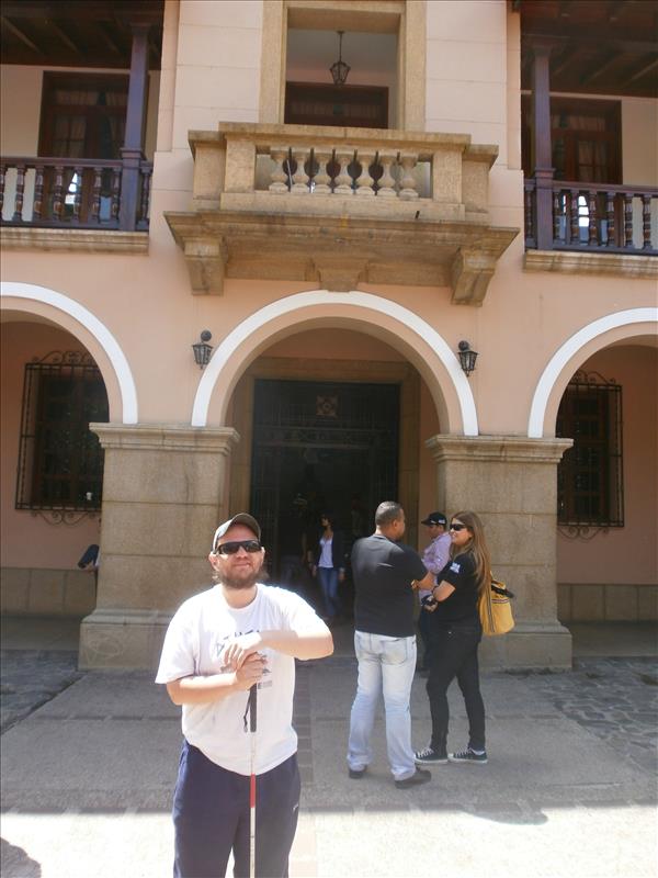
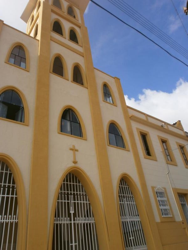
 Outside the church of Our Lady of the Immaculate Conception in Canaima Village. Tony stayed in the village for the first night.
 Tony by the door of the church.
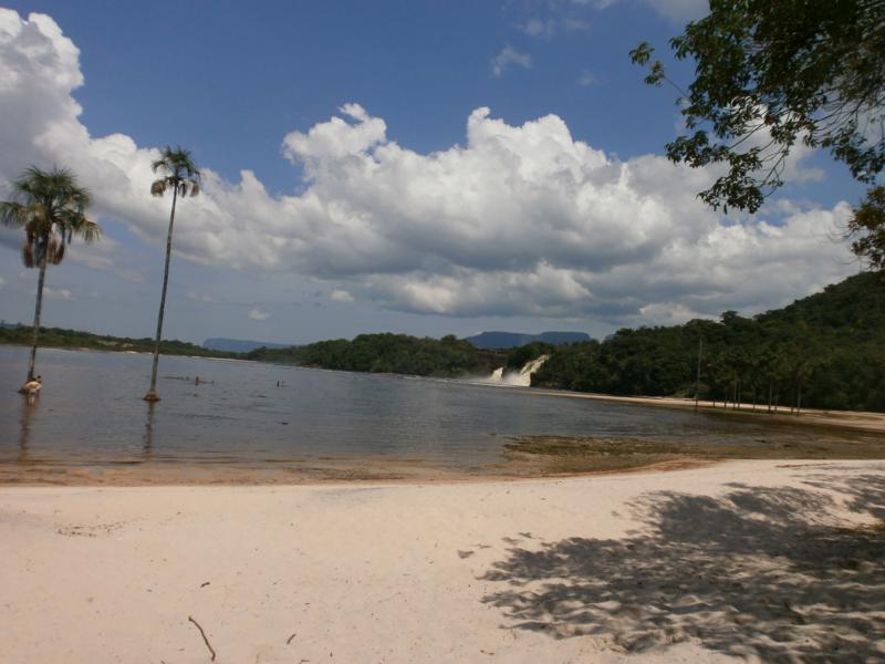 View of Canaima lagoon from a sandy beach. Looking along the densely wooded edge of the lagoon, Salto Ucaima, the nearest waterfall to Canaima Village, can be seen in the middle distance.
 Another vista from the beach. In the foreground trees growing on the beach and wooden canoes tied up on the shore. Along the side of the lagoon, four separate waterfalls can be seen: from nearest to furthest they are called Salto Ucaima, Salto Golondrima, Salto Wadaima and Salto Hacha.
 Tony in a motorised dugout canoe (curiara) on the lagoon approaching Ucaima and Golondrima waterfalls.
 Tony near the front of the canoe.
 Nearing Salto Ucaima – spray in the air creating a faint rainbow.
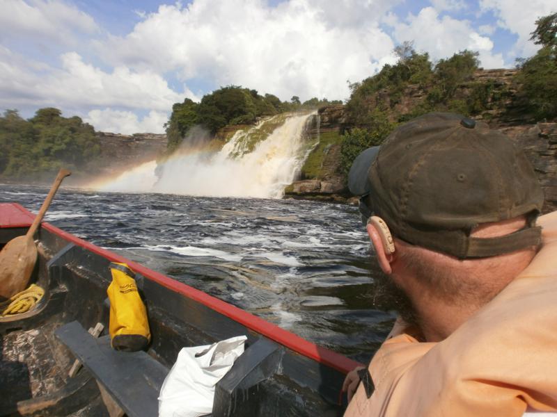
 Tony in the canoe as it passes in front of Ucaima and Golondrima waterfalls. Rainbow again visible.
 Another even bigger waterfall: this is Salto Hacha. Two massive torrents of water cascading over a cliff into the lagoon.
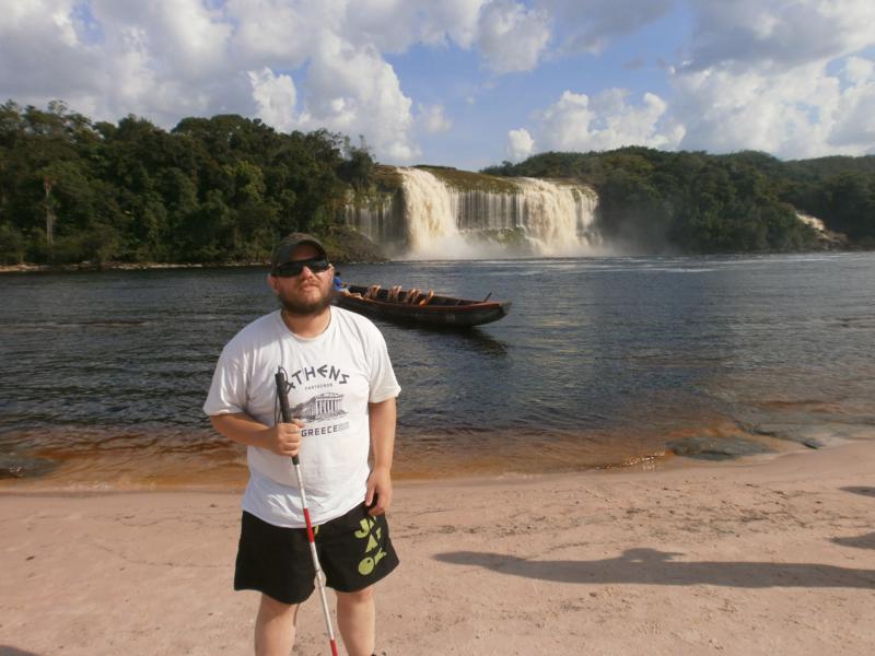 Tony standing on a sandy beach with another beautiful shot of Salto Hacha away on the opposite side of the lagoon. The canoe waiting nearby. The beach is on Isla Anatoly – a sand island in Canaima Lagoon.
 Tony ‘touching’ Salto Hacha.
 Tony relaxing in the water. Another amazing view of Hacha waterfall behind.
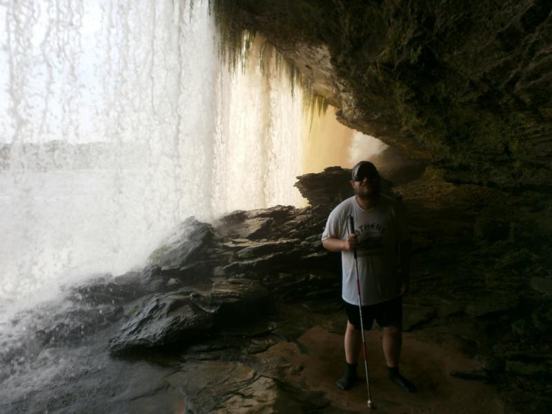
 Behind the curtain of water at Hacha Falls. I actually got to walk inside the water and received a cool shower! Really amazing.
 Again behind the white mist of falling water.
 Tony with arms outstretched at Hacha Falls.
 Tony sitting on a rock holding a piece of weathered wood. Trees and bushes behind. Near the beach at Isla Anatoly again.
23rd November
 Tony on a grassy area above the lagoon.
 In the motorised canoe on the Carrao River at this point heading to Angel Falls. The boat ride took over five hours due to the shallowness of the rivers. Forest along the shore with massive rocky cliffs towering inland.
 Tony with other members of his group on a rocky beach preparing for the trek to Angel Falls.
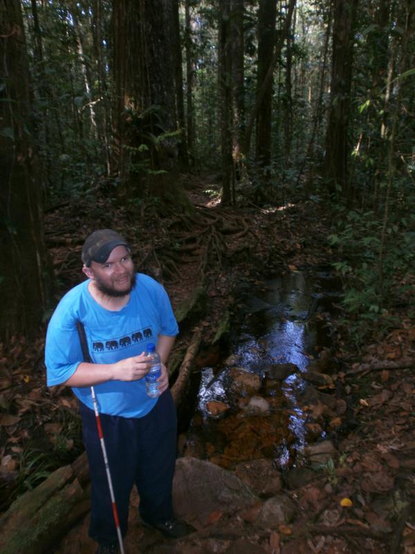 On a hiking trail through gallery forest. Tony by a pool of water. Many rocks and tree roots underfoot.
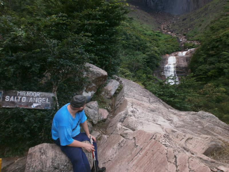
 Tony by a large boulder and a sign that reads “Sendero Salto Angel” (Angel Falls trail). It’s known as Parekupa-meru by the local Pemon Indians, but gained the Angel name after US pilot Jimmy Angel crash-landed on the Auyan Tepuy whilst searching the area for gold in 1937.
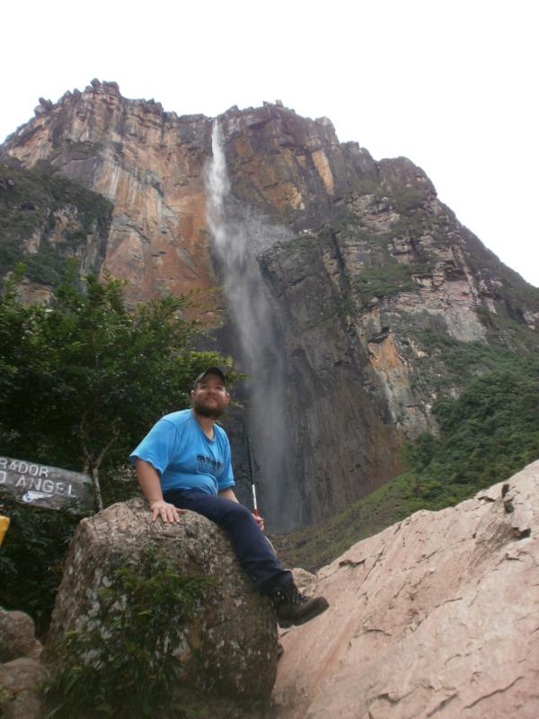
 Tony at Angel Falls! The waterfall is towering behind him. It is the world’s highest with a height of 979 metres (3,212 ft) and a plunge of 807 metres (2,648 ft). The mountain it flows over is called Auyantepui. It is a tepui, a mountain with a flat top and steep cliffs around the sides.
 Tony with his guide George at the base of Angel Falls. It takes most people about 1.5 hours to hike to the base and lookout at Angel Falls, it took me over 3 hours!
 Tony sitting on a boulder, Angel Falls plunging down the sheer side of the mountain behind him.
 Tony looking towards Angel Falls.
 Tony again looking towards Angel Falls. The river flowing from the foot of the waterfall is in view. The river is called the Gauja (also known as the Kerep River or Kerepacupai), it flows into the Churun River, a tributary of the Carrao River.
 A final view from the bottom of Angel Falls.
24th November
 Tony again in the canoe on the Churun River.
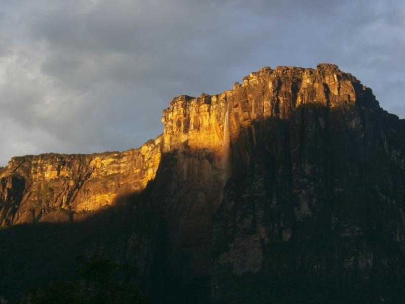 The sun lighting up the top of Auyantepui and Angel Falls away in the distance.
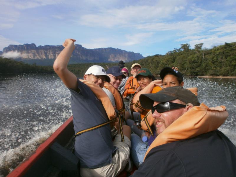 Group photo in the canoe.
 Back near Canaima Village. Tony by railings overlooking the fast-flowing rocky Carrao River.
 Another view over the Carrao River as it flows into the lagoon.
 Tony pointing at a tactile map of Canaima National Park.
Ciudad Bolívar, Bolívar State
25th November
 Tony sitting with a French couple under a tree in a courtyard.
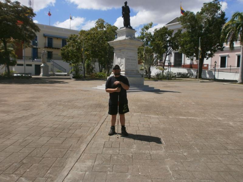
 In Plaza Bolivar (Ciudad Bolívar’s main square).
 Tony in front of a statue of Simon Bolivar in the main square. Simon Bolivar (24th July 1783 – 17th December 1830) was a Venezuelan military and political leader. He played a key role in Latin America’s successful struggle for independence from the Spanish Empire. Today he is considered one of the most influential politicians in the history of the Americas. Many things in South America are named after him, including the countries of Bolivia and Venezuela (its full name being the Bolívarian Republic of Venezuela), plus also the currencies of those two countries.
 Another view of Tony by the Simon Bolivar statue.
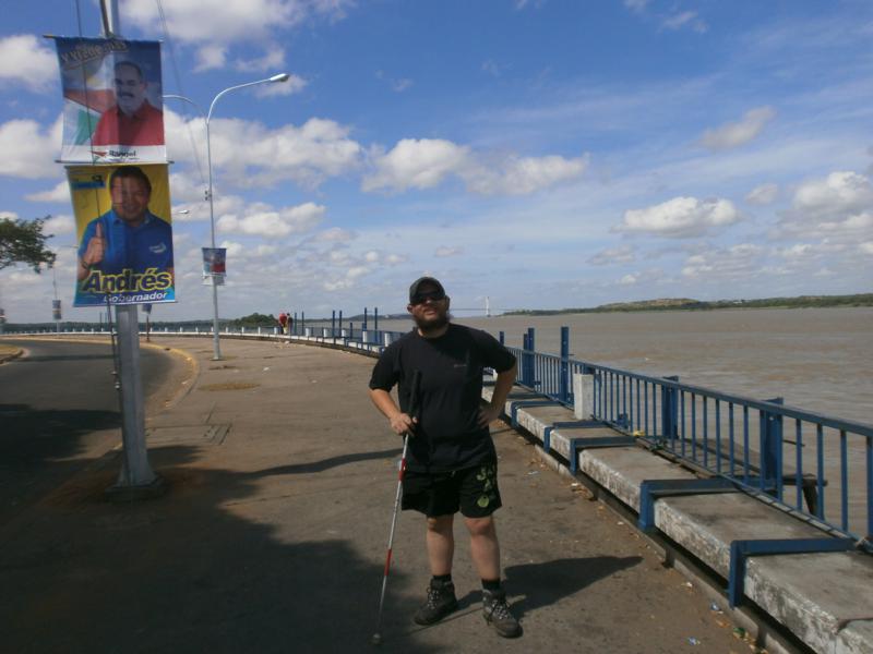 Tony by the wide Orinoco River. It is about 1 mile (1.6 km) wide at this point. A large suspension bridge over the river can be seen away in the distance.
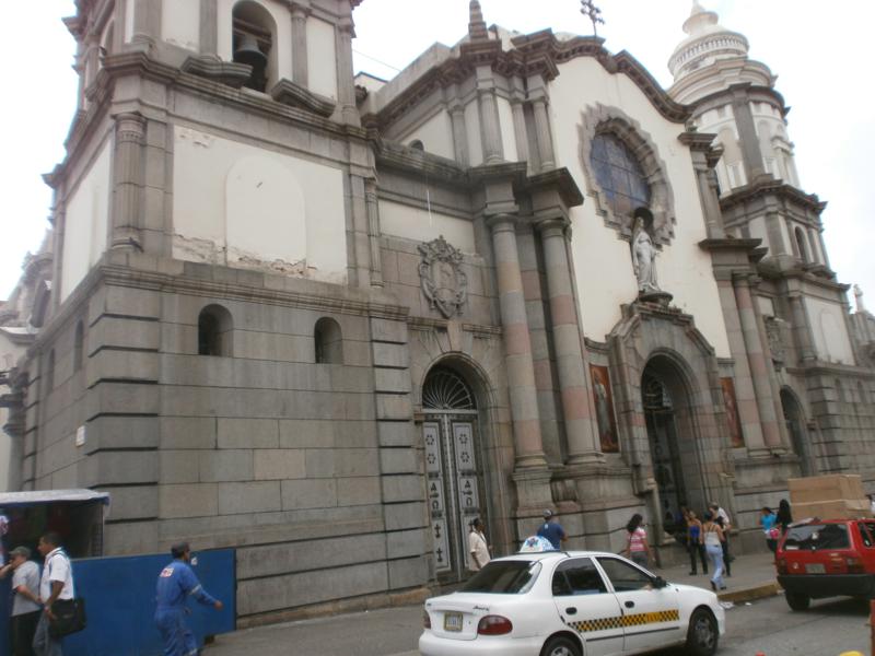
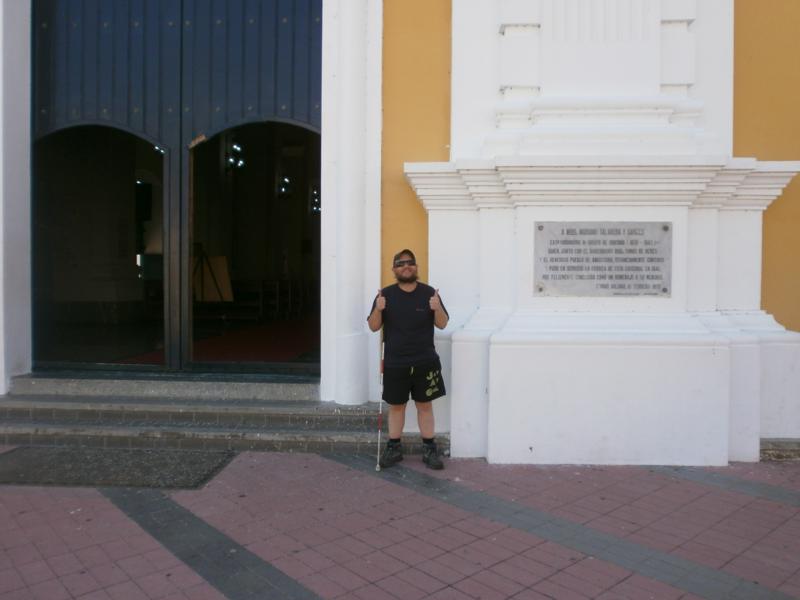 Tony outside Ciudad Bolívar’s colonial era cathedral. Its construction began in 1771 but it was not completed until 1840. It is located on Plaza Bolivar along with other colonial buildings.
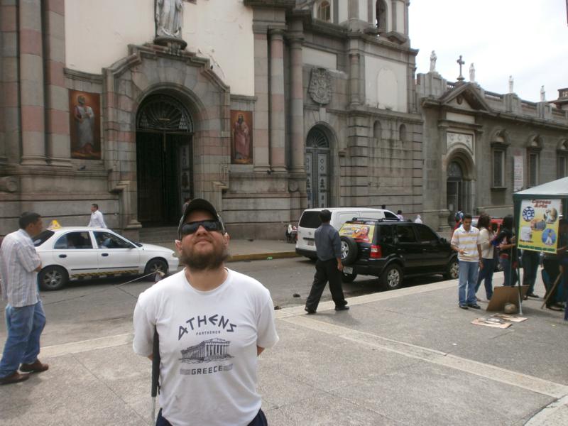
 Again outside the cathedral.
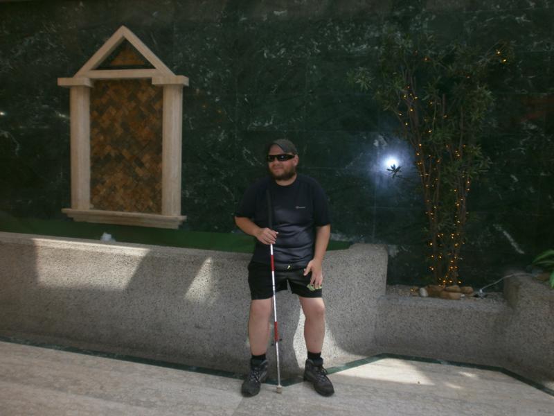 Tony leaning against a marble wall. Alongside is a plant with a string of small lights wrapped around its stems. Probably inside the cathedral.
 House of the Congress of Angostura. Tony at the foot of steps leading through the building into a courtyard. Flags at either side: one the Venezuelan national flag and the other of Bolívar State. The Congress of Angostura was brought together by Simón Bolívar during Colombia and Venezuela’s wars of independence. It sat from February 1819 to July 1821.
Santa Ana de Coro, capital of Falcon State
It’s known as Coro. The city, along with its port, is a UNESCO World Heritage Site, and the oldest city in western Venezuela. Founded 26th July 1527 and situated at the southern end of the Paraguana Peninsula.
27th November
 Tony outside Coro Cathedral. The white painted cathedral is located on Plaza Bolivar. Construction began in 1583 and it was completed approximately 50 years later. It is the oldest cathedral in Venezuela.
 Tony standing under the shade of a tree in Plaza San Clemente.
 St Clement’s Cross. A wooden cross protected within an open-sided stone shelter. It is said that St Clement’s Cross marks the spot where the first mass in South America was held. Located in Plaza San Clemente.
 Outside St Clement’s Church (Iglesia de San Clemente). A church has stood on this site since the 16th century. The present structure dates from the 18th century. It is one of the few examples of colonial architecture laid out in the form of a cross in Venezuela.
 The main altar inside St Clement’s Church.
 Tony sitting on a low branch of an old-looking strangely-shaped tree. In a park/square. The tree is local to the region, needs little water to grow and has deep roots.
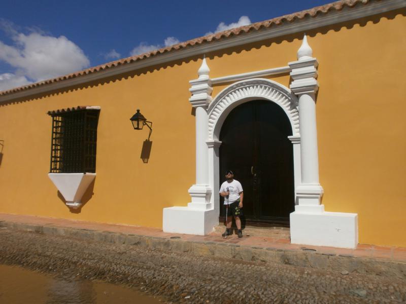
 Tony outside a white-painted colonial-era house. A tall cactus also in view.
 Tony in the doorway of the Casa de las Ventanas de Hierro (House of the Iron Windows). This mansion was built in the 17th century. It is so named because it was built with iron grills across the windows: they were imported from Andalusia and were unusual in Venezuela at that time.
 Casa del Tesoro – another colonial-era mansion built in 1770 by the Talavera family.
 Tony outside Coro Art Museum. The colonial-era two-storey building that houses the museum is called Balcón de Bolívar (or Casa de los Senior). The exterior is painted yellow with a blue-painted wooden balcony around the first floor. It served as military headquarters of the patriot forces during the War of Independence. It is said that Simón Bolívar stayed here on 23rd December 1826 and from the balcony greeted the patriots who gathered outside to greet him.
 The inner courtyard of the Coro Art Museum. Tony in front of the stone column of a covered walkway that runs along one side.
 Looking along Paseo Talavera, a pedestrian colonial-era street. The colonial buildings that line the street include the Coro Art Museum. In front workmen are repaving part of the street.
 Sand dunes at Médanos de Coro National Park, in the city’s extreme north-east, on the Isthmus of Médanos. These large dunes are the only desert in Venezuela. They can reach up to 40 metres in height and are constantly being transformed by the persistent winds blowing in from the sea.
Merida, Merida State, Andes Region
28th November
 Tony holding a tortoise in the hostel where he stayed in downtown Merida, a short walk to Plaza Bolivar.
29th November
 The hostel where Tony stayed. A couple of hammocks are in view.
 Outside Merida Cathedral. Construction of the cathedral started in 1803 but it was not completed until 1960 – 157 years later! It incorporates an eclectic mixture of architectural styles.
 Tony in the street outside the cathedral.
 Tony in front of a bronze statue of Simon Bolivar on horseback. It stands on a white marble base. It is located in the central square, which is also named after Bolivar.
 Tony standing among pigeons in Plaza Bolivar.
 The main doorway into a colonial-era building located near the plaza. A stone balcony above. Possibly a government building.
 View to one side of the main altar inside Merida Cathedral.
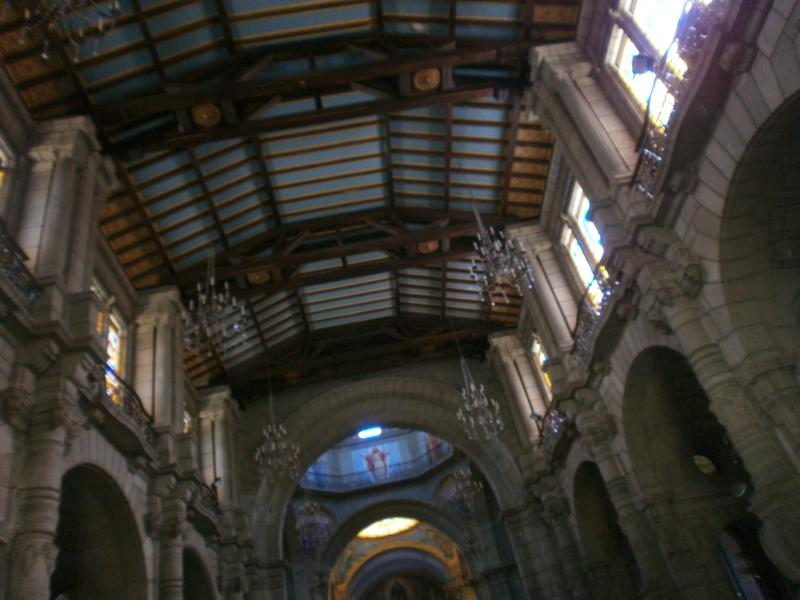 Looking up at the ceiling from the cathedral’s central aisle.
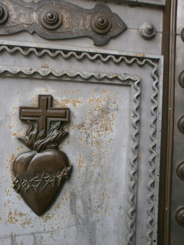 Detail on a metal door into the cathedral: a heart surrounded by a ring of thorns, with a cross standing above.
 A pedestrian route lined with market stalls in Plaza Bolivar heading away from the cathedral.
 Busy street scene. Several small stalls selling drinks and snacks.
 Tony back at the hostel in the garden by a tall fern. Away in the distance Mount Bolivar (or another one of the Andes mountains surrounding the city) can be seen rising up and disappearing into the cloud.
 Outside Iglesia de la Tercera (The Third Church).
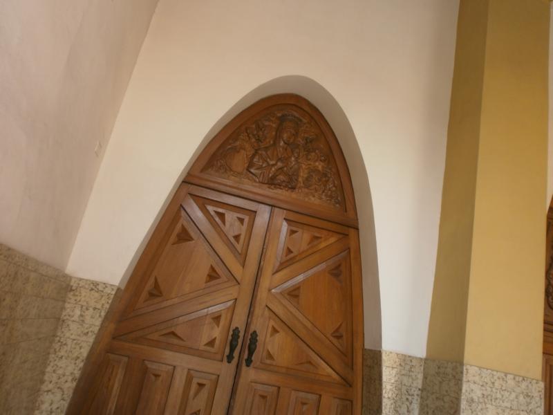 Arched wooden doorway into the church.
 Windows outside the church, following the same distinctive curve/arch design as the doorway.
30th November
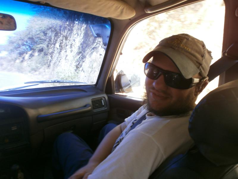 Tony in a car heading up into the Andes mountains near Merida to go paragliding.
 A pair of goats grazing by the side of the road.
 View of mountains from the road.
 Tony talking with the driver inside the car.
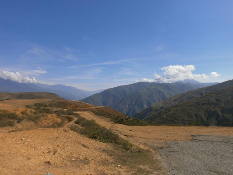
 Tony high up on the mountain. A spectacular view down into a wide valley below.
 Cacti and other spiky mountain plants.
 Tony in front of more vegetation, including cactus. Mountains in the distance.
 Kit being prepared for Tony’s paraglide.
 Tony wearing a helmet and other kit ready for his paraglide. Again excellent views into the valley below.
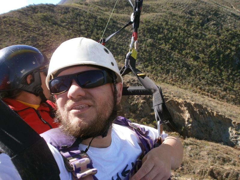 Tony strapped into a harness with his pilot as he begins his paraglide.
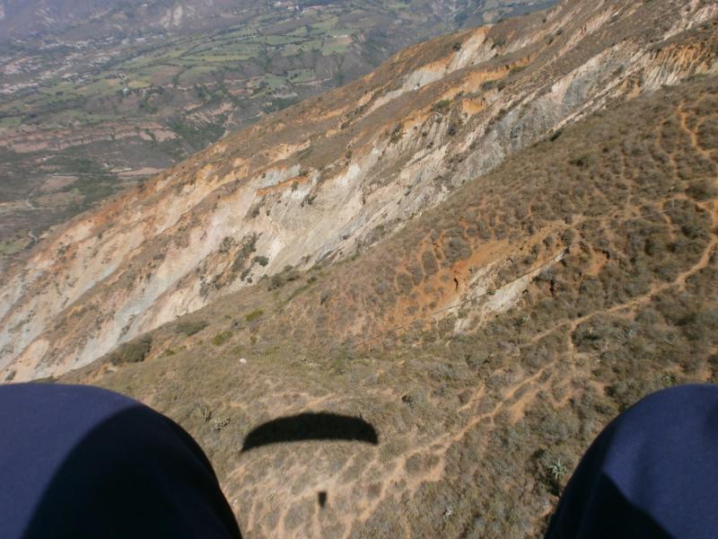 The rocky slopes of the mountain. The parachute casting a shadow.
 Tony during his paraglide.
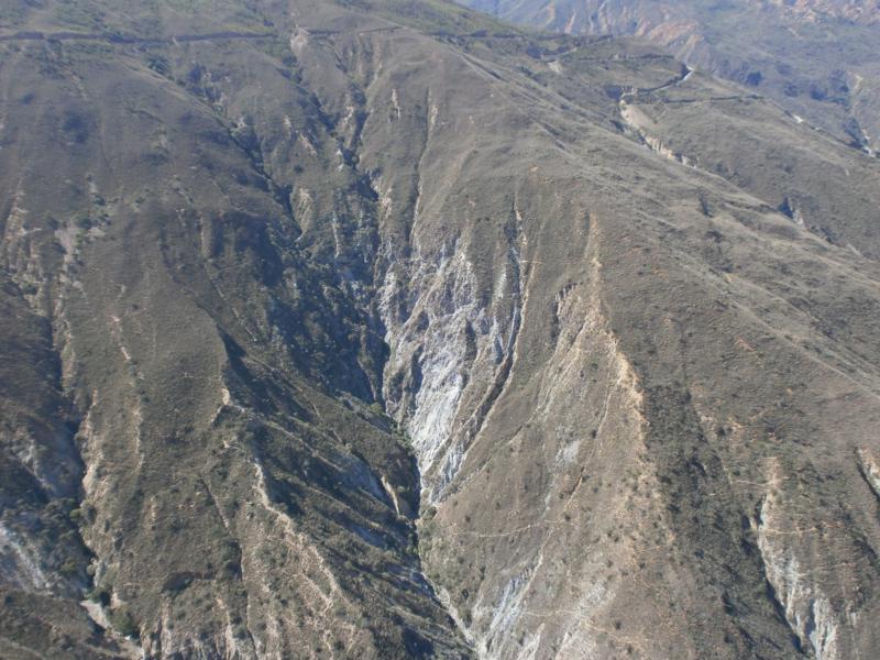 Excellent view of a nearby mountain side.
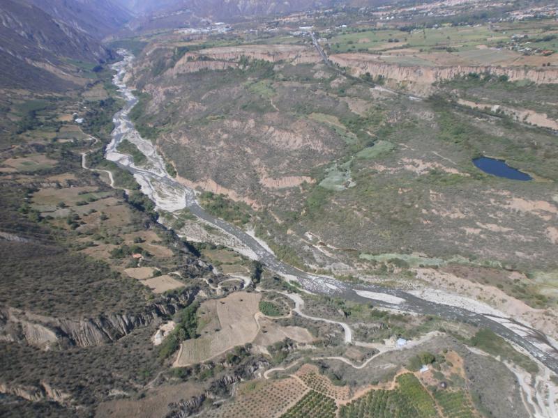 Looking down into the valley still far below. A river running through the middle surrounded by a patchwork of fields.