
Previous: Morocco and Western Sahara
Nouadhibou, Mauritania
Sunday, 26th February
 Courtyard of the guesthouse Auberge Camping Abba. This is where Tony stayed.
 Looking towards the gate at the guesthouse entrance.
 Guesthouse room.
 Looking at the guesthouse courtyard through a doorway.
 A dusty back street outside the guesthouse Auberge Camping Abba.
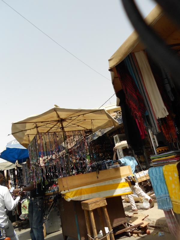
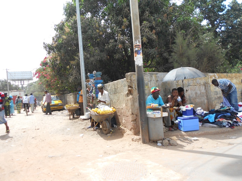
 A narrow street with shops and stalls, mostly selling clothes. In or around Nouadhibou market.
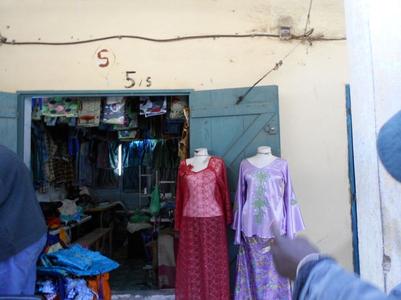 Looking into a small ladies’ clothes shop.
 More stalls – selling textiles and foodstuffs.
 Narrow route between market stalls – cheap necklaces for sale at the nearest stall.
 In front of a fruit stall. The young African stall owner staring at the camera.
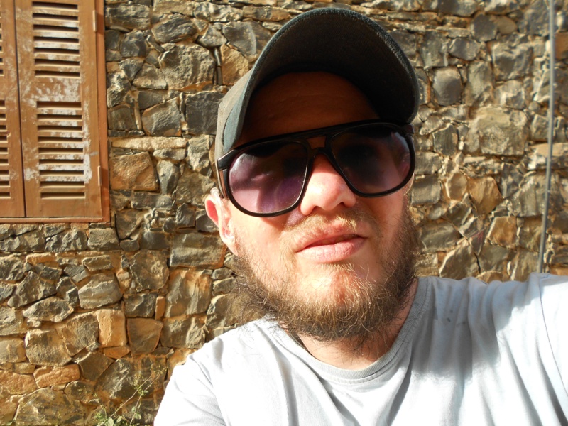
 Tony sitting on a bed holding a camel’s skull. It’s placed outside the guesthouse to give protection!
 Tony lying on a bed in the guesthouse, holding a large wad of money and looking like a gambler!
Nouakchot, Mauritania
The largest city and capital. Located on the Atlantic Ocean, south of Nouadhibou
Tuesday 28th February
 Inside a café. A few locals having drinks and snacks.
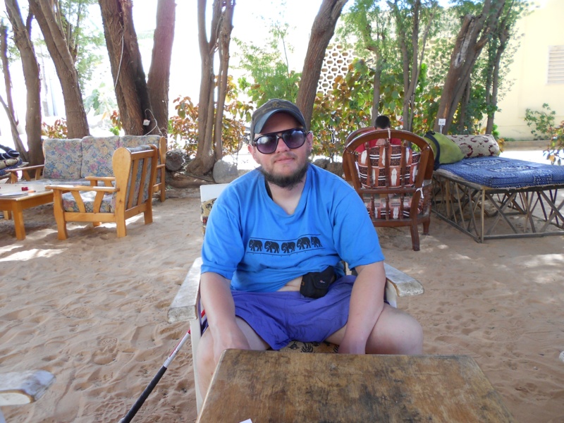 Tony in the backyard of Auberge Menata, sitting in a comfortable chair.
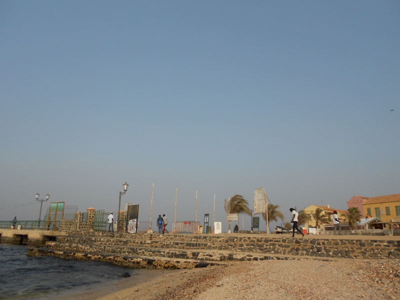
 View of the sea at Nouakchott fish market. The sun low in the sky.
 On Nouakchott beach. There are a number of local people, mostly women, with buckets filled with fish. The fish market beyond.
Saint Louis, Senegal
Saint Louis, or Ndar as it is called in Wolof, is a town on an island located in the north-west of Senegal, near the mouth of the Senegal River, and 320 km north of Dakar, Senegal’s capital.
Thursday, 1st March
 A sandy side street. Children sitting in the shade under a building.
 Outside Restaurant Teranga Ndar. Tony ate in here during his two days in the town.
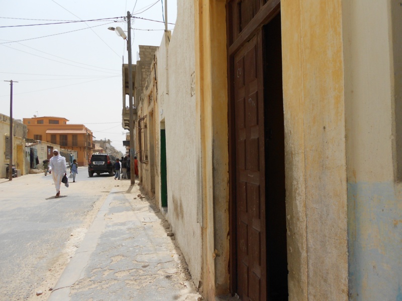 A street in Saint Louis.
 Another street. A post office in front. A French style building with a metal balcony opposite. There’s also a sign advertising an African art and crafts exhibition sale.
 Buildings, offices, graffiti on the outside walls.
 A local Senegalese woman with a child walking along a street. The woman in a white dress and head scarf and the boy in a blue robe.
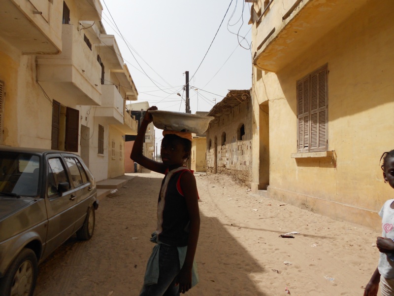 A dusty side street. A girl walking past carrying a bowl on her head.
 Looking out along the Senegal River.
 Looking the other way towards a bridge over the river.
 Tony by a road taking a photo of himself.
 A road running alongside the river, the bridge again visible in the distance.
 A side street with the river at the end. The fish market with pictures of fish painted on the side wall.
 Another side street. Craft objects, mostly made of wood, for sale.
 Inside a shop. Traditional craft objects – including a wooden mask and a large wooden figurine.
 Looking into a dusty street with the minaret of a small mosque a little way along.
Dakar, Senegal
Dakar is the capital and largest city of Senegal. It is located on the Cap-Vert Peninsula on the Atlantic coast and is the westernmost city on the African mainland. Its position, on the western edge of Africa, is an advantageous departure point for trans-Atlantic and European trade; this fact aided its growth into a major regional port.
(Info taken from Wikipedia, 9th July 2012)
Saturday 3rd to Monday 5th March
 Yoff Beach. Looking towards the Atlantic Ocean. A group of local men in front, kicking a football about.
 An excellent view along Yoff Beach off into the hazy distance.
 Looking towards wooden sun shelters at the top of the beach.
 Tony on the beach (self taken).
 Looking towards the sea. Tony framing the view with his cane.
 Sandaga, Dakar’s largest market, located right in the heart of the city. Stalls selling textiles and jewellery in view.
 A road busy with people at Sandaga market.
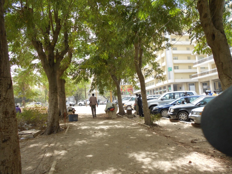
 A walkway shaded by trees on the edge of Independence Square. Alongside is a road lined with tall government buildings and other offices.
 Independence Square.
 Looking into a street off Independence Square. Tall office buildings at either side.
 View across the square.
 In the centre of the square.
 Tony (self-taken) at the side of the square.
 Independence Square.
 A pavement, shaded by the building overhanging above. Crowded with people and lined with offices (banks, travel agencies).
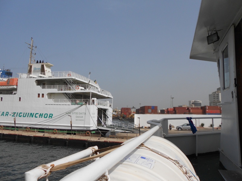 View from the deck of a boat in Dakar port. A car ferry is moored opposite.
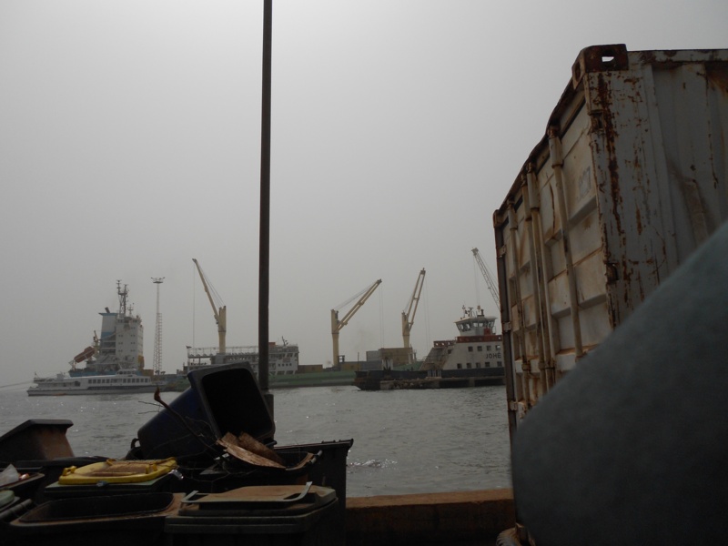
 Dakar port. Large ships with cargo being loaded and unloaded.
 View from the deck of the boat. Heading to Ile de Gorée, which is approaching in the distance.
 Now nearing the Ile de Gorée.
Ile de Gorée is located two miles from Dakar Harbour. It contains former slave houses and a slave market, the last place slaves were held before being shipped to the Americas, Caribbean and Europe.
 A beach by the harbour at Gorée. On the beach are a few small fishing boats.
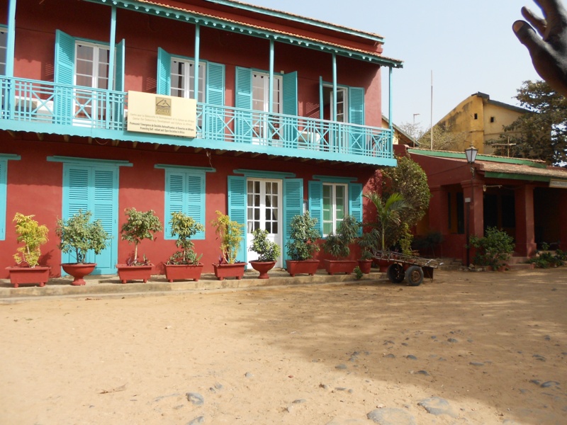 A colonial era building with a first floor balcony and wooden shutters on the doors and windows.
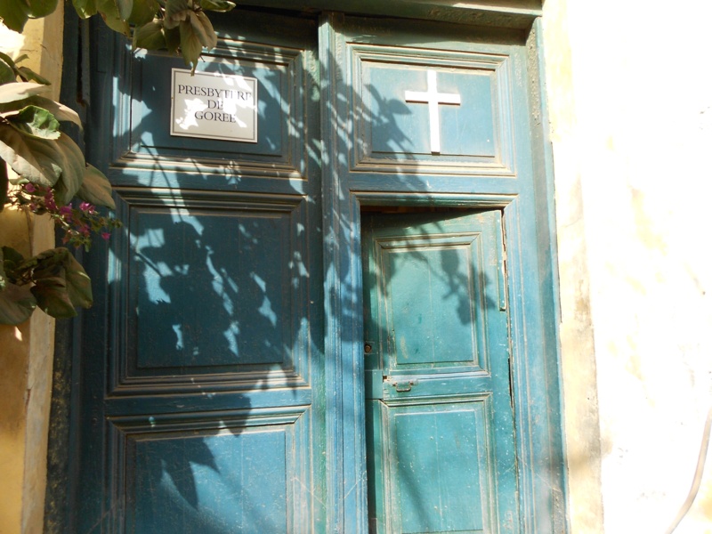 Doorway to a church: ‘Presbytere de Gorée’.
 Tony outside the church.
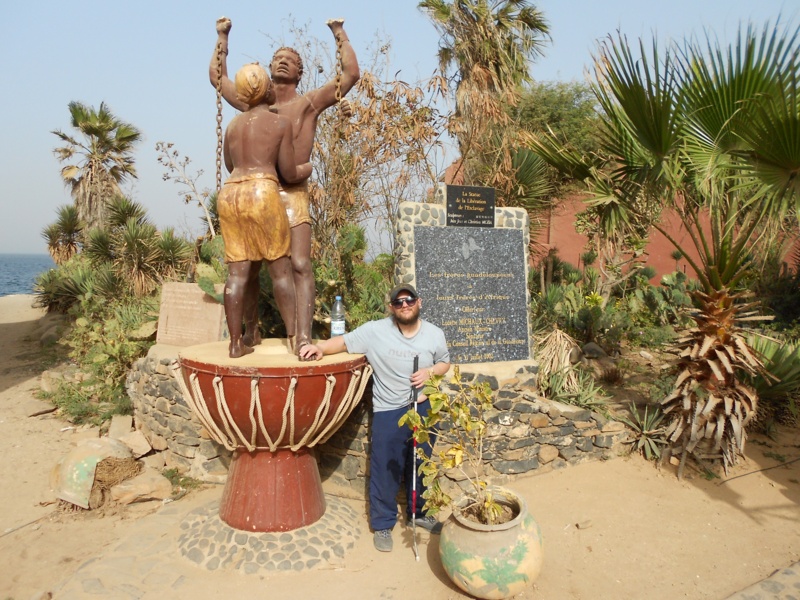 Tony by a statue of two freed slaves: a man and a woman. The statue commemorates the abolition of slavery.
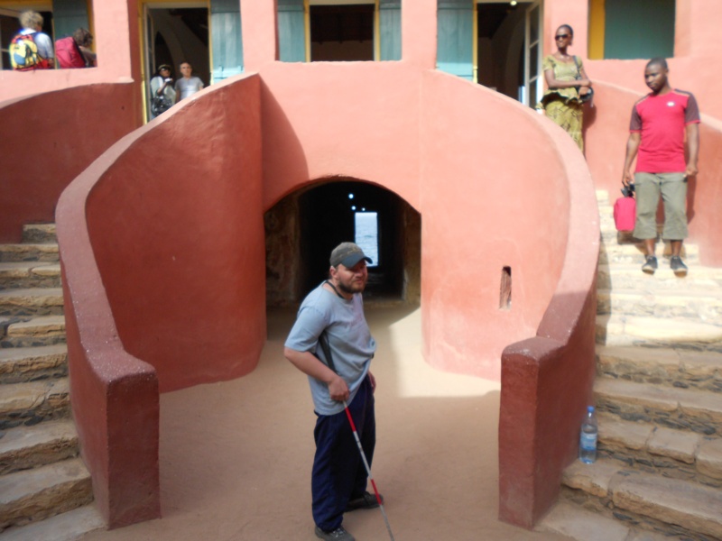
 Outer doorway into the Maison des Esclaves (House of Slaves).
 Tony standing in a doorway labelled ‘Hommes’ (Men). This is where male slaves were held.
 Tony bending over in order to walk along a very low passageway.
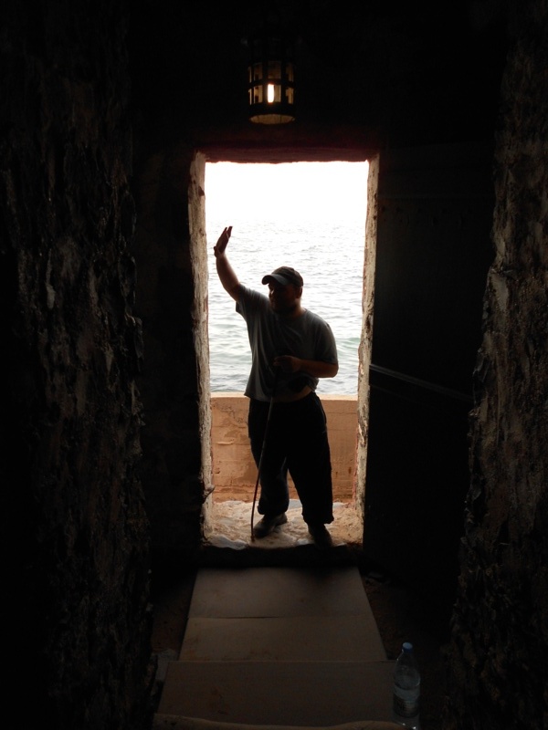 Tony standing in a doorway that looks out towards the sea. This is the ‘door of no return’ that slaves left through.
 The front of the slave house. A pair of stairways lead to the building above and there’s a passage below leading to the ‘door of no return’.
 Tony holding a pair of shackles, as would have been used to chain slaves.
 Tony standing with arms outstretched in front of a large Bouback tree. A square in Gorée.
 Close-up of Tony in front of the stone wall to a house.
 Tony outside the door to the Catholic church.
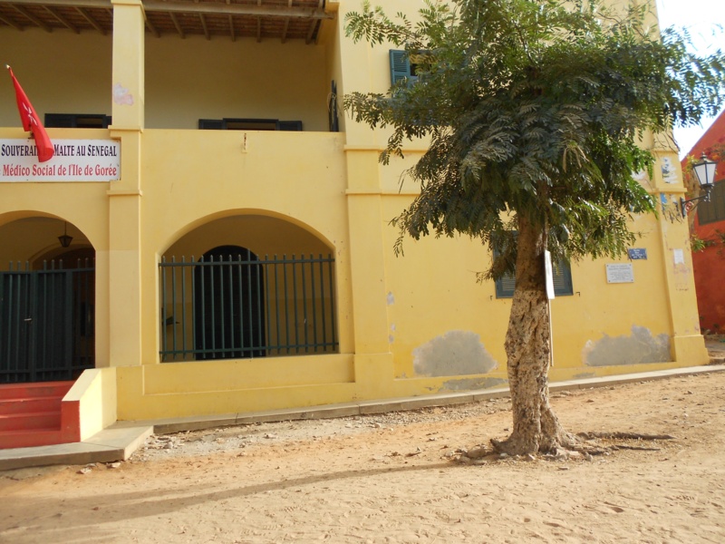 Outside a medical centre belonging to the Sovereign Order of Malta.
 Tony touching a canon sunk into the ground next to a woman selling local artwork.
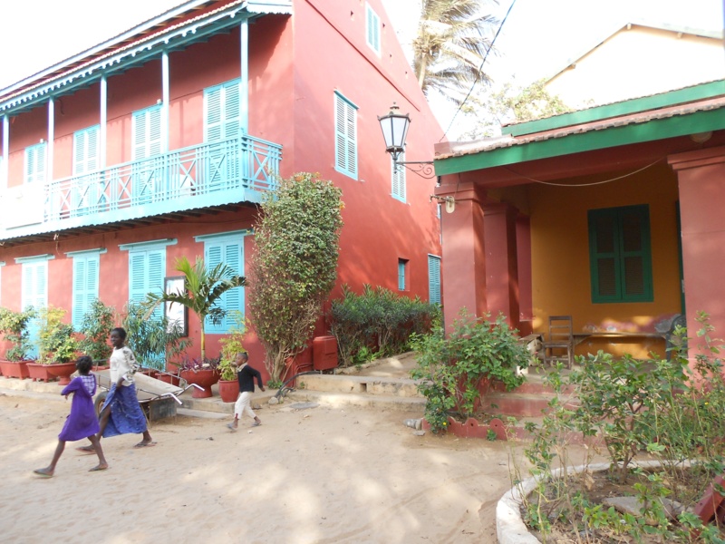 Colourfully painted colonial era buildings in Gorée.
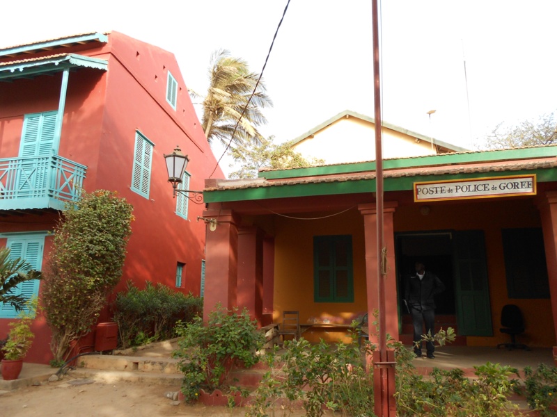 “Poste de Police de Gorée” (police station).
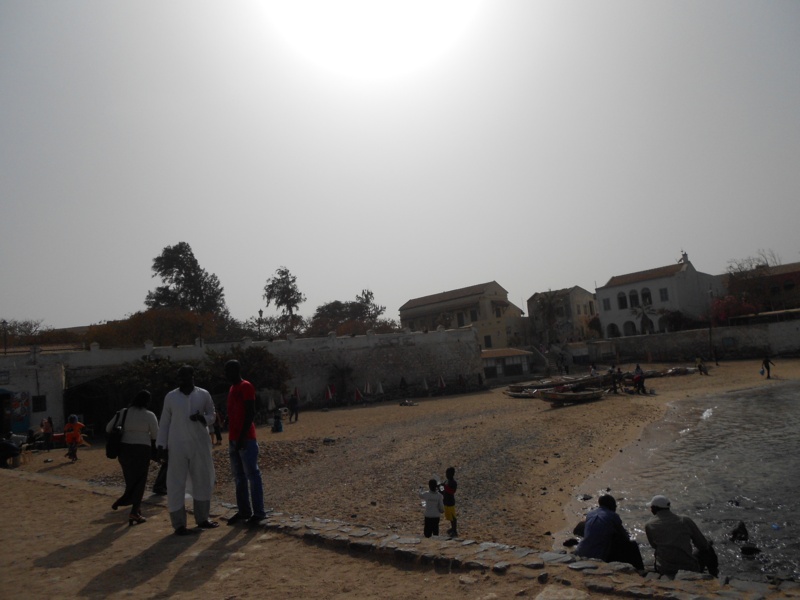
 Gorée harbour seen from the beach.
 Concrete walkway to the harbour.
 A café on the beach by the harbour.
 Tony sitting with a local man on the boat back to Dakar.
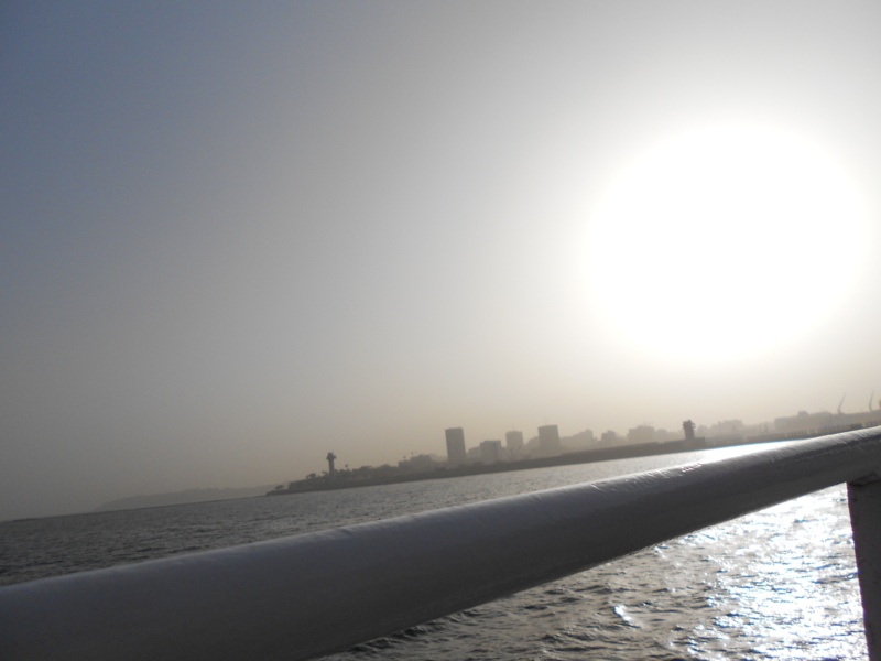 A hazy view of Dakar from the boat.
M’Bour, Senegal
M’Bour (Mbour), a rural village on the Petite Côte, in the Thiès Region, approximately 80 kilometres south of Dakar, Senegal.
Tuesday, 6th March
 Tony outside the Auberge Africa Thiossane Hotel in M’Bour. The exterior wall behind decorated with a mural depicting traditional canoes on a river.
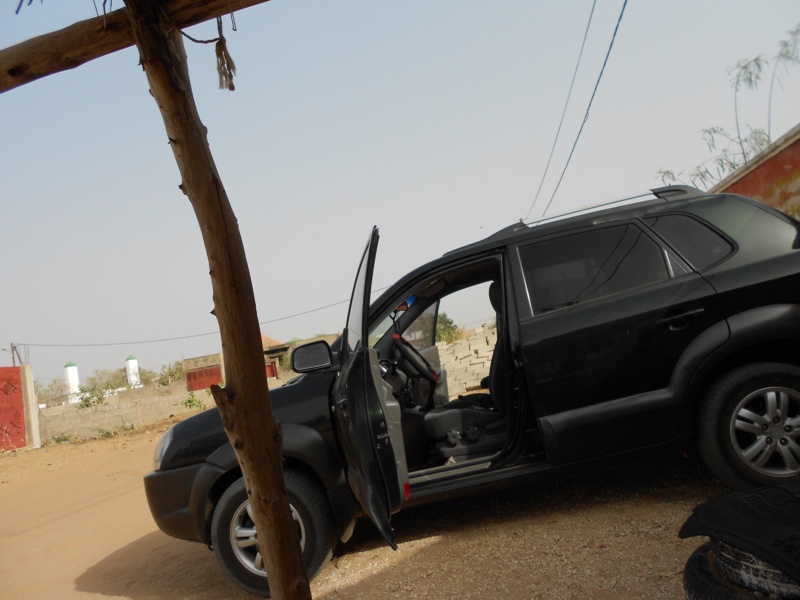 A car being loaded with luggage outside the hotel.
 Doorway into the hotel compound.
 A sandy residential street outside the hotel in M’Bour.
 On M’Bour Beach looking out to sea. The sun is low in the sky.
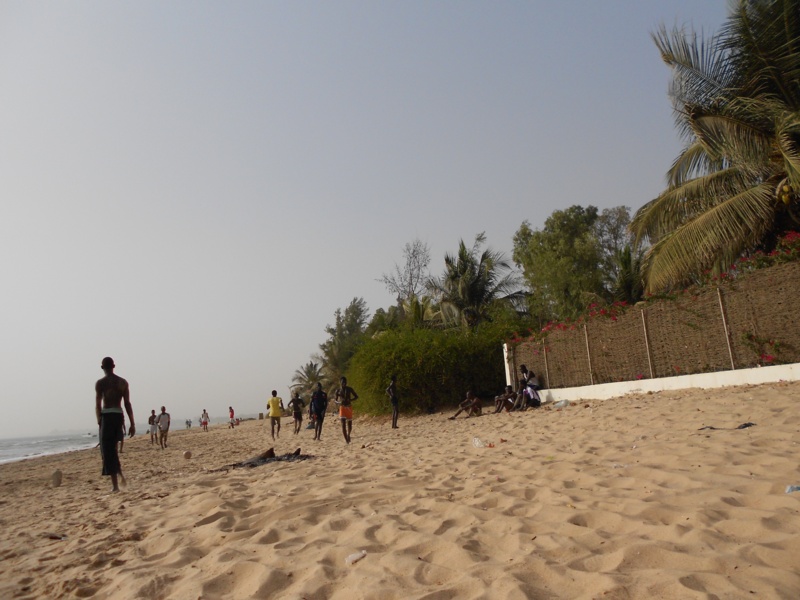 View along the beach. Boys kicking a ball about.
 People jogging along the sea shore.
 An outdoor café bar.
 Lots of vans and minibuses, M’Bour minibus station, on the edge of the rural town. The tall minarets and dome of a mosque are visible away in the distance.
Banjul, capital of The Gambia
A tiny sea port town on an island, plus Serrakunda, Gambia’s largest town, near the Atlantic Coast, 11 km from Banjul.
Wednesday, 7th March, 3 nights
 People at the side of a road selling clothes, fruit and other goods.
 Another street scene. Gas bottles for sale and a clothes shop behind.
 A roadside stall selling toiletries and other goods, part of Serrakunda market – the largest market in the Gambia.
 Close-up of Tony at Serrakunda market.
 July 22 Arch in Banjul. The arch was built in 1996 to mark the assumption of power by president Yahya Jammeh. He took power on 22nd July 1994 through a military coup d’etat.
 Tony in front of the arch.
 Inside a museum at the top of the arch. Tony beside a mannequin dressed in a traditional white robe.
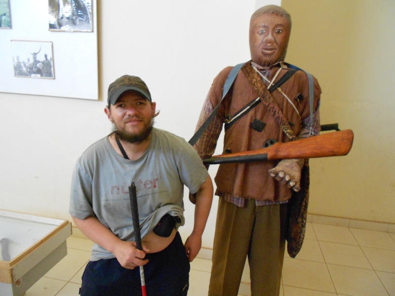 Tony by another mannequin: a man holding a replica rifle
 Outside the Royal Victoria Teaching Hospital (RVH), Independence Drive, Banjul.
The Royal Victoria Teaching Hospital (RVTH) was built in 1853 by the British Government, who also provided funds for a substantial improvement in facilities and subsequently handed it over to the Gambian Government. This financing provided many of the buildings that make up the teaching hospital today. The RTVH is a 650-bed hospital based in the capital, Banjul. It is the leading referral hospital in The Gambia and has recently become a teaching hospital to train Gambians to become doctors.
 Tony standing on the grass at Independence/MacCarthy Square.
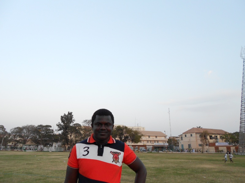 A local man named Mohamed, wearing a sports shirt. Independence/ MacCarthy Square. Tony met Mohamed while waiting for the ferry to cross the Gambia River to Banjul, on his first night in the Gambia.
 Tony sitting at a table with Mohamed in a restaurant, in ‘the strip’, SENEGAMBIA.
 Banjul port. A shipping container in the foreground; boats and cranes in the middle distance.
 A queue of people, some with goods piled on carts, waiting to board a ferry at Banjul port. A pair of goats are tied to a cart immediately in front.
 Sea front view, taken from the ferry. A bustling scene with many people, some in the water, around large wooden boats. Buildings behind.
 View out of the window from a stationary van in a local village on the north bank of the Gambia River.
Kuntaur Village, The Gambia
Saturday 10th to Monday 12th March
 Tony outside Kairoh Garden Guesthouse, Kuntaur Village, on the north bank of the Gambia River.
 Chairs and tables at Kairoh Garden Guesthouse.
 Tony with a fellow traveller from Slovakia by the Gambia River. Several canoes on the river.
 Tony and the Slovakian guy waiting by a donkey cart in Kuntaur village.
 Tony travelling on the donkey cart.
 View along the road from the cart. Waterlogged fields on both sides. Rice is grown in the fields, the track the donkey cart uses is a river bed.
 Goats grazing at the side of the road.
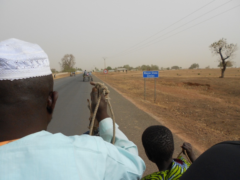 A Gambian man and boy sitting at the front of the cart guiding the donkey along the road.
 Wassu Stone Circles entrance.
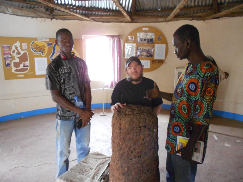 Tony, with two guides, touching a stone inside a small museum at the Wassu Stone Circles archaeological site.
 Tony inside one of the circles touching a stone. The stone circles at Wassu are around 1,200 years old and were erected to mark burials.
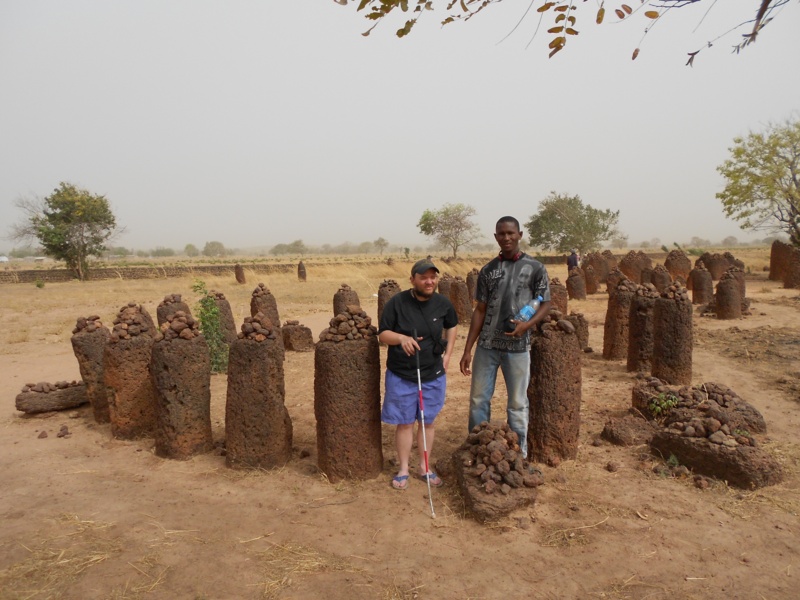 Tony with a guide at the edge of a stone circle. More stone circles can be seen behind.
 Tony with a guide by the standing stones.
 A 50 dalasi Gambian bank note with a stone circle drawing and the actual stone circle depicted in front.
 Tony standing between two of the stones, touching piles of smaller stones placed on top of them.
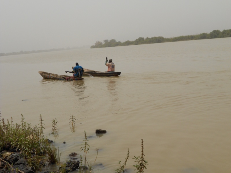
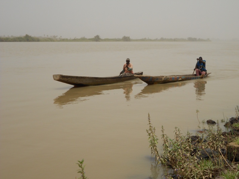 View across the wide Gambia River. Two local men paddling canoes are approaching.
 A small tourist boat and a canoe passing by on the river
 Looking the other way along the river.
 Tony relaxing on a traditional wooden sun bed at Kairoh Garden Guesthouse.
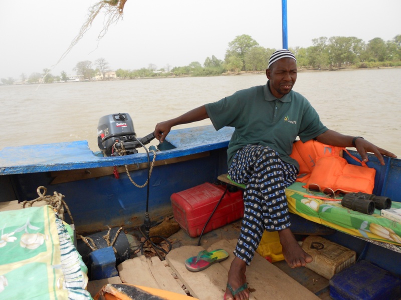 On the Gambia River in a traditionally designed river boat with a motor. Looking towards the Gambian boat owner and guide as he steers. An afternoon boat trip to the River Gambia National Park to view hippos and chimpanzees.
 A pair of buildings on the edge of the river seen from the boat.
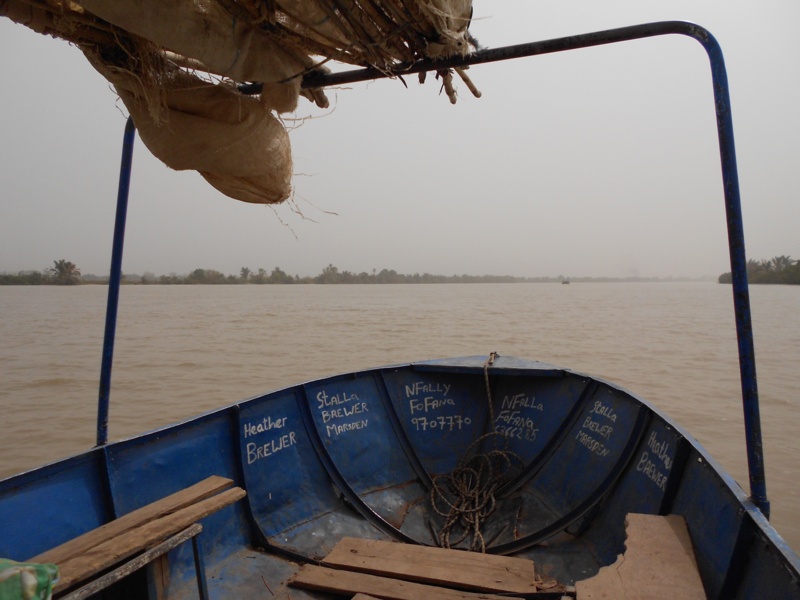 View along the wide river from the boat’s bow.
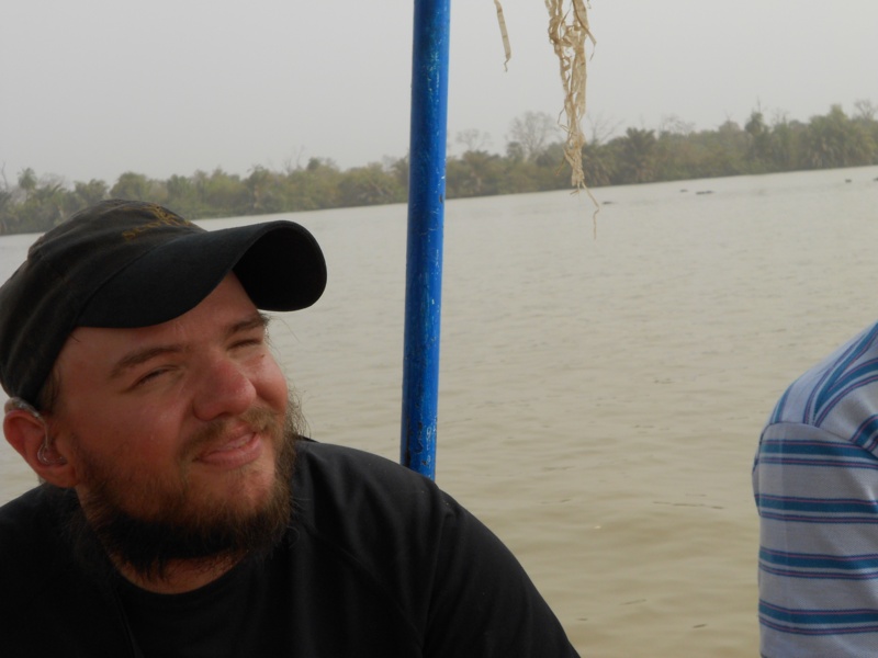
 Tony sitting on-board the boat.
 Tony looking through binoculars!
 Dense vegetation at the side of the river, looking for chimpanzees.
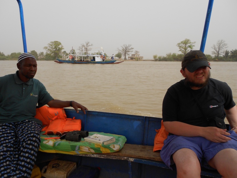
 Tony sat next to a park ranger on-board the boat. The ranger is from the Gambia.
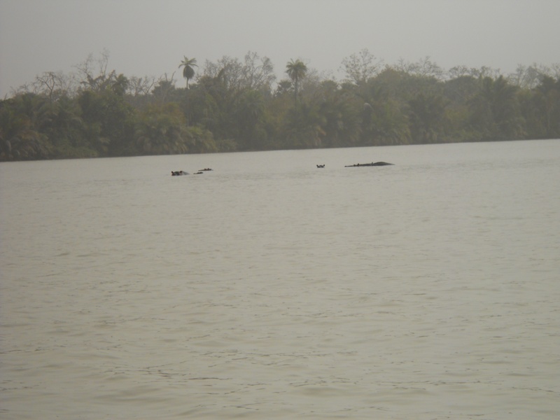 A group of hippos in the river.
 Tony on-board the boat.
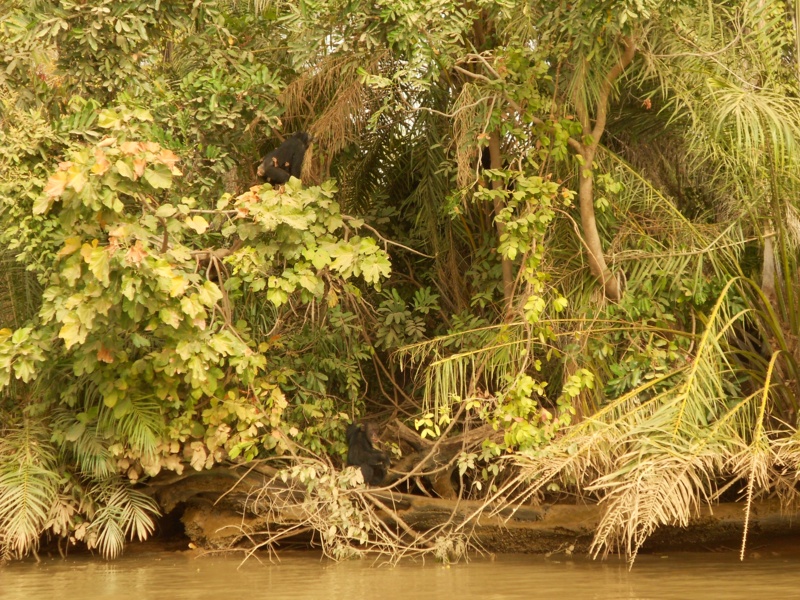 A chimpanzee sitting in a tree. The chimpanzees are not native to the habitat, but have been placed on the five islands that comprise the River Gambia National Park for protection.
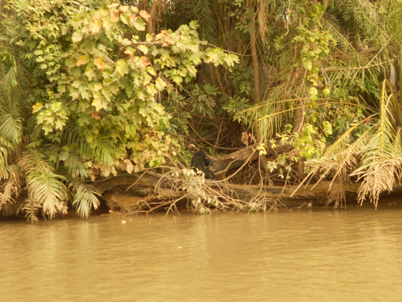 Another chimpanzee sitting amongst vegetation at the edge of the river.
 Tony steering the boat.
 In the centre of Wassu. Luggage being loaded on to the roofs of minibuses.
Janjanbureh, The Gambia
Janjanbureh or Jangjangbureh is a town, founded in 1832, on Janjanbureh Island in the Gambia River in eastern Gambia. It was formerly known as Georgetown and was the second largest town in the country. It is now the capital of the Central River Division and is best known as home to Gambia’s main prison. The Wassu stone circles lie 22 kilometres north-west of Lamin Koto, on the north bank across from Janjanbureh. It is also noted for being the site of the first church in Gambia.
The island is known locally as McCarthy Island, and is located in what used to be called McCarthy Island Division. The island is accessed by bridge from the south bank, and by small ferry boats or a government ferry from the north bank. In 1995, both the city of Georgetown and MacCarthy Island were renamed Janjanbureh respectively. Janjanbureh is also the name of the district in which the town of Janjanbureh is located.
Monday 12th March
 An old canon surrounded by parched grass, a few trees and a cow drinking from a trough. Janjanbureh, upper Gambia.
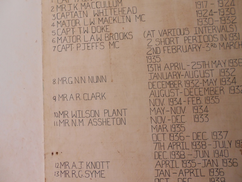 A list of names of British governors of Janjanbureh and dates of their office on a wall. The dates are from around 1910 onwards until Gambian independence in 1968.
 Tony outside the Methodist Church, Janjanbureh, Gambia. The church dates from 1835 and is the oldest Methodist church in Sub-Saharan Africa.
Below, additional photos of Janjanbureh Town and island, taken by Saikou Sanyang, Tony’s friend from Janjanbureh. These photos were taken after Tony left and kindly sent by Saikou, taken May-August 2012.
 Large single storey building. Possibly an orphanage.
 Old walls – remains of warehouses by the river.
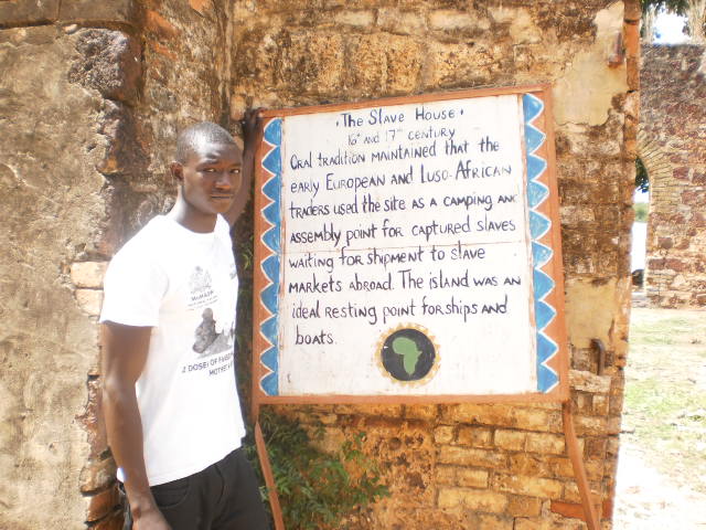 Saigou standing by a ‘Slave House’ sign.
 Saigou, behind him is an old wall with a doorway leading to the river.
 Saigou again by the old wall.
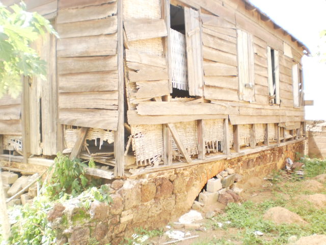 The Wooden House. One of around 200 houses built in 1832 to house liberated slaves.
 Entrance to the Freedom Tree Monument.
 The Freedom Tree.
 The old canon.
 In front of the canon. Behind is a large colonial era building.
 Saigou.
Next: Senegal (part 2)