
Lesbos Island, North Aegean, Greece
The capital is Mytilene, sometimes called Mytilini. The island is
Greece’s third largest after Crete and Evia and is separated from Turkey
by the narrow Mytilini Strait.
Mytilene
This ancient city, founded in the 11th century BC, spreads from the
large harbour up into the hills and mountains beyond. It is crowned by
an enormous castle, the foundations of which were laid in the 6th
century AD during the reign of Justinian, on the ruins of an even more
ancient fortification. The city is located on the south-east edge of
Lesbos.
Saturday, 11th September 2014
 Evening view of Mytilene’s large harbour. Sailing boats moored in front.
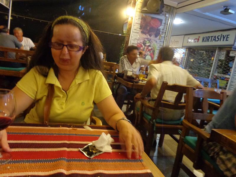
 Tatiana eating in a restaurant.
Sunday, 12th September 2014
Bus trip to Agiasos, a large village located 26 kilometres (16 miles) from Mytilene on the slopes of Mount Olympos.
 Tatiana next to a female manikin in traditional dress outside a restaurant.
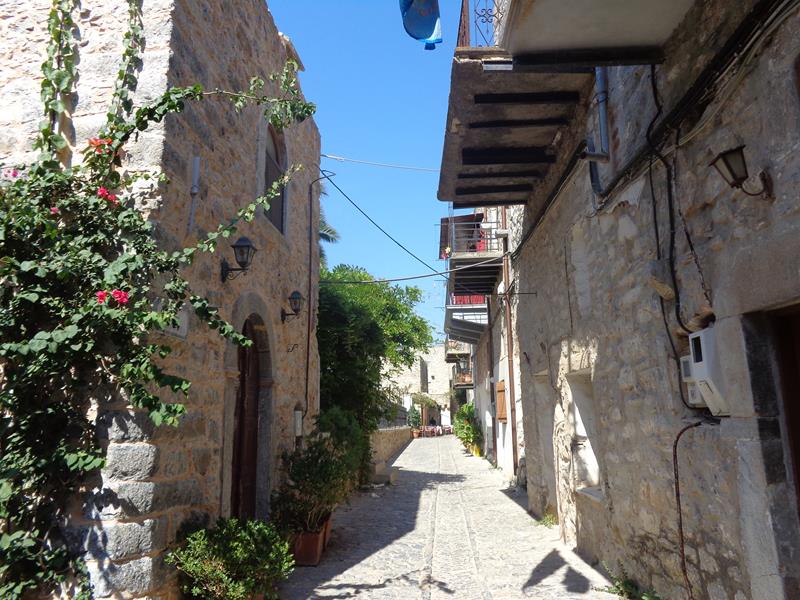
 Looking up a narrow street. Shops selling various craft items, including religious icons.
 Wooden craft items for sale outside a shop, including chess boards and trays with inlaid decoration.
 View through an entrance gate into the courtyard outside the Church of Panayia (Church of the Virgin Mary). This church was founded in 1170, but the present building dates back to the early 19th century. It is a popular destination with pilgrims, especially during the Festival of Panayia (Virgin Mary) on August 15th. They come to pay tribute an old icon of the Virgin Mary, which is said to work miracles.
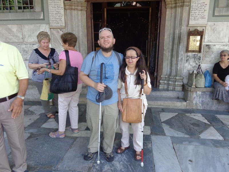 Tony and Tatiana outside the main doorway into the Church of Panayia.
 View of the church’s entrance portico.
 Tatiana relaxing in a shaded seat, outside a café. Near the Church of Panayia.
 Street stalls selling items including fruit, clothes and gifts.
 At the intersection of two narrow streets. Small religious icons for sale on a wall to one side.
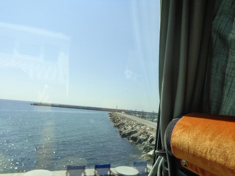 View from the bus window passing the harbour at Plomari: a town on the south coast of Lesbos. The substantial harbour walls extending out to sea.
 Tatiana sitting at a pleasant beach side café at Plomari.
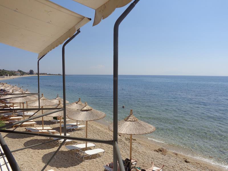 View along the narrow sandy beach. Line of sun umbrellas and loungers.
Evening back in Mytilene.
Monday, 13th September 2014
Bus trip to monasteries and other sites around Lesbos.
 Sappho Square – the town’s main square, located on the north side of the inner harbour. In front, a statue of Sappho. She was a poet born on Lesbos around 620 BC.
 Outside the Monastery of Agios Raphael. Located close to the village of Thermi, on the hill of Karyes, north-east Lesbos. The monastery is dedicated to Saints Raphael, Nicholas and Irene. It is a place of pilgrimage and is associated with miracles. The present monastery dates from the 1960s and was built on the foundations of a Byzantine era monastery that was burned to the ground by the Ottomans in 1463.
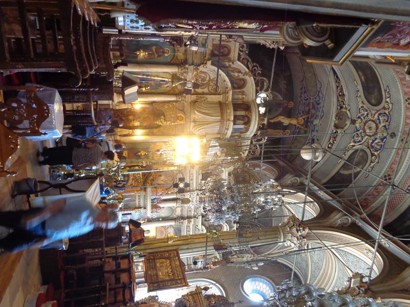
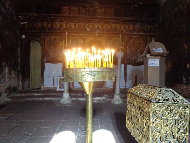
 Inside the monastery church. Religious icons on the walls and metal vessels for burning incense (thuribles) hanging from the ceiling.
 Looking towards the main altar. A large dome above colourfully painted with frescos.
 Tony and Tatiana standing outside a doorway at the Monastery of Agios Raphael.
 Now at the Monastery of Taxiarchis, located in the north-east of the island close to the village of Mandamados. Tony and Tatiana in the monastery’s courtyard.
 Inside Taxiarchis monastery church. The current building dates from 1879. The church houses a revered miraculous icon of Archangel Michael. There are two accounts about the origin of the icon: one linked to the Ottoman Turkish occupation and destruction of the island in 1462 and the other an attack by Saracen pirates during the 9th or 10th centuries.
 A life-sized icon of Archangel Michael in full regalia hanging on a wall inside the church. This is different from the famous icon described above.
 Mithymna (Molyvos). A hillside town that slopes down to the sea on the north coast of Lesbos. In view, a cobbled street heading uphill with traditional stone and wood built houses.
 Tony and Tatiana in Mithymna.
 On a hill, looking north across a bay with Mithymna town at the far side. Mithymna’s large Byzantine castle can just be seen on top of the hill with the town spread out below.
 A narrow street with shops in Petra: a village on the central-north coast.
 Vareltzidena Mansion in Petra. A well-preserved early 18th century two storey house. The ground floor is built with thick stone walls, while the upper storey is made of wood. It has been recently restored and is open as a museum.
 View of Petra village from the Church of Glykfylousa Panagia (Our Lady of the Sweet Kiss), which stands on top of a giant rock in the centre of the town.
 Fresco above a doorway into the Church of Glykfylousa Panagia. The first church was built here in 1609 and the present one dates from 1747.
 Another door into the church, again adorned with a fresco above.
 Tatiana by a stone column outside the church. View of the town and the surrounding hills and fields in the background.
 View of the rock on which the church sits. The church is reached by 114 steps cut into the stone.
 Tony and Tatiana on the steps.
 Inside the small church of Saint Nicolas (Agios Nikolaos) in Petra village. Candles lit on a stand in front.
 Colourful paintings along a wall inside Saint Nicolas church. The church’s earliest frescos date from the 16th century.
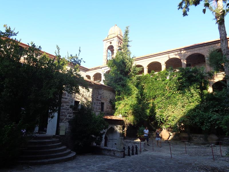 Courtyard of Limonos Monastery, located near the village of Kalloni, near the centre of the island. This is the largest monastery on Lesbos. The monastery was founded in 1526 by Saint Ignatios Agallianos.
Tuesday, 14th September 2014
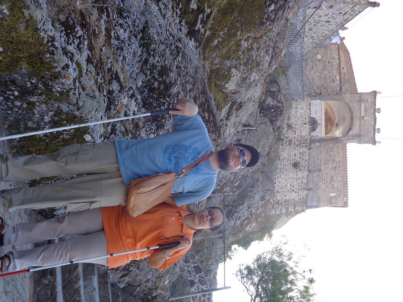
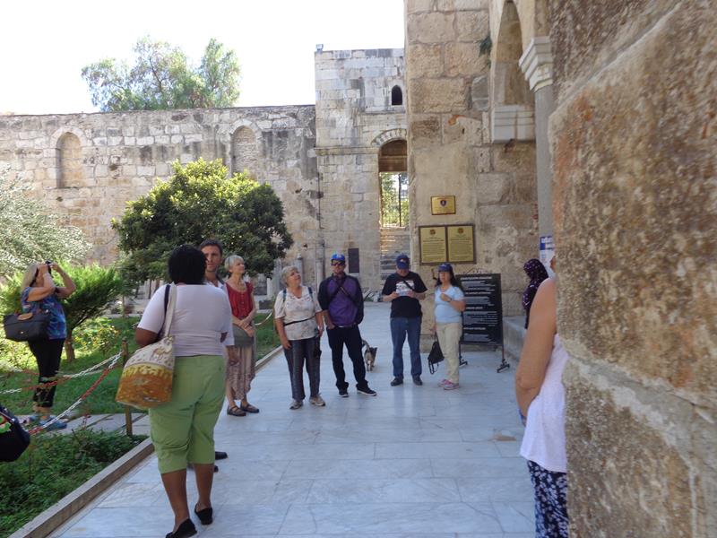
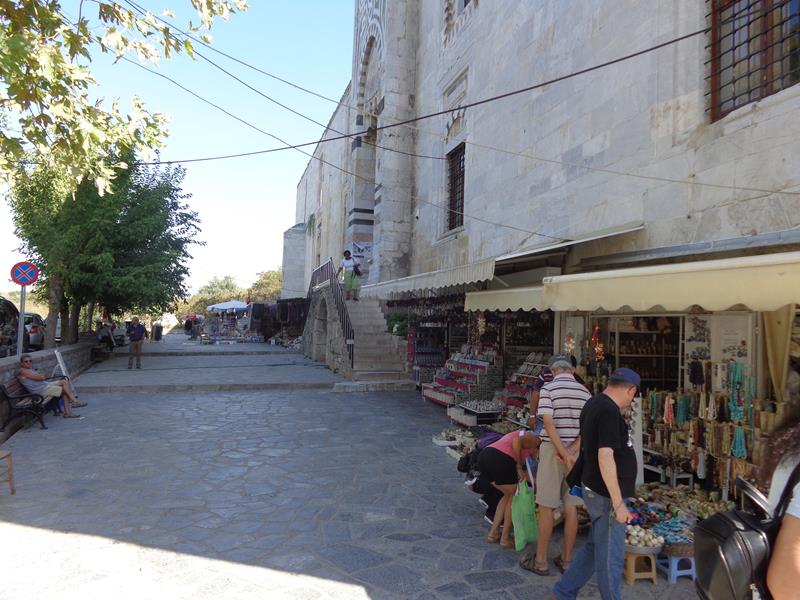
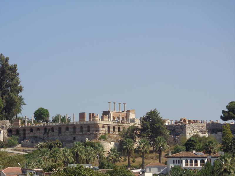
 Outside Mytilene Castle. This very large castle covers an area of 60 acres. The first castle on this site is believed to have been erected during the time of Justinian I in the 6th-century AD, although this is believed to be on the ruins of an even more ancient fortification.
 Another view of the fortified stone walls around Mytilene Castle.
 Palm trees by the harbour in Mytilene.
Chios Island, North Aegean, Greece
Greece’s 5th largest island is located in the Aegean Sea, 7 kilometres (4.3 miles) off the Anatolian coast. It is separated from Turkey by the Chios Strait. Chios is known for the export of mastic gum and its nickname is the mastic island.
Wednesday, 15th September 2014
Mesta Village
The village is 35 km (22 miles) south-west of Chios Town, in the area of Mastihohoria (meaning the “mastic villages”). It is a well preserved medieval village.
 A straight narrow street in Mesta village. Small stone-built houses along the left side. The houses in the village were deliberately built tightly side-by-side creating protective walls around the perimeter to protect against pirate raids.
 Mesta village square. Lined with stone buildings and shaded by trees. People relaxing at café tables.
 A quiet corner of Mesta village square.
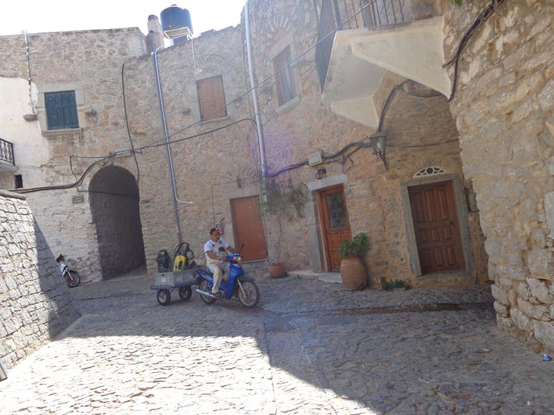 A junction of cobbled streets in Mesta village. A man passing by on a scooter pulling a small trailer.
 Flowers growing against the high stone walls of a house.
 A narrow covered street with stone walls and arched roof. There are lots of these vaulted alley ways in the village.
 A low rectangular stone tower at the end of a street. There are several of these formerly defensive towers around the village.
Çesme (Izmir Province, Aegean Region, Western Turkey)
A coastal town on a promontory, on the tip of a peninsula with the same name, which connects to the wider Karaburun Peninsula. The town’s name means “fountain” and may refer to the numerous Ottoman fountains in the area.
Tuesday, 16th September 2014
 On a ferry heading from the Greek island of Chios to Çesme on the mainland of Turkey.
 View of Çesme town approaching through a ferry window.
 In front of a statue of Cezayirli Gazi Hasan Pasha (1714-1790), his hand on a lion, which stands alongside. He was a Ottoman admiral, who rose through the military ranks, having been bought as a slave by a Turkish merchant when he was a child. He was fleet commander during the Battle of Çesme against the Russians. The lion is said to have been a pet brought back from Africa.
 Tony in front of the Cezayirli Gazi Hasan Pasha statue, touching the lion. In the background, the large stone outer wall of Çesme Castle.
 Tony touching one of three rusty canons. The walls of Çesme Castle again behind. The castle dates from the early 16th century. Its walls dominate the town.
Izmir City (Izmir Province, Aegean Region, Western Turkey)
Izmir is a large city in the extremity of western Anatolia. It is the third most populated city in Turkey. The city stretches along the Gulf of Izmir. Its ancient Greek name was Smyrna. Izmir suffered a disastrous fire in 1905 destroying most of its historical sites.
Wednesday, 17th September 2014
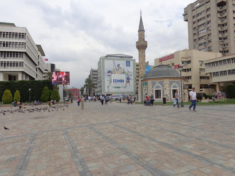
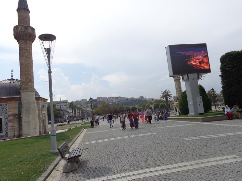 Konak Square (Konak Meydani). This large busy square is at the southern end of Atatürk Avenue in the Konak district of Izmir. The square is named after the Vali Konagi (Governor’s Mansion) of Izmir Province, which is located here (“konak” means mansion in Turkish).
 Konak Square busy with people. On the left, the minaret of Yali Mosque. This mosque was constructed in 1755 under the patronage of Ayse Hanim, the wife of Katipzade Mehmet Pasa, who governed Izmir at the time.
 Tatiana in Konak Square. Behind her, Yali Mosque can again be seen. The building is octagonal in shape with a domed roof. The outer walls are decorated with tiles.
 Looking across Konak Square to Izmir Clock Tower, one of the city’s main landmarks. The Clock Tower was built in 1901 to commemorate the 25th anniversary of Abdülhamid II’s accession to the throne. It is 25 metres (82 feet) in height and features four fountains (sadirvan), which are placed around the base.
 People sitting on benches in Konak Square with Yali Mosque again in the background.
 Tony and Tatiana by a fountain in Konak Square.
 View towards the Governor’s Mansion at the side of Konak Square.
 Looking north from Konak Square along pedestrianised Cumhuriyet Bulvari (Republic Boulevard).
 The main doorway into Yali Mosque with the base of the minaret to the left side.
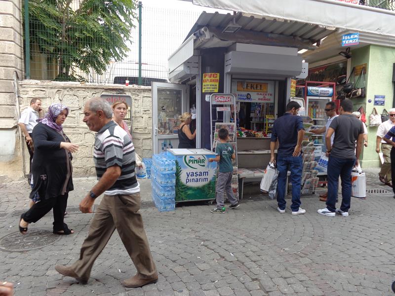 A street in the shopping market area. People at a typical kiosk selling newspapers, drinks and confectionery.
 Crowded street lined with shops. A large jewellery shop on the right side.
 View across Izmir Bay from a viewing platform. The platform is at the top of an historic elevator in Izmir’s Karatas quarter. The elevator was built in 1907 by Nesim Levi Bayraklioglu, a local Jewish banker and trader, to facilitate access up a steep cliff separating Karatas’s narrow coastal strip from the land above.
 Tatiana on the viewing platform.
 Looking down at apartment buildings along the sea front and the sea beyond.
 The viewing platform, including the entrance at the top of the brick-built lift shaft.
 The lower entrance to the elevator.
 A leafy street leading up to the elevator’s lower entrance.
 Tatiana sitting on a wall with water cascading into a pool behind.
 View into Konak Square. A horse and cart carrying tourists passing by.
 Tatiana sitting in a restaurant.
Thursday, 18th September 2014
 View across the bay from Izmir’s sea front promenade.
 At a café table by the sea front promenade. Boats moored in front.
 Cumhuriyet Meydani (Republic Square). This is one of Izmir’s main squares located on the sea front between the neighbourhoods of Alsancak and Çankaya in the Konak district.
 In the middle distance, centrally located in Cumhuriyet Meydani, a large statue of Atatürk on horseback.
Friday, 19th September 2014
Day trip to three ancient Greek settlements: Priene, Miletus and Didyma
Priene
Built by Theban colonists in circa 1000 BC, Priene was an ancient Greek city, located in the former region of Ionia. Today it is in Izmir Province. The site was formerly on the coast, built on steep slopes and terraces extending from sea level up to a height of 380 metres (1,250 feet) above sea level at the top of the escarpment.
 Steps heading uphill near the East Gate at Priene.
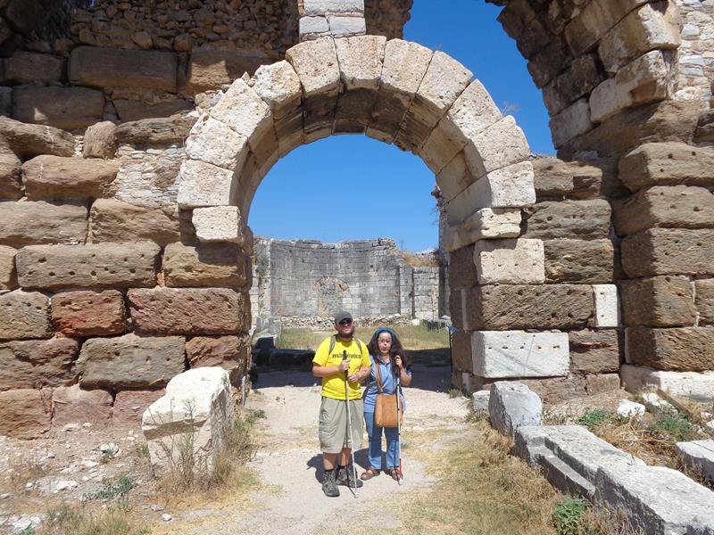
 Tony and Tatiana by the town walls. These fortified walls, built out of large stone blocks, surround the site. They are two metres thick, with towers at intervals, and with three principal gates.
 Stone columns outside a ruined building within Priene’s theatre.
 Rows of stone seating at the theatre. The seats form a horseshoe shape cut into the hillside. The theatre was first built around 340 BC.
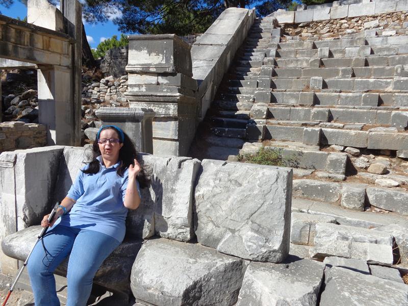 Tatiana sitting on a stone seat at the theatre.
 Tony and Tatiana within the theatre.
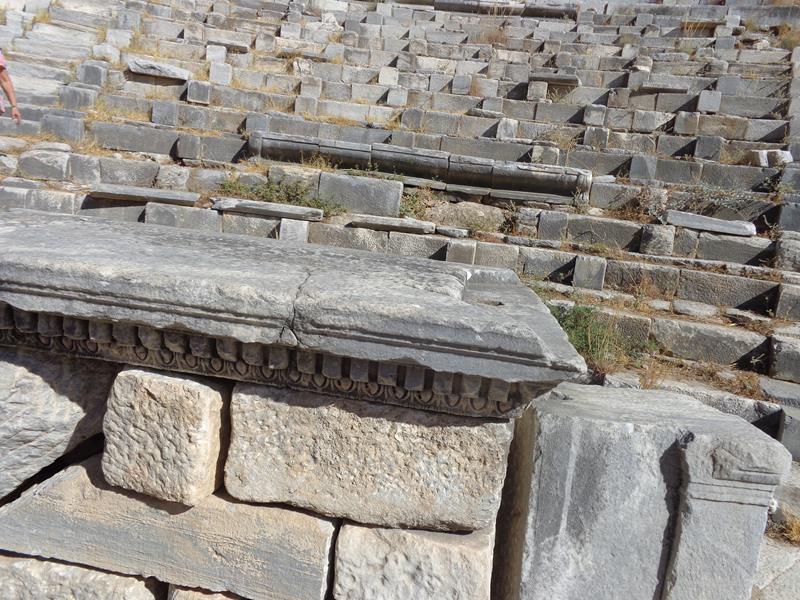 Another view of the theatre. Rows of well preserved stone seats. There were originally 22 tiers of seats in the lower storey and 25 in the upper accommodating perhaps 5,000 spectators.
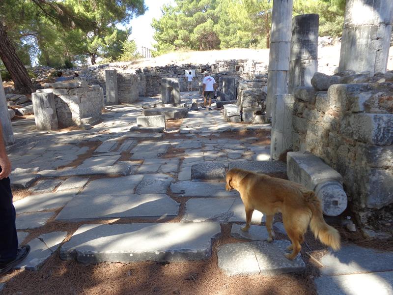 Remains of a Byzantine church. A stray dog wondering in front.
 Tatiana touching a piece of carved stonework inside the church. The stone has an alcove at the bottom with embossed decoration above.
 Tony and Tatiana leaning on a large segment of stone column. Other column segments strewn behind.
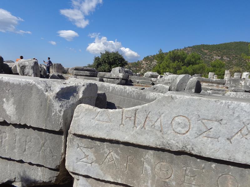 Big stone blocks with Greek lettering carved on the front.
 The Temple of Athena. Five stone columns standing in the background. These columns were erected in 1965–66 from rubble and are 3 metres (9.8 feet) short of the calculated original column height. The temple was the largest edifice and most significant structure at Priene. It was built between the 4th and 2nd centuries BC and was funded by Alexander the Great.
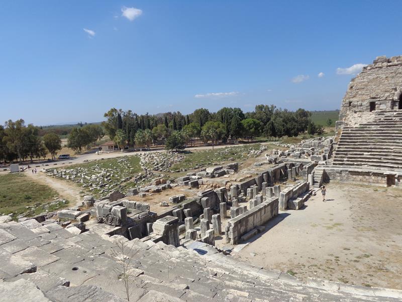
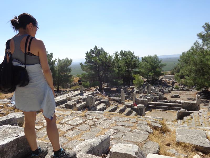 View of terraces filled with stone remains of buildings.
Miletus
An ancient Greek settlement located on the west coast of Anatolia, near the mouth of the Maeander River. Built by Minoans, later Mycenaeans. Before the Persian invasion in the middle of the 6th century BC, Miletus was considered the greatest and wealthiest of Greek cities.
 Ruins of the Faustina Baths. This was the frigidarium (cold room). An empty pool in front with a stone lion sitting at the far side. This extensive bath complex was built between 161 to 180 AD under the patronage of Faustina, the wife of the Roman Emperor Marcus Aurelius.
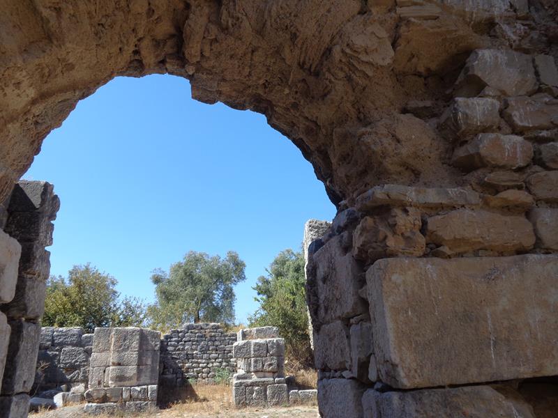 Looking through a stone archway into the remains of a room. Faustina Baths.
 Tony and Tatiana standing in front of another entrance archway passing through thick stone walls. Part of the Faustina Baths.
 View of the surrounding landscape – parched fields and rolling
hills. Other archaeological remains just visible in the middle distance.
Higher hills and mountains in the far distance.
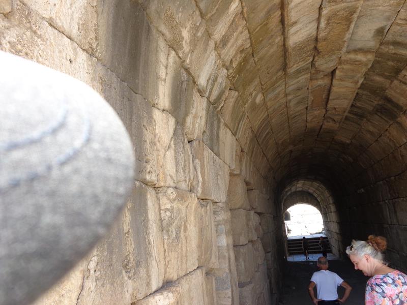 A long passageway into the theatre.
 Tony and Tatiana sitting on stone seats within the theatre. The theatre was first built in the 4th century BC by the Greeks. Later re-constructed by the Romans. It once had capacity for 15,000 spectators.
 View down the rows of stone seats into the horseshoe-shaped theatre.
Didyma
Didyma was an ancient Greek Sanctuary near Didim (Aydin province, Ionian Region). Didyma means twin in Greek. It contained the temple and oracle of Apollo, the Didymaion. Next to Delphi, in mainland Greece, Didyma was the most renowned oracle of the Hellenic world, first mentioned among the Greeks in the Homeric Hymn to Apollo.
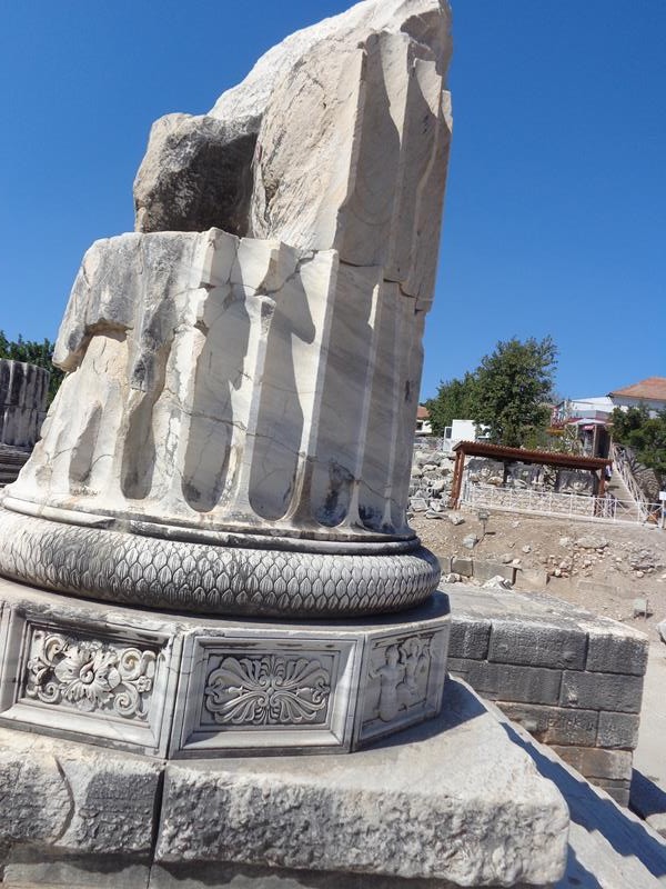
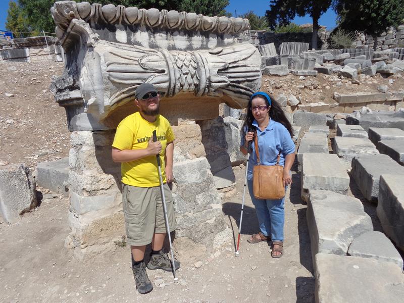 Tony and Tatiana by a decoratively carved stone block, possibly at column base, at Didyma.
 A column base covered with carved decoration, which includes a merman and mermaid – male and female figures with human upper bodies and the tails of fish.
 Another view of the same column showing a series of decorative panels around the base.
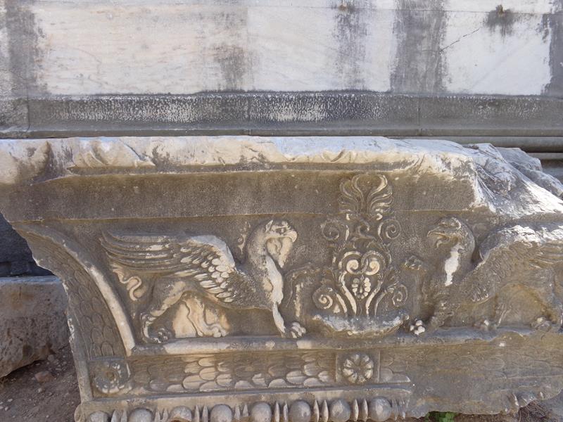 A carved stone block with two griffins depicted on the side.
 Looking down steps into the large inner chamber (cella) of the Temple to Apollo. The remains of the sacred spring towards the far end.
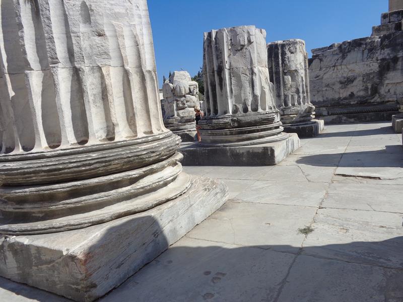 The bases of massive stone columns at the Temple to Apollo.
Selçuk and Ephesus
Monday, 20th September 2014
 Tony and Tatiana outside the House of the Virgin Mary, near Ephesus. This Catholic shrine is believed by some to be the location where Mary was taken by Saint John and lived until her Assumption. It was discovered by a German nun named Anne Catherine Emmerich in the early 19th century. A chapel now stands on the site, incorporating the original house.
 Visitors adding messages to a prayer wall near the House of the Virgin Mary. Thousands of messages are already attached on small pieces of paper or fabric.
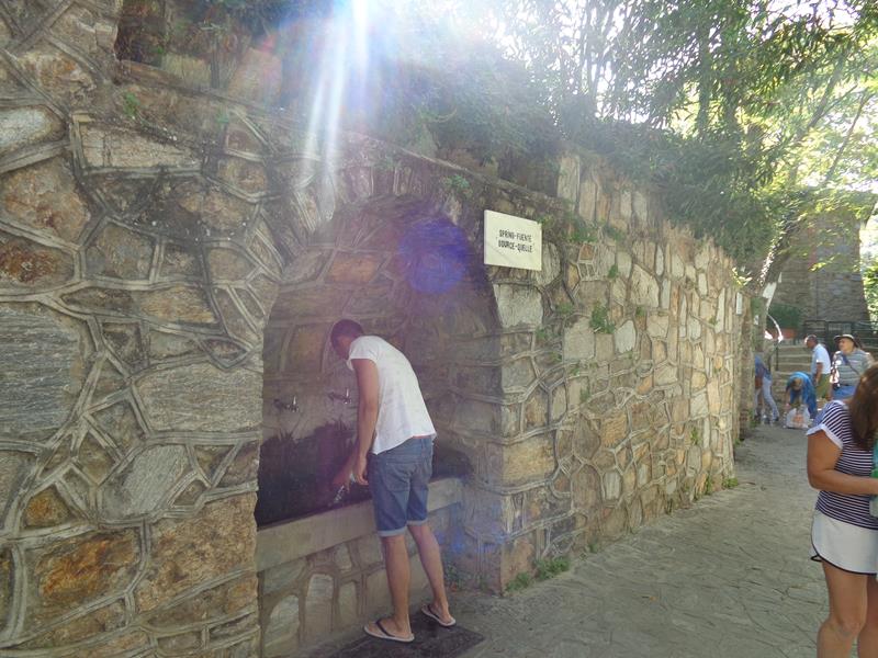 A drinking fountain in a wall alcove near the House of the Virgin Mary. The water comes from an underground spring and is said to be holy.
 A golden statue of the Virgin Mary on the road near the house.
 Courtyard outside the Isa Bey Mosque. Located on the edge of Selçuk near the Basilica of Saint John and the remains of Artemis Temple.
 View of the mosque’s external stone walls. The mosque was constructed in 1374–75 by master architect Ali son of Mushaimish Dimiskliogl. It is regarded as one of the earliest and best examples of Seljukian architecture. In the 19th century it was in ruins, but it has since been restored and has reopened for prayer.
 Inside the Isa Bey Mosque. Looking towards the mihrab, an alcove in the wall, indicating the direction of Mecca that Muslims face when praying.
 Tony and Tatiana inside the mosque. The mosque’s dome partially visible above.
 Stalls selling souvenirs in the street directly in front of the Isa Bey Mosque.
 Ruins of a hammam (bathhouse) south of the Isa Bey Mosque. Two stone domes, one partly collapsed, in view.
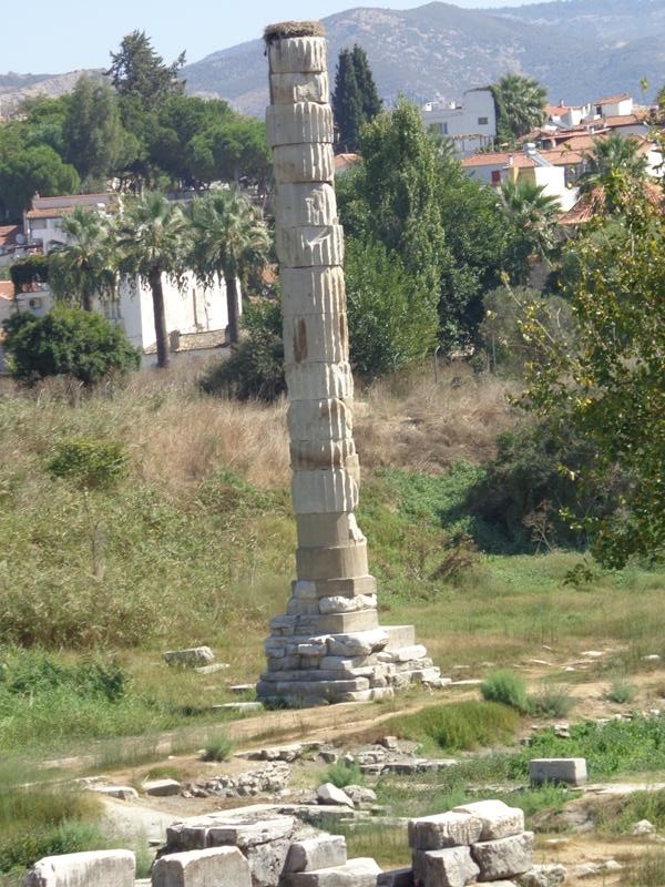 A single column marking the site of the Temple of Artemis. This column was re-erected from fragments found on the site. The ancient city of Ephesus was once famed for the Temple of Artemis, which was considered one of the Seven Wonders of the Ancient World. The temple, dedicated to the goddess of fertility and birth, was completed circa 520 BC and destroyed many times over the centuries with its final destruction occurring in 401 AD. Several columns were then re-used in the construction of the Hagia Sophia church, located 450 miles north in Constantinople (Istanbul).
 Ruins of the Basilica of St John in the near distance. Stone walls and the remains of columns can be seen. The basilica was constructed by Justinian I in the 6th century AD. It stands over the believed burial site of John the Apostle.
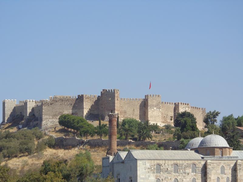 Further in the distance, the high stone walls of the Grand Fortress (Ayasuluk Fortress), standing on top of Ayasuluk Hill, on the north-west edge of Selçuk town.
Ephesus
The remains of the ancient Greek city of Ephesus stand 3 kilometres (1.8 miles) from the modern town of Selçuk. The city was once a port on the Aegean Sea, but is today 8 kilometres (5 miles) inland. It was founded in the 10th century BC by Attic and Ionian Greek colonists. During the Classical Greek era it was one of the twelve cities of the Ionian League. The city came under the control of the Roman Republic in 129 BC. In the Roman period, Ephesus had an estimated population of 33,600 to 56,000. Today over one million people visit the well preserved ruins each year.
These photos were taken by American tourist, not Tony.
 The Odeon at Ephesus. A semi-circular theatre built into the hillside. Constructed in the 2nd century AD.
 A row of three stone columns on Curetes Street close to the upper entrance.
 Close-up of the top of one of the Ionic style columns.
 A pair of carvings depicting male figures on the side of tall stone blocks.
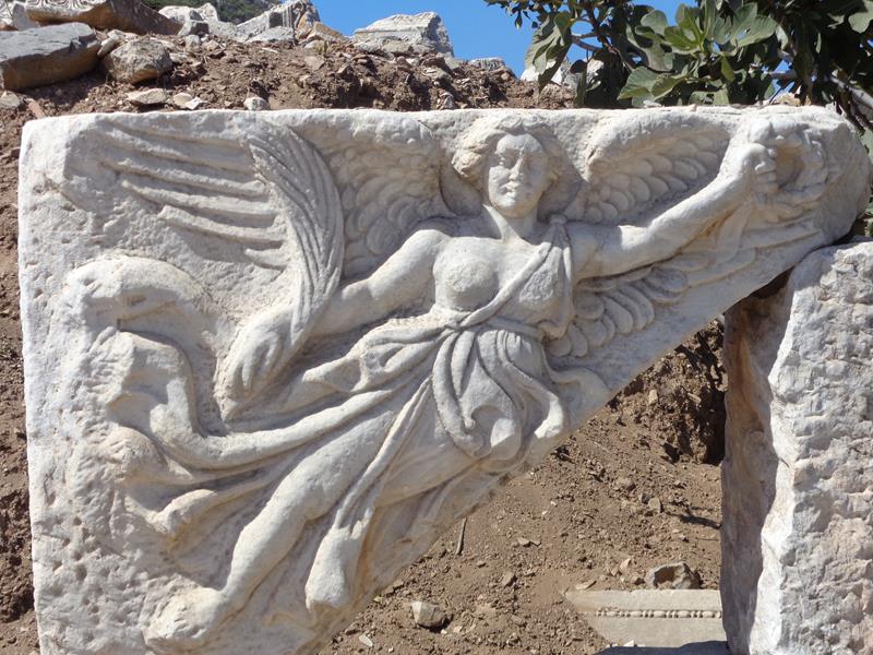 Carving of the winged Roman goddess Nike on a stone block.
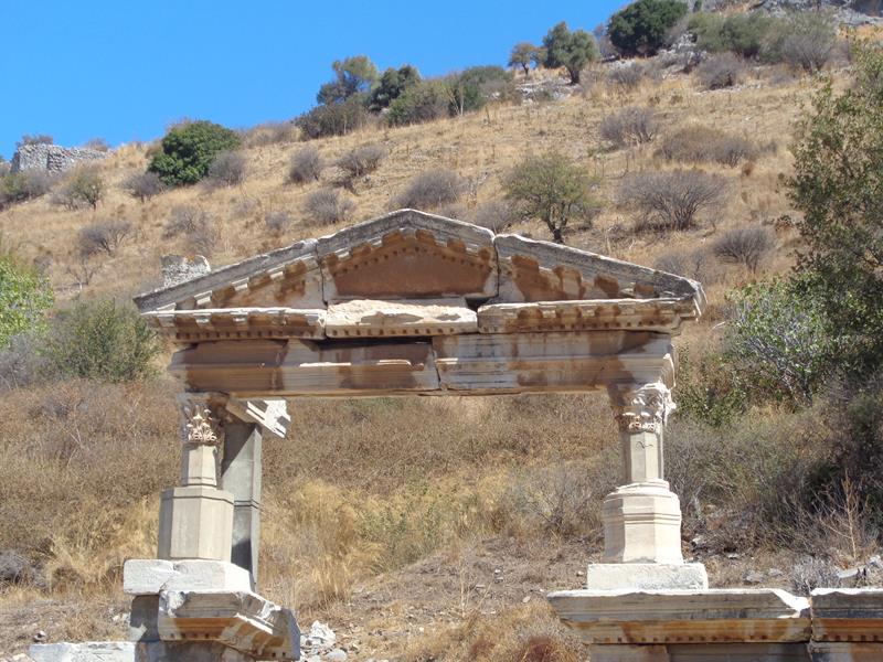
 The Temple of Domitian. A reconstructed pair of columns with connecting lintels and walls behind. Built in the 1st century AD dedicated to a Roman Emperor Domitian.
 Curetes Street heading downhill. This marble paved street is very slippery and well worn.
 Part of Trajan’s Fountain. This structure was constructed in honour of Emperor Trajan in 104 AD.
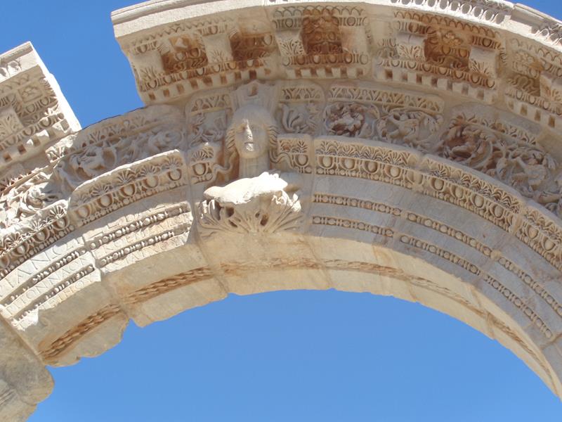 Decoration on an arched entrance to Hadrian’s Temple. A female head in the centre.
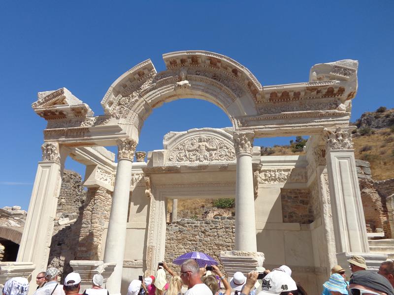 View of the well preserved remains of Hadrian’s Temple. Dedicated to Emperor Hadrian and built before 138 AD.
 The front façade of the Celsus Library. One of Ephesus’s most impressive sites. This two storey library was built in around 117 AD.
 Tony and Tatiana at the Celsus Library.
 Tatiana and Tony in front of ruins close to the Celsus Library.
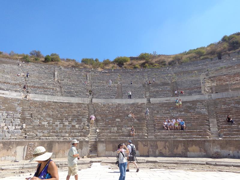 Inside the Theatre. Ephesus’s impressive theatre once had 25,000 seats.
Sirince
Tuesday, 21st September 2014
A traditional mountain village located about 8 kilometres (5 miles) east of Selçuk town, Izmir Province, west Turkey.
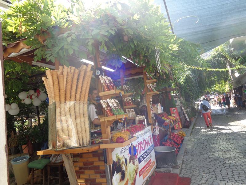 A cobbled street lined with stalls selling local products in Sirince village.
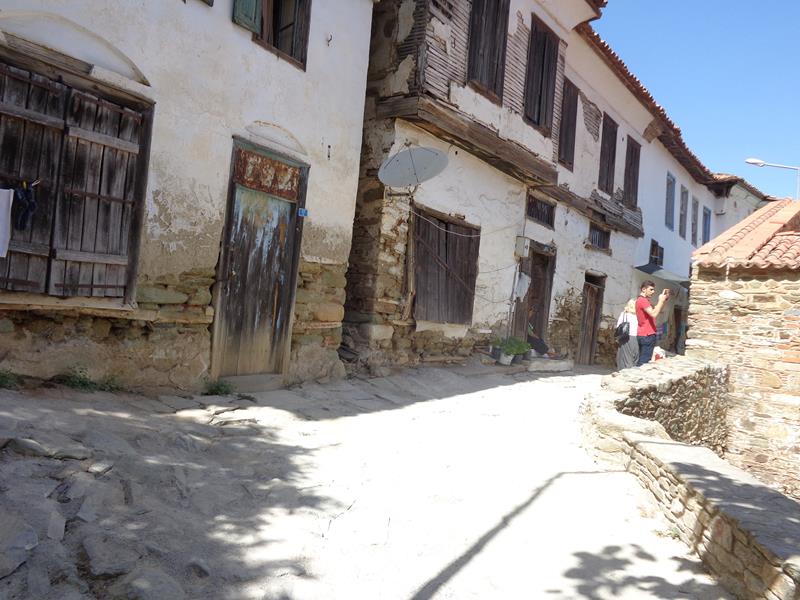 A narrow street with a row of traditional houses. Sirince was settled when Ephesus was abandoned in the 15th Century, however, much of what is seen today dates from the 19th century.
 Heading down a winding narrow street in Sirince village. Paintings for sale of the walls.
 Inside St John the Baptist Church. This Greek Orthodox church is no longer in use.
 People emerging from the entrance doorway of St John the Baptist Church. The church has recently been restored according to a sign outside.
 Courtyard outside St John the Baptist Church. A circular water feature standing in the centre.
Samos Island, North Aegean Region, Greece
Located in the East Aegean Sea, south of Chios, north of Patmos and the Dodecanese, and off the coast of Turkey, from which it is separated by the 1.6 kilometre (1 mile) wide Mycale Strait.
Wednesday, 22nd September 2014
 View of the harbour in Samos Town. A line of restaurants down the side.
 A quiet part of Samos harbour with small fishing boats in the water.