
Algiers City
Algiers is the capital and largest city of Algeria. It is a hilly city located roughly at the centre of Algeria’s Mediterranean coastline.
14th December 2018
 Tony at Place des Martyrs, a large square in the centre of Algiers’s historical area. A Metro station entrance is in the background.
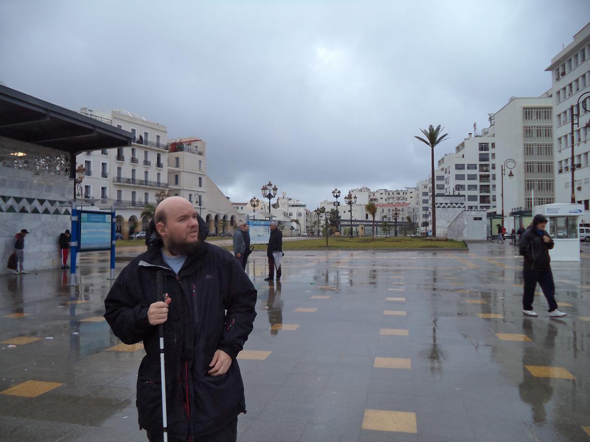 View across Place des Martyrs. Ottoman archaeological ruins can vaguely be seen in the background.
 Entrance to Ketchaoua Mosque, which was built during Ottoman rule in the 17th century. In the 19th Century, it was converted into a cathedral under French rule, but it became a mosque again in 1962. It is located at the foot of the Casbah close to Place des Martyrs.
 Tony half way up the 17 steps leading to the main entrance of Ketchaoua Mosque. Above the stone front façade with a pair of octagonal minarets flank either side of the entrance.
 Tony at Promenade des Sablettes. In the distance a lighthouse and Fort Penon can be seen. The lighthouse, which occupies the site of Fort Penon, was built in 1544.
 Tony at Notre Dame d’Afrique. This Roman Catholic basilica was built in 1872. It is a prime example of the neo-Byzantine architectural style.
 Excellent view towards the Bay of Algiers from Notre Dame d’Afrique’s hilltop location. The basilica is on a cliff 124 metres (407 ft) above sea level.
 Another view of Notre Dame d’Afrique, including the central dome.
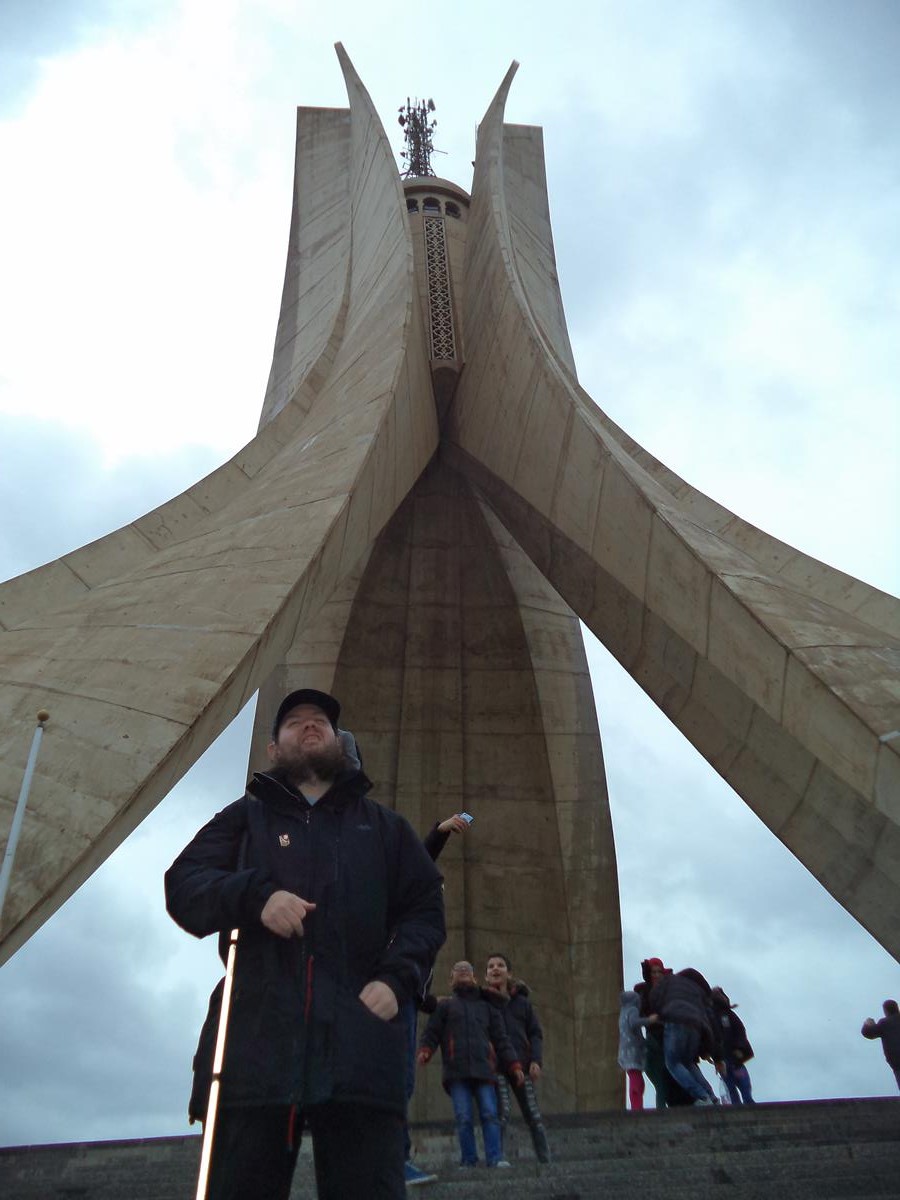
 Tony on steps in front of the Maqam Echahid (Martyrs Memorial). This iconic concrete monument commemorates the Algerian war for independence (1954-1962). The monument was opened in 1982 on the 20th anniversary of Algeria’s independence. It is fashioned in the shape of three standing palm leaves, which shelter the “Eternal Flame” beneath. At the edge of each palm leaf stands a statue of a soldier, each representing a stage of Algeria’s struggle. It stands at 92 metres (302 ft) in height.
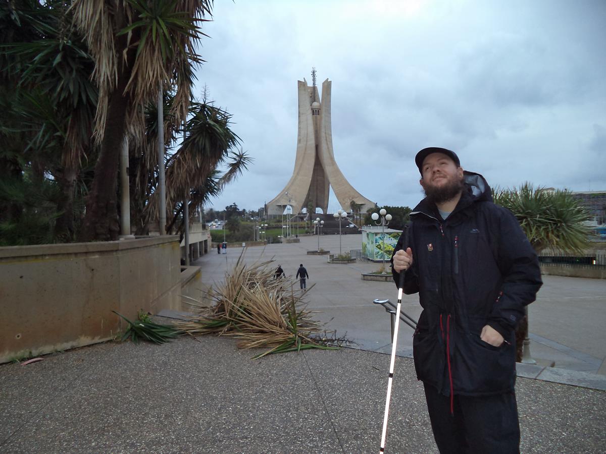
 Again Tony with the Martyrs Memorial above.
 Tony in front of an old Russian fighter jet at the Algeria Army Museum (Musem de l’Armee).
 Tony with various weaponry in the background outside the Algeria Army Museum.
 Another view of the Martyrs Memorial from the Algeria Army Museum.
15th December 2018
 Straight tree-lined avenue with a path running down the middle at El-Hamma Jardin d’Essai botanical garden in Algiers. A circular formal pond a short way along.
 Tony at the end of the tree-lined avenue. The botanical gardens were established in 1832 and cover 58 hectares (140 acres). There are currently an estimated 1,200 different species of plants in the garden. The gardens are located in the Mohamed Belouizdad (formerly Hamma-Anassers) district of Algiers.
 Tony standing under a tree with a dense mass of branches projecting out above.
 Tony touching what appears to be the massive roots of an enormous tree. This could be a Banyan tree, which are characterized by aerial prop roots that mature into thick, woody trunks.
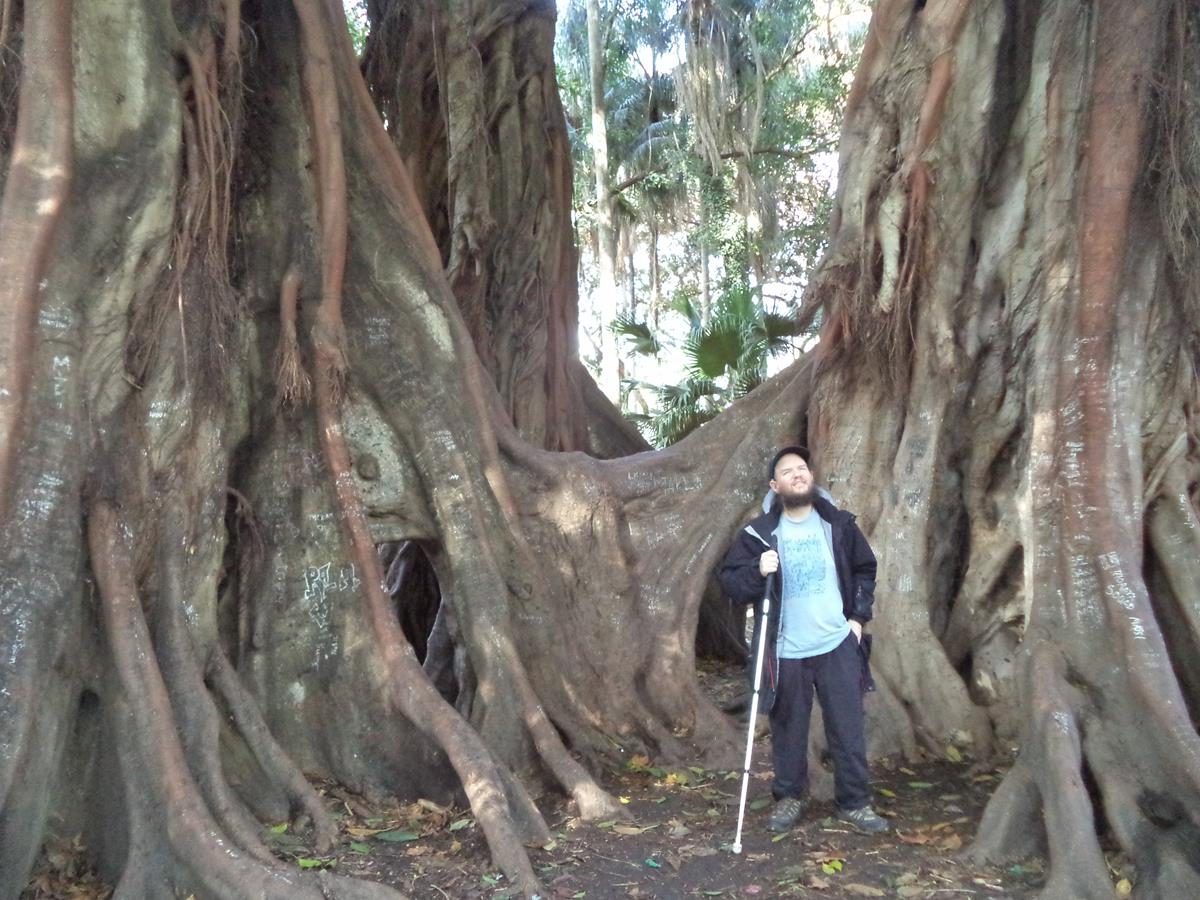 Tony at the foot of the enormous tree with its interestingly shaped aerial roots.
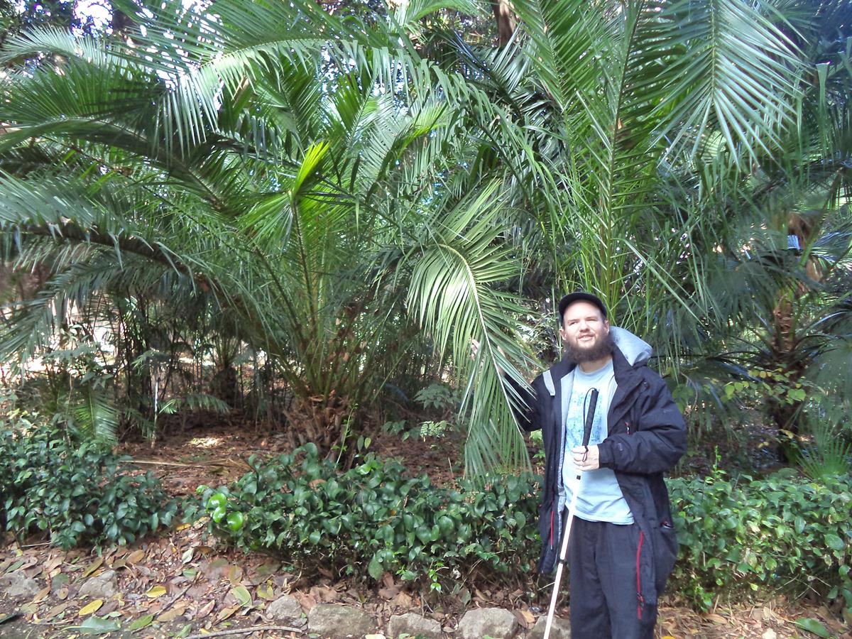 Tony holding the leaves of a palm tree.
 Again Tony touching palm leaves with a view along a path lined with trees and more palms in front.
 Tony by a statue of a female Burba dancer, sculpted by a French artist. Located in the garden.
Ancient Roman Tipasa
Tipasa was an Ancient Roman military colony in the province of Mauretania Caesariensis, nowadays called Tipaza, and located in coastal central Algeria. Before being conquered by Rome it was a small ancient Punic trading post. The Roman city was built on three small hills which overlook the sea.
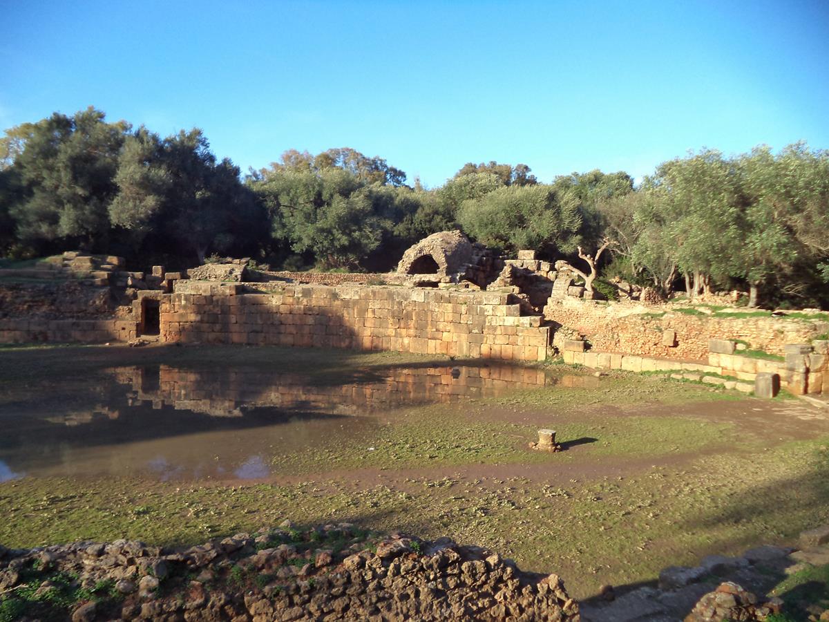 A ruined amphitheatre. Surviving stone walls and tunnels in view at the far side.
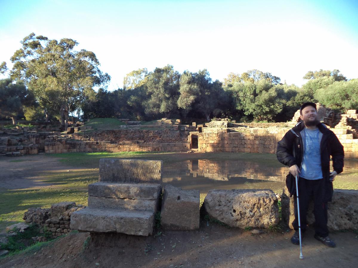 Tony at the edge of the amphitheatre. The centre of the amphitheatre is partly flooded with water.
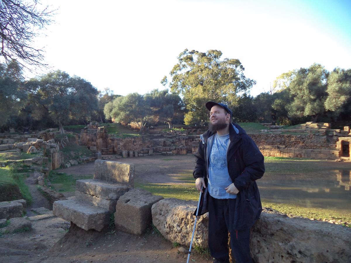 A view of the opposite side of the amphitheatre. Tony in the foreground.
 Ancient road/walkway that slowly descends to the Mediterranean Sea through the ruins.
 View from near the ancient road showing ruins extending around a bay.
 Tony on the ancient road with the sea crashing against rocks below.
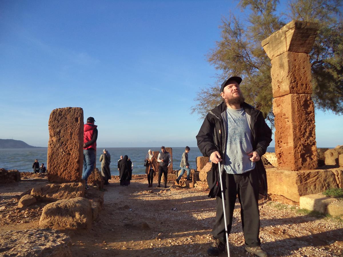
 Various stone pillars and columns at Roman Tipasa.
 Tony sitting on brown coloured rocks next to the sea.
 Tony standing under a shelter cut into the dense vegetation of a large bush.
 Remains of ruined buildings at Roman Tipasa. The site includes three ruined basilicas as well as bathhouses.
Annaba
Annaba is a medium-size city on the Mediterranean coast in north-east Algeria.
16th December 2018
 Tony in front of the National Theatre of Annaba (also known as Azzeddine Medjoubi Theatre).
 Again in front of the National Theatre of Annaba. Tony with Amel, an Algerian lady from Annaba and her husband, Sidali, originally from Tipasa. Tony stayed with them in Annaba.
18th December 2018
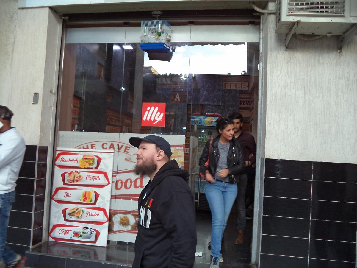 Tony walking past a cafe.
 Old-style French colonial building at Place de la Révolution. The building overhangs the pavement at ground floor level.
 Tony in a street close to Place de la Révolution.
 View of a partly demolished building. Low light with the moon above.
Constantine
Constantine is Algeria’s third largest city and is located in the north east. In Roman times it was called Cirta and then later was renamed “Constantina” in honour of emperor Constantine the Great of the Byzantine Empire.
The city is situated on a plateau at an elevation of 640 metres (2,100 ft). A dramatic deep ravine cuts through the city and is crossed by eight bridges. The city is approximately 80 kilometres (50 miles) from the Mediterranean coast on the banks of the Rhumel River.
19th December 2018
 Tony in a public garden. People sitting on benches around the edge. A hexagonal pond with a small fountain in the centre.
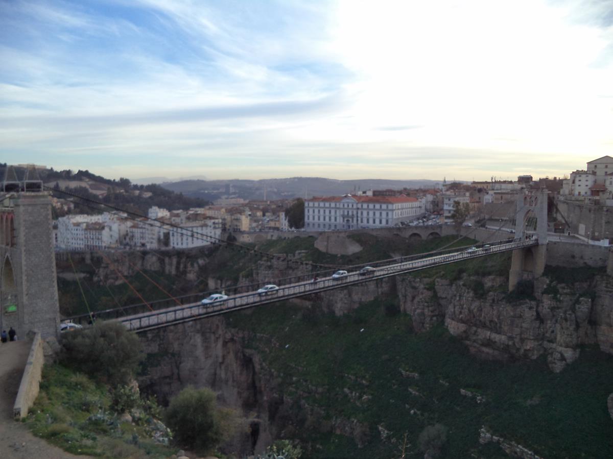
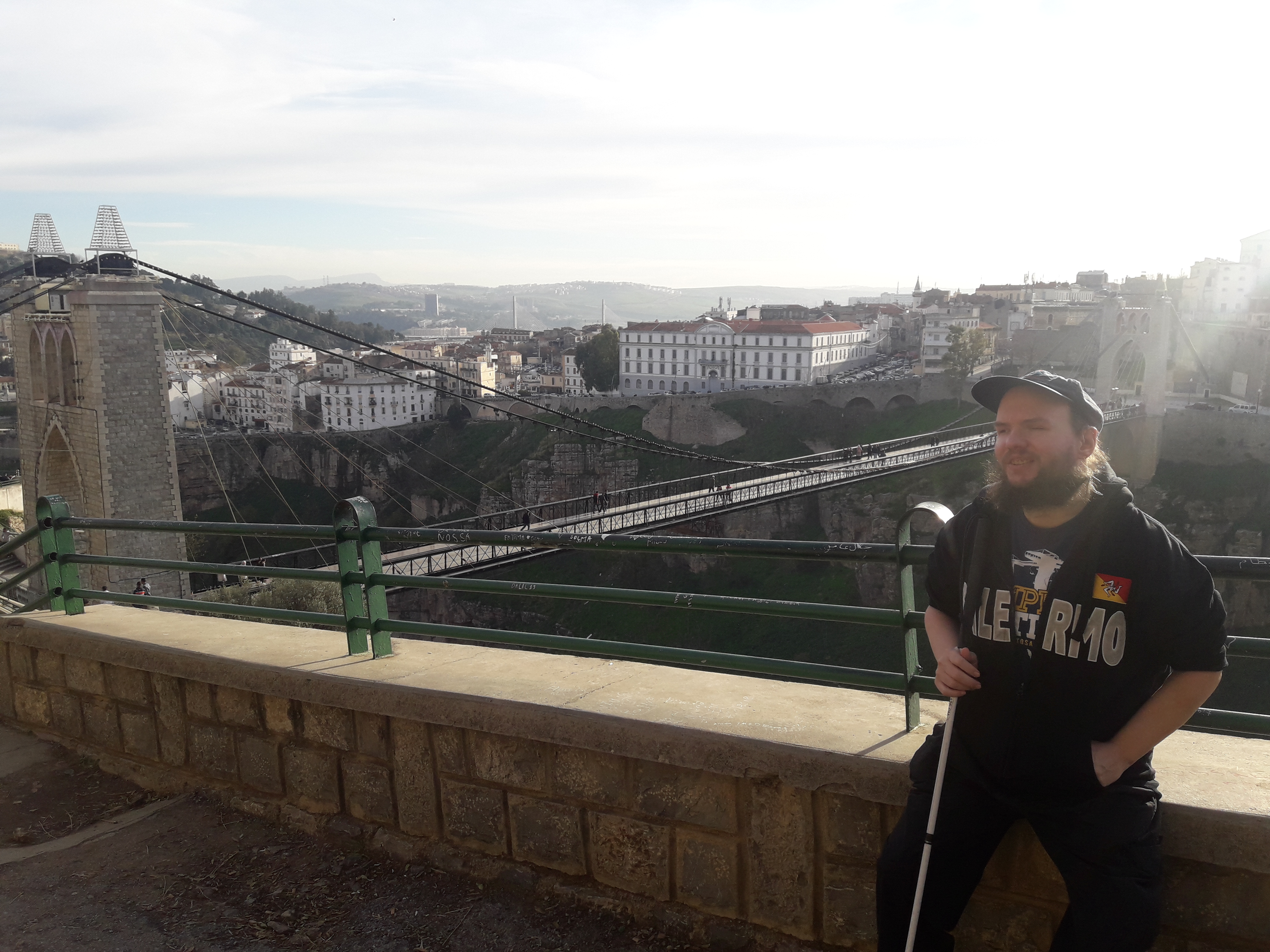
 View through metal bars on a balcony towards the Mellah Slimane Bridge (also known as Perregaux footbridge) which spans the city’s dramatic deep ravine. The bridge was completed in 1925. It is a suspension bridge and is 125 metres in length but only 2.5 metres wide. The bridge wobbles alarmingly! An elevator carries people down to the bridge from the old town for a small fee.
 Tony on the balcony with the Mellah Slimane Bridge and ravine below.
 Another view of Tony on the balcony.
 View of footbridge and gorge from Restaurant Igharssan.
 Tony eating chakhchoukha (a traditional dish) at Restaurant Igharssan.
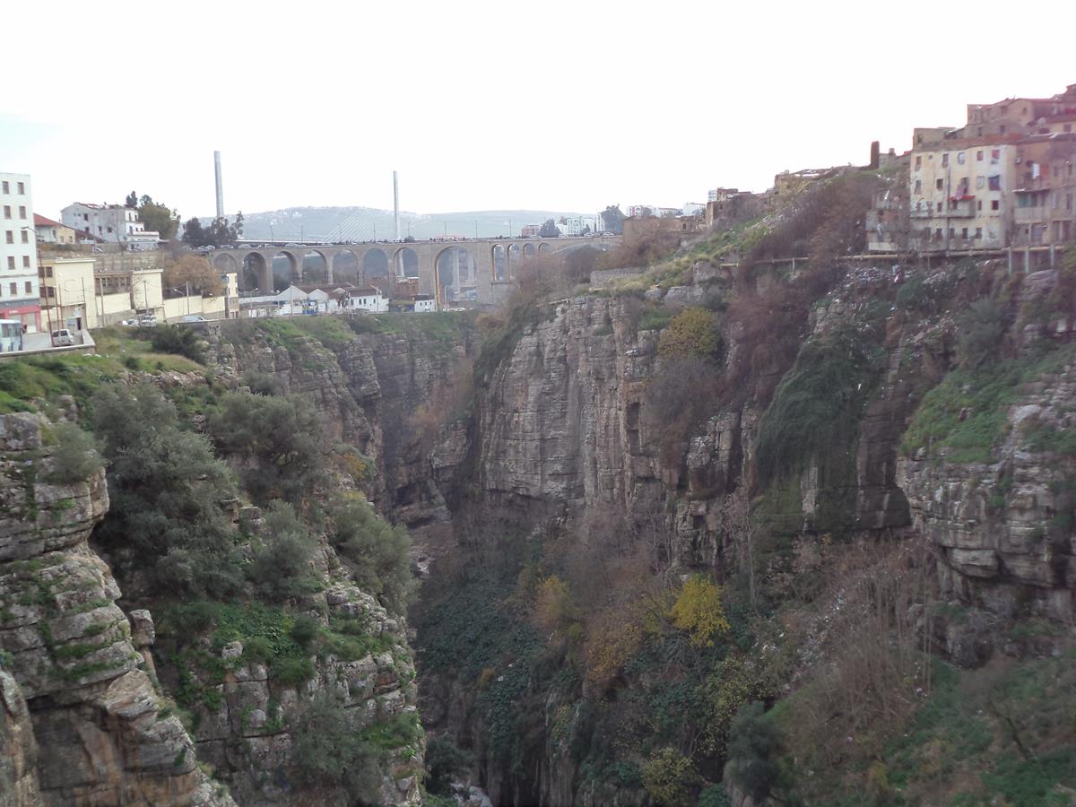 View along the ravine which is over 100 metres in depth. The River Rhumel only just visible at the bottom. In the distance is the Sidi Rached road bridge. This bridge was completed in 1912 with a length of 447 metres over 27 concrete and steel arches. The widest arch has a span of 70 metres. Further along another bridge, the Salah Bey Bridge, is just visible.
 View from the Mellah Slimane Bridge with the large white-painted La Medersa (Madrasa) sitting prominently at the edge of the ravine. This madrasa, or religious school, opened in 1909.
 View of people crossing the Mellah Slimane Bridge with the elevator up to the old town at the end.
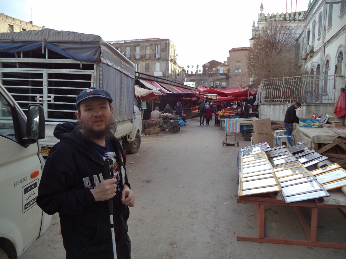
 An outdoor market with stalls piled high with shoes and clothes.
 More market stalls, the one immediately in front selling hand bags.
 Street at the edge of the market. Stalls selling fruit and clothes.
 Local boy smiling for the camera near the market.
 Tony next to a stall selling framed pictures.
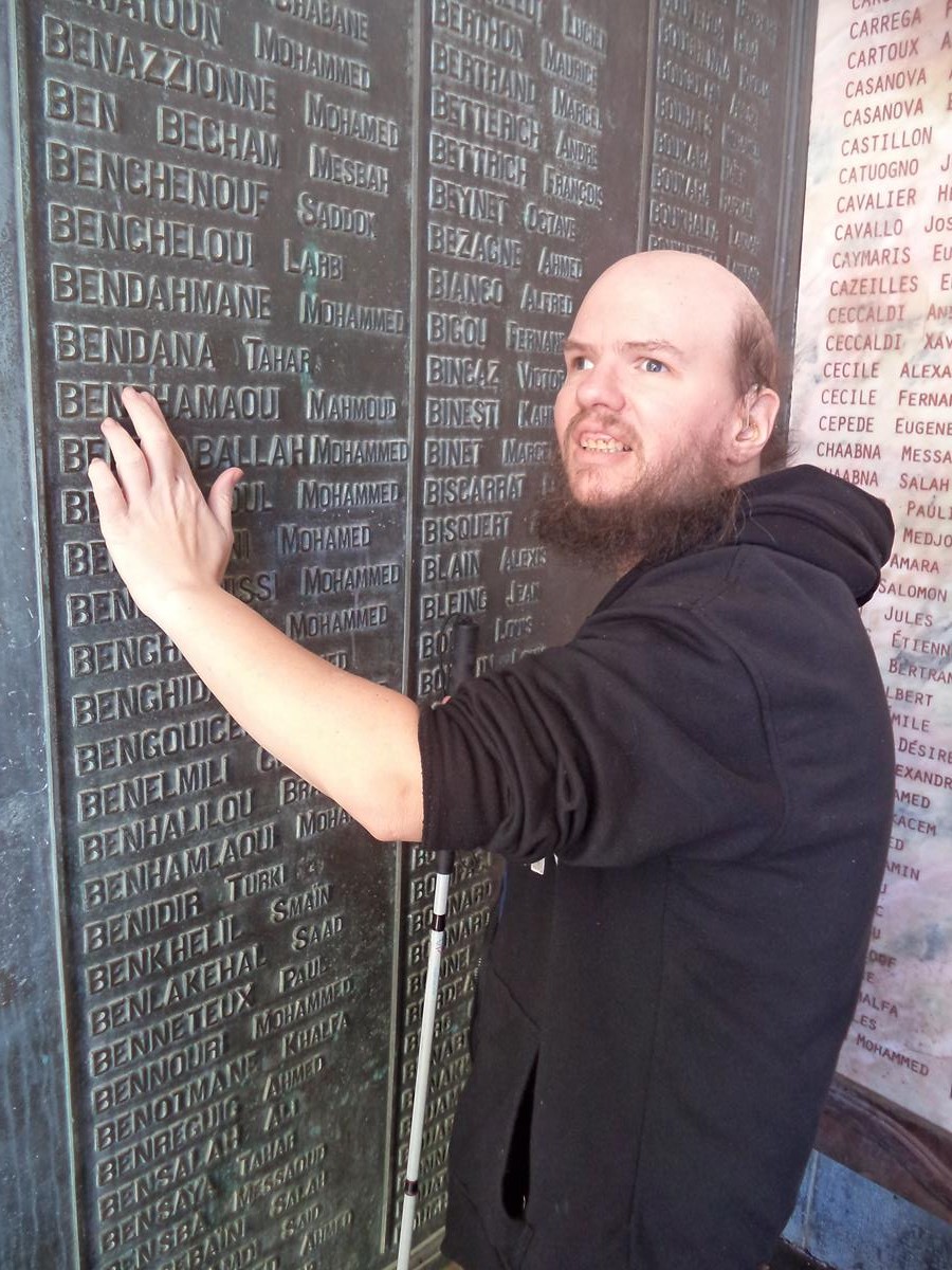 Tony touching a tactile list of names, part of a roll of honour at Monument Aux Morts, a memorial to the victims of World War I.
 Monument Aux Morts, a 21 metre (68 ft) tall triumphal arch topped by a victory statue. The memorial bears the engraved names of some 800 soldiers and citizens: Muslims, Christians, and Jews, who hailed from Constantine.
 Tony in front of Monument Aux Morts.
 Tinhinane and Tony in front of Monument aux Morts arch.
 View from a terrace at Monument Aux Morts. The memorial is on a hill overlooking the city and offers a panoramic view of the surroundings.
 Tony looking from the terrace at Monument Aux Morts. The River Rhumel can clearly be seen below flowing north-west away from the city towards the sea.
 The Sidi M’Cid Bridge, a road suspension bridge with a length of 168 metres, built in 1912.
 Tony sitting with the old city and the Sidi M’Cid Bridge in the background.
 Tony near the edge of the ravine close to the Sidi M’Cid Bridge.
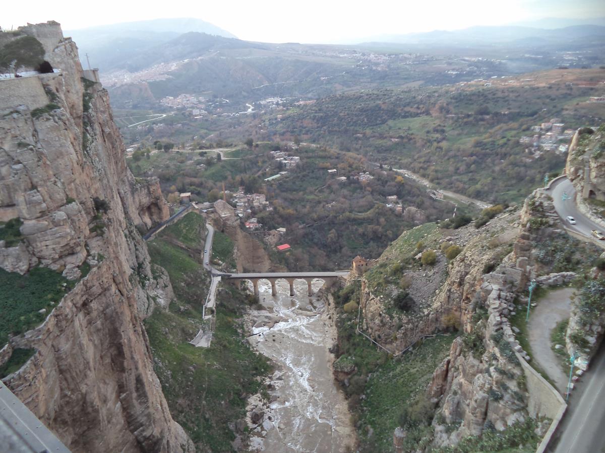 Dramatic view from Sidi M’Cid Bridge looking out of the north end of the ravine towards surrounding hills. Down below a smaller bridge can be seen: this is the Falls bridge (Pont des Chutes), a series of stone arches at the top of a waterfall. The waterfall is at the far side out of view.
 Tony on Sidi M’Cid Bridge.
 Tony and Tinhinane crossing Sidi M’Cid Bridge.
 View from Tony’s room at Hotel de Paris.
20th December 2018
 Inside Bey’s Palace or Ahmed Bey Palace. A tiled room with three manikins in traditional dress sitting on chairs amongst old furniture.
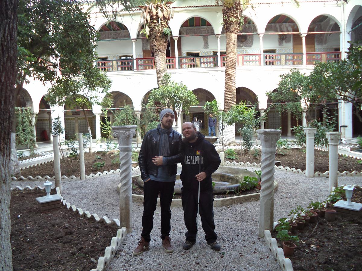
The palace was commissioned during the rule of Ahmed Bey ben Mohamed Chérif and was built between 1825 and 1835. Two years after completion Constantine fell into French colonial occupation, and the palace was turned into their headquarters, until Algerian independence in 1962. The palace consists of three suites of rooms connected by hallways, as well as three courtyards and a garden planted with orange and palm trees.
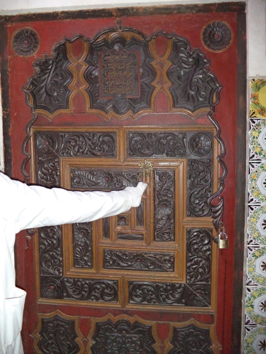 An old decorative door made of cedar wood. The palace has 540 doors made of cedar wood, which are inscribed and engraved with different sculptures and decorations.
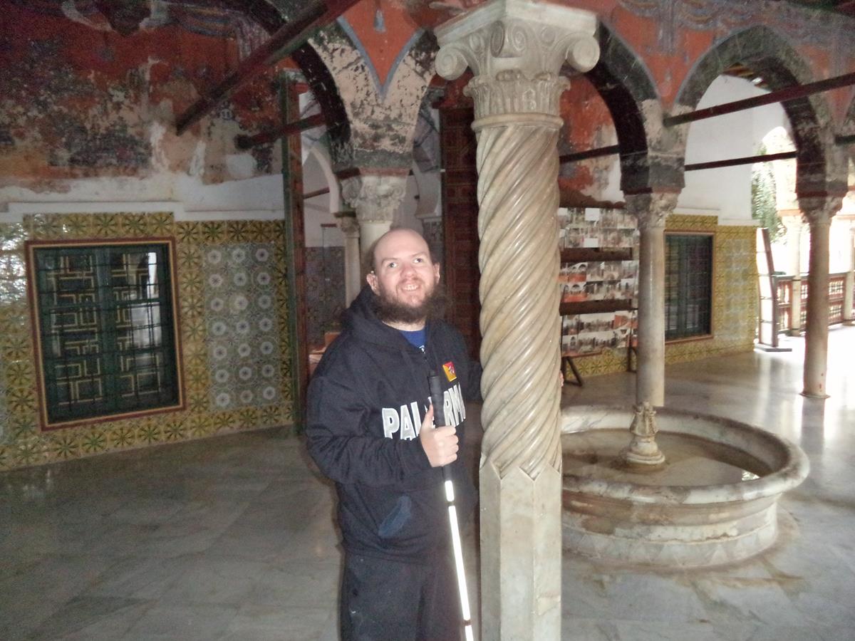 Tony by a thin column of twisted Italian marble in a courtyard. A circular fountain alongside.
 Tony touching the trunk of a mature tree in the palace’s garden.
 A marble fountain in the centre of the garden. Beyond a pair of palm trees and an entrance into the palace.
 Tony with his Algerian friend Ramy in the garden.
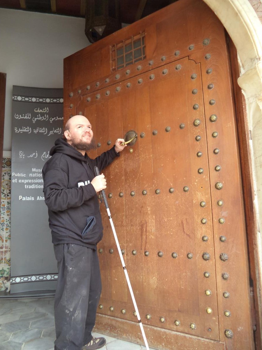 Tony holding a metal knocker on a large external door into the palace.
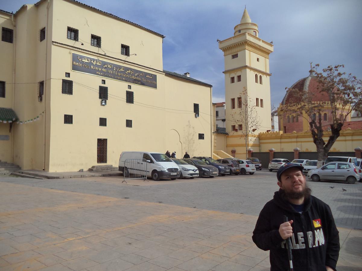 Tony outside the palace. The exterior is plain with pale yellow painted walls and small windows.
 View of the Salah Bey Bridge, the first cable-stayed bridge in Constantine, built in 2014. It is 750 metres in length with 245 metres for its longest single span.
 Tony in front of the Salah Bey Bridge.
 Striking view into the ravine from near the Salah Bey Bridge.
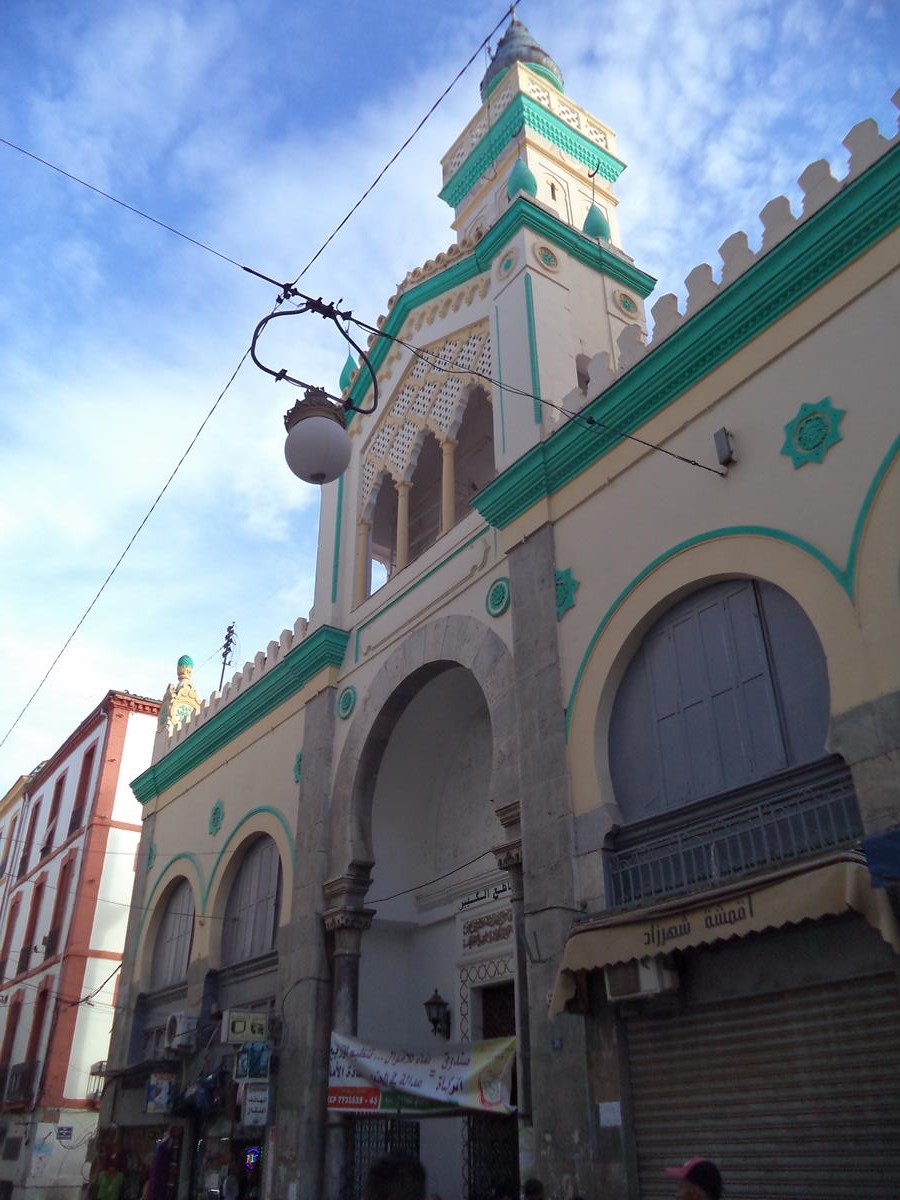 Outside an old building painted in green and cream, possibly a mosque.
 Tony in a small room full of sacks of foodstuffs.
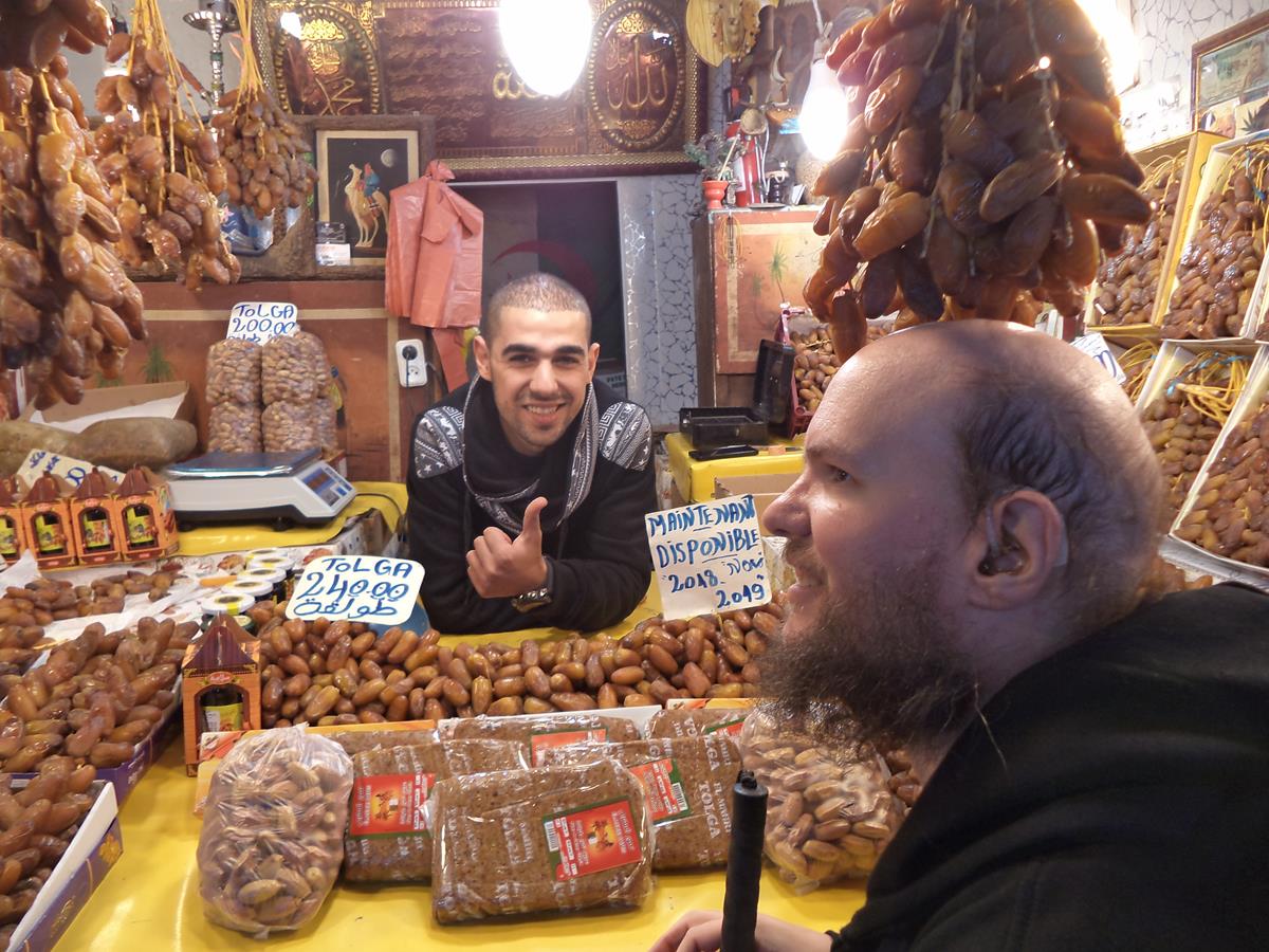 Tony at a small shop/stall selling dates.
 Inside Theatre Regional de Constantine. Tony visited with friends, made via couchsurfing, to enjoy a live performance by BB Blues, a local blues band.