St. Peter Port is a town and one of the ten parishes on the island of Guernsey in the Channel Islands. It is the capital of the Bailiwick of Guernsey as well as the main port. The population in 2019 was 18,958.
Tuesday, 11th April 2023
The following photos were taken at La Valette Underground Military Museum. The museum covers Guernsey’s military history, including World War One and the German Occupation of the island from 1940 to 1945. The museum is housed in a complex of tunnels built by the occupying German forces as a U-Boat fuel storage facility during World War Two.
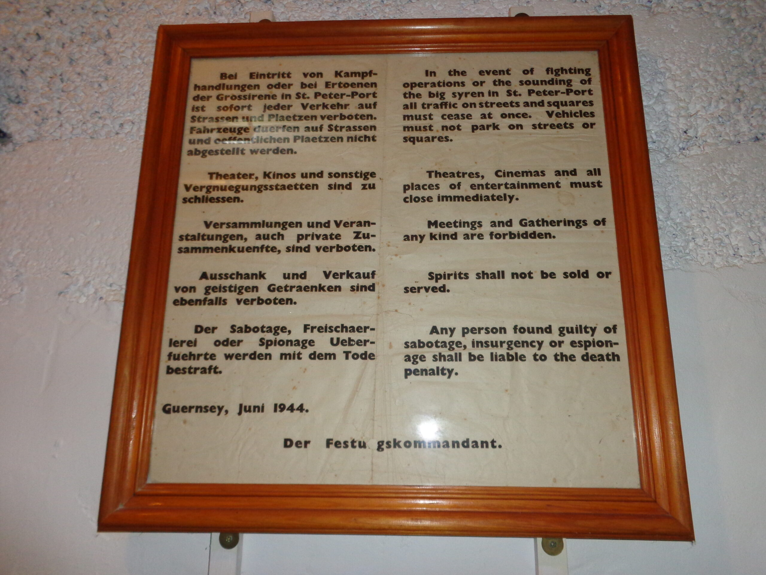
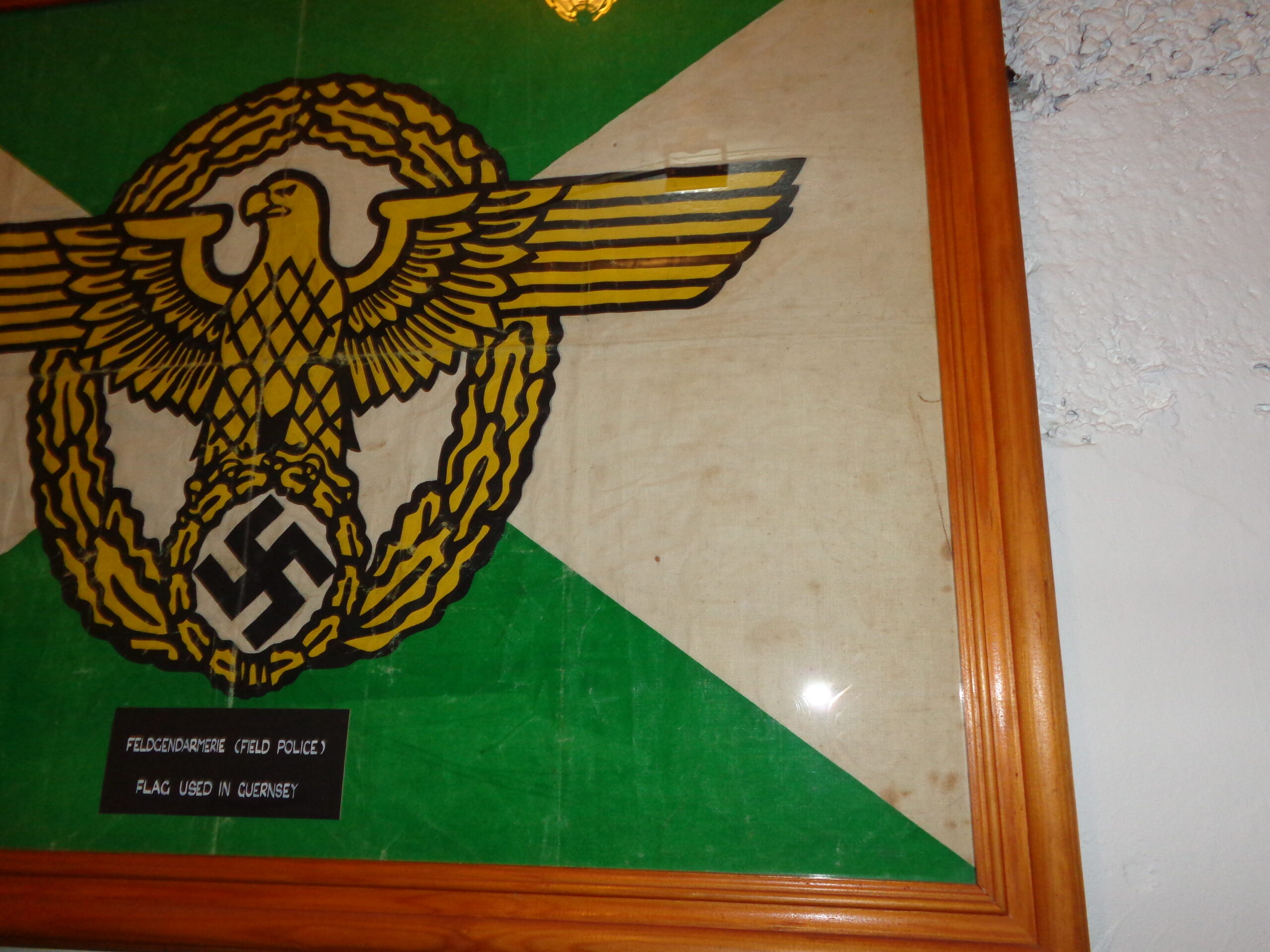
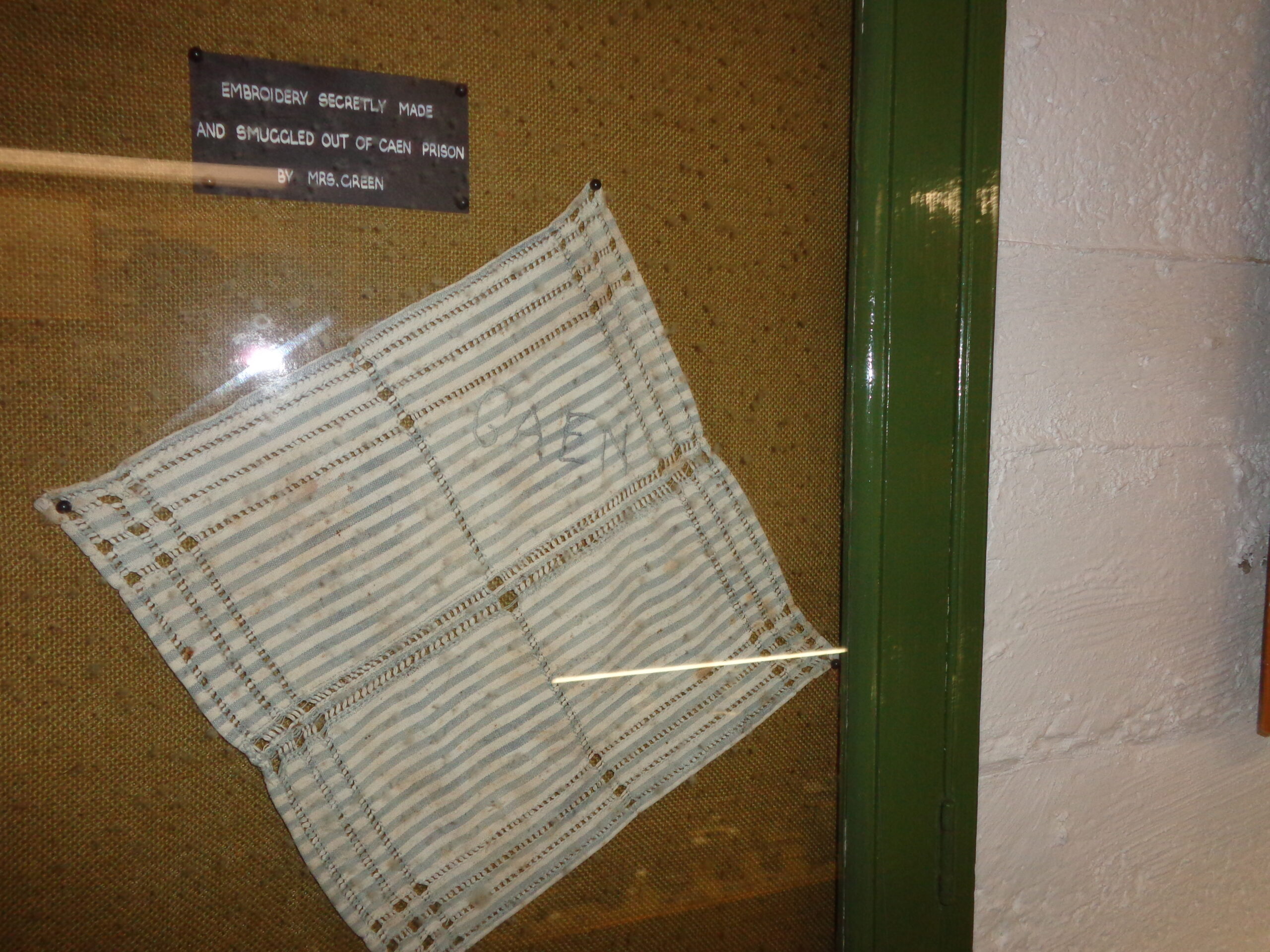
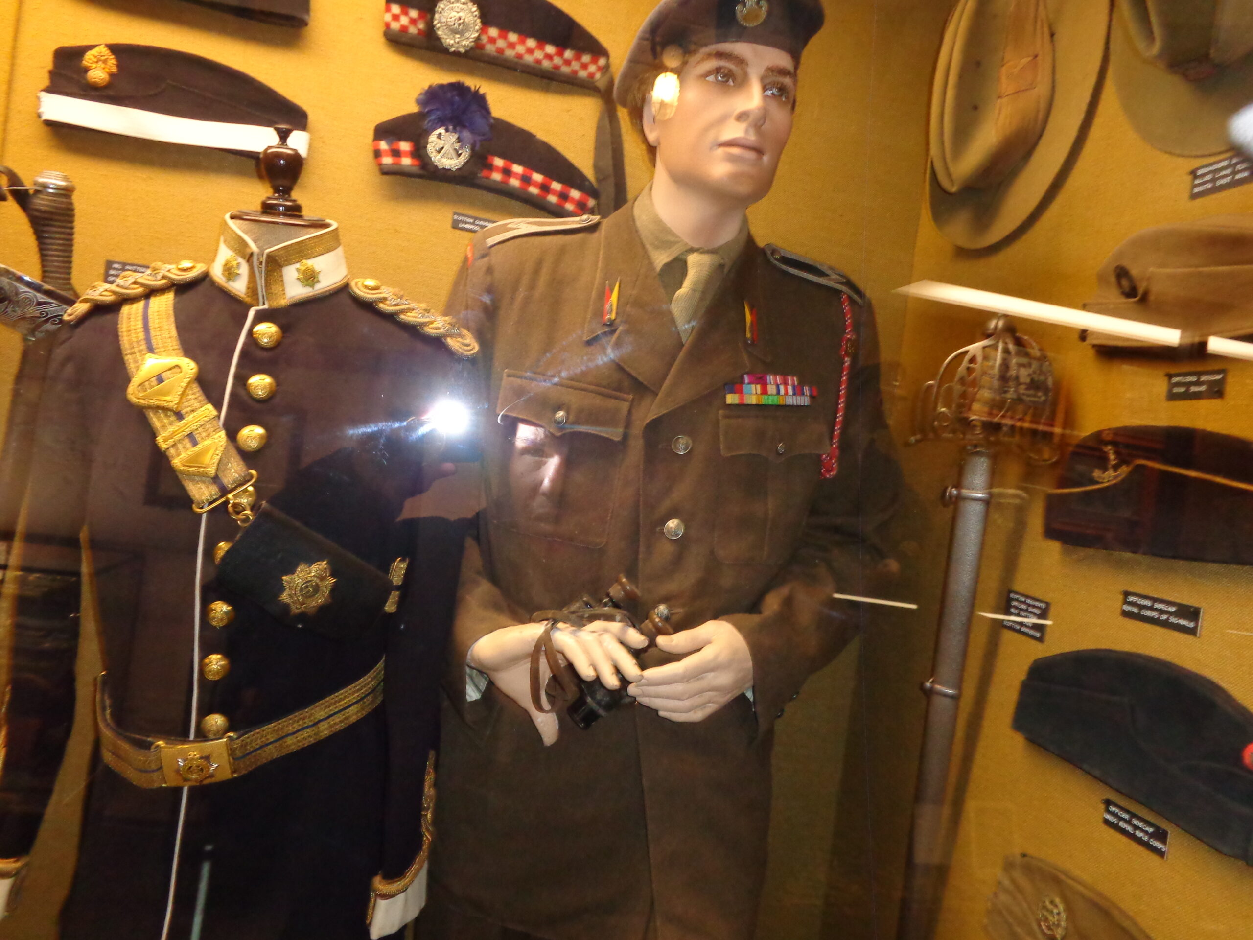
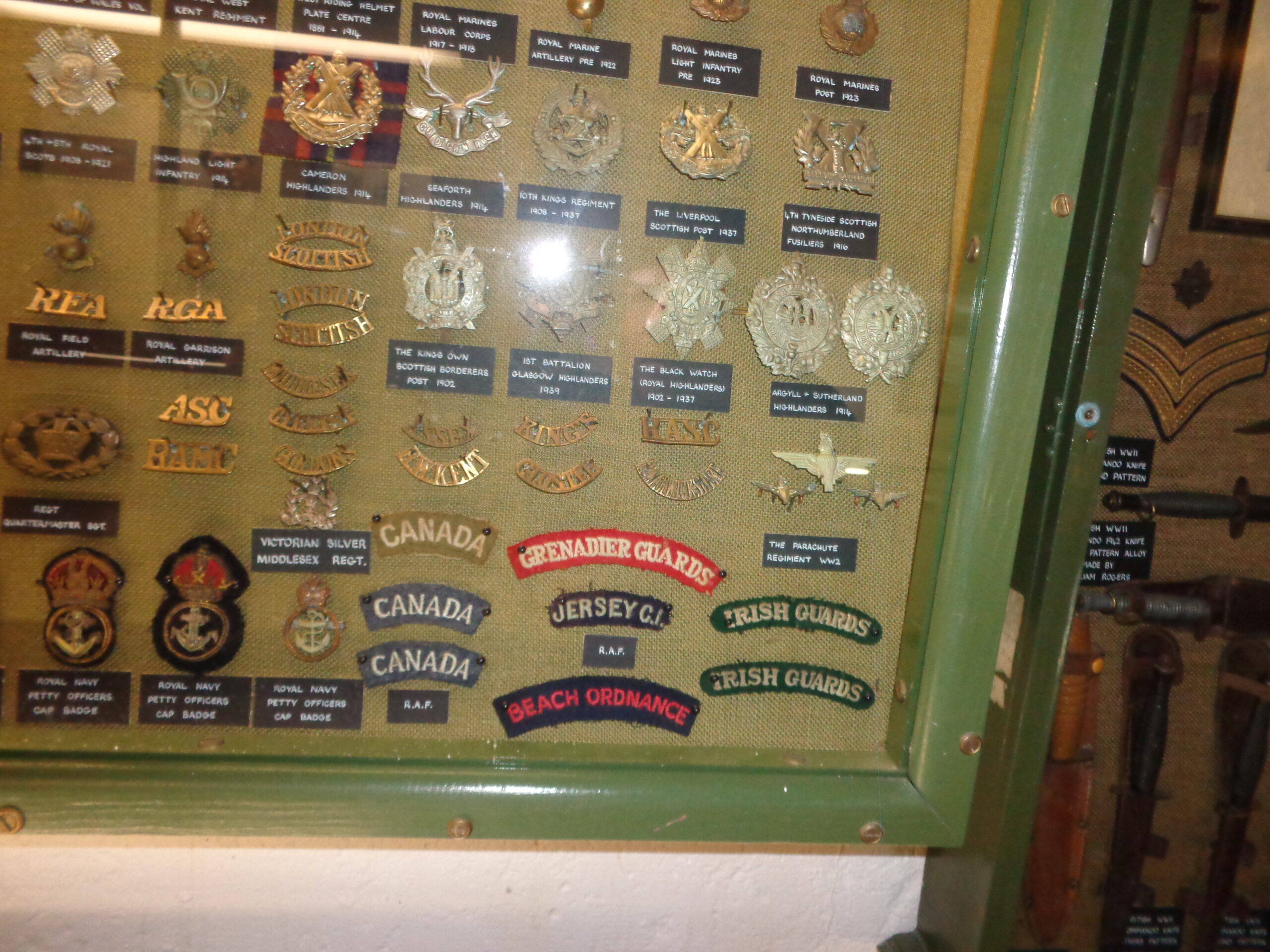
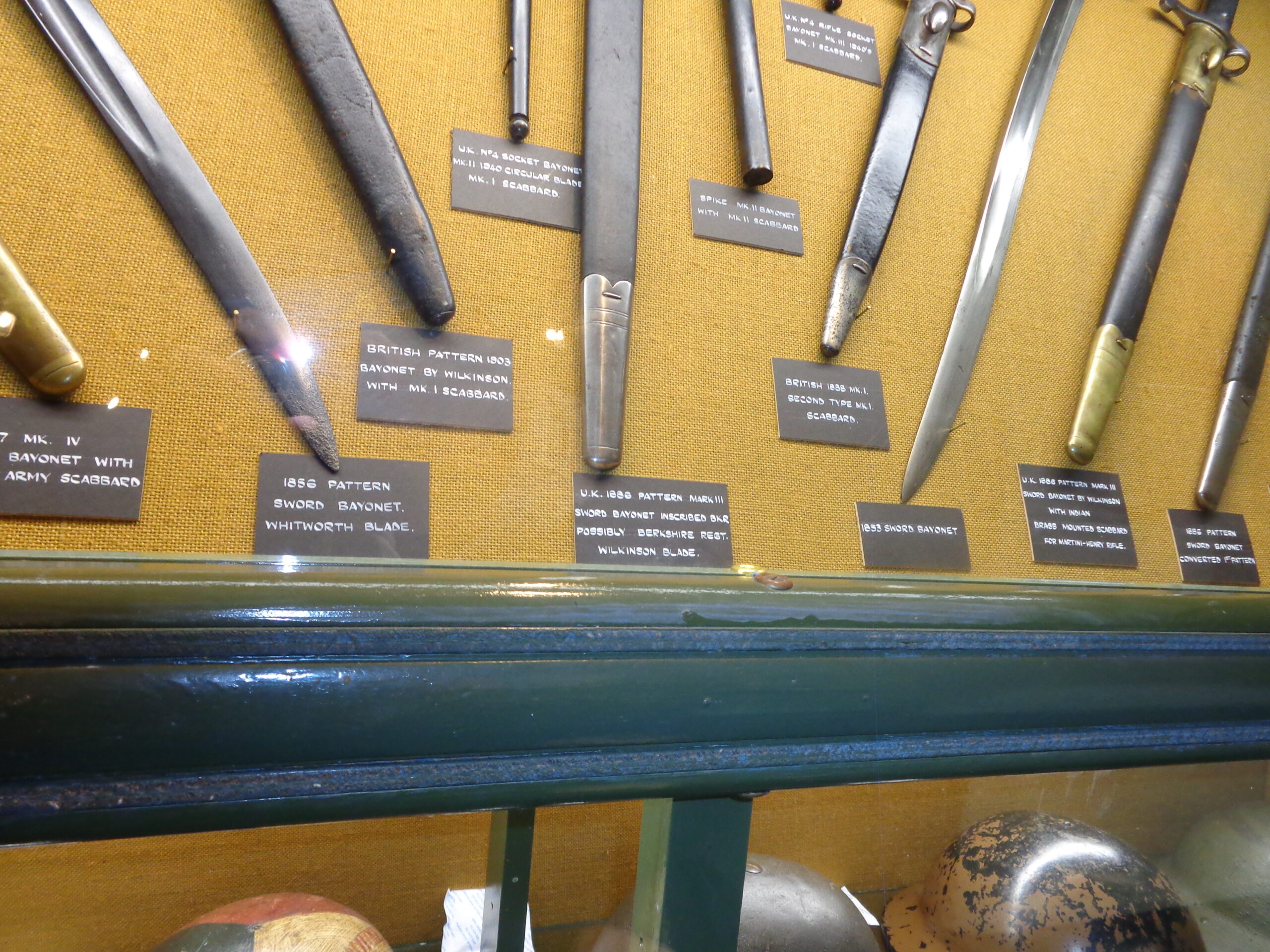
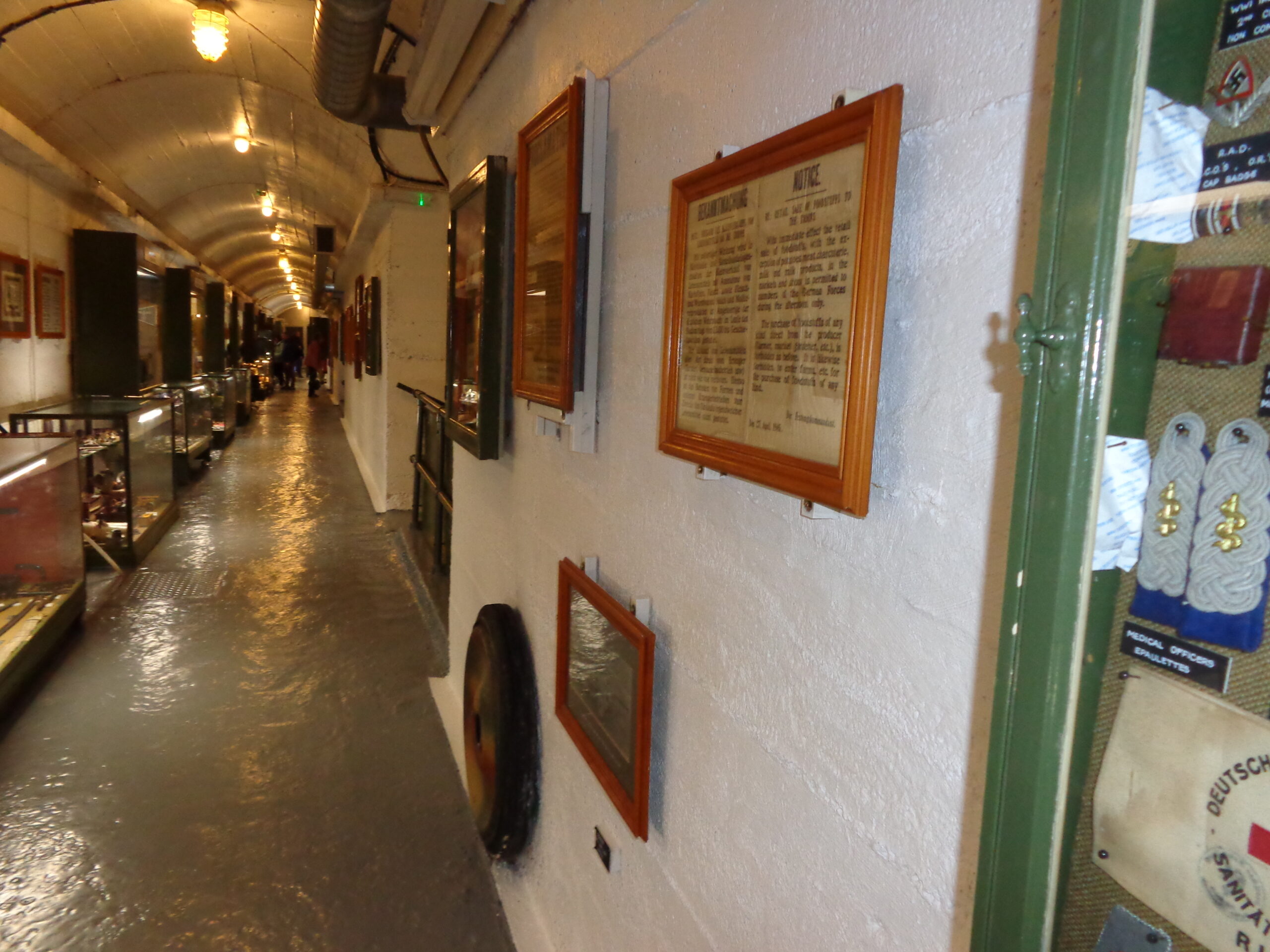
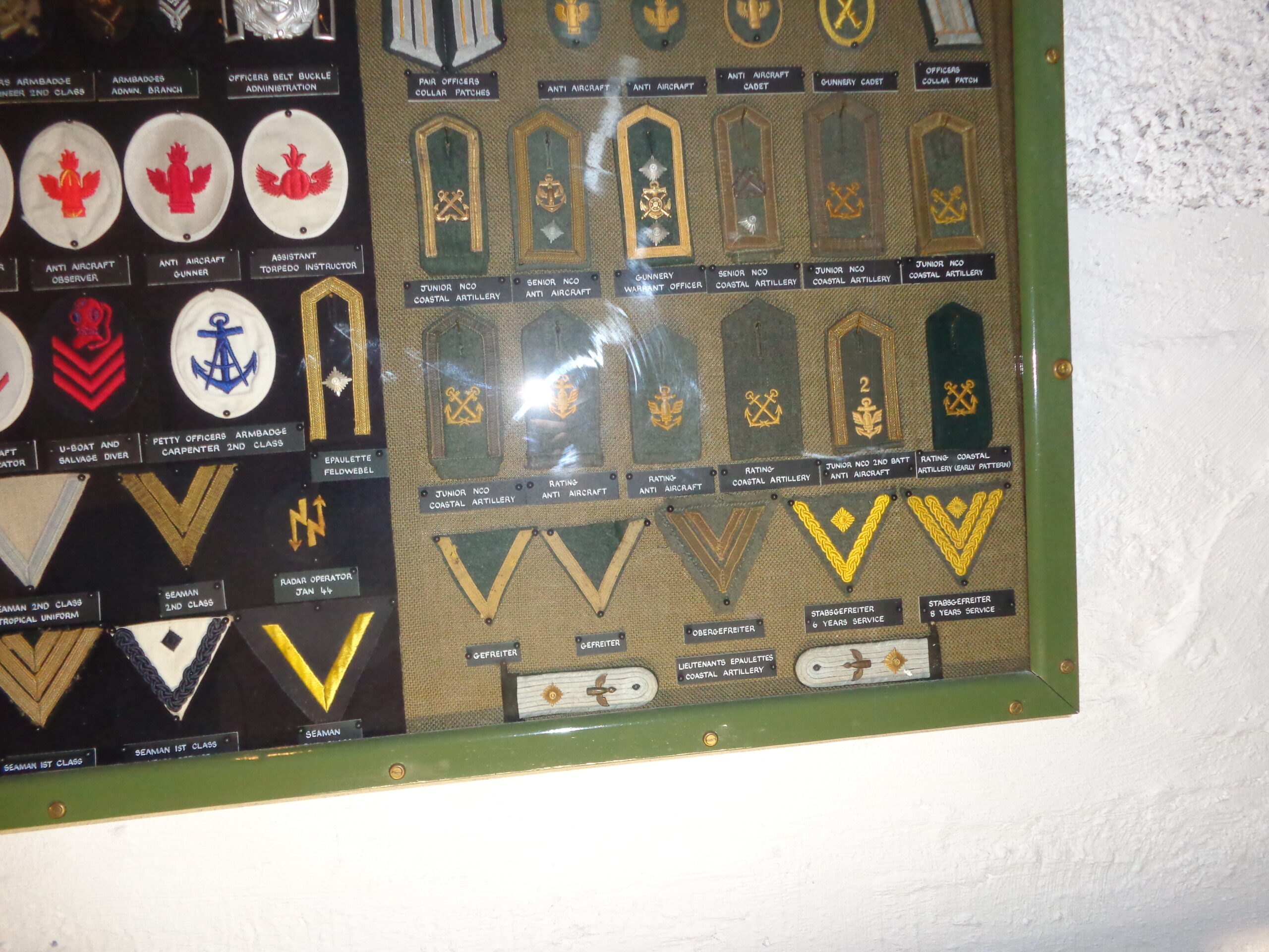
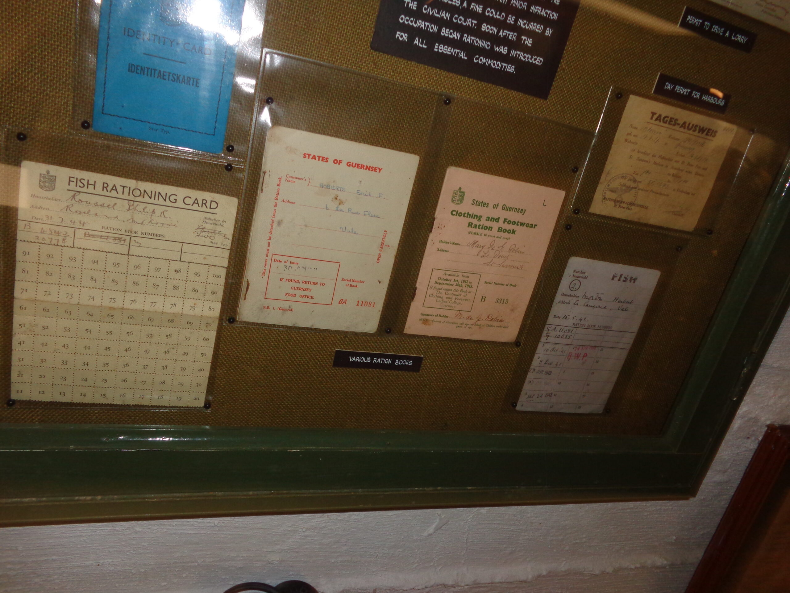
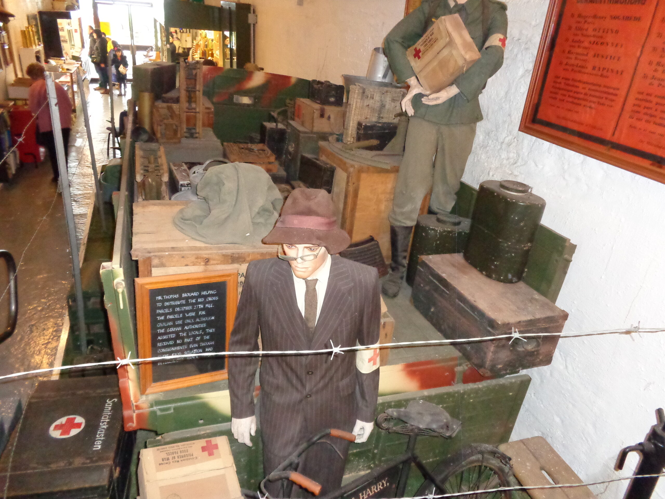
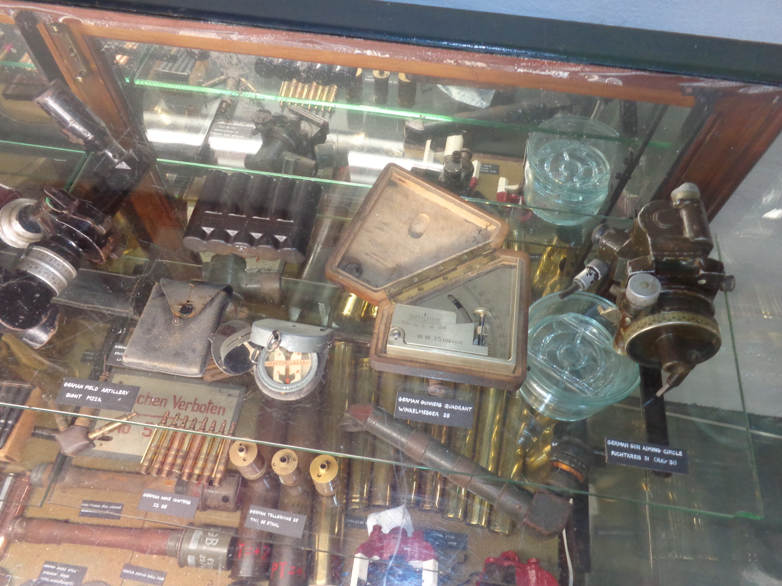
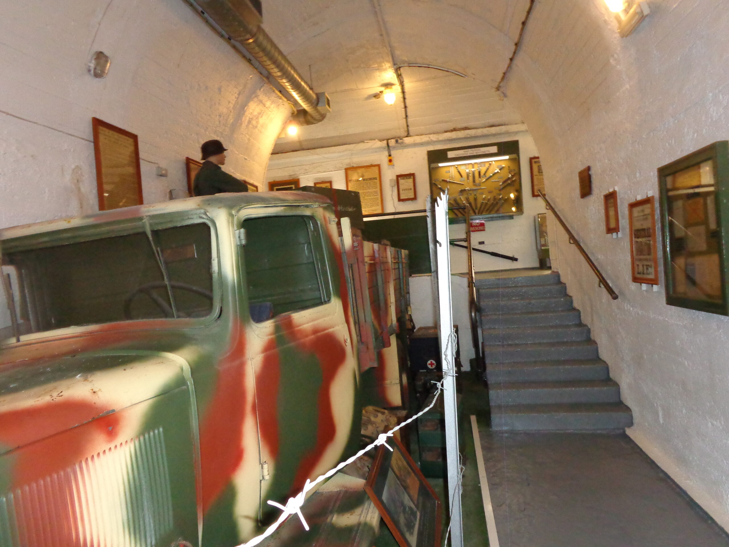
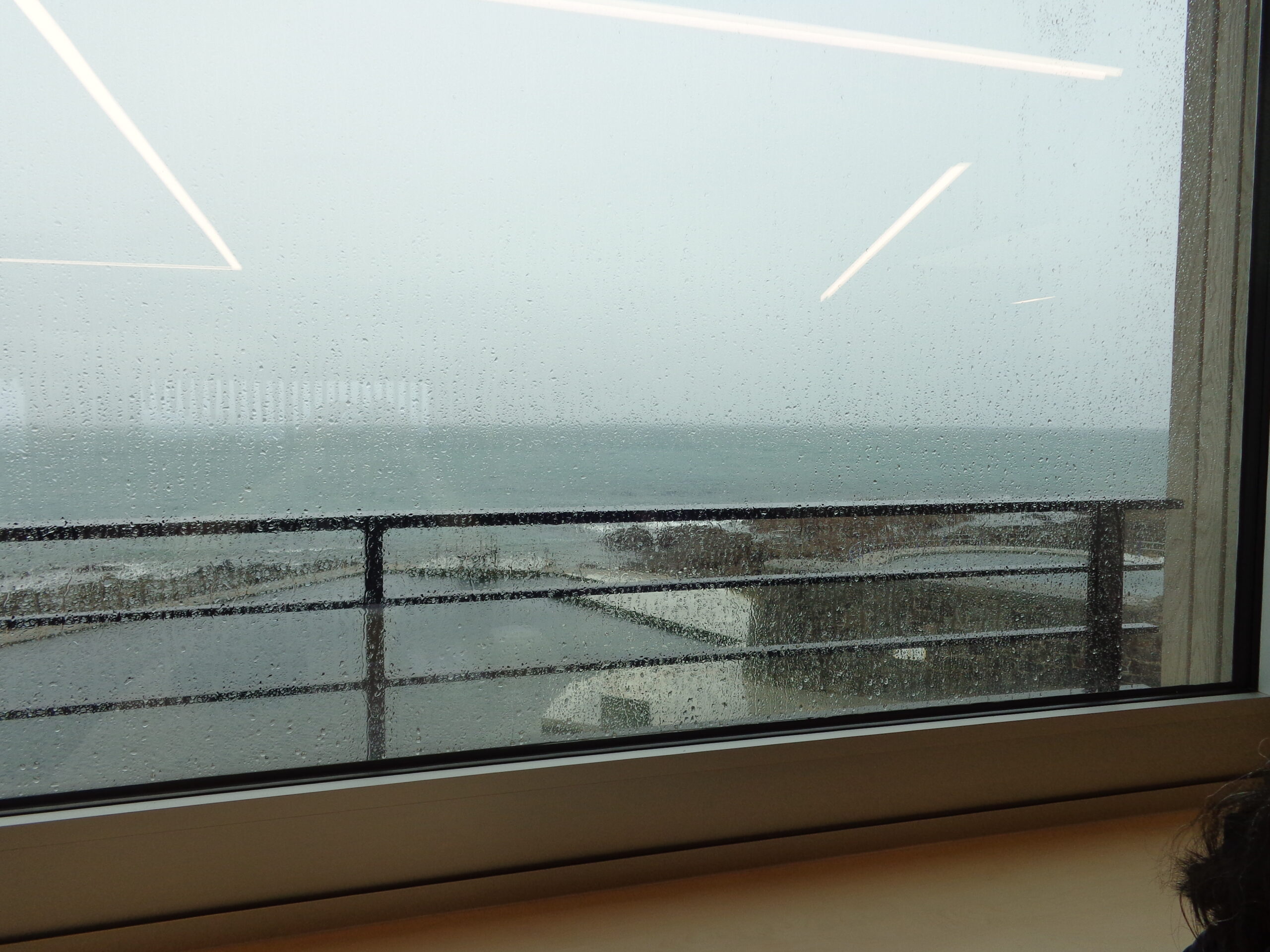
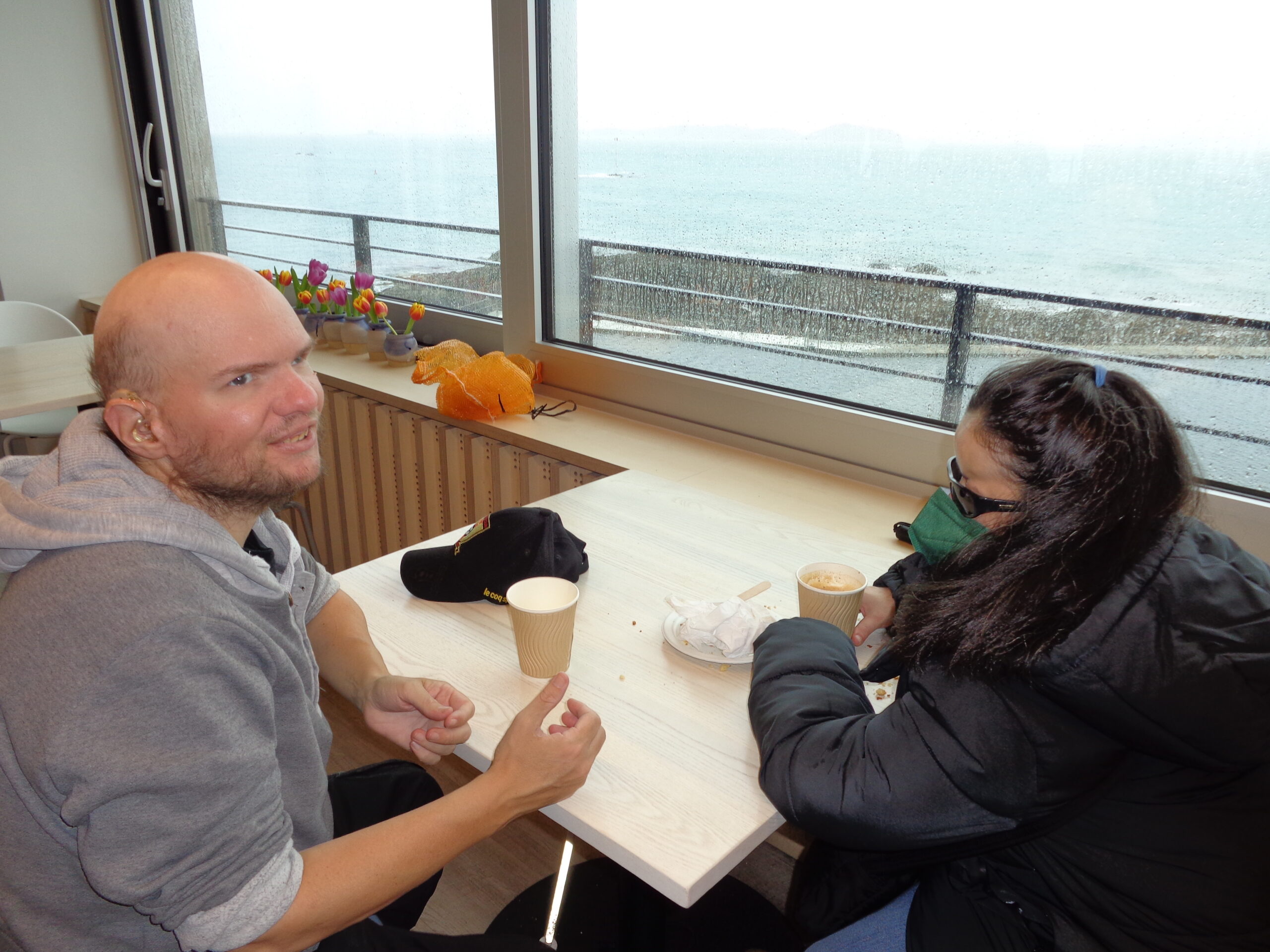
A framed German military declaration providing instructions to residents of Guernsey should hostilities occur. It dates from June 1944. The text is in German and English. It includes: “Theatres, Cinemas and all places of entertainment must close immediately.” “Meetings and Gatherings of any kind are forbidden.” “Any person found guilty of sabotage, insurgency or espionage shall be liable of the death penalty.”A flag used in Guernsey by the German Field Police (Feldgendarmerie) during the World War Two occupation. The flag is split diagonally into two white and two green triangles. In the centre is a large eagle and swastika emblem. During World War Two the Channel Islands were under German military occupation from 30th June 1940 to 9th May 1945.An embroidered cloth made by Winifred Green during her time in Caen Prison. She was imprisoned in 1941 for resisting the German occupation of Guernsey. She is possibly the most well-known of all female Guernsey resisters. Her nickname was ‘Mrs Churchill’ She was charged and imprisoned for ‘anti-German information’. At her military tribunal she was asked if she admitted to saying what she did about Hitler and the rice pudding and she said that she most certainly did. It is known from other such defendants that this attitude in court would not have helped her. More information at https://www.frankfallaarchive.org/people/winifred-elizabeth-green/.A collection of British military caps. There is also a mannikin of a British soldier in uniform. He is wearing a khaki brown jacket and a blue cap, and is holding a pair of binoculars. A smarter formal military uniform with gold buttons is displayed along side.British and Commonwealth military epaulettes and cap badges in a display case. The labels indicate these items date from between the late-19th century and the 1930s.A case containing a collection of swords and daggers. These are British military items mostly dating from the second half of the 19th century.A long white-painted corridor in La Valette Underground Military Museum. It is lined with display cases and framed items.A glass display case containing a collection of German military epaulettes and badges dating from around the World War Two occupation of the Channel Islands.A display case containing a collection of ration books from the period of German occupation between 1940 and 1945. They include a Fishing Ration Card and a Clothes and Footwear Ration Book both issued by the States of Guernsey. The fronts of these documents typically include the name and address of the person it was issued to and the issue date. There is also a day permit to access the harbour, which unlike the other documents, is in German and has a German military stamp.A group of Red Cross food parcels. Following the D-Day landings in June 1944 the Channel Islands became cut-off from supplies and in the winter of 1944-45 provisions of food became scarce. A delivery of Red Cross food parcels on the ship SS Vega in December 1944 helped save the civilian population from starvation.A display case containing various small items of German military equipment dating from World War II. It includes a compass, a gunner’s quadrant and mine igniters.A German military truck painted in camouflage colours inside La Valette Underground Military Museum.A rainy view through a cafe window over the bathing pools at La Vallette, St Peter Port. These salt water bathing pools date from 1865.Tony and Tatiana sitting in a cafe. Through the window there is a view of the bathing pools and the sea beyond. It is raining outside making the view a little hazy.
Wednesday, 12th April 2023
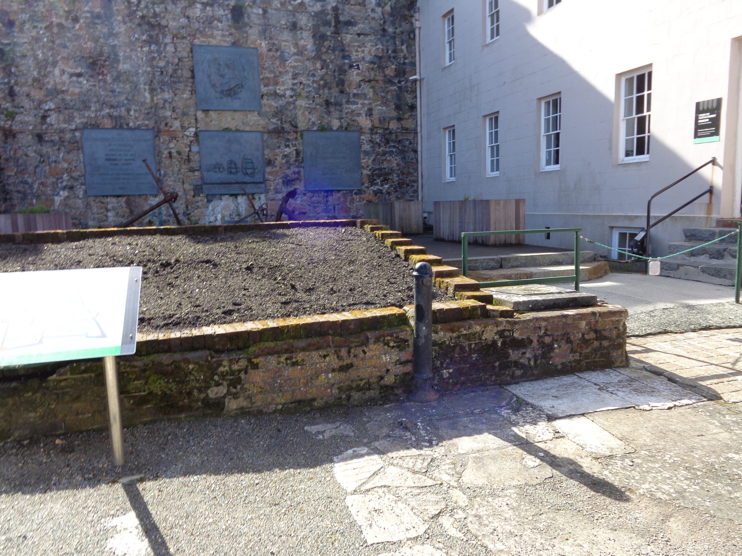
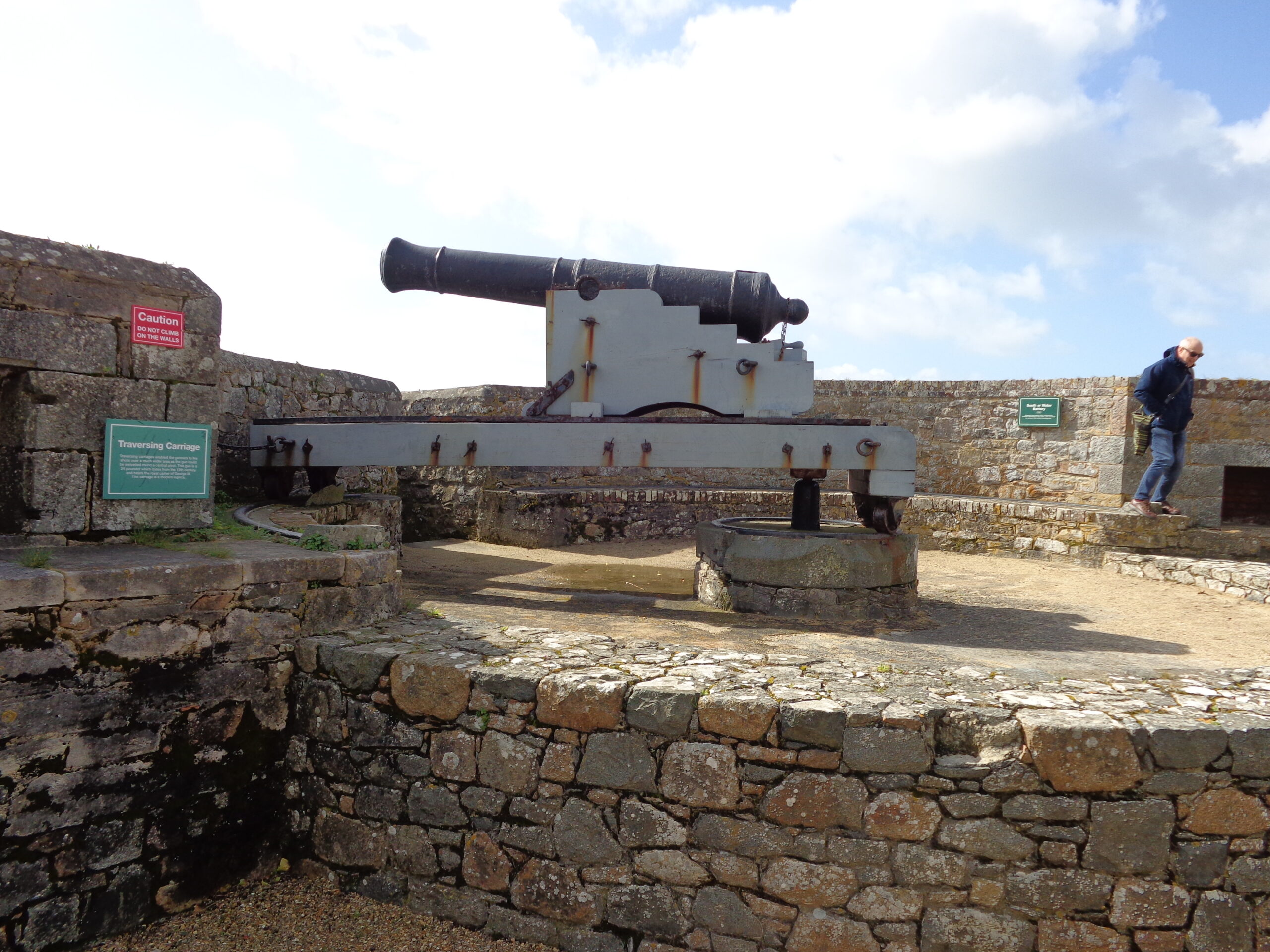
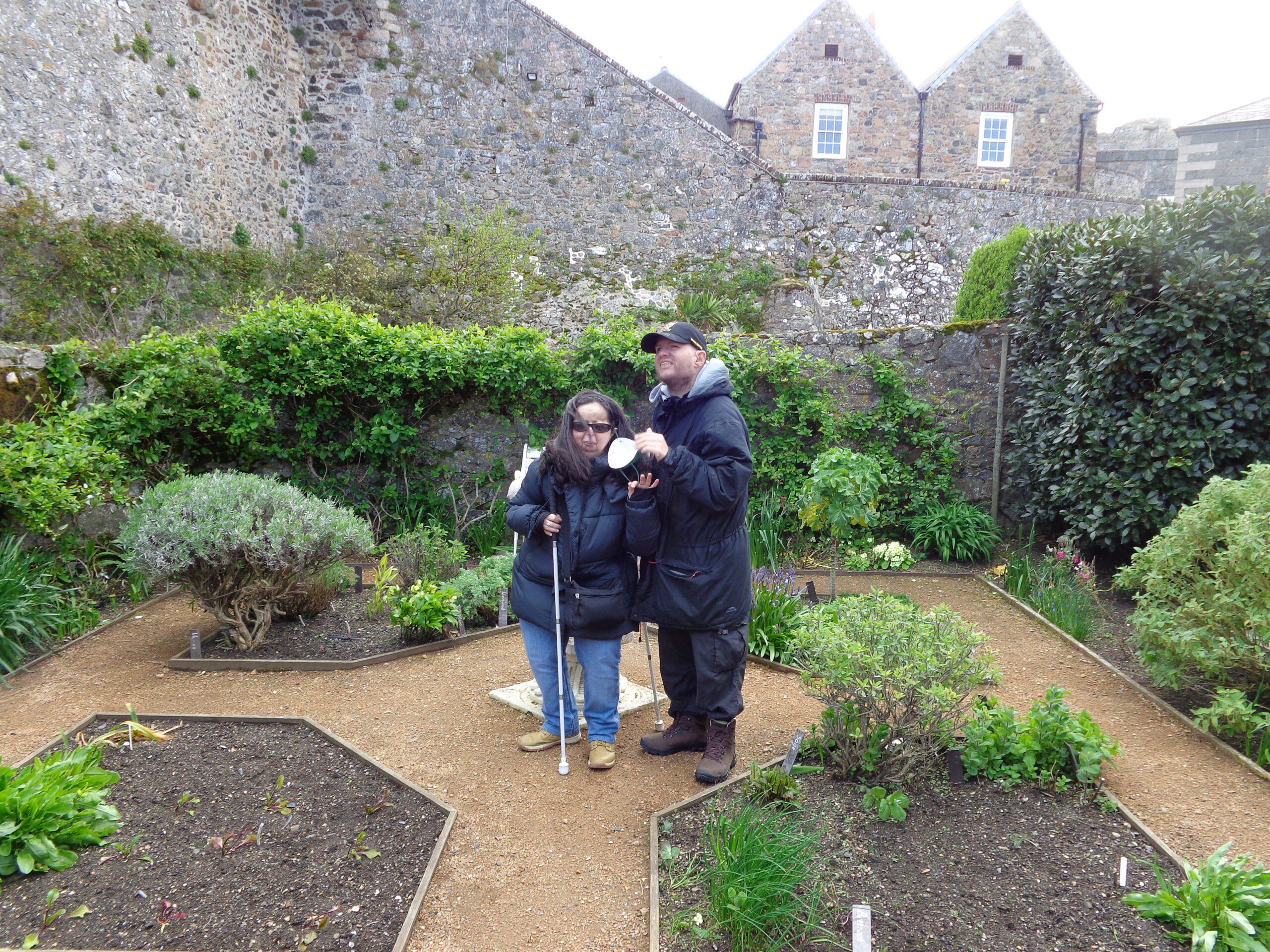
A stone and gravel path at the entrance to Castle Cornet in St. Peter Port, Guernsey. In front is a stone wall with four large bronze plaques attached. One of the plaques depicts a line of sailing ships. The writing on the other plaques is too distant to read. At the foot of the wall are three metal ship’s anchors. The cream coloured building on the right is the Lower Barracks which dates from 1745 to 1750.
Castle Cornet stands on what was originally a tidal island strategically located at the entrance to Guernsey’s main harbour at St Peter Port. The island was first fortified between 1206 and 1256. During the English Civil War the castle held out under siege for nine years. The castle supported the Royalist cause while Guernsey itself supported the Parliamentarians. It is estimated that ten thousand cannonballs were fired at the town during this period. During the Napoleonic Wars in the early 19th century the castle was upgraded and afterwards it was joined to the mainland via a breakwater. The island is 175 metres (574 ft) in length and 130 metres (430 ft) in width and it lies 600 metres (2,000 ft) from the mainland. Today the castle is open to the public as a museum.
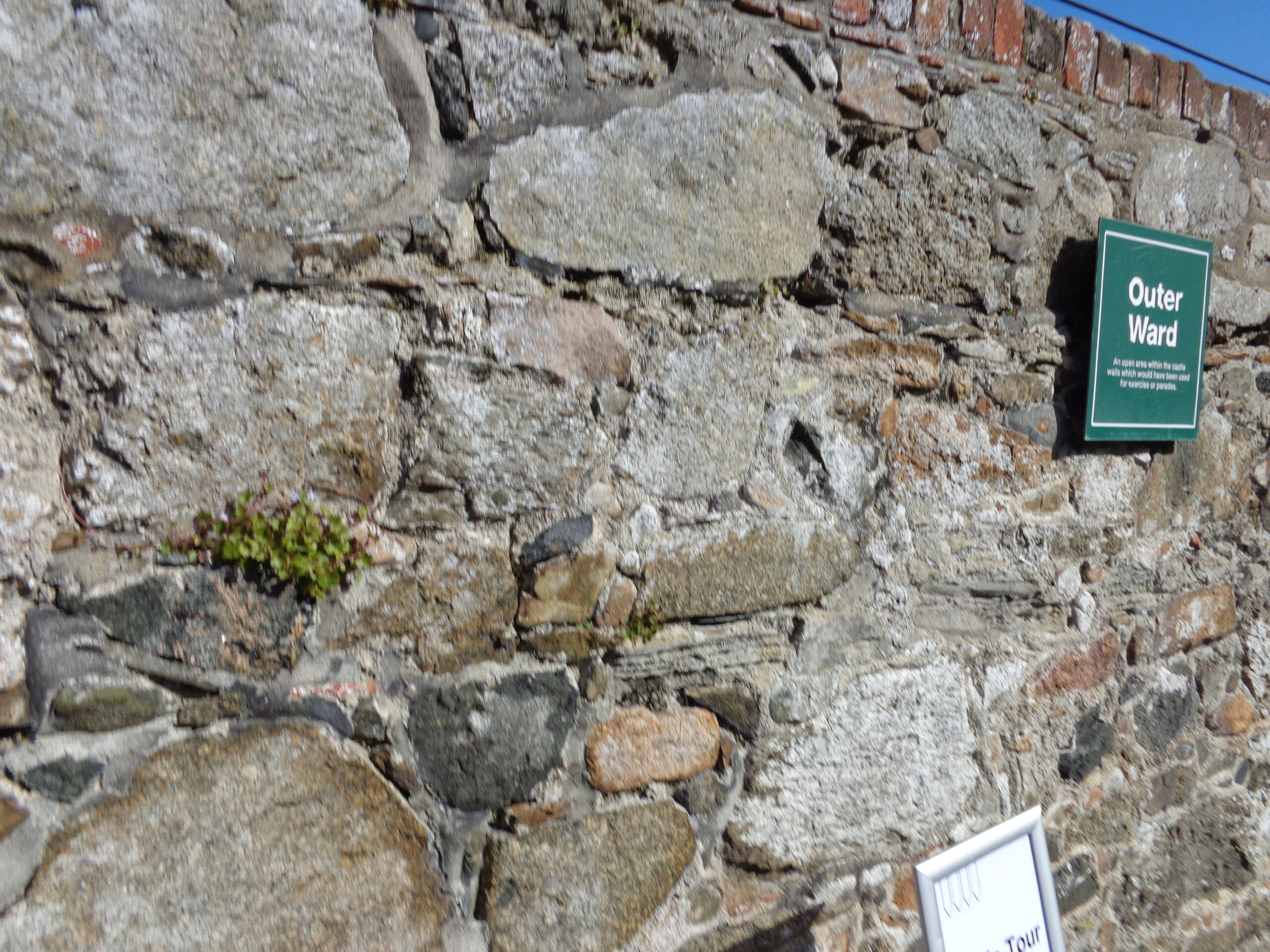
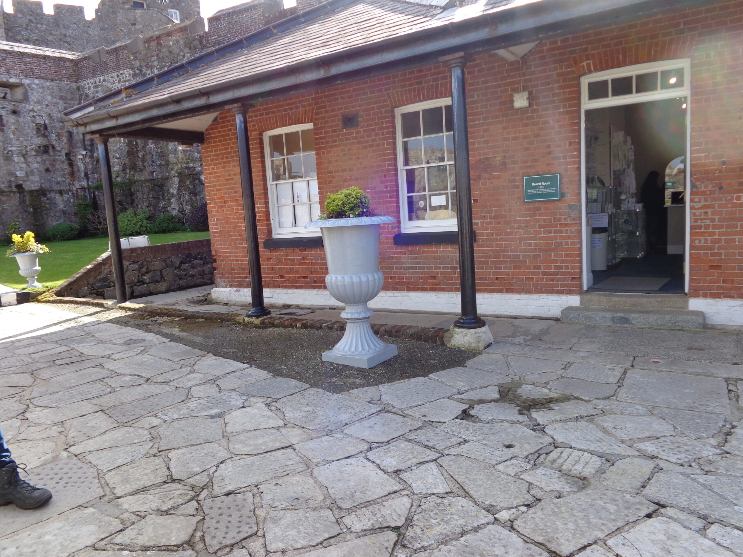
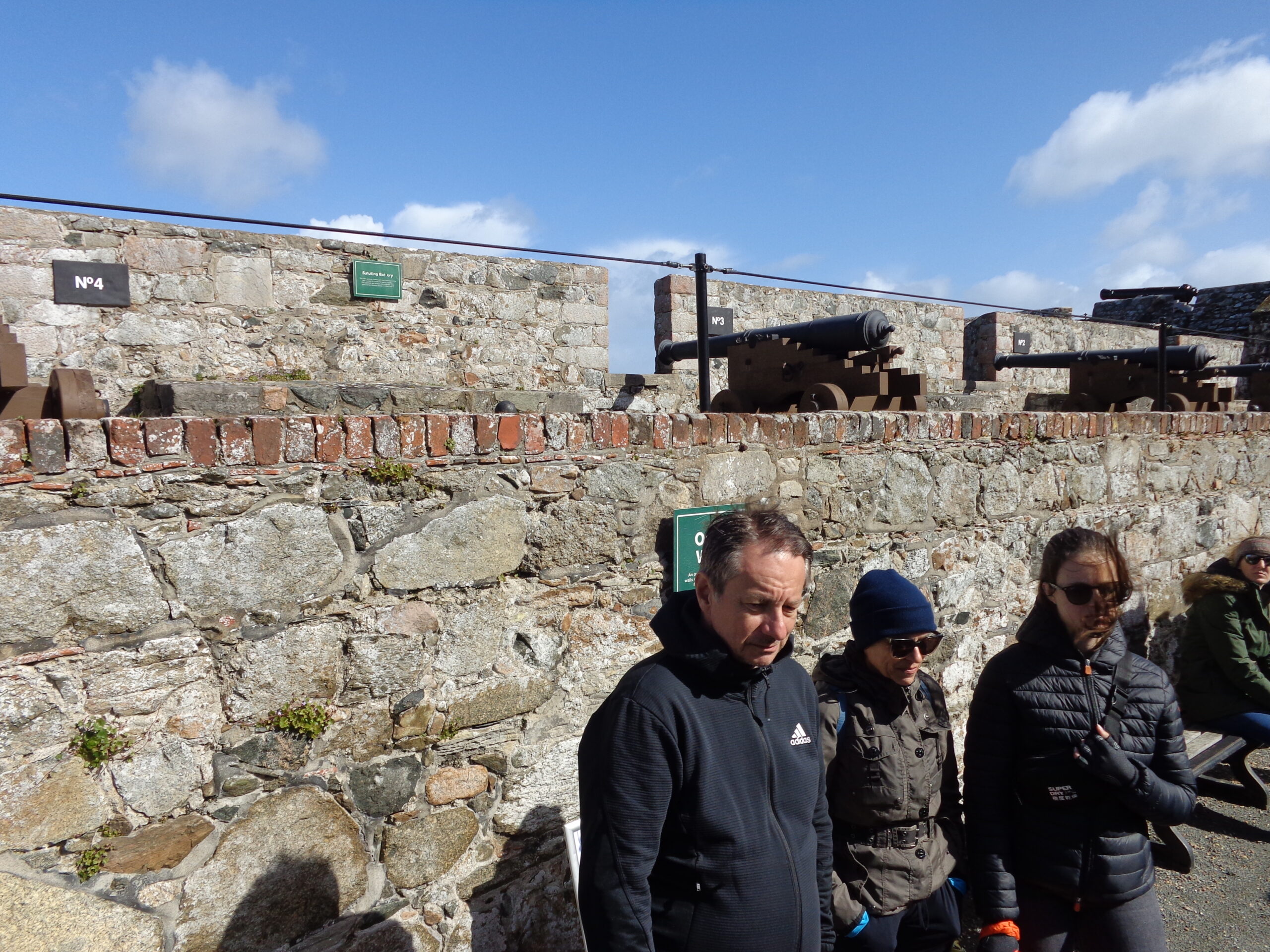
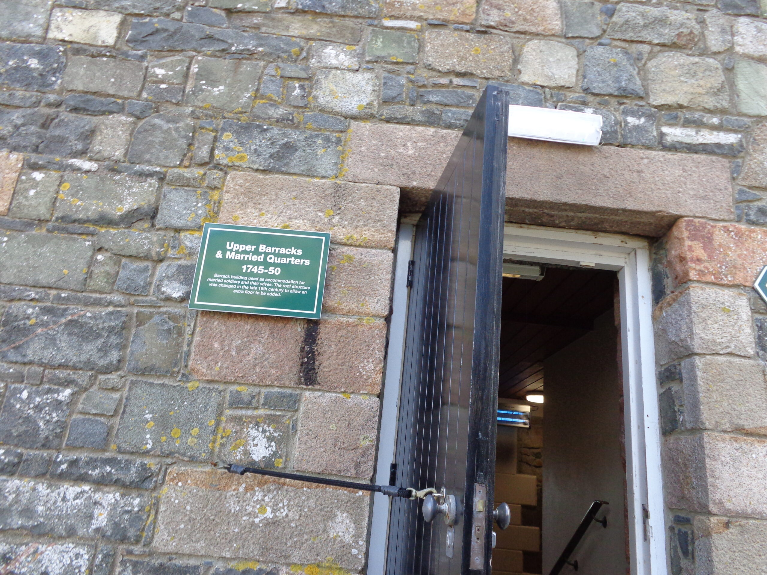
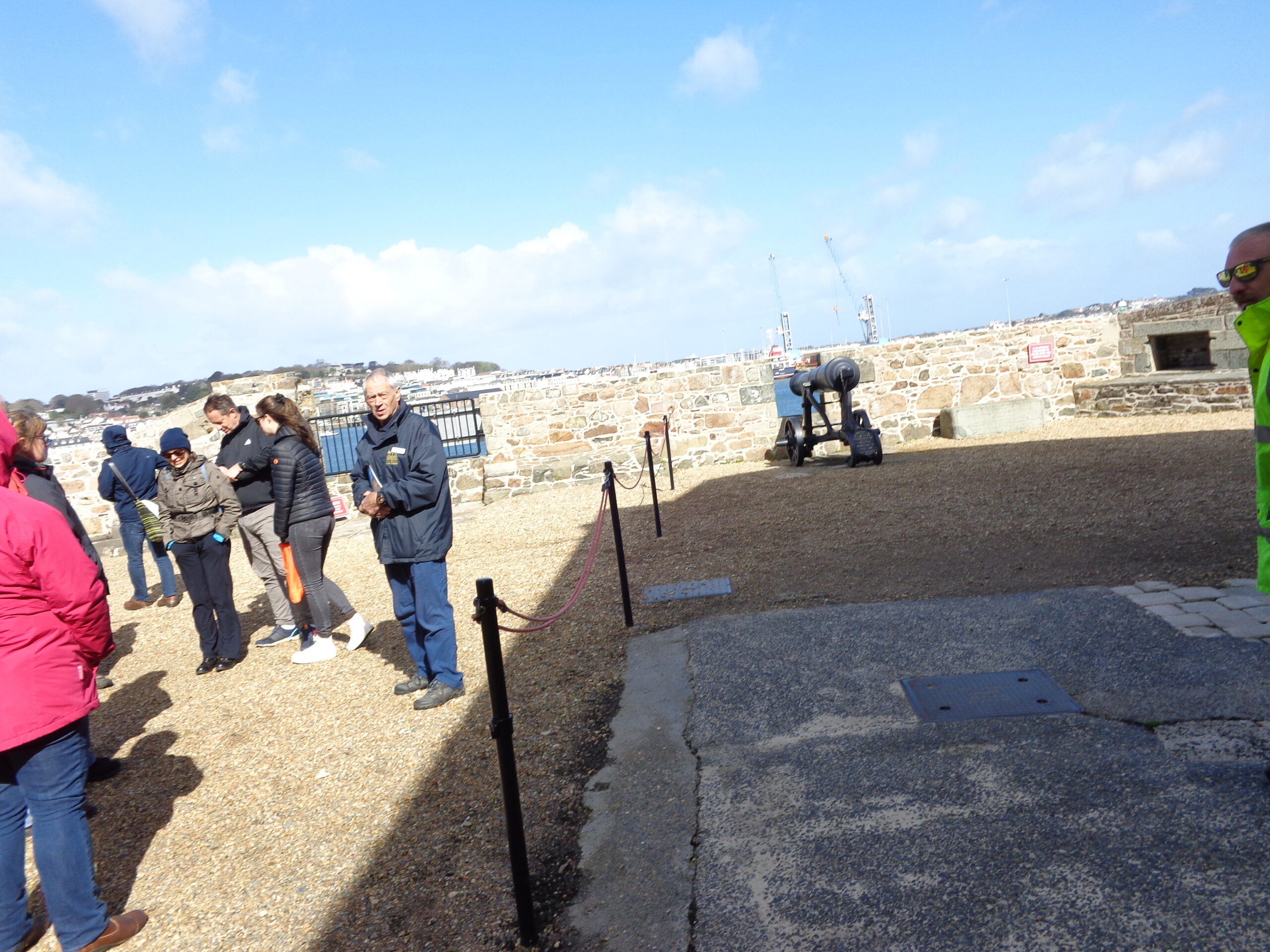
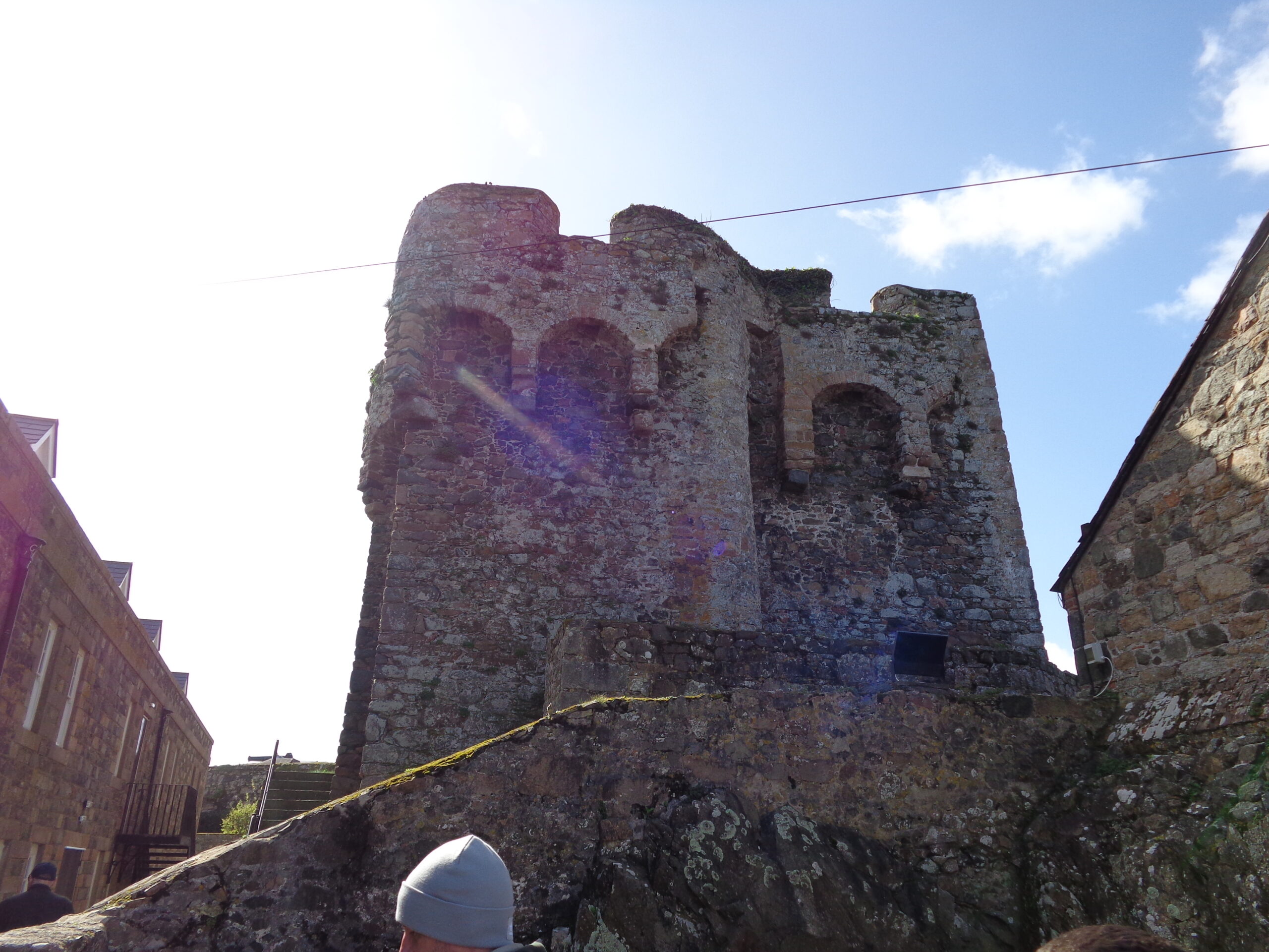
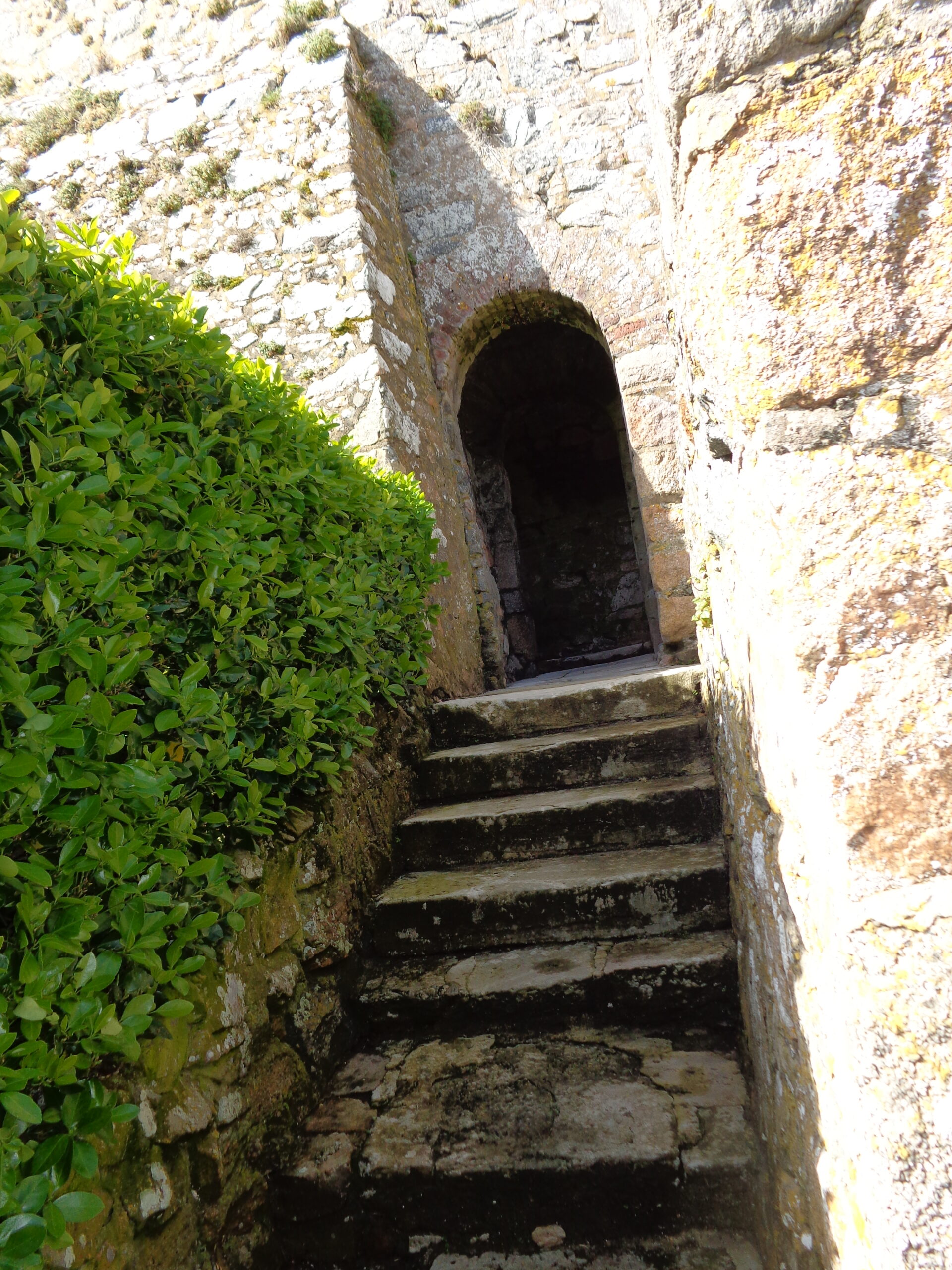
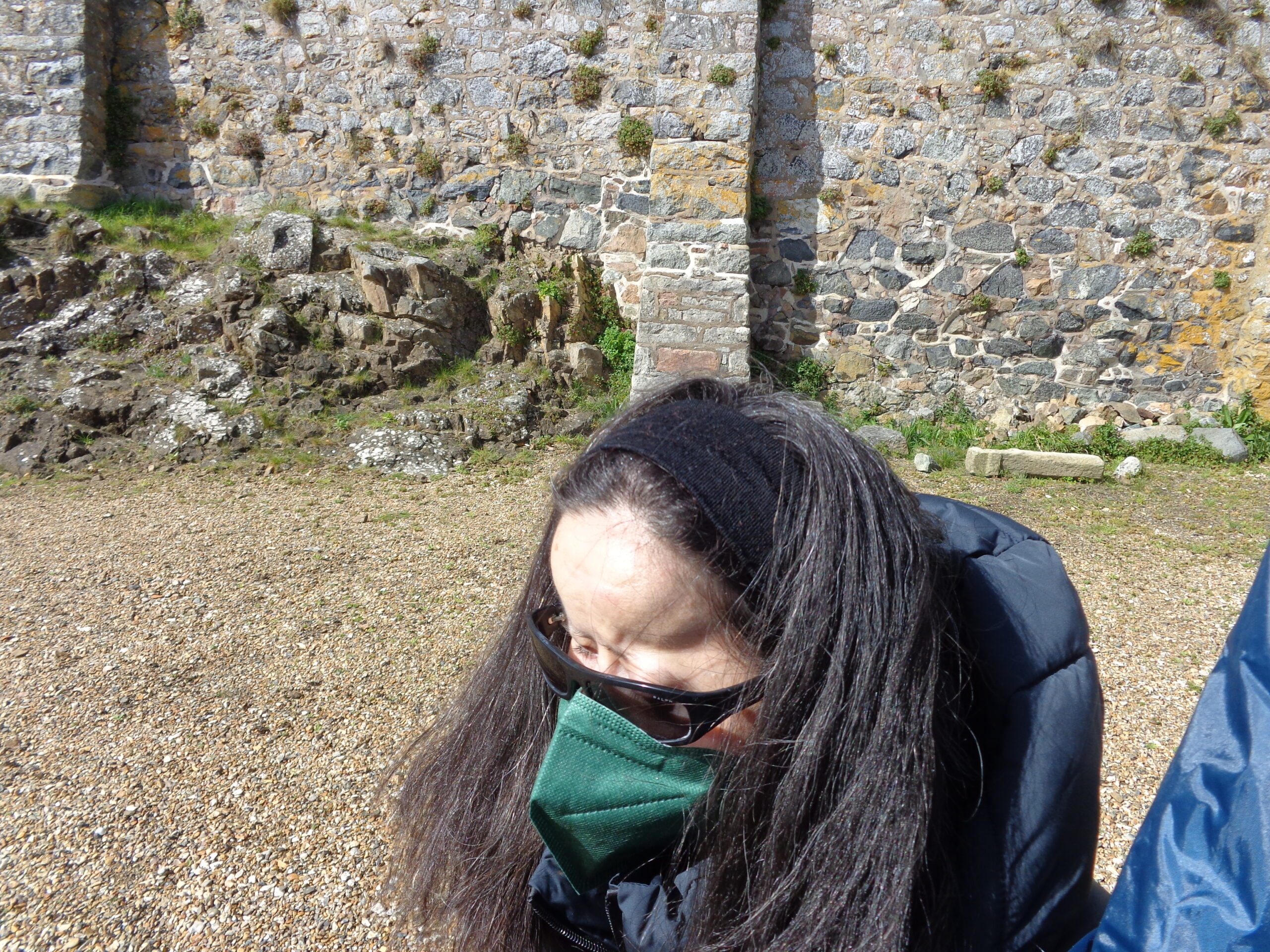
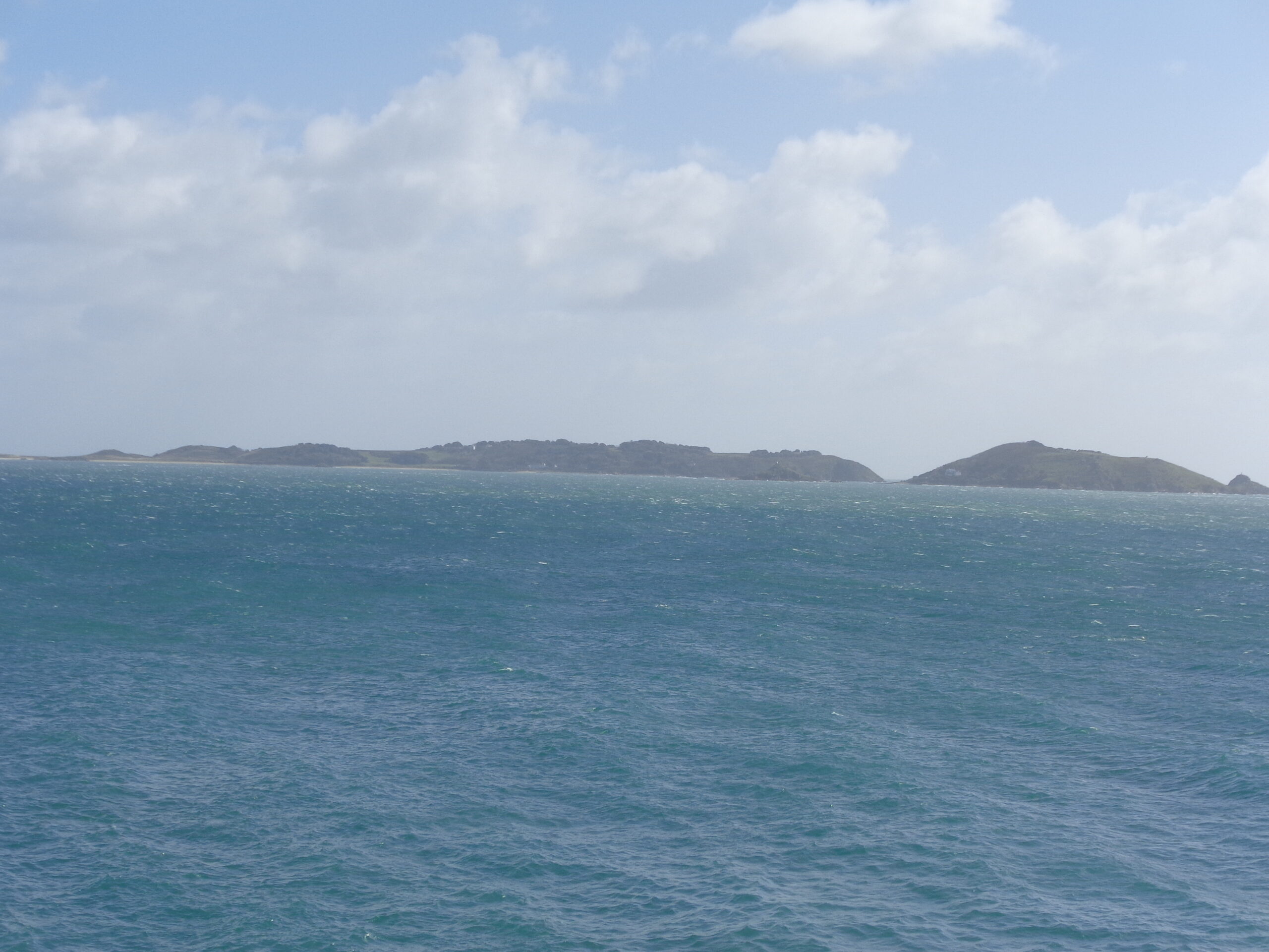
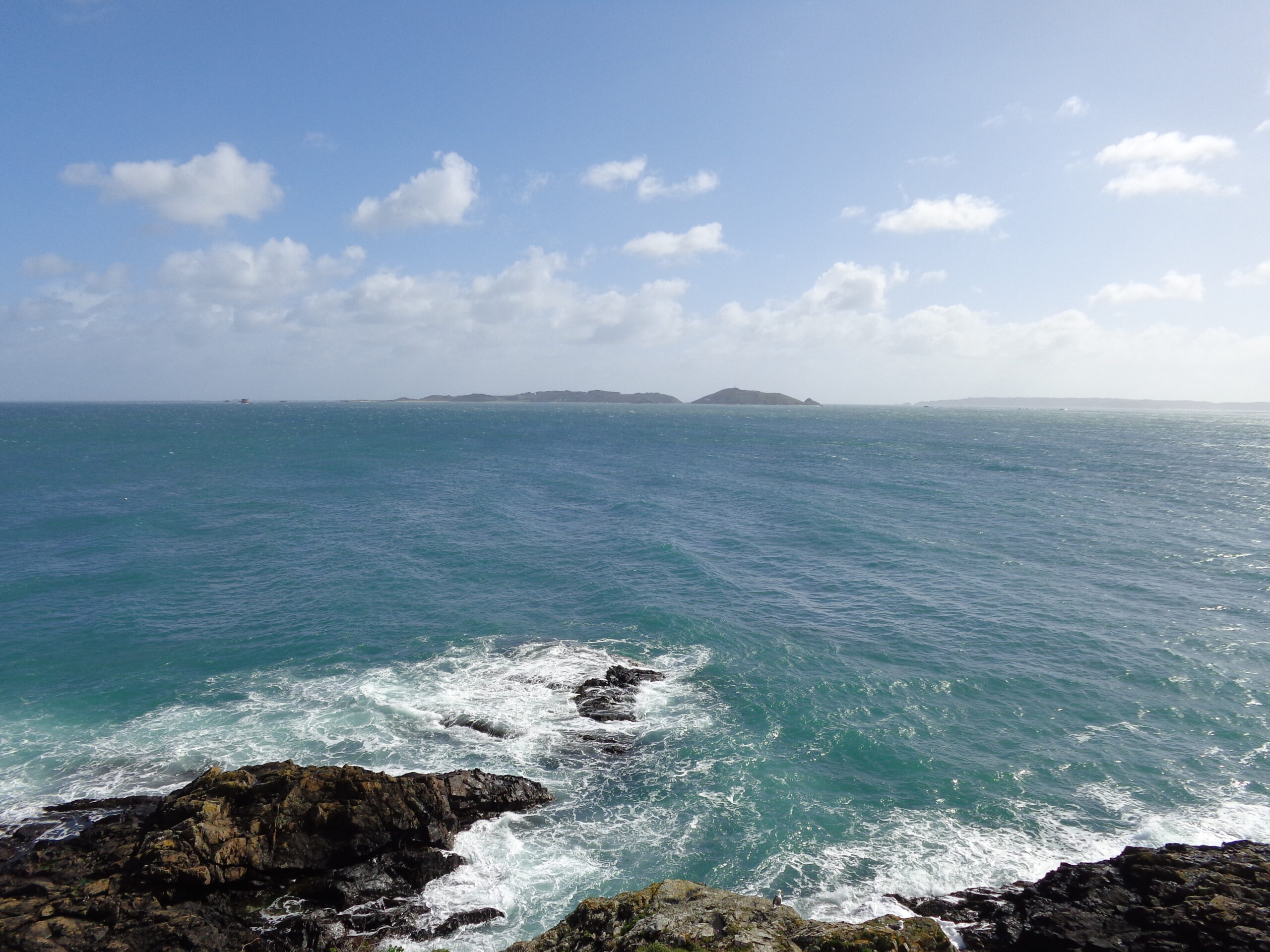
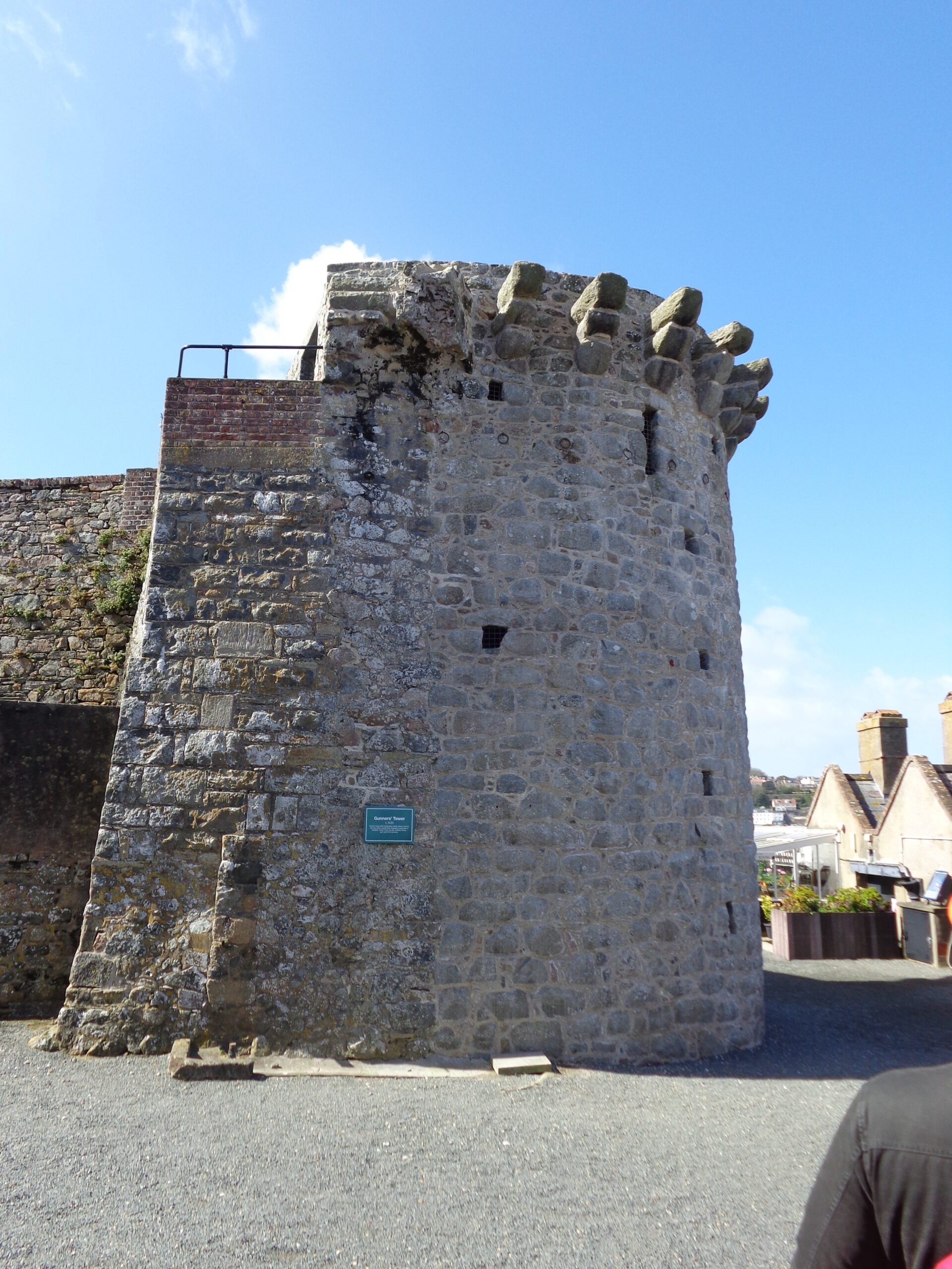
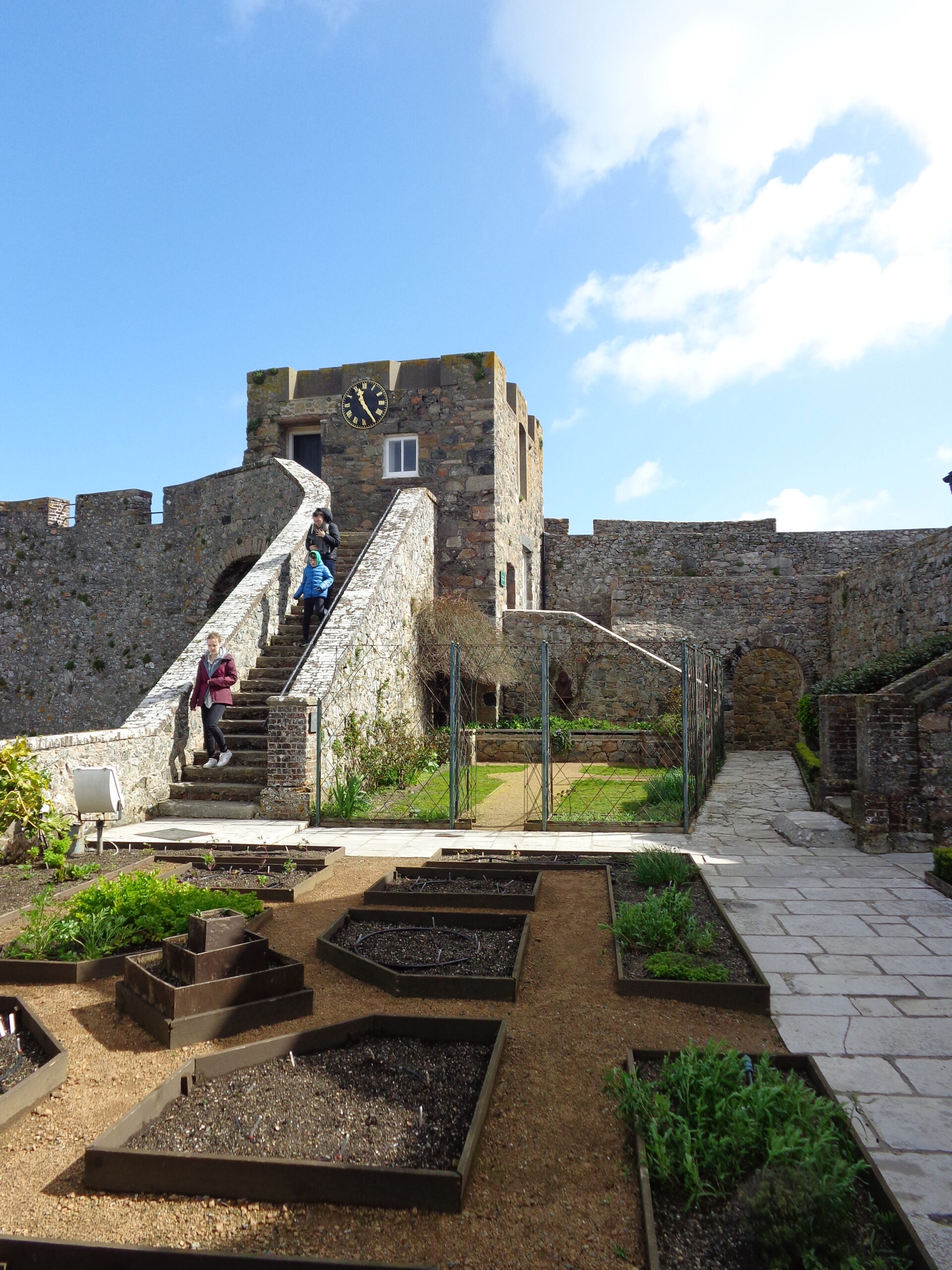
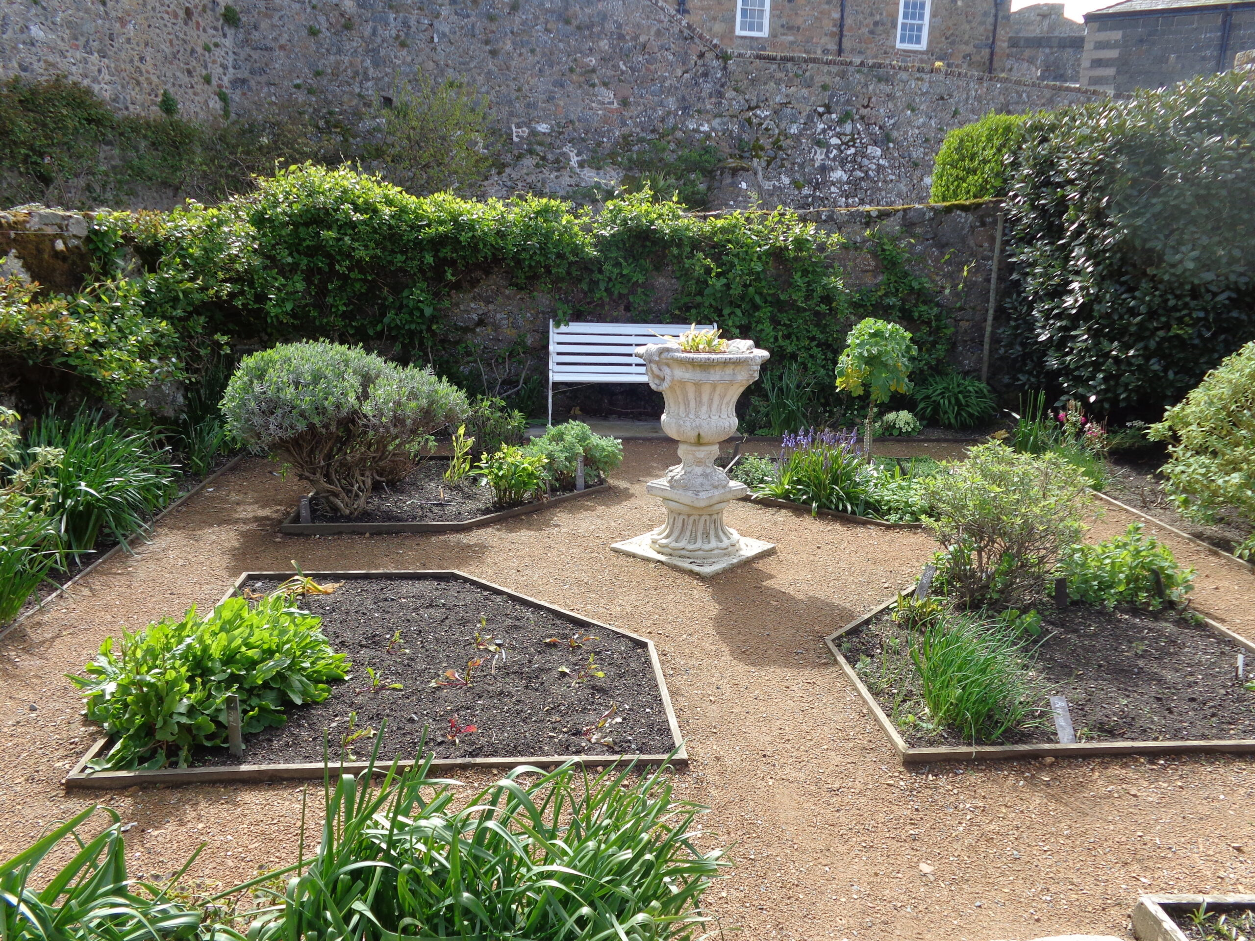
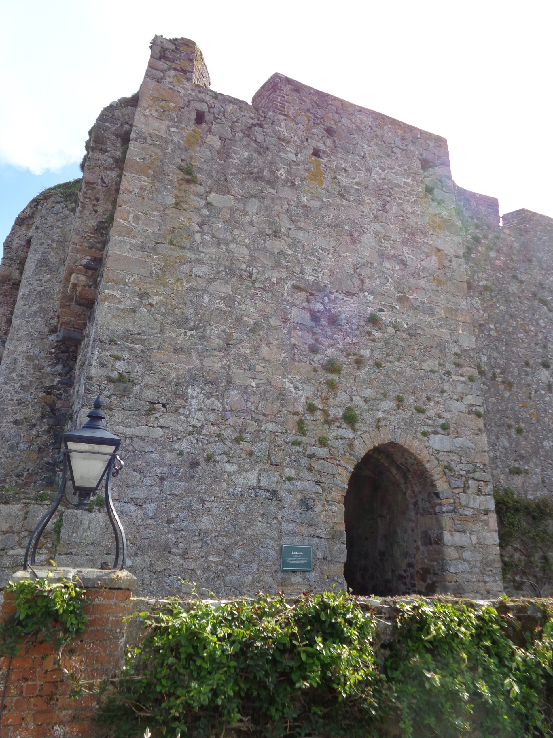
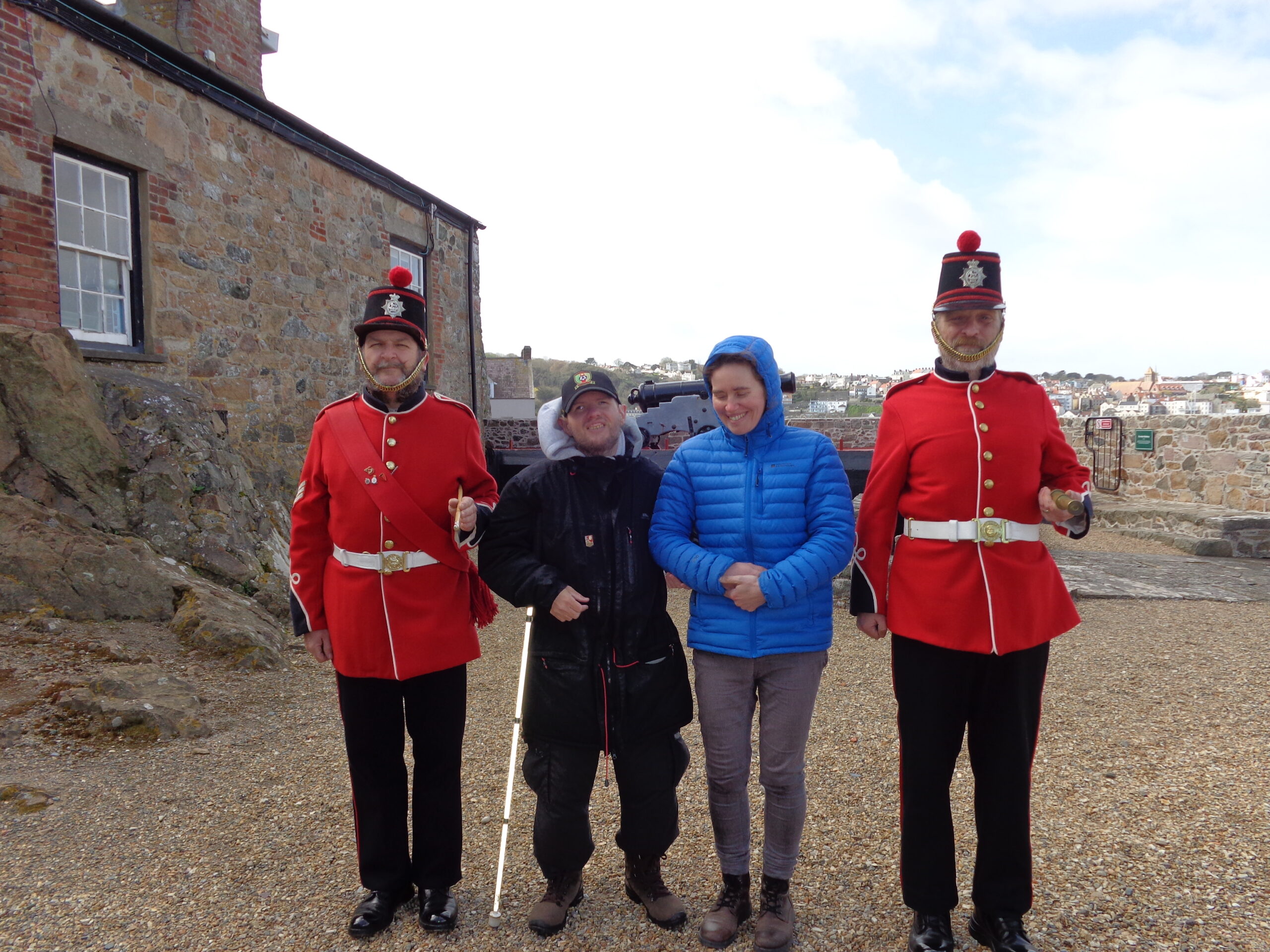
The Outer Ward at Castle Cornet. A stone outer wall runs down the left side of the photo. This courtyard would have originally been used for exercise and parades. In the background a higher stone and brick wall rises up with fortified buildings beyond.The red brick building in front was originally the Guard Room built around 1850. It is today the castle’s ticket office and shop. This is located in the Outer Ward. The tiled roof of the Guard Room has a wide overhang and is supported by metal pillars.View of the Saluting Battery at Castle Cornet. A row of old cannons on metal carriages are pointing through gaps in the battlements. The cannons in view are numbered 2 and 3. Other visitors can be seen standing and sitting in the foreground.A black painted doorway in a stone wall leading into the Upper Barracks. According to a sign that can be seen the building dates from 1745-50. The Upper Barracks was used as accommodation for married soldiers and their families. The interior was changed in the 19th century to allow an extra floor to be added.A group of visitors in a gravel covered area at Castle Cornet. The stone outer battlements can be seen around the edge with a cannon mounted on a carriage pointing outward through a gap in the wall. Parts of St. Peter Port are visible across the harbour in the middle distance.Another old cannon on a carriage. It is on a walkway on the battlements of Castle Cornet. There is a scenic view of St. Peter Port in the background with many white painted buildings on the hillside rising up from the sea front and harbour.An old stone tower at Castle Cornet. Its appearance suggests it might be medieval. Newer stone buildings are partly visible at either side.A flight of stone steps leading up to an old-looking arched stone doorway at Castle Cornet. The stones are covered with patches of moss and lichen.Photo of Tatiana standing in one of the courtyards at Castle Cornet. She is wearing a black headband, dark sunglasses, a green face mask and a warm blue jacket.View out to sea from Castle Cornet. In the middle distance the island of Herm can be seen. Herm is located 3.5 miles (5.7 km) from Castle Cornet. It has an area of 0.77 square miles (2 sq. km) and has a population of around 60. The smaller island of Jethou is also visible to the right.Another view across the sea from Castle Cornet. Herm can again be seen to the left. To the right the more distant island of Sark is also visible. Sark is about 7 miles (11 km) away. Sark is self-governing with a population of around 560. It has an area of 2.10 square miles (5.45 sq. km).Historic cannon mounted on a large metal traversing carriage, positioned on a circular stone platform, surrounded by old stone walls. The original barrel is a 24 pounder of 1764 Pattern which has been mounted on a reproduction traversing carriage built to authentic specifications. It bears the royal cypher of George III. The cannon is situated at the South (Water) Battery.Selfie of Tony with stone walls and a doorway behind.The Gunners’ Tower at Castle Cornet. According to an attached sign this stone tower dates from around 1435. The tower has a semi-circular profile. It was the first tower at the castle designed to take cannon. There are protruding stone supports at the top, perhaps for defence purposes, or to support a roof.One of four small gardens at Castle Cornet. This is Lambert’s Garden, named after General Sir John Lambert, who was held prisoner here for ten years following the fall of Oliver Cromwell and the return of the monarchy after the English Civil War. He is known to have kept a garden while a prisoner here. The garden is formally laid out with beds separated by gravel paths. Stone walls, steps and a tower with a clockface can be seen in the background.Another part of Lambert’s Garden at Castle Cornet. It is again formally planted with a stone urn in the centre of four geometrically laid out beds. There is a white bench behind. The garden appears to be mostly planted with herbs.Foliage growing up a brick wall at the edge of one of the gardens at Castle Cornet. A metal lantern is attached to a pillar at the end of the wall. In the background there is a substantial stone tower. According to a sign this is part of the Barbican, one of the oldest surviving parts of the castle, dating from around 1338-45.Tony and Tatiana stood together in the formally laid-out Lambert’s Garden at Castle Cornet. Various stone walls and buildings are visible in the background.Four people stood in the castle’s main courtyard. The two men at the ends of the group are formally dressed in bright red military-style tunics with black trousers and white belts. They are wearing black hats with red bands. The hats have silver badges attached to the front and red pommels on top. These men are known as Castle Keepers: museum staff who wear replica Guernsey Militia uniforms and are involved with the firing of the “Noon day Gun”. The two people in the centre of the group are Tony and a woman who could be a visitor or a member of staff. The courtyard is surrounded by low stone walls and a building to the left. There is gravel under foot. Buildings of St. Peter Port are visible in the distance.
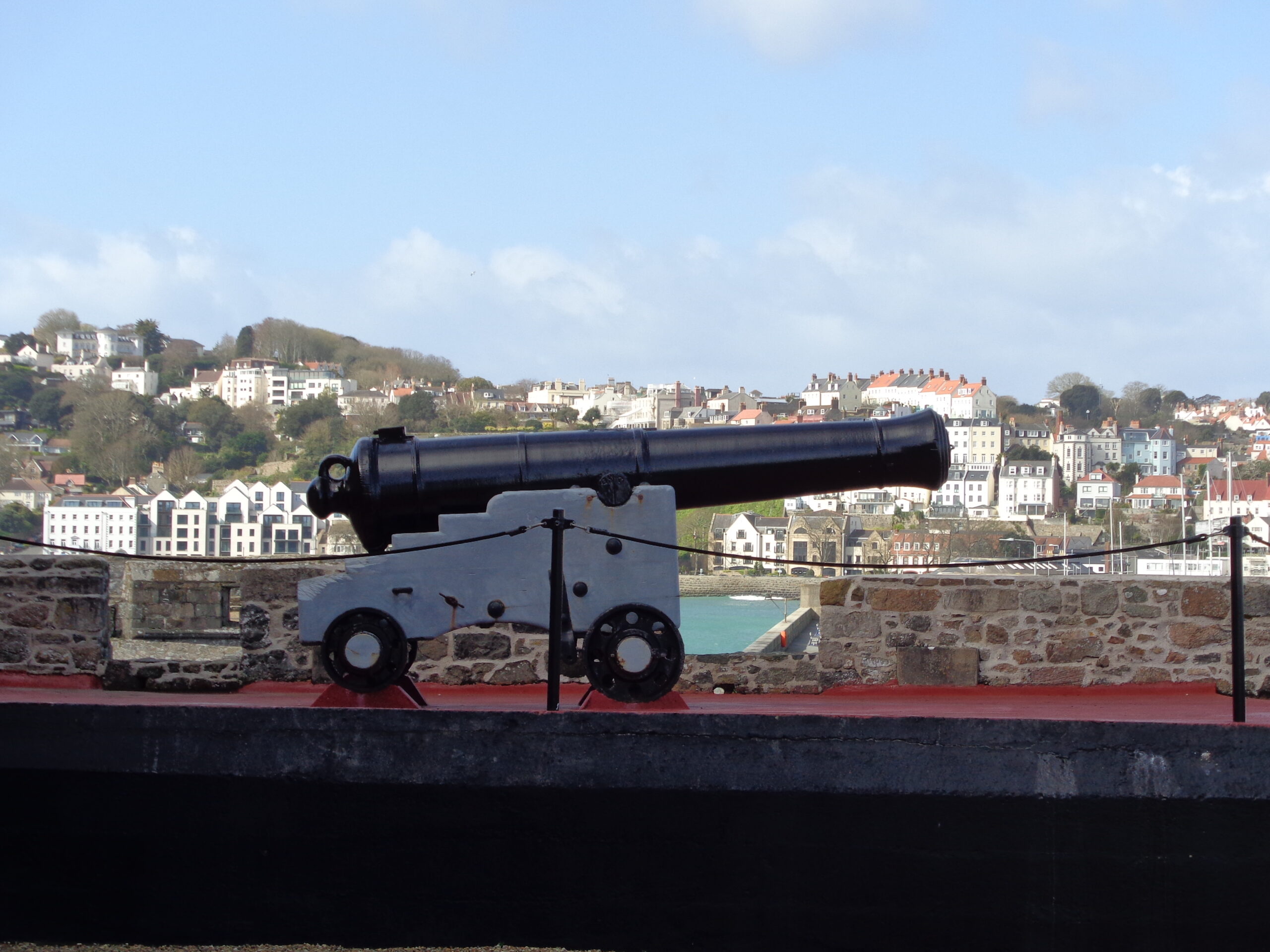
The Noon-day Gun is a 1799 Blomefield Pattern gun which would originally have fired a 32 pound (14.5 kilogram) ball. Blank charges are now used when it is fired each day during the open season at midday. It is the largest original artillery piece in the Castle that is still fired with live ammunition and is also the only gun to still retain its original wooden carriage.
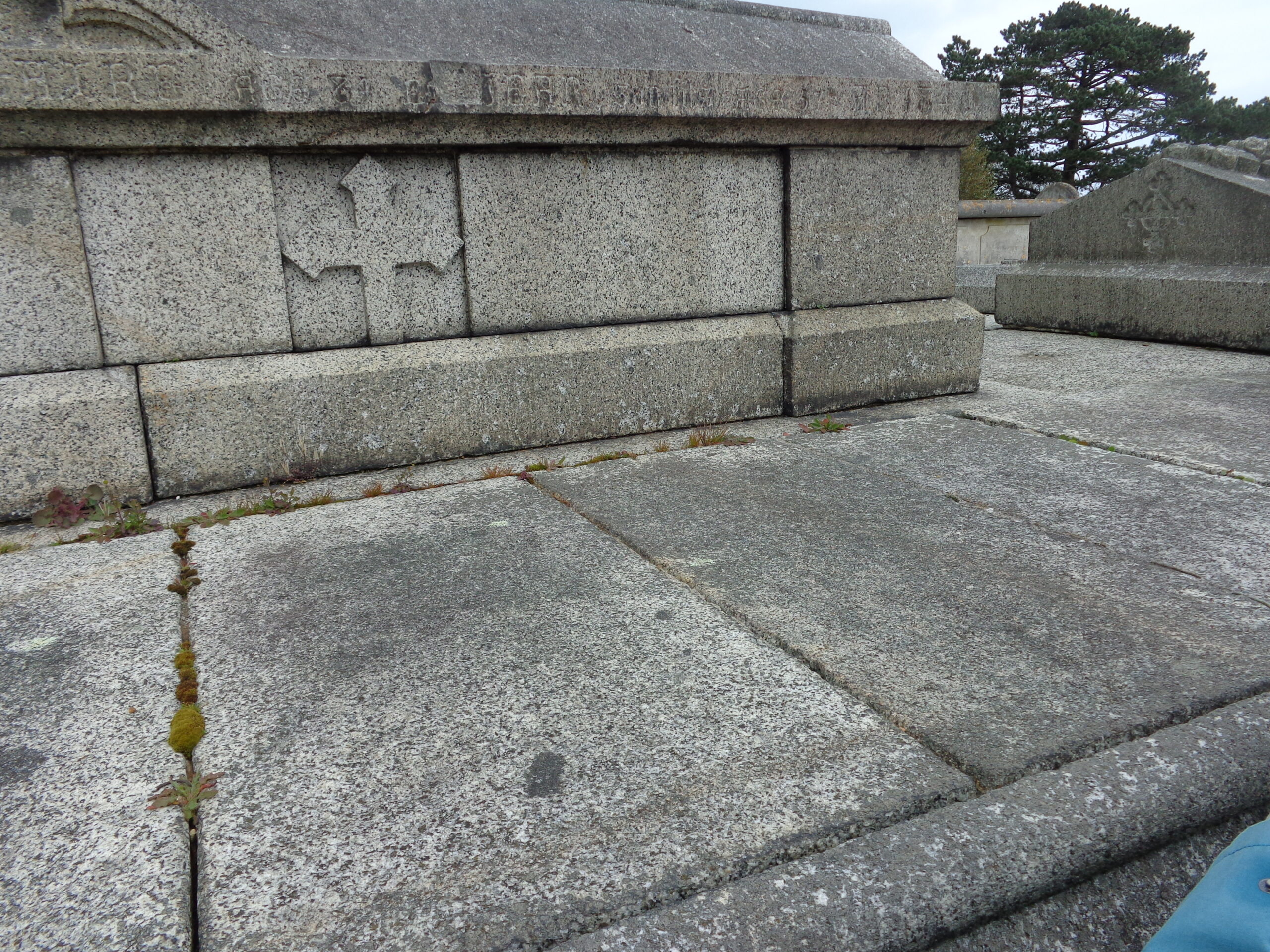
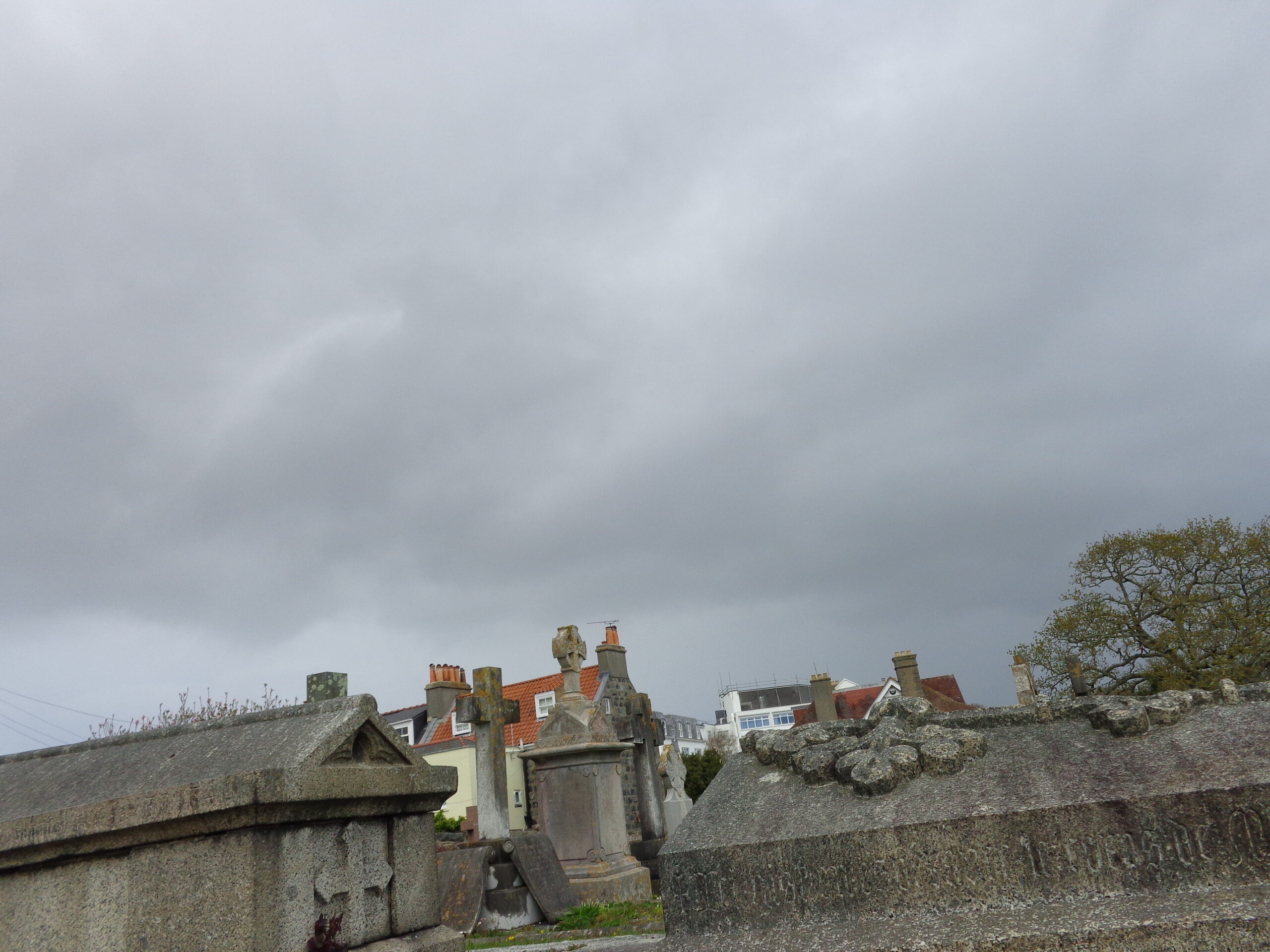
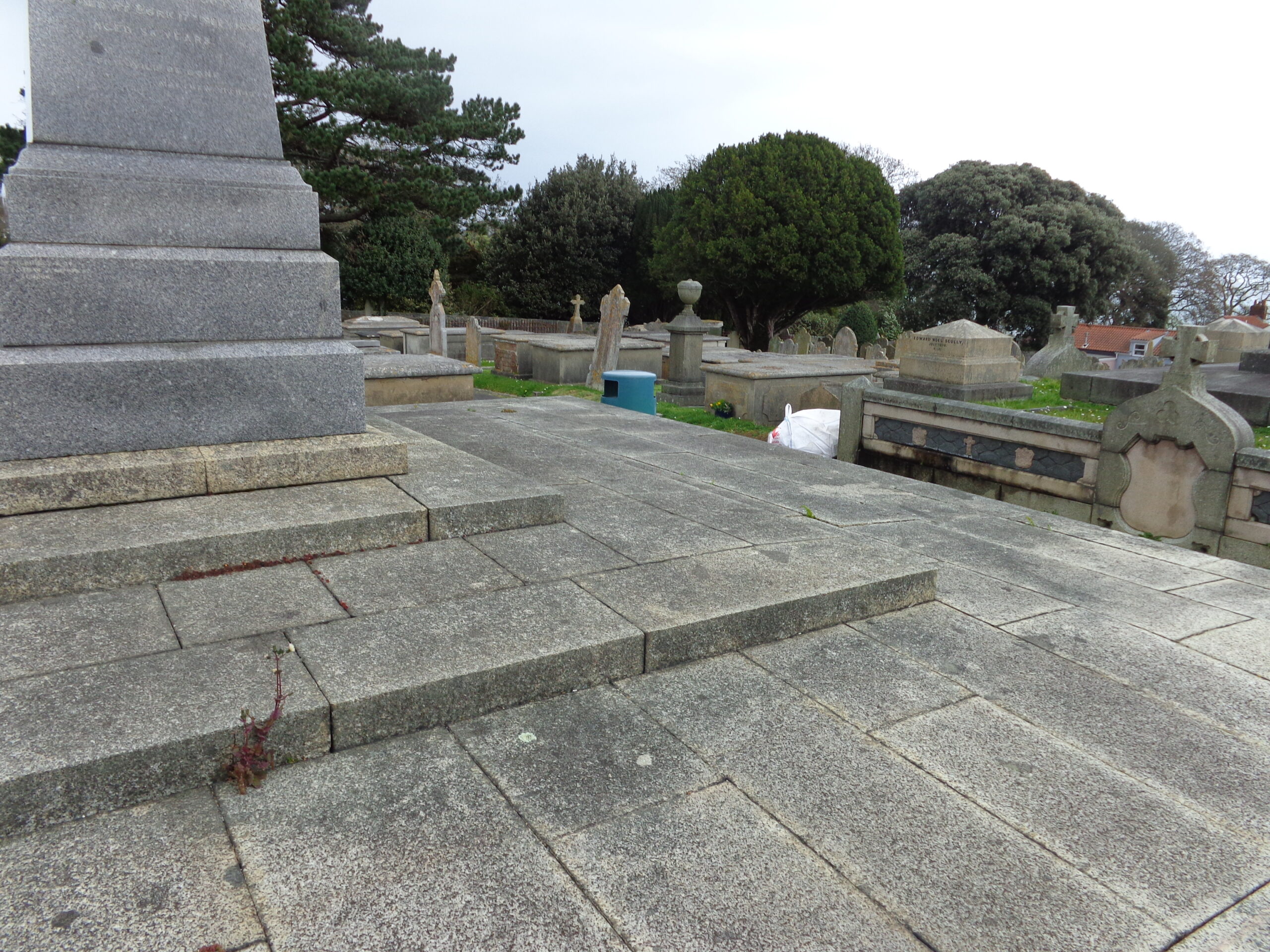
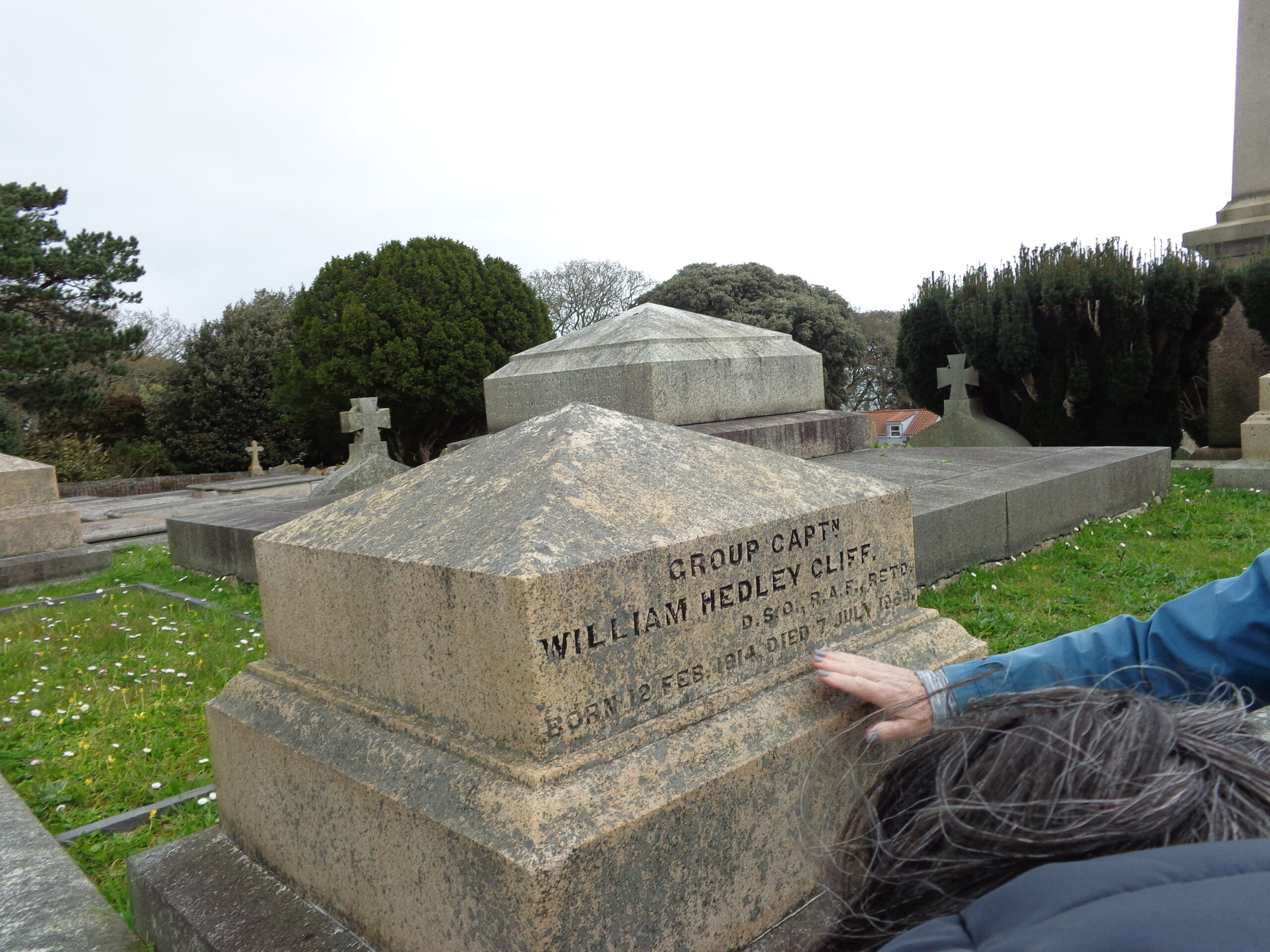
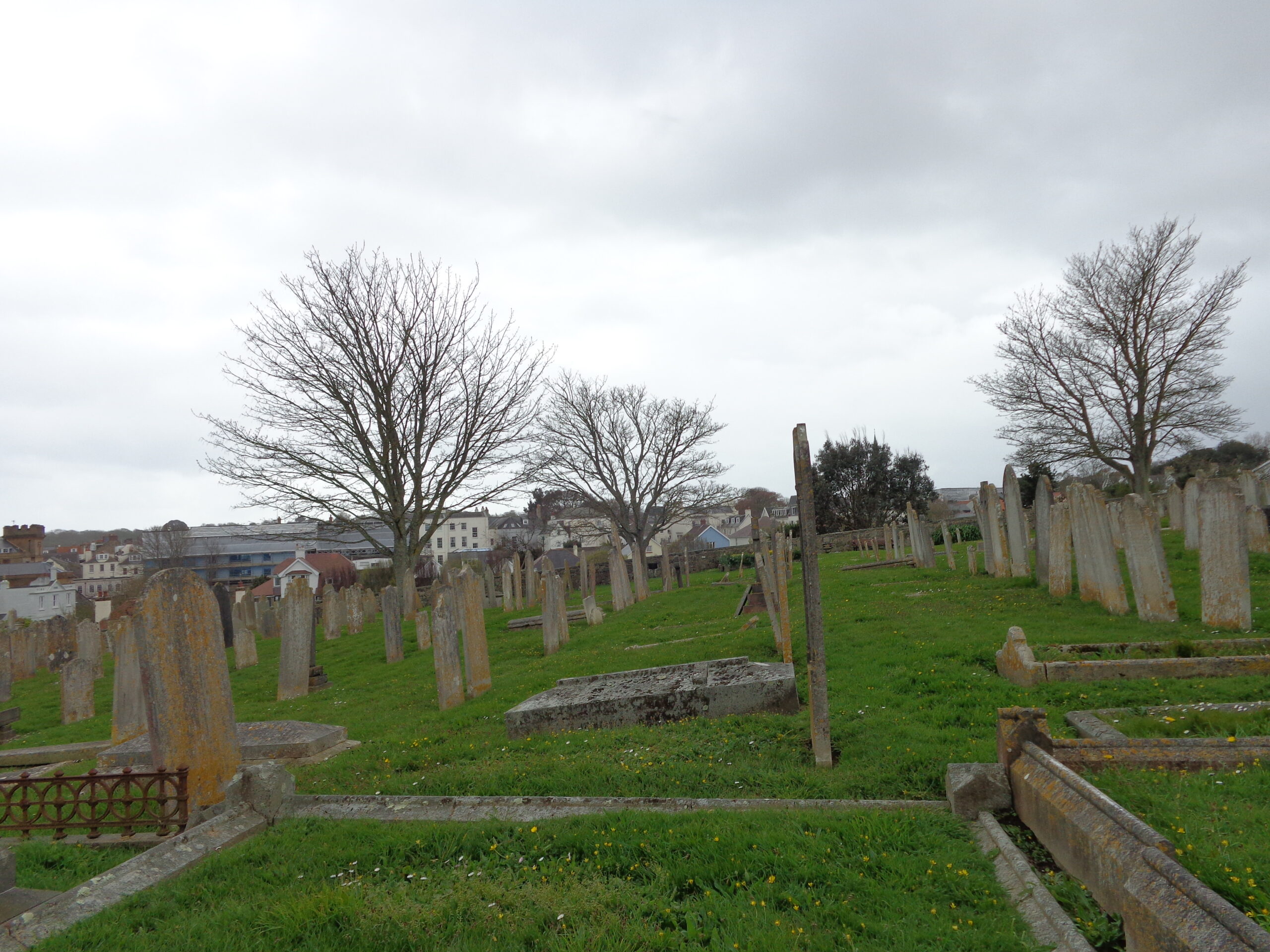
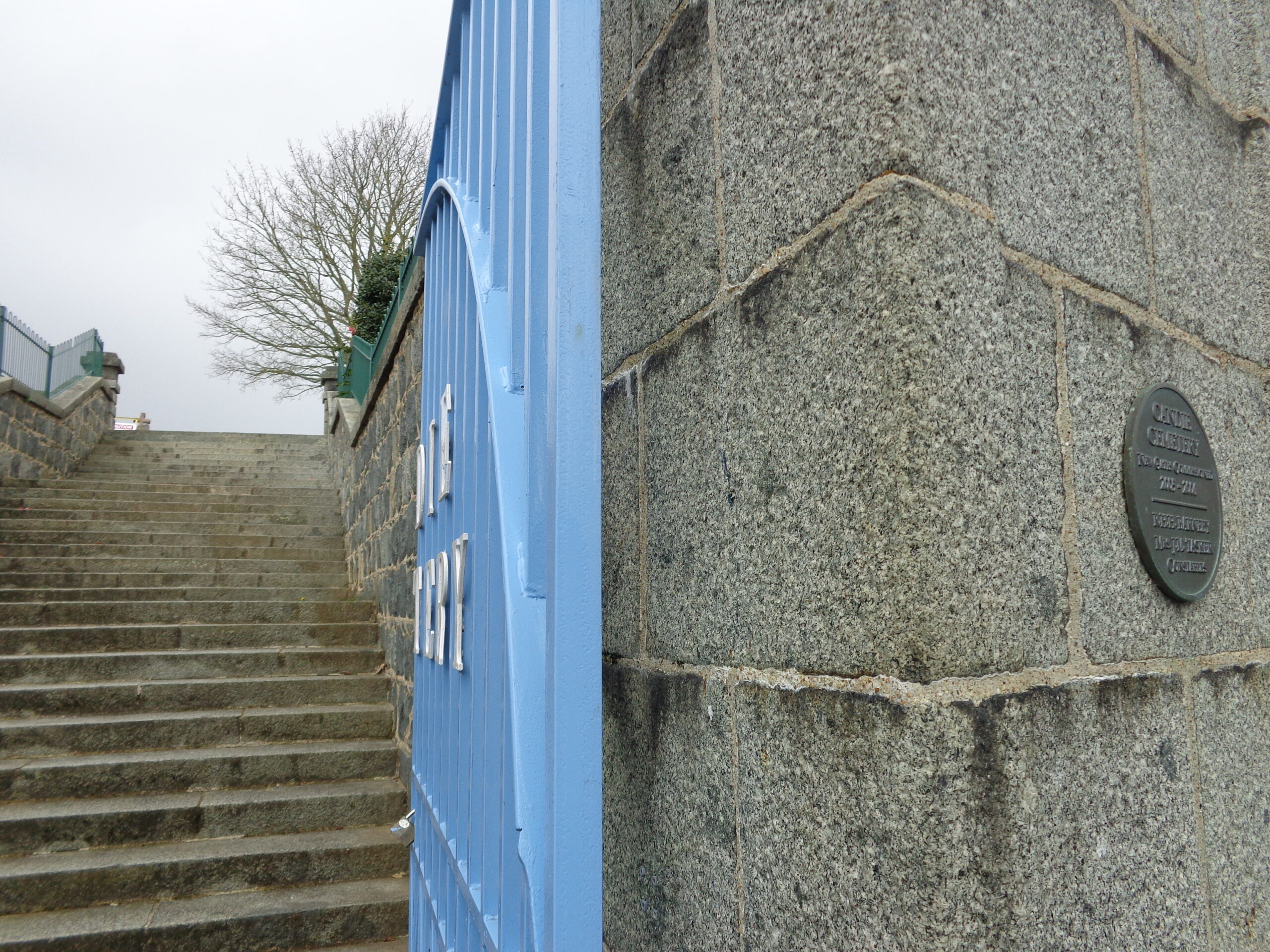
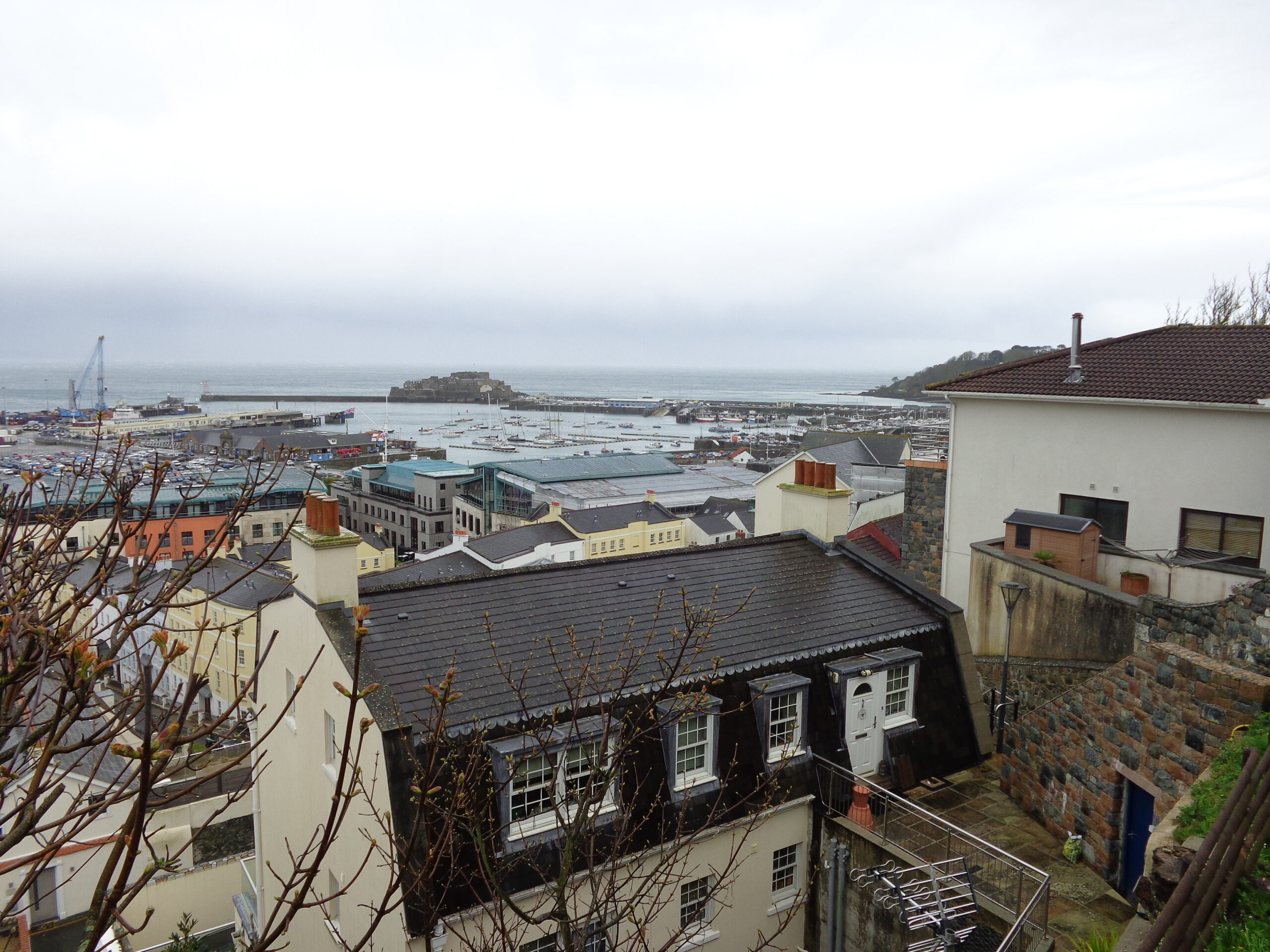
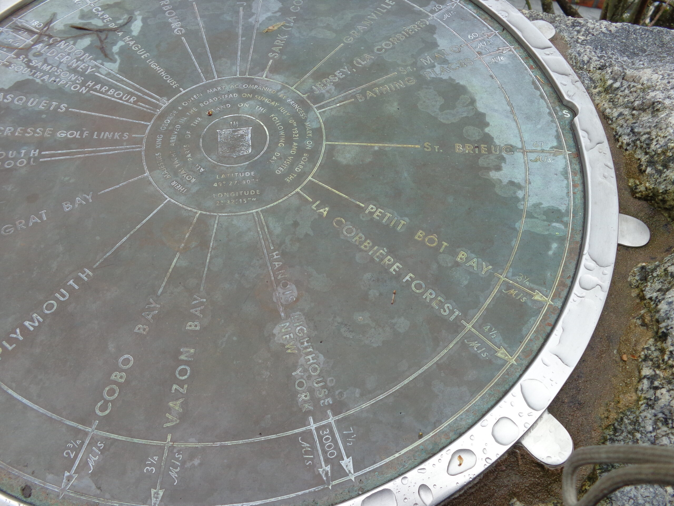
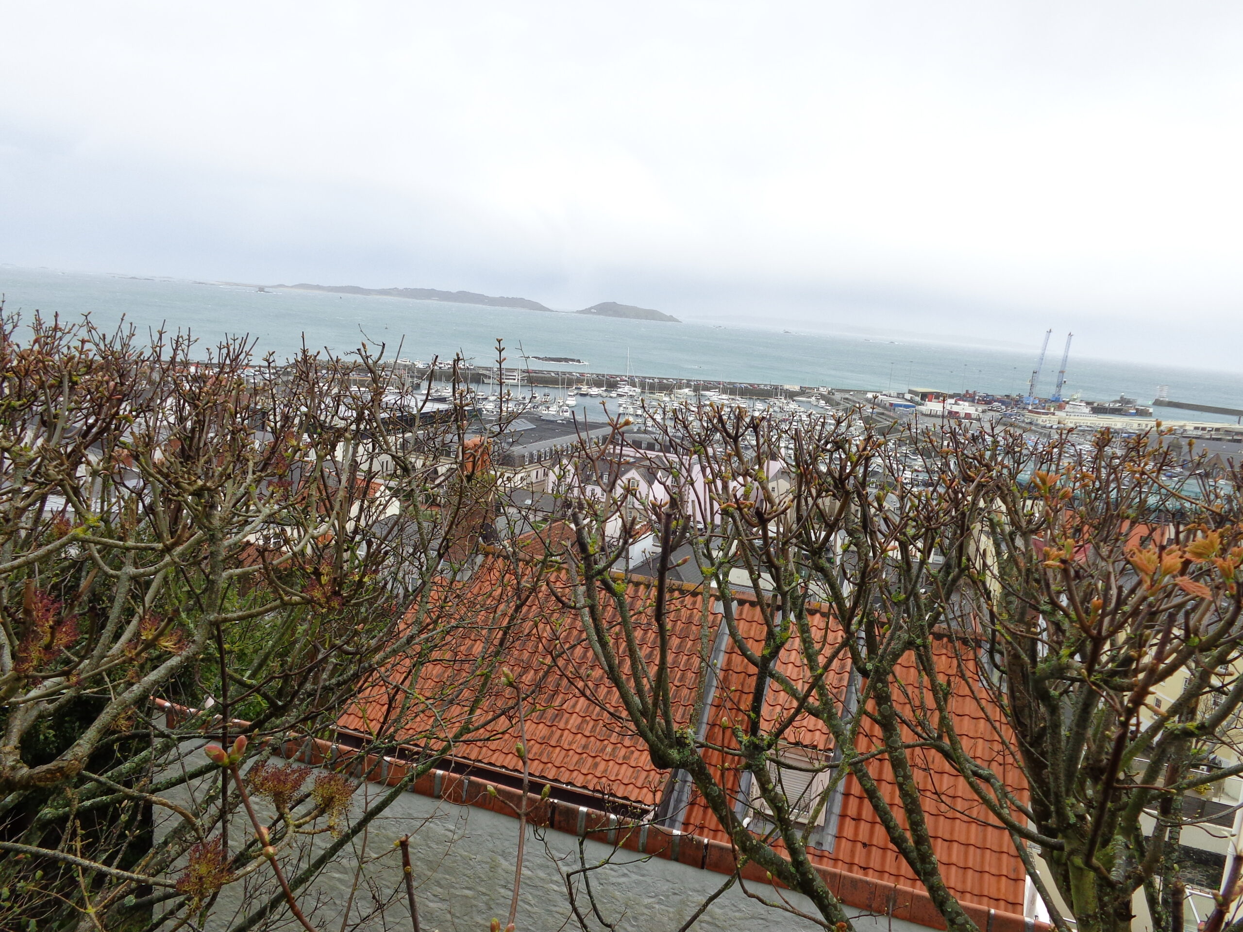
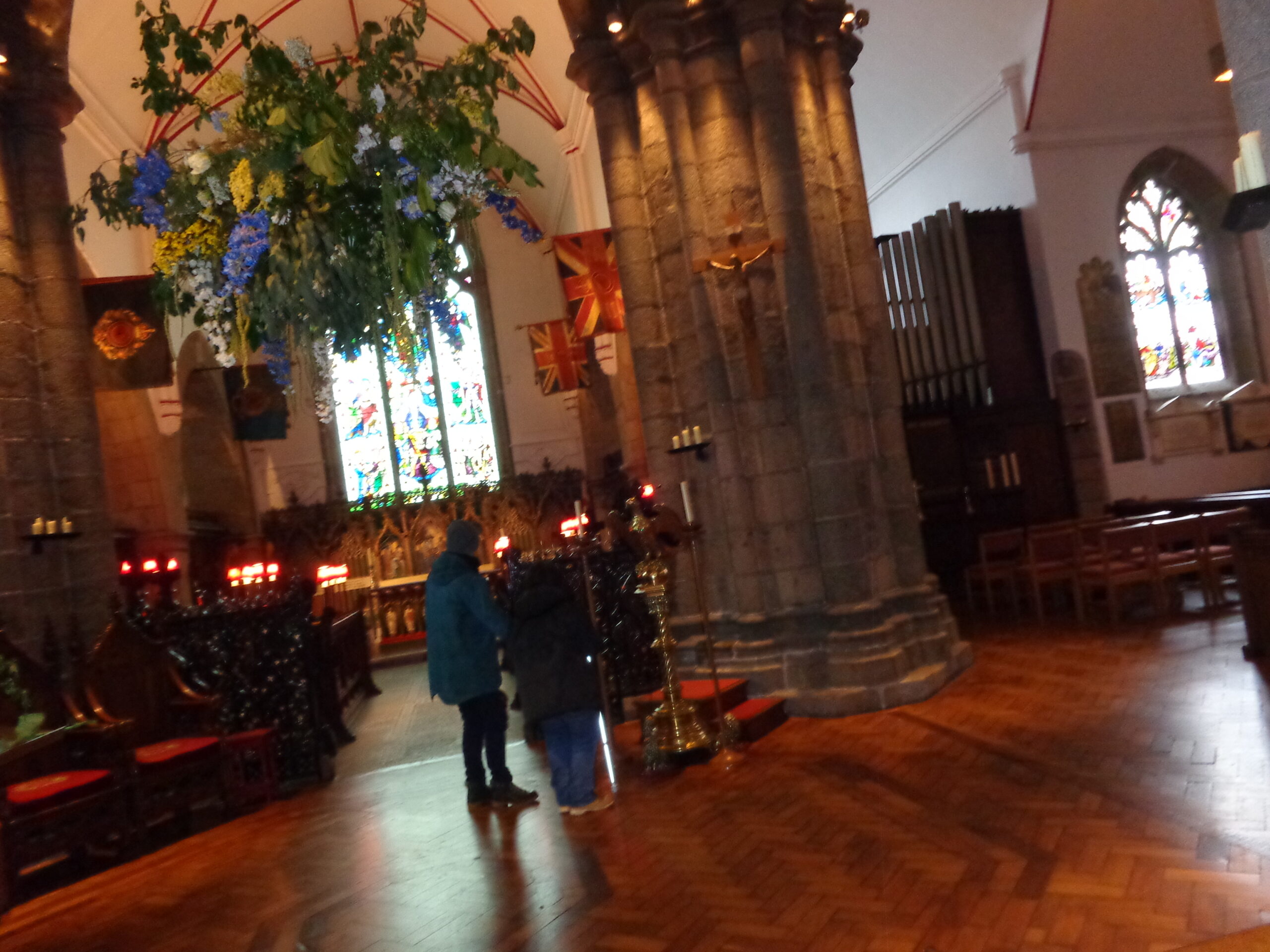
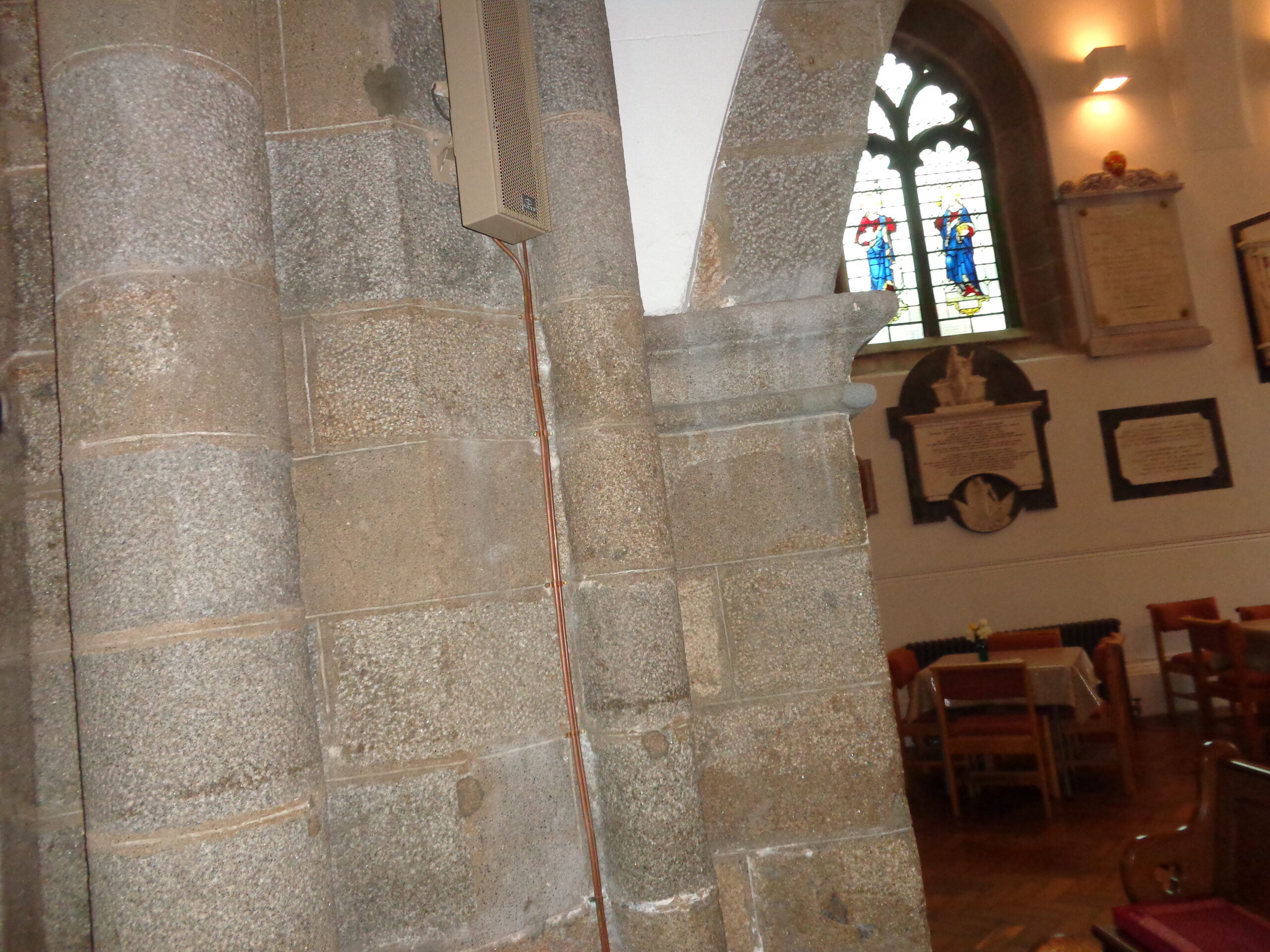
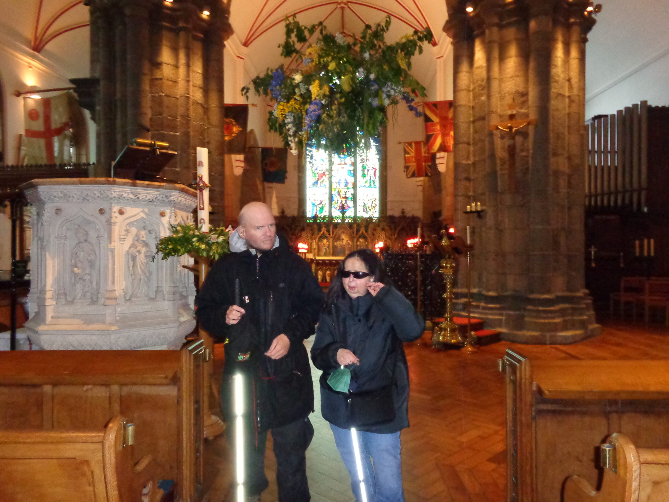
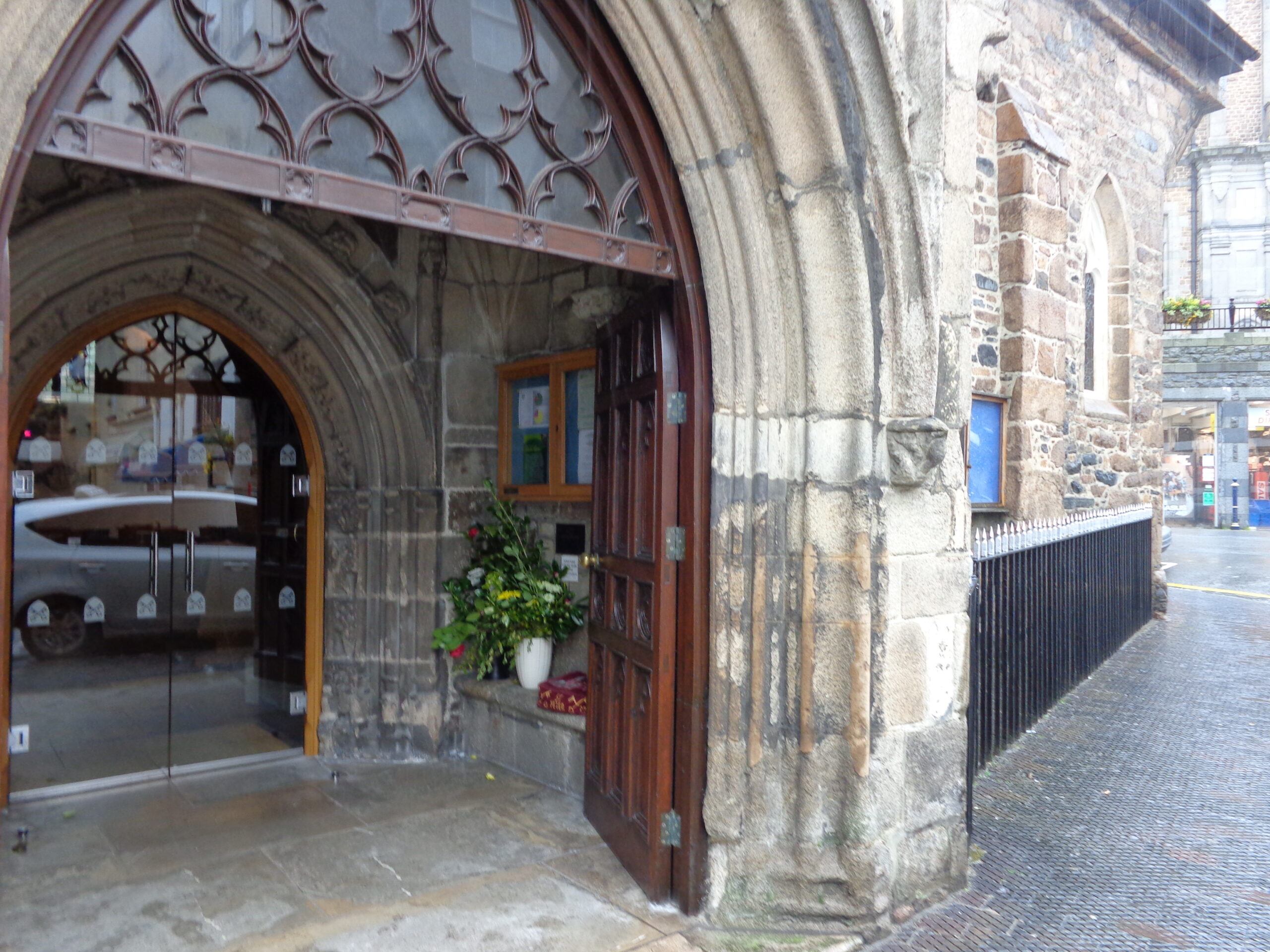
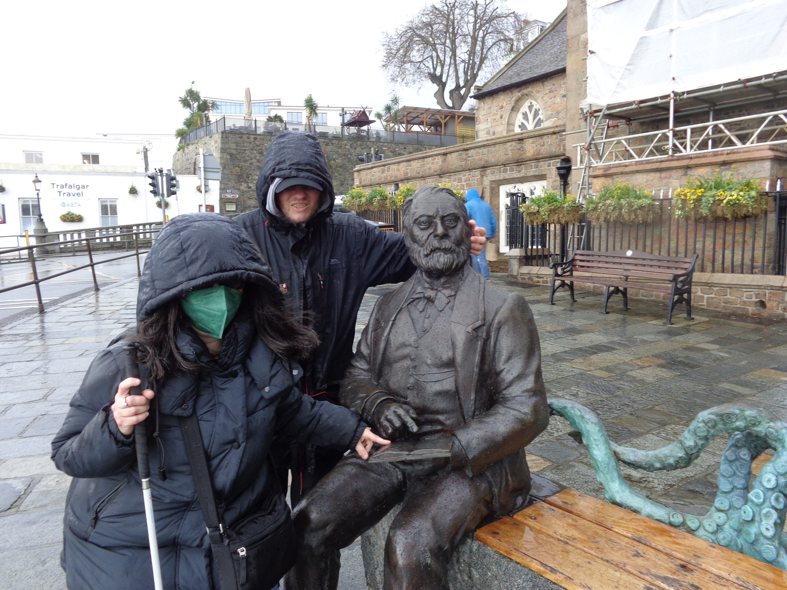
A rectangular granite tomb at Candie Cemetery. There is a cross carved on the side of the tomb and it has a pitched top. The tomb has an inscription around the top which can’t easily be read in the photo. Candie Cemetery, also referred to as Candie Road Church Cemetery, is known for its tomb graves.View across Candie Cemetery which opened in 1830. Two stone tombs can be seen in the foreground with various grave stones and monuments behind.A substantial stone monument with a central plinth at Candie Cemetery. The inscription on the plinth is mostly out of view. Beyond are rows of raised stone tombs mixed with more ordinary grave stones.A light-coloured gravestone with a square-profile and pyramid-shaped top. The inscription reads: “GROUP CAPTN. WILLIAM HEDLEY CLIFF, D.S.O., R.A.F., RETD., BORN 12 FEB. 1914, DIED 7 JULY 1989.” Captain William Hedley Cliff won the DSO for action during World War II. In 1958 he bought the lease to the small Channel Island of Jethou and opened it as a resort with around 5,000 visitors a year. At that time the island printed its own postage stamps which were sold to tourists. He sold the island five years later.Rows of weathered-looking gravestones at Candie Cemetery. Some of the gravestones are leaning or tilted and a few are surrounded by low stone borders. Leafless trees stand among the graves, and beyond the cemetery, buildings of St. Peter Port can be seen, many painted white or cream.Blue-painted metal gates at the entrance to Candie Cemetery. Beyond a long flight of around 50 steps leads up into the cemetery. A metal plaque to the right remembers the replacement of the cemetery gates in 2005-2006.Good view over the rooftops of St. Peter Port town towards the harbour. Lots of boats, mostly quite small, can be seen in the harbour. Two harbour cranes are also in view. At the far side of the harbour, Castle Cornet is visible, attached to the mainland by the harbour wall.A round metal topographic plate, at a look-out point, somewhere above the main town of St. Peter Port. It is engraved with place names and their distance in miles. For example: Jersey (La Corbiere), 20 miles, St. Malo, 60 miles, and Cobo Bay, 2¾ miles. Its purpose is to help people identify notable places visible from this viewpoint. It was erected to commemorate a visit to Guernsey by King George V and Queen Mary in 1921.Another view over St. Peter Port towards the harbour. The island of Herm is clearly visible in the distance. In the further distance, to the right, the island of Sark is also just visible in the haze. Red and black tiled rooftops can be seen below and immediately in front is a leafless hedge with spring buds ready to open.Interior of the Town Church, the parish church of St Peter Port. Tatiana can be seen standing with a tour guide in front of a brass lectern in the form of an eagle. The photo is looking towards the altar where rows of candles have been lit. There are stained-glass windows behind. A large stone column and an organ can also be seen. There is wooden parquet flooring. This church was completed in its current form by 1466, but a small chapel is known to have existed here in 1020. As well as being the parish church of St. Peter Port this is also considered to be Guernsey’s main church.A stone pillar and archway inside the Town Church. To the right a stained-glass window can be seen with several memorial plaques attached to the wall beneath. There are chairs, tables and pews in front.Tony and Tatiana near to the stone pulpit decorated with carved figures in Town Church. Greenery and flowers are hanging from above. The altar with candles lit is visible in the background. Various flags are hanging from columns inside the church: two are Union Jacks with an extra emblem in the centre.The main entrance to Town Church. There is a stone archway with large heavy wooden doors. Within there is a porch with a second set of glass doors beyond. There is a vase of flowers and a noticeboard inside the porch. The old stone-exterior-walls of the church can be seen.Tony and Tatiana wrapped up against the cold and wet evening weather, beside a bronze statue of 19th century writer, Victor Hugo, who is sat on a bench. Victor Hugo is depicted with a beard, wearing a suit and bow tie, and holding a book. The tentacles of a sculpted octopus curl around the back of the bench: this is a character from one of Hugo’s novels. Tony and Tatiana are touching the statue.
Thursday, 13th April 2023
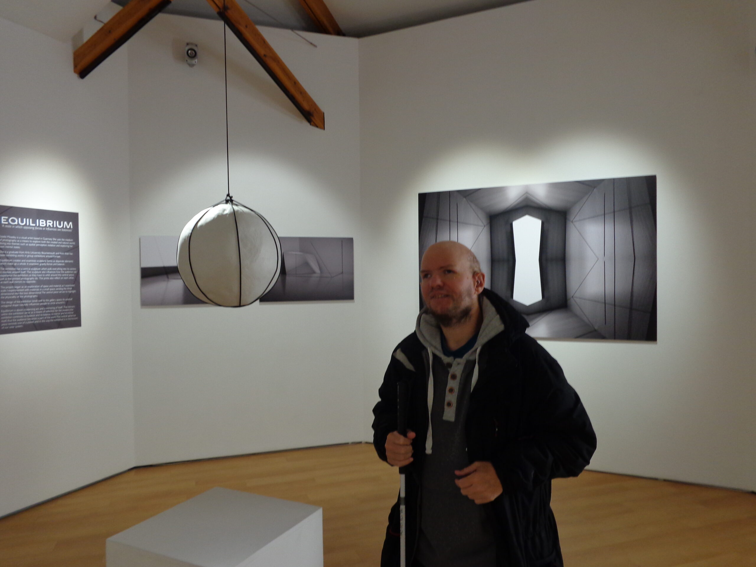
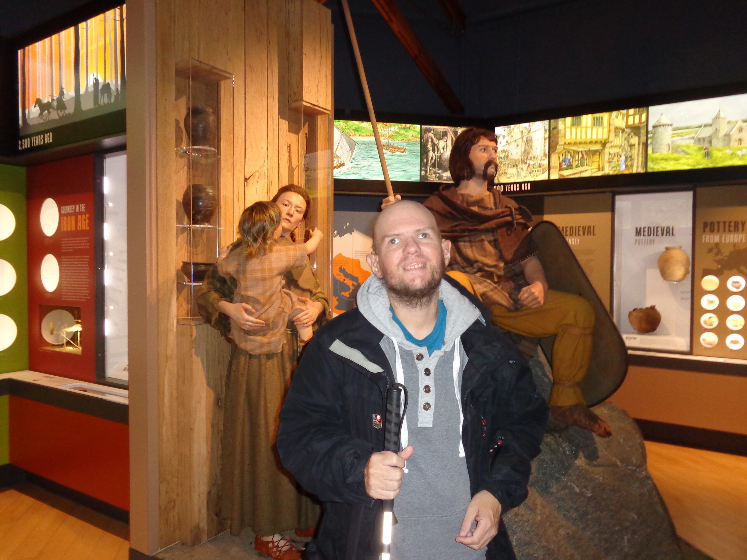
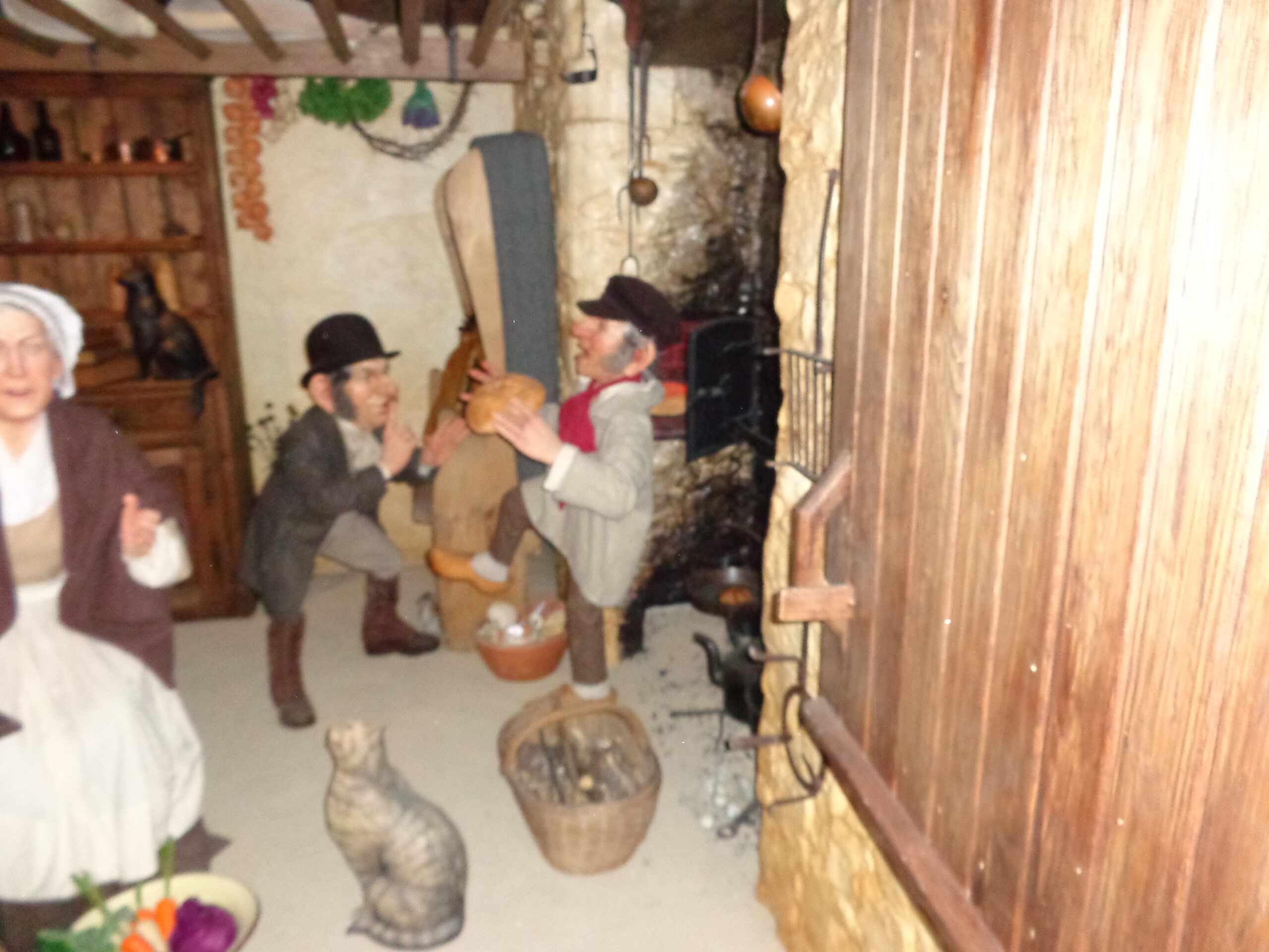
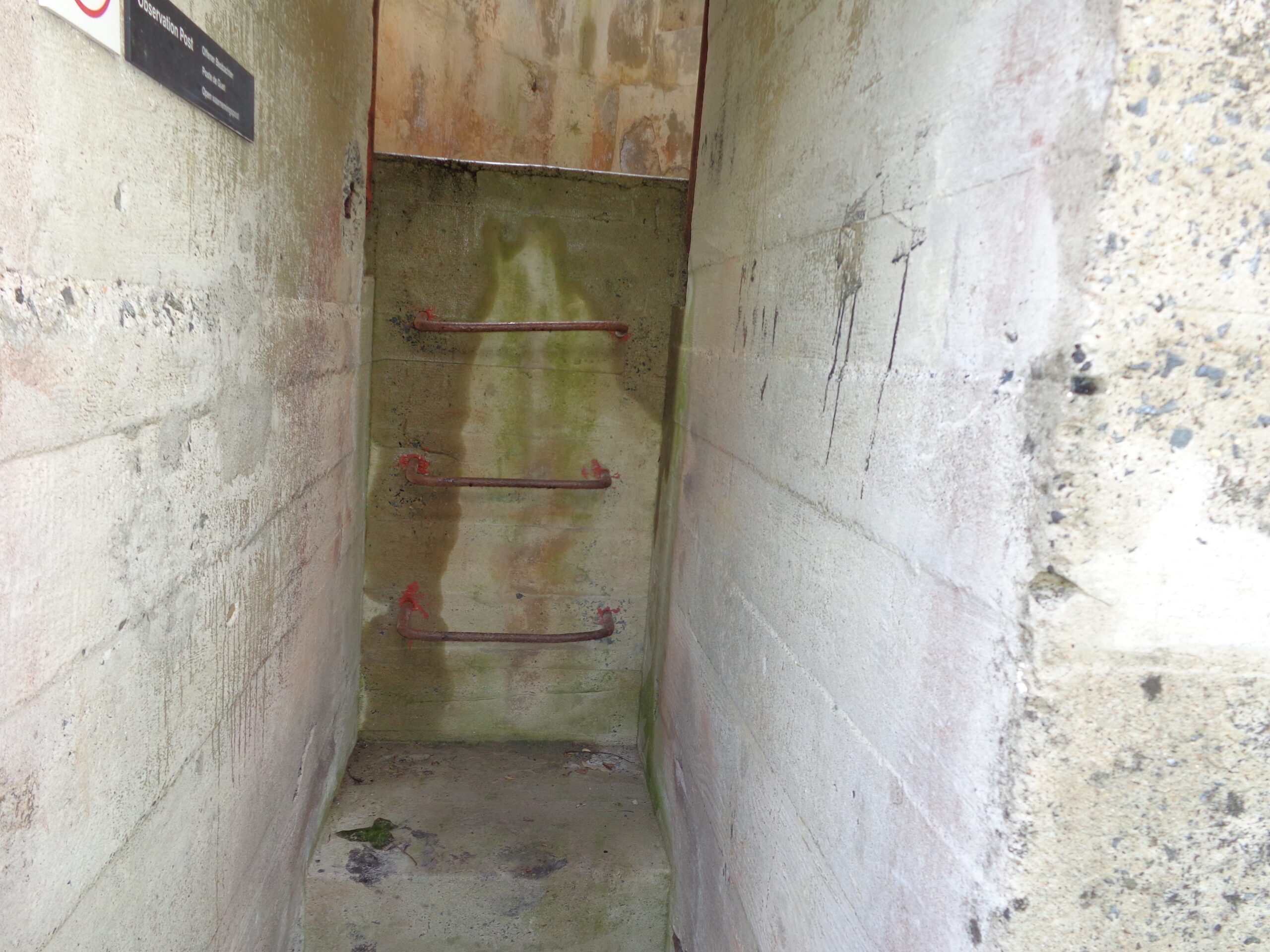
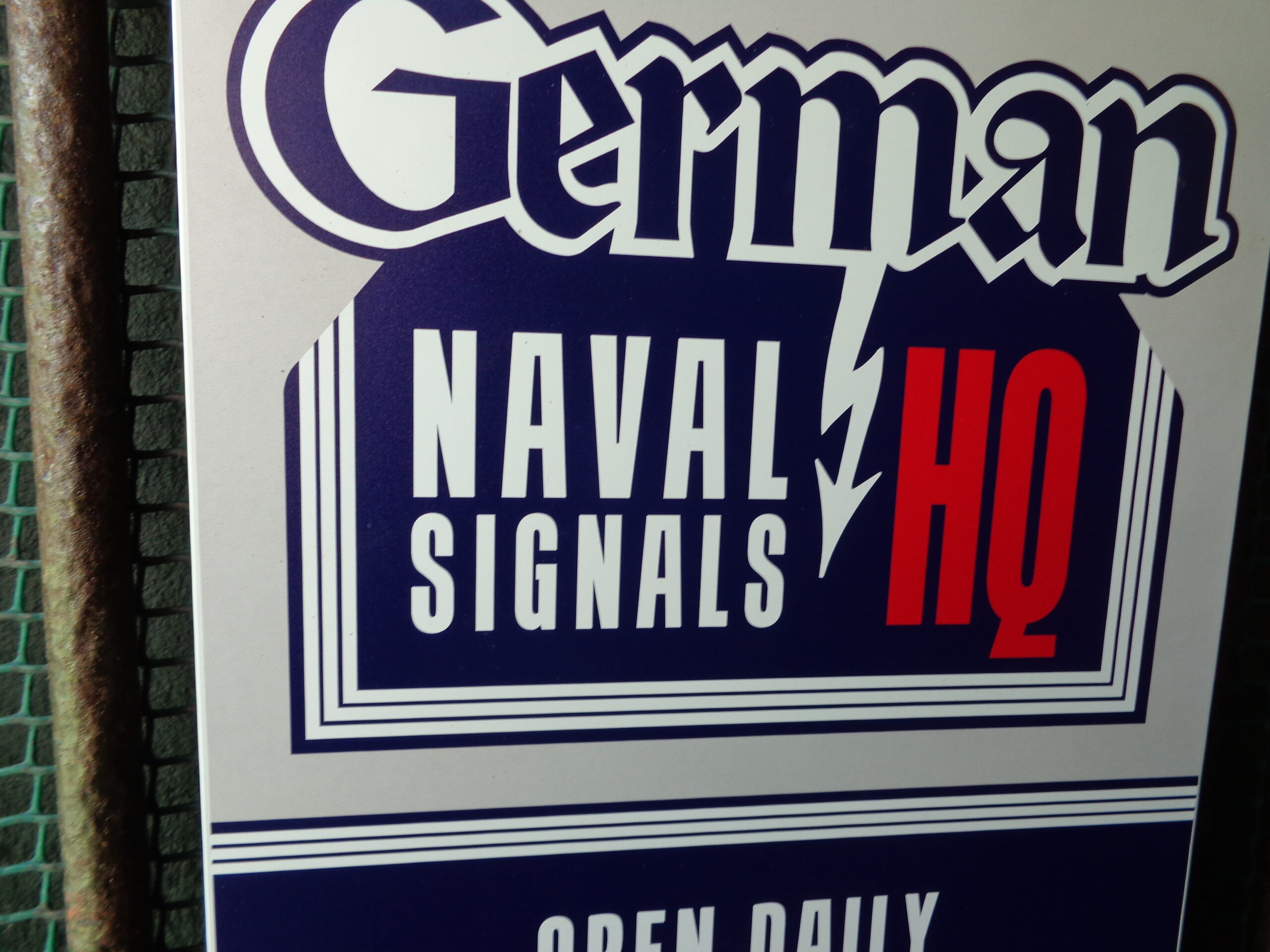
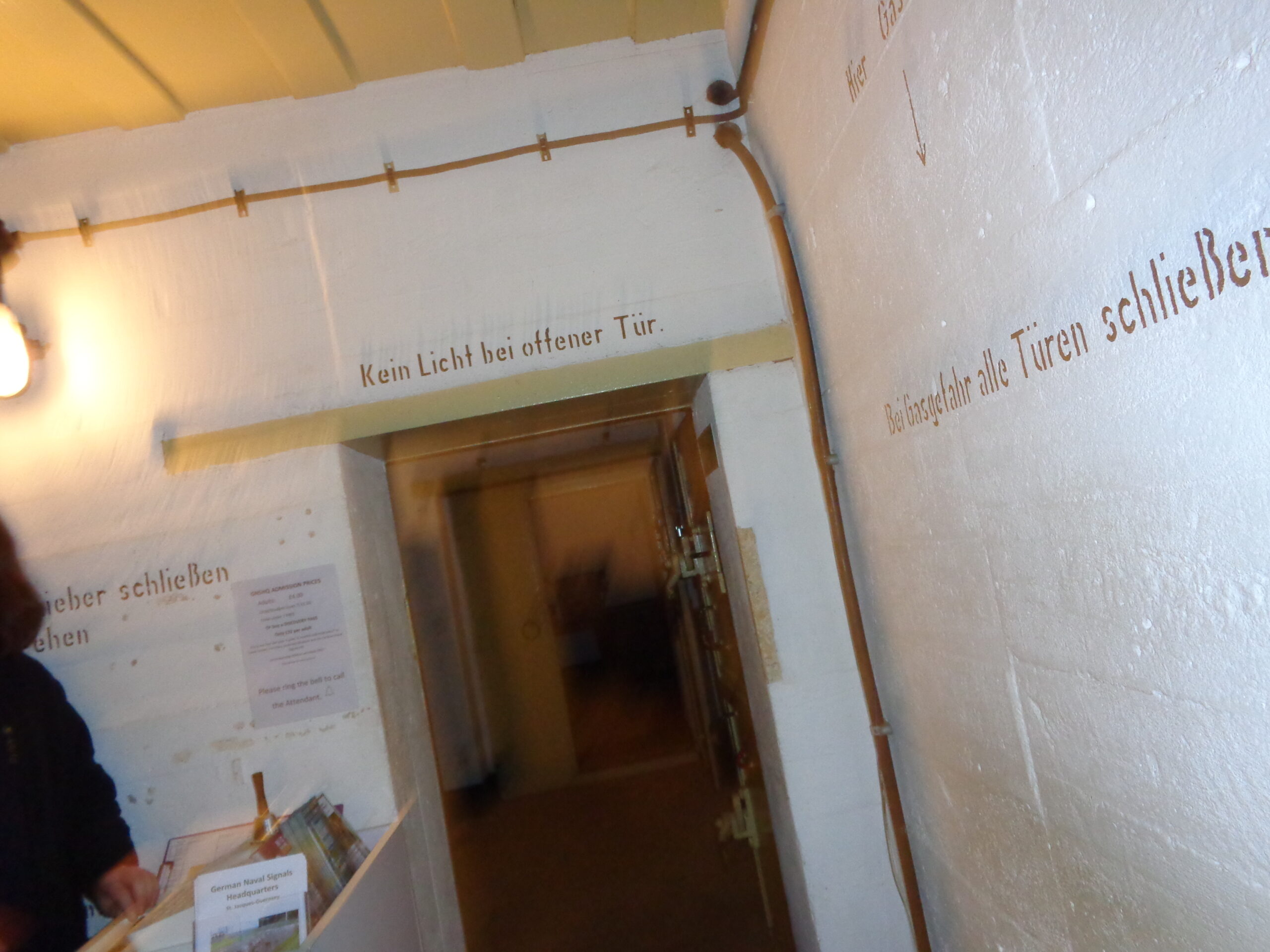
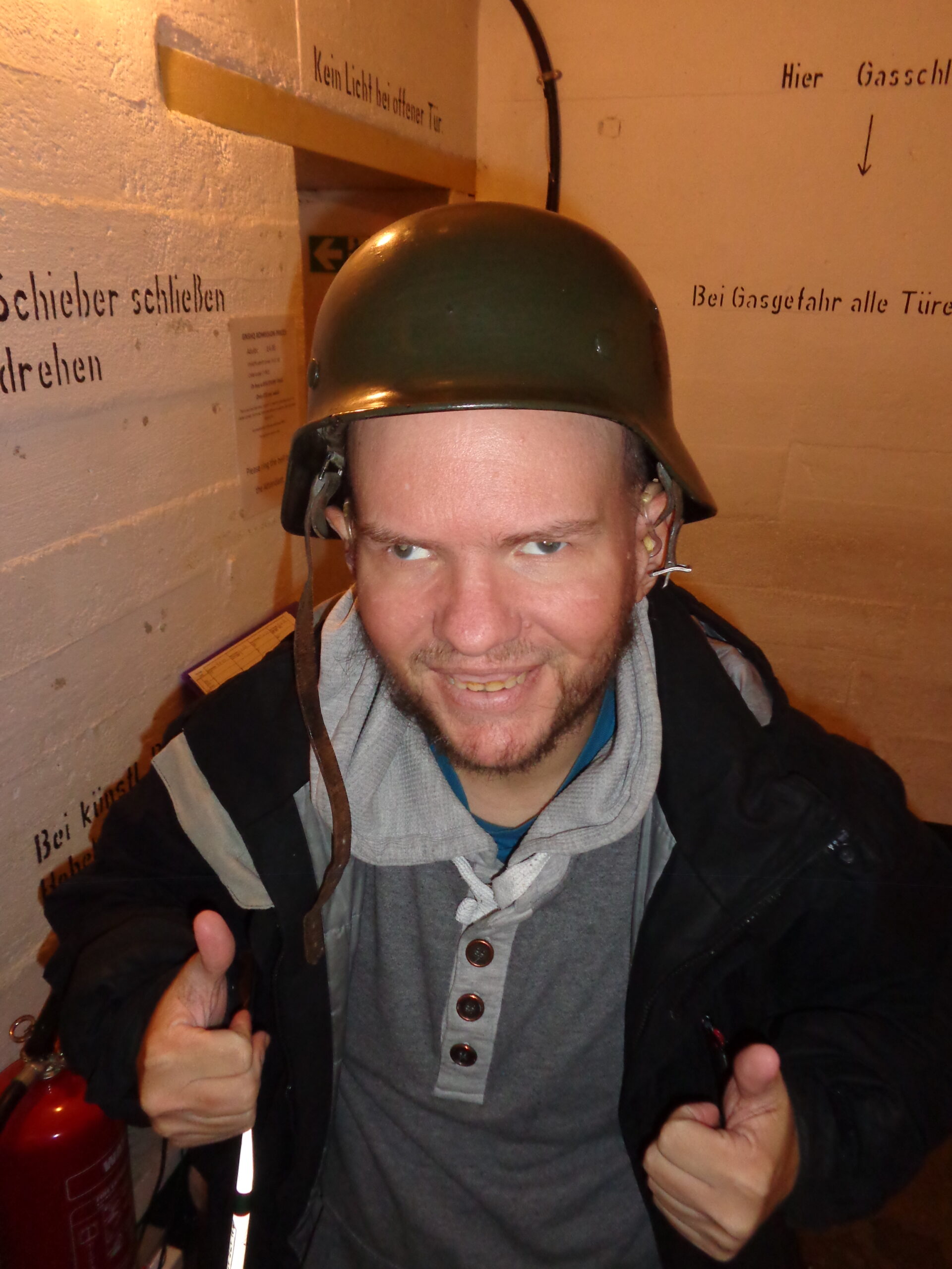
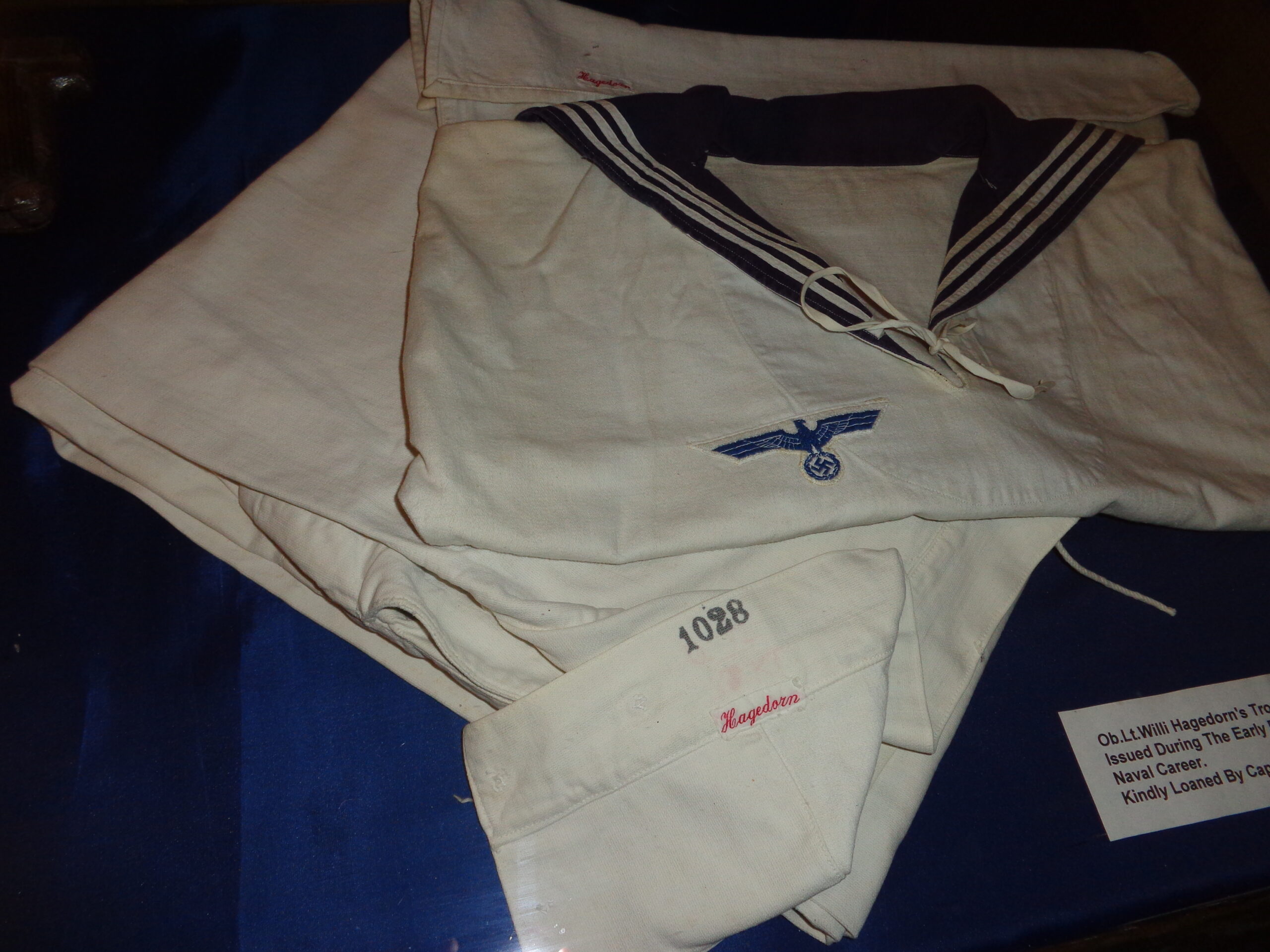
Tony in a room inside the Guernsey Museum and Art Gallery. A white sphere is hanging from the ceiling supported by black cord. Abstract monochrome artworks are displayed on the walls. There is an information board titled “Equilibrium”, which might be the title of the collection of artworks on display.Displays about Guernsey at different points in its history at Guernsey Museum and Art Gallery. To the left is a display about Iron Age Guernsey and on the right a room dedicated to Medieval Guernsey. In the foreground are mannikins in Iron Age dress. There is a man holding a spear and shield. He is wearing a brown cloak. Next to him is a woman holding a child. She is wearing a dress made of coarse yellow-brown cloth.Re-creation of a historic kitchen at Guernsey Museum and Art Gallery. There is a mannikin of a woman in a bonnet and apron on the left. Two male mannikins appear to be talking to the right. One of the men is holding a loaf of bread. One man is wearing a top hat and the other a cap. There is a fireplace to the right and a dresser at the back of the room. There are two cats: one sitting on the floor and the other on the dresser. This is perhaps a scene from the 18th or 19th centuries.Entrance to the German Naval Signals Headquarters in St. Peter Port. There is a short concrete passageway with three metal rungs embedded in the far wall. A modern sign says Observation Post. The rough concrete walls are stained with algae. This was the headquarters for the German Naval Commander of the Channel Islands during the Second World War as well as the main communications centre. All the important radio signals traffic for the German Forces in the Channel Islands was handled here. The Channel Islands Occupation Society has refitted one of the bunkers as a museum. It is situated in St. Jacques, St. Peter Port, next door to La Collinette Hotel.A modern logo sign that reads “German Naval Signals HQ”.Thick white painted concrete walls inside the German Naval Signals Headquarters museum. There is a square opening in the concrete wall in front, which is covered with a metal shutter, except for a small opening in the centre. A room is just visible beyond.Still inside the German Naval Signals Headquarters bunker. A small room with white-painted concrete walls. There is a reception desk to the left. Pipes are attached to the walls. There is writing in German on the walls. This includes “Kein Licht bei offener Tür”, which translates as “No light when the door is open”. Also, “Bei Gasgefahr alle Türen schließen”, meaning “In case of gas danger, close all doors”.Tony wearing a green German military helmet, smiling and giving two thumbs up. There are again white painted concrete walls with instructions in German written on them.A white German Navy uniform displayed at the German Naval Signals Headquarters museum. The shirt is embroidered with eagle and swastika insignia. There is an arm band embroidered with number “1028” and the name “Haagedorn”. This uniform dates from World War II when the Channel Islands were under German occupation. The uniform belonged to Oberleutnant Willi Hagedorn. Oberleutnant zur See is the highest rank of Lieutenant in the German Navy.
Guided tour around Guernsey
Afternoon of Friday, 14th April 2023
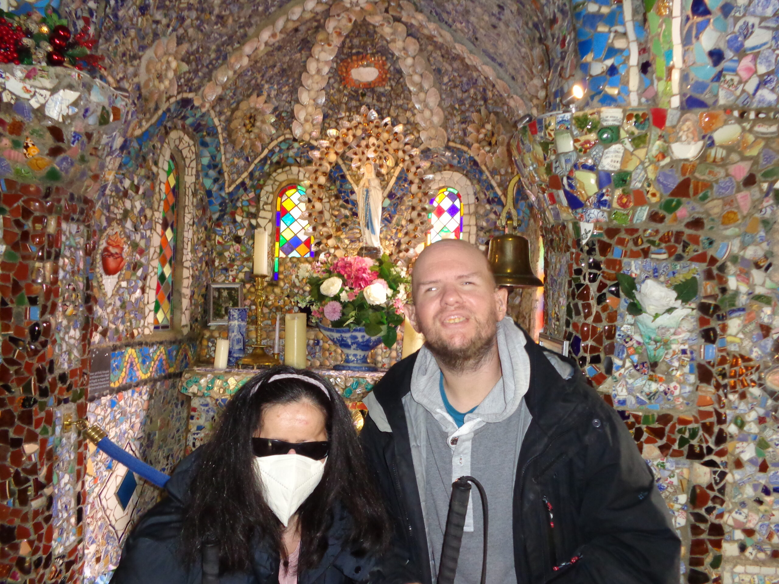
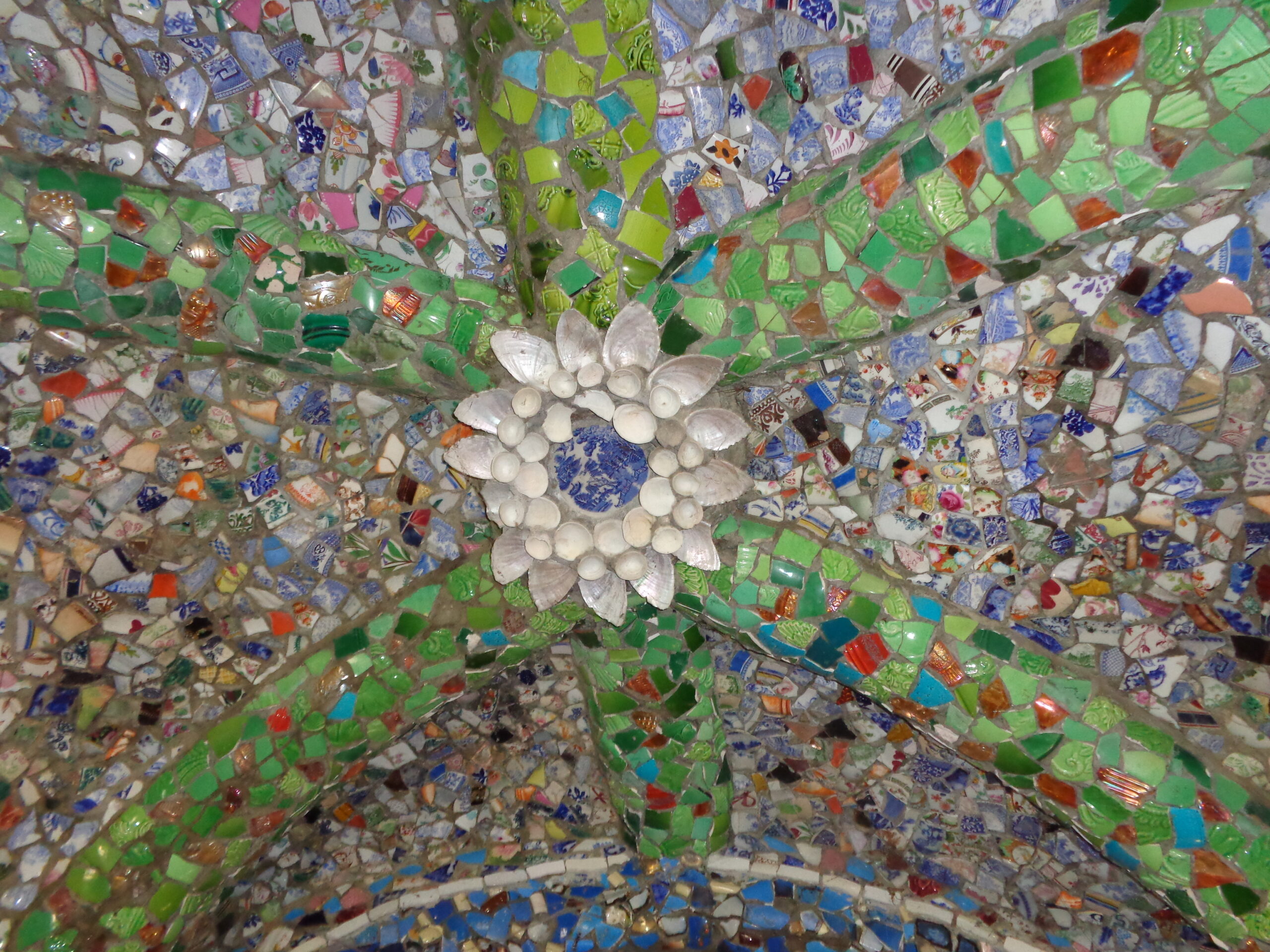
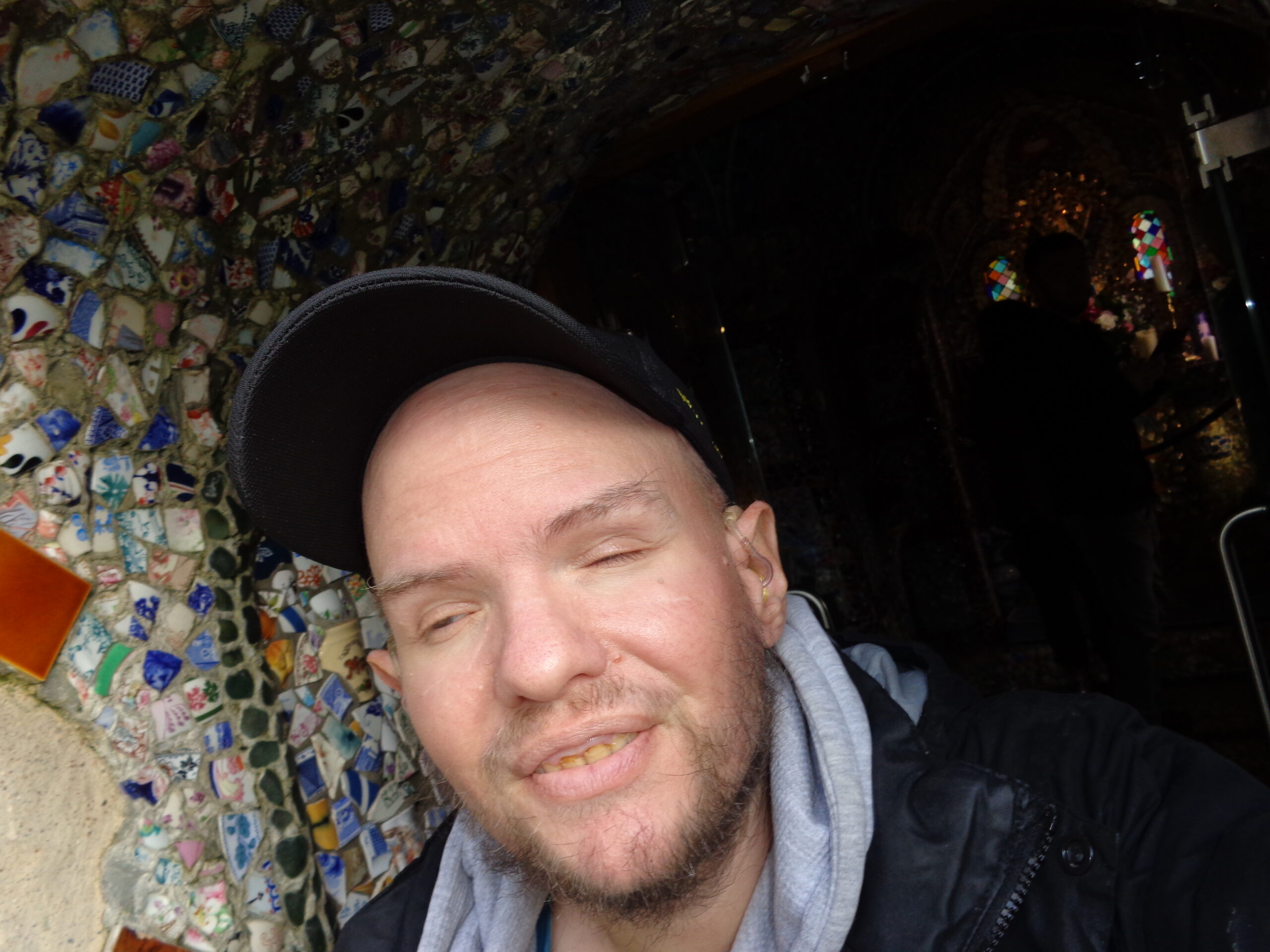
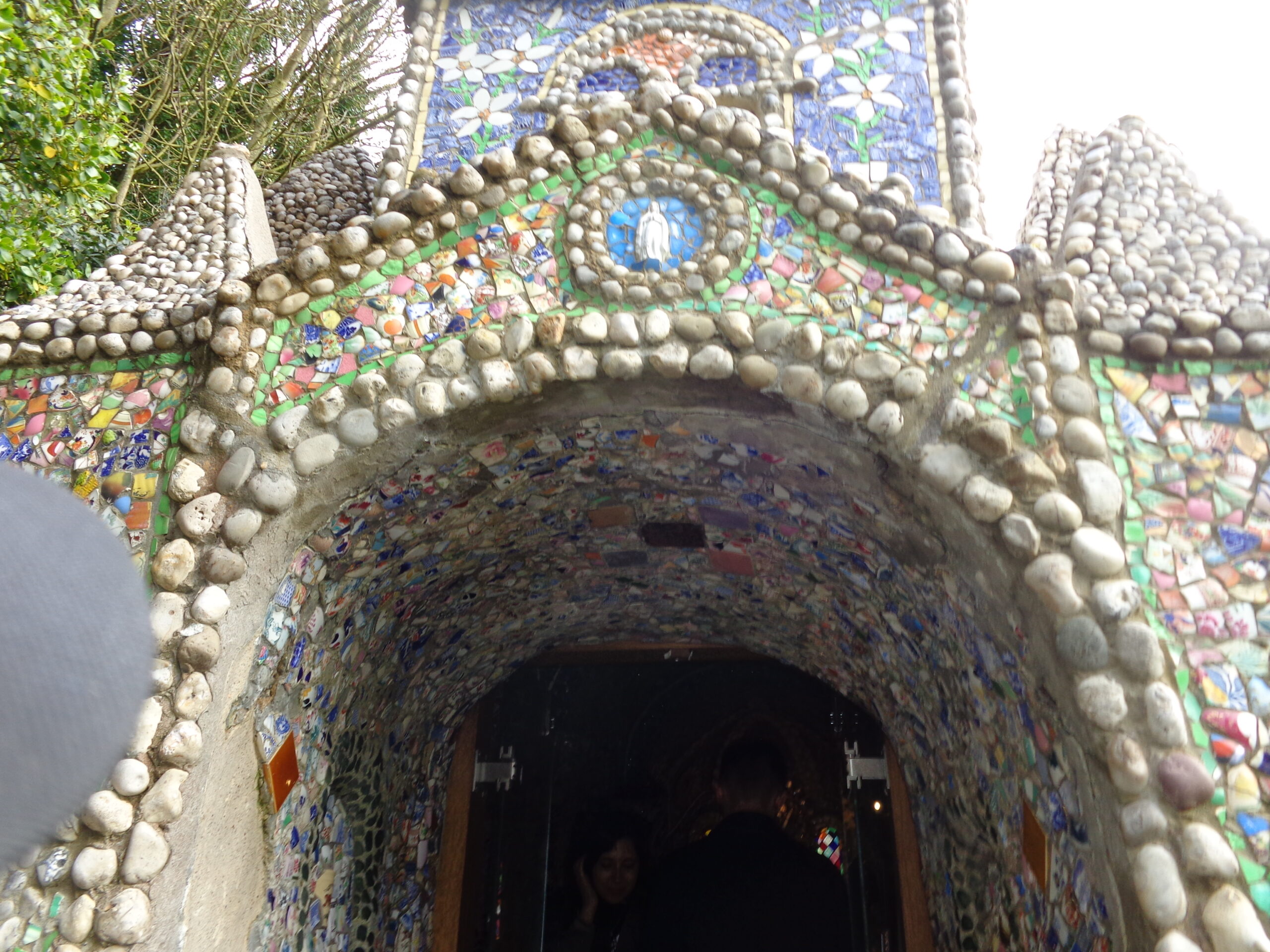
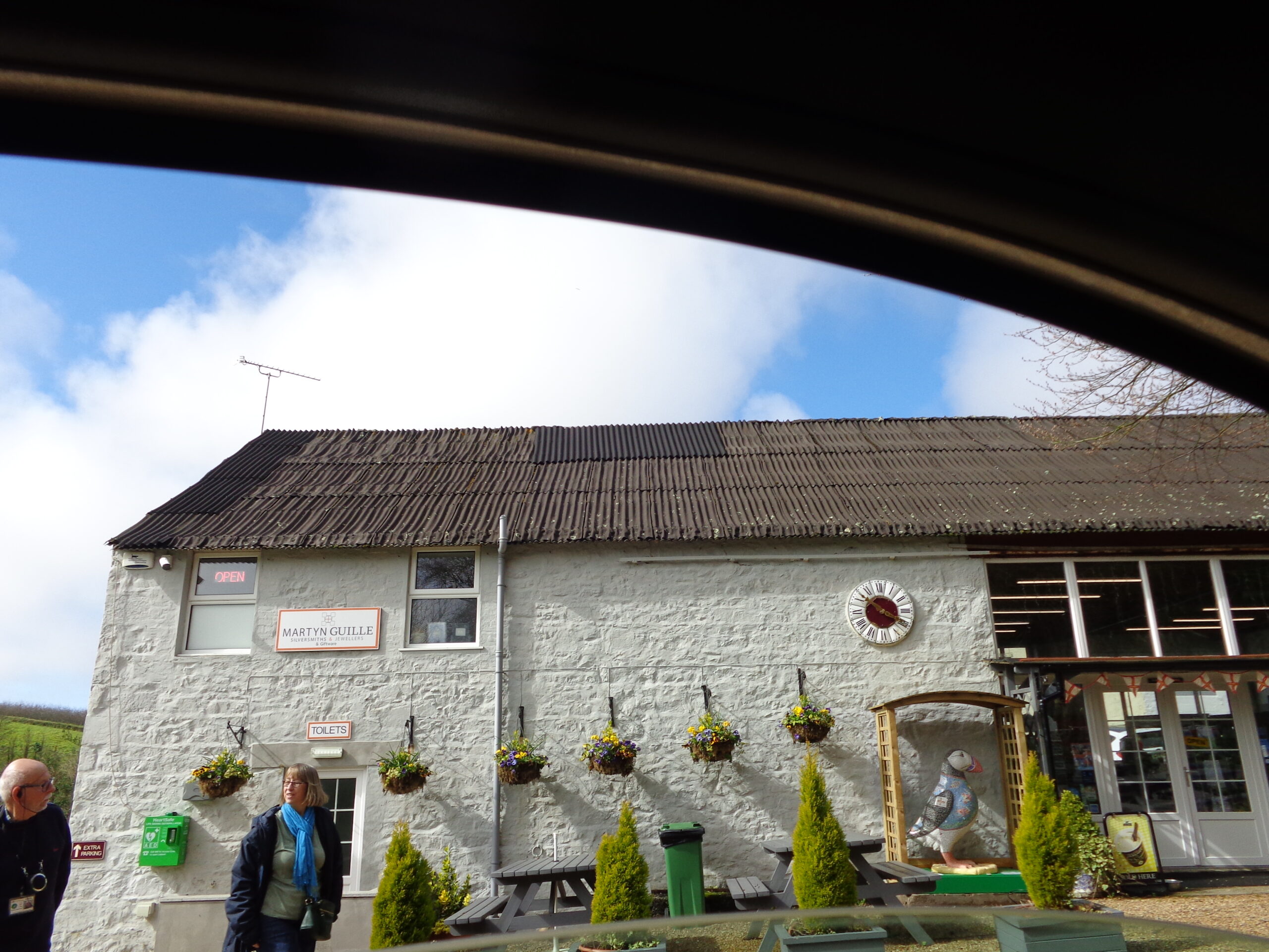
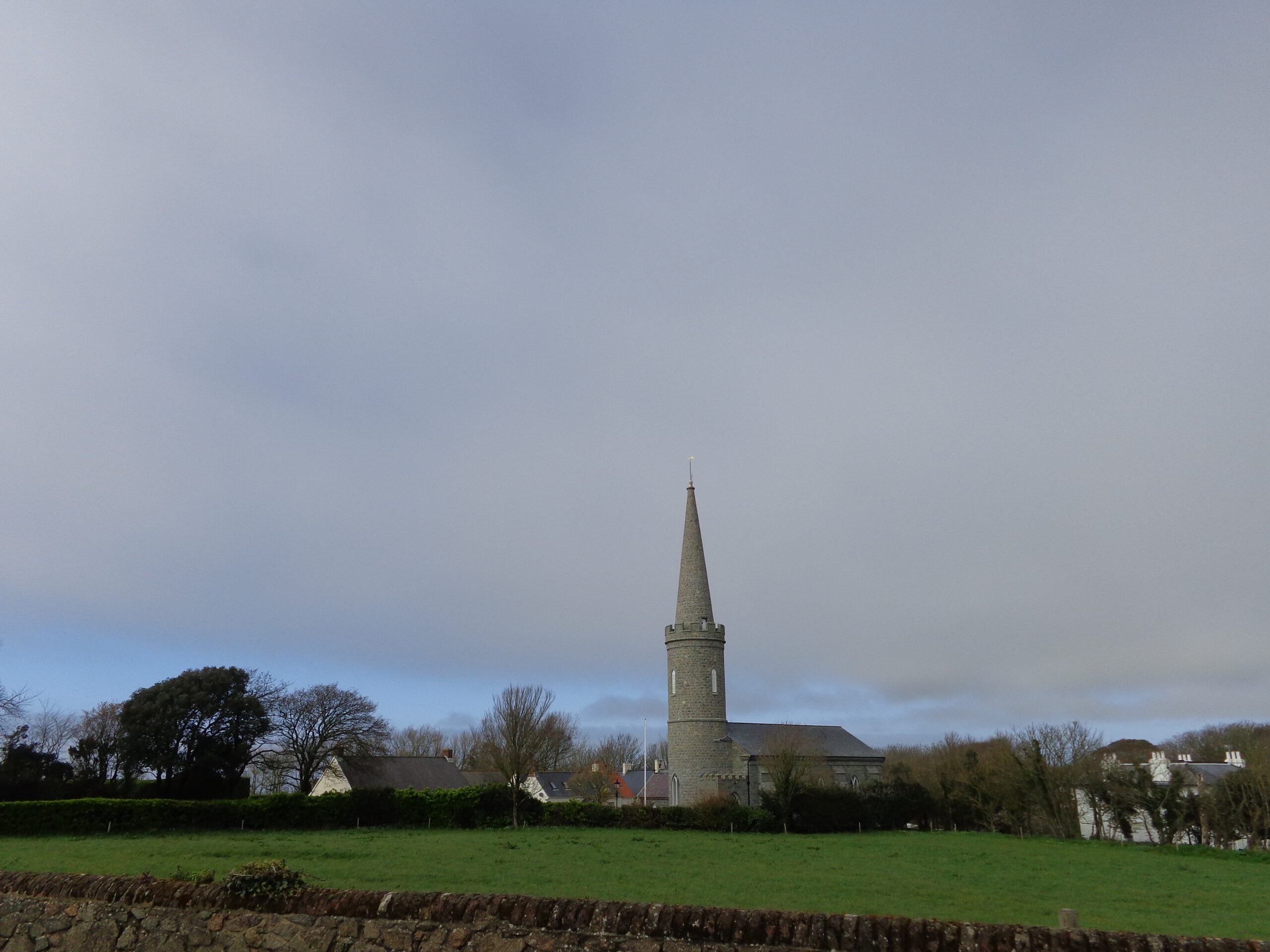
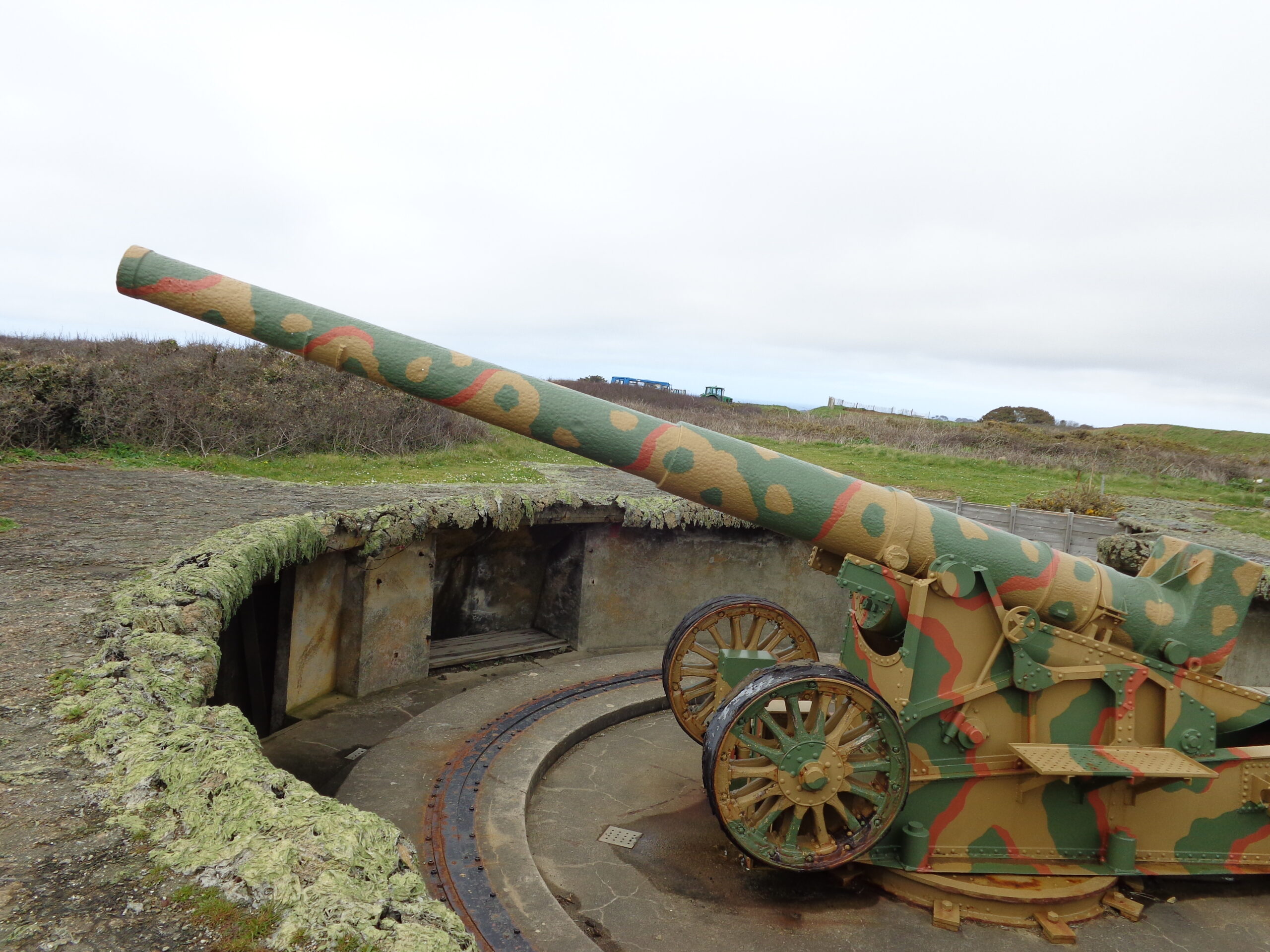
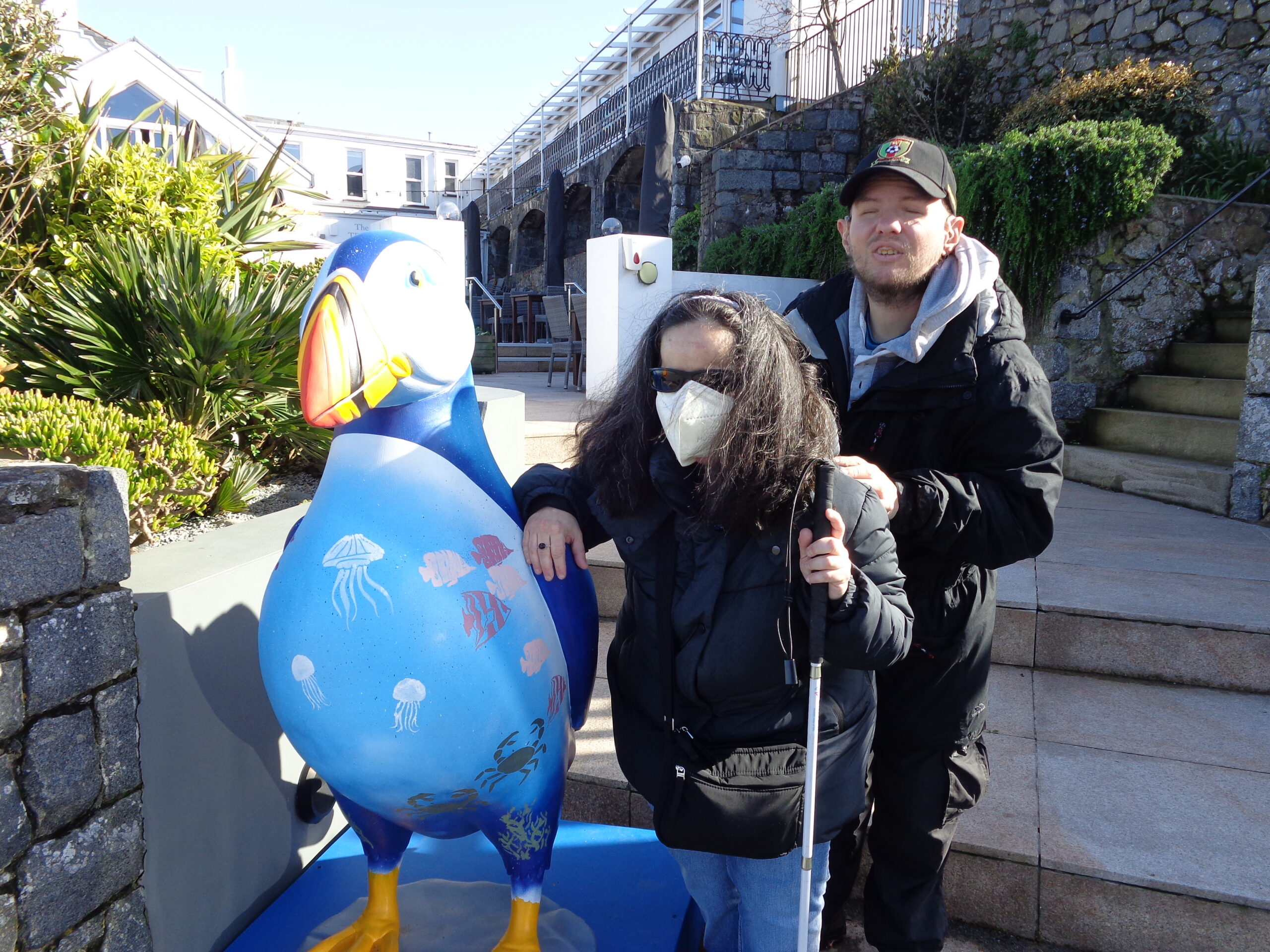
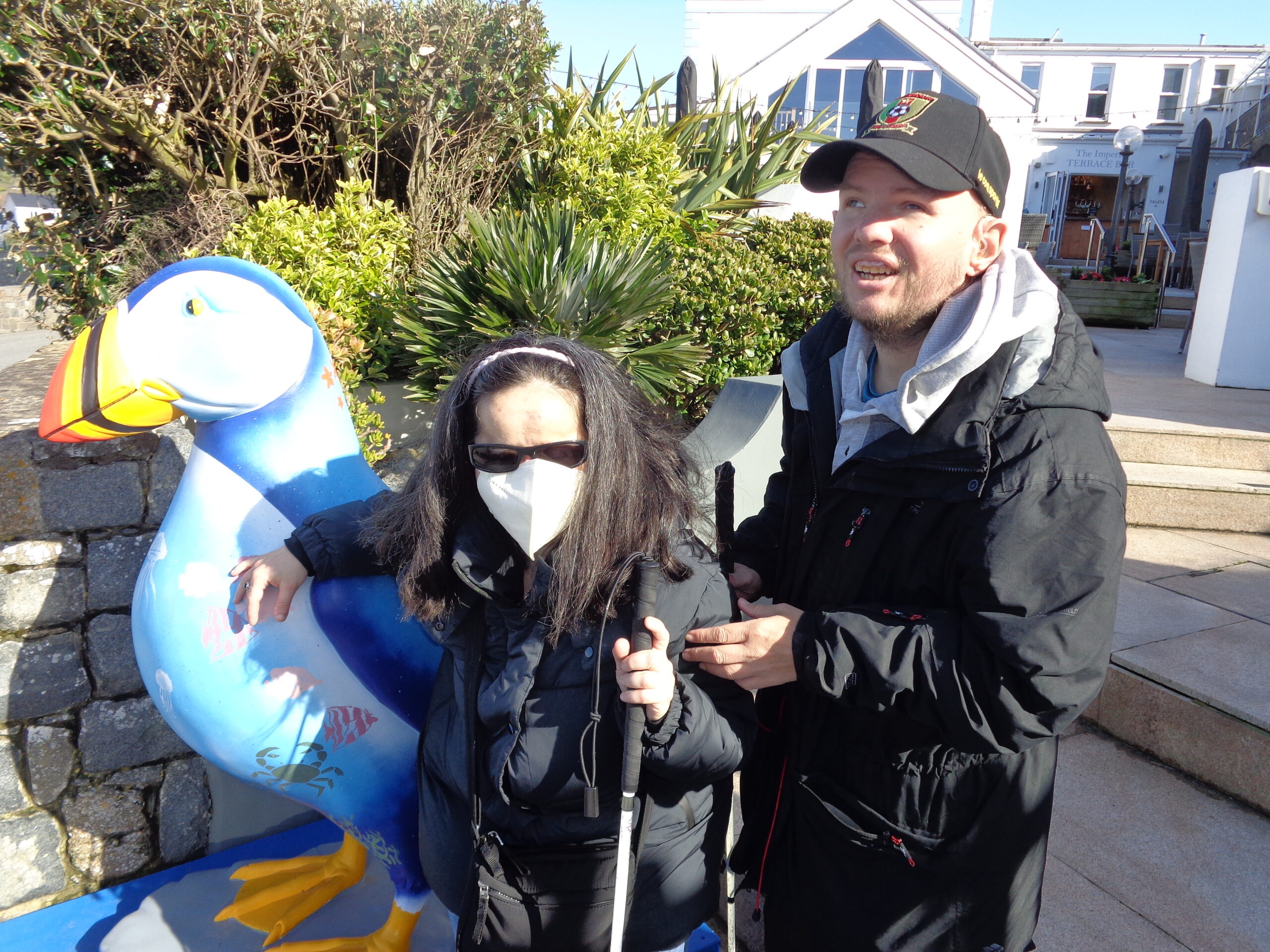
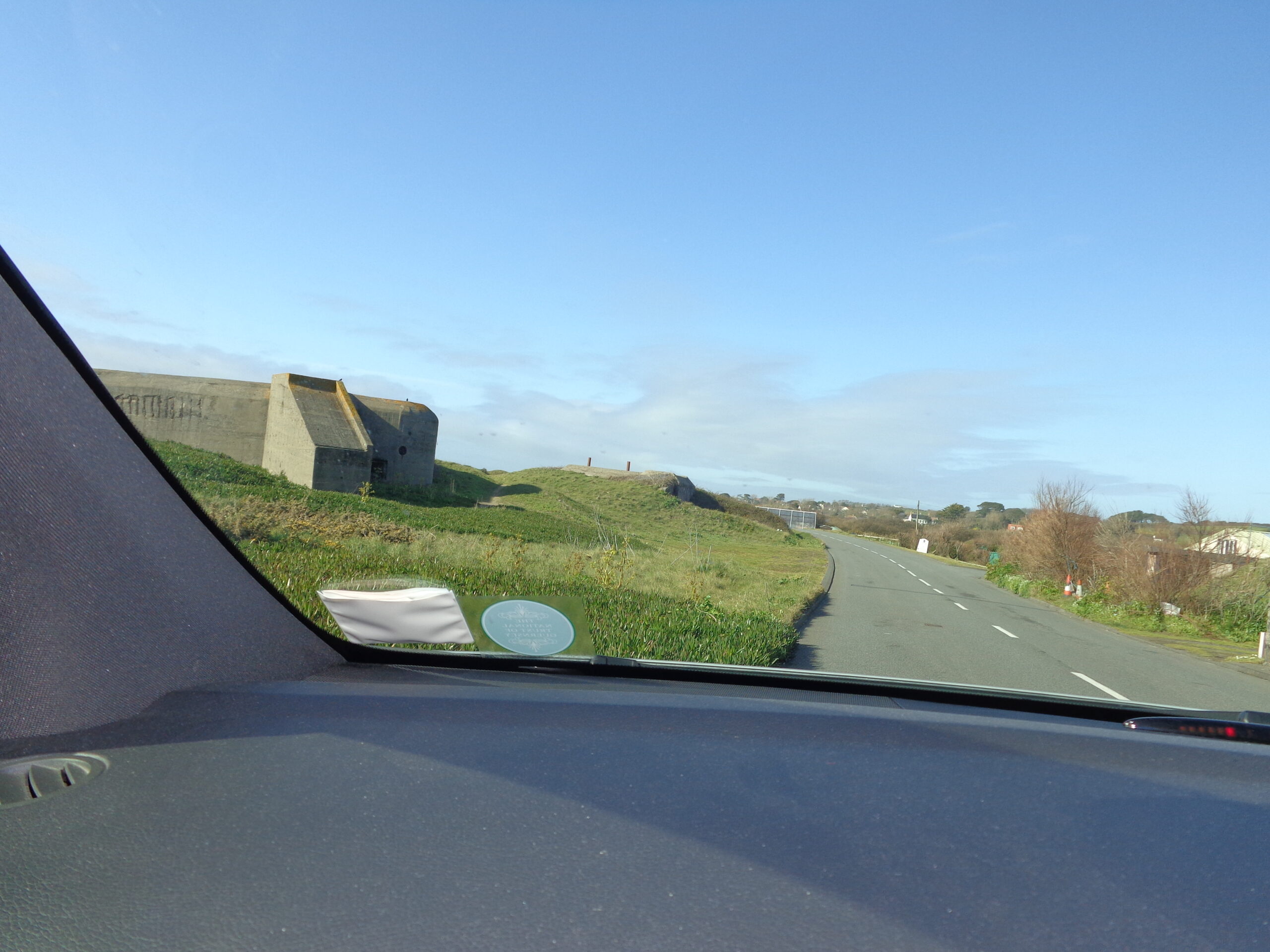
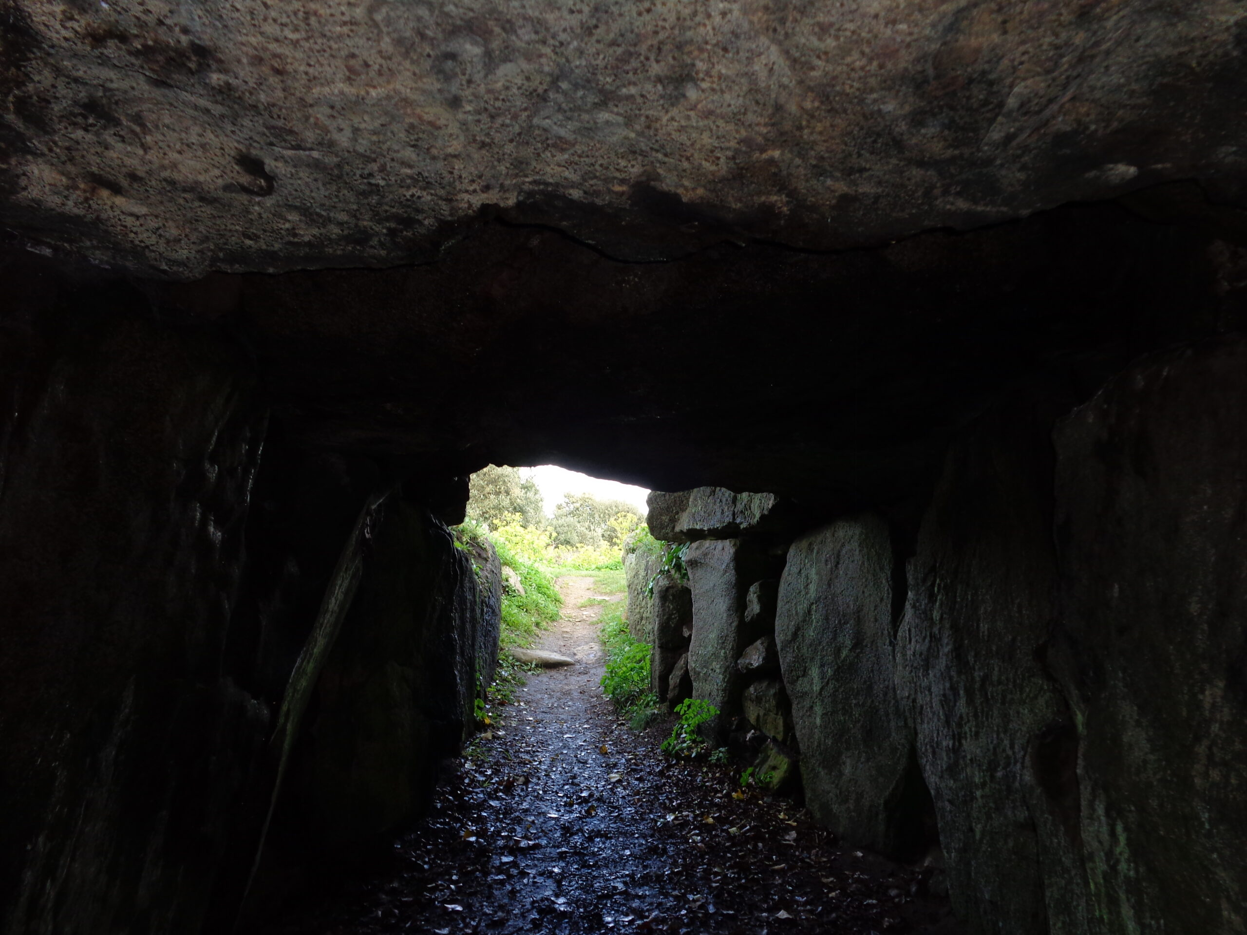
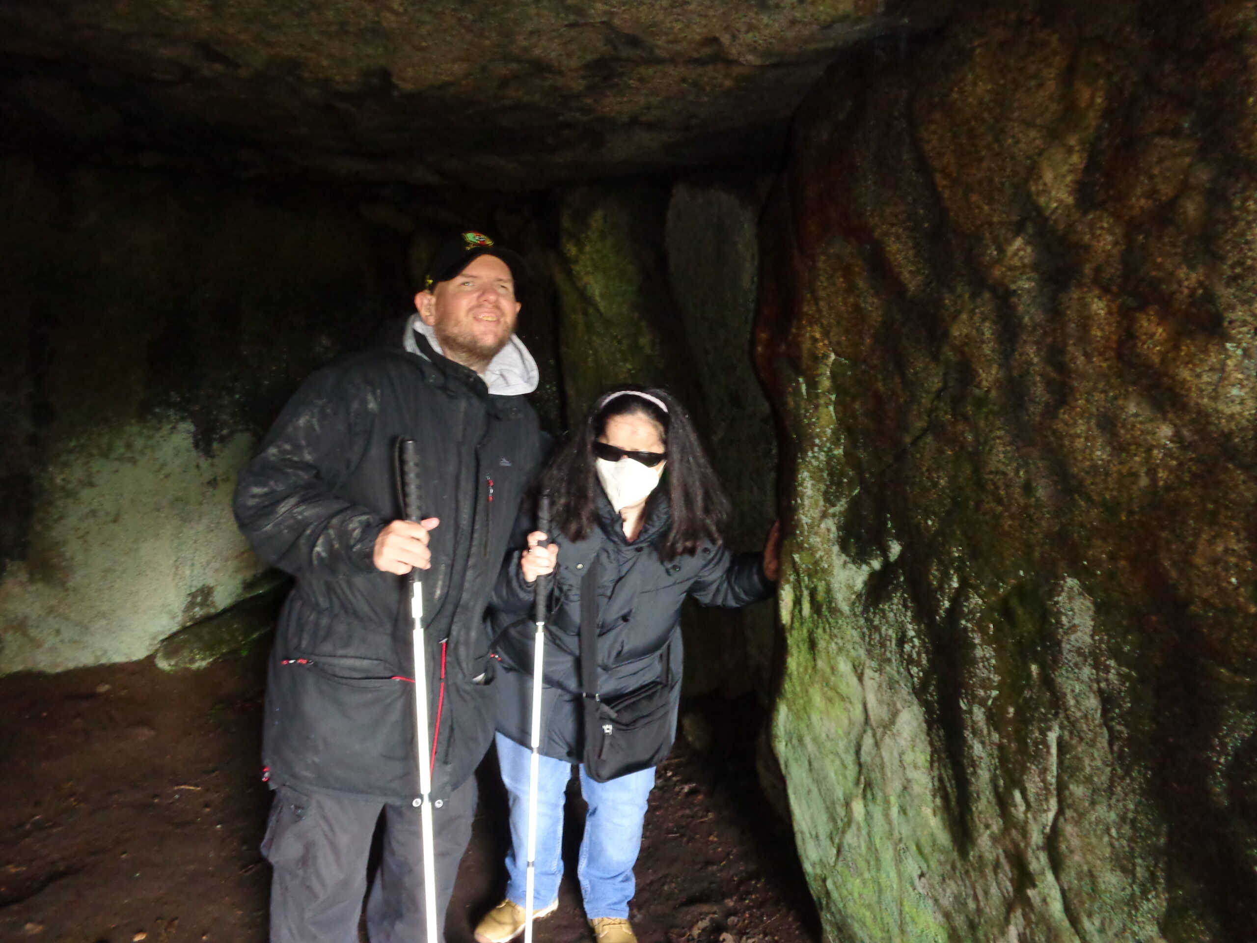
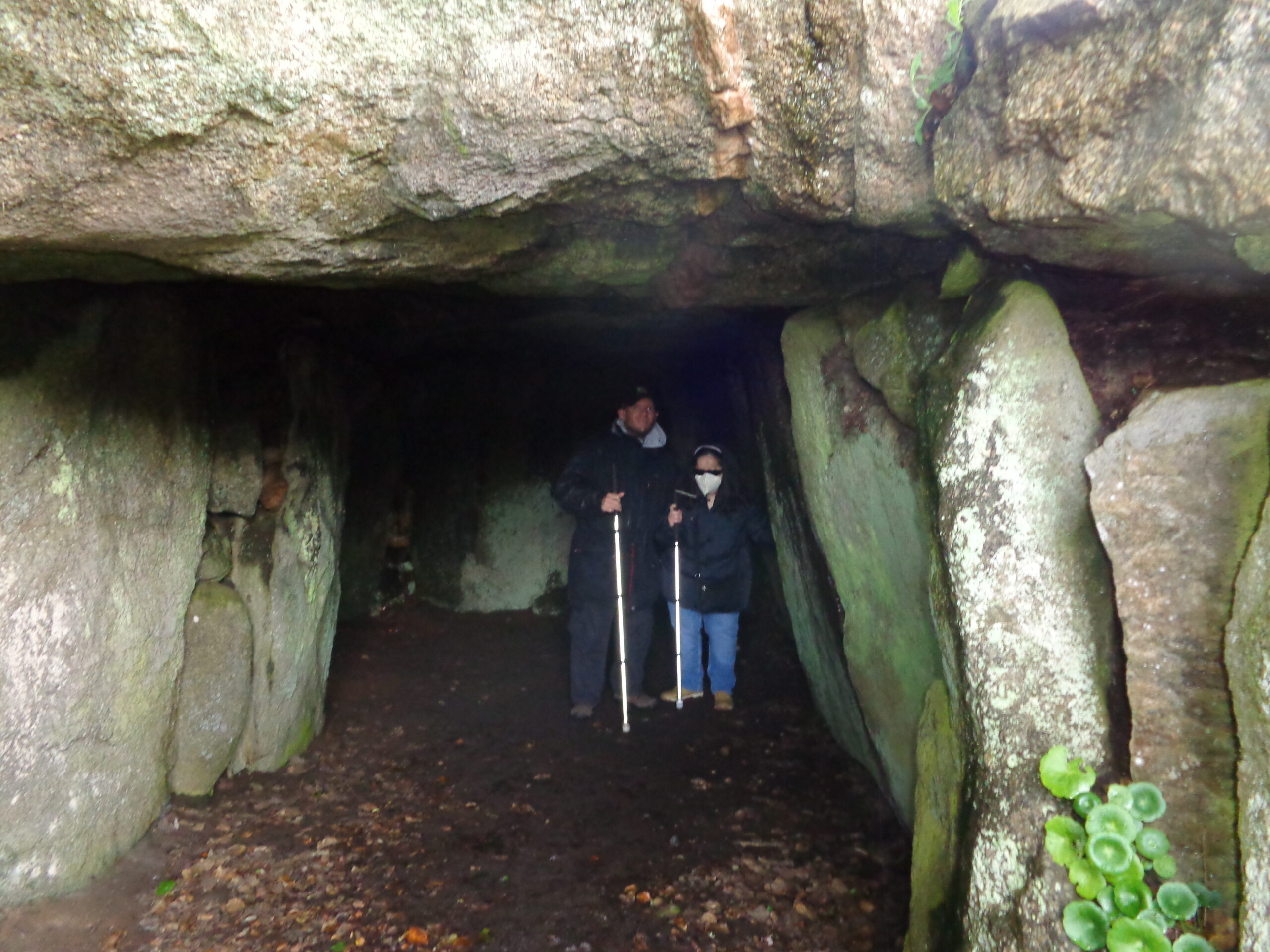
Tony and Tatiana inside the Little Chapel. The walls and ceiling are covered with mosaic decoration made-up of colourful bits of broken pottery and sea shells. There are small colourful stained-glass windows in a geometric design. A simple altar can be seen behind with candles and a vase of flowers. The Little Chapel is situated in the Les Vauxbelets valley in Guernsey’s Saint Andrew parish. It was created by Brother Déodat starting in 1914. He intended to create a miniature version of the Rosary Basilica at Lourdes. The chapel was rebuilt twice with the dimensions increasing each time. When the Bishop of Portsmouth visited the second iteration of the chapel in 1923 he was unable to fit through the door, so Déodat demolished the structure, and started building the bigger version that exists today. The chapel’s dimensions are 4.9 metres (16 feet) by 2.7 metres (9 feet). The chapel has been restored in recent years and is one of the most popular tourist attractions on Guernsey.Flower decoration on the ceiling of the Little Chapel. The petals of the flower are formed from sea shells with a blue and white Willow pattern plate in the centre. Bands of green pottery fragments extend from the flower.Tony in the doorway of the Little Chapel. The doorway is decorated with a colourful mosaic of pottery fragments.Now outside the Little Chapel looking towards the doorway. The exterior walls are again decorated with a mosaic of broken pottery as well as pebbles. The Virgin Mary is depicted above the doorway and the mosaic decoration depicts flowers on the chapel’s small tower above.Martyn Guille silversmith, jewellers and gift shop. This shop is located close to the Little Chapel in central Guernsey. Many items in the shop are crafted by the owner himself in his on-site workshop.View towards Torteval Parish Church. This church was designed by John Wilson and built in 1818. It has a round tower with a tall spire on top. This is the tallest steeple in Guernsey and was intended to be used as a sea mark. The present structure was built on the site on an older church which had fallen into disrepair. The original church was consecrated in 1140. The church houses the oldest bell in the Channel Islands dating from 1432.A Germany artillery gun painted in camouflage colours and situated in a shallow circular gun pit. It is constructed so that the gun can quickly be rotated to fire in different directions. It is located at Batterie Dollman on the south-west coast of Guernsey. The restored gun pit is the last of its type in Europe. The 10 tonne, 22cm gun was manufactured in France and was restored by Guernsey Armouries in 1997.Tony and Tatiana next to Puff the puffin. This larger than life-sized fibreglass puffin sculpture is one of 60 that were decorated by local artists, community groups, and schools. It was part of an event organised by the GSPCA and Autism Guernsey between April and August 2023. In August 2023 the sculptures were auctioned raising over £98,000 for the two charities.Another shot of Tatiana and Tony by Puff the puffin.A large concrete bunker seen through the window of a car. Located on the west coast of Guernsey. This World War Two bunker would have contained several machine gun positions.Dimly lit passage constructed from large boulders. This is Le Creux ès Faies passage tomb: a well preserved megalithic passage tomb dating from between 3,000 and 2,500 BC. The tomb is located on a small headland to the north of L’Eree Bay on Guernsey’s west coast. In local folklore the passage is known as the entrance to the Fairy Kingdom. It was thought that fairies came out at midnight on moonlit nights to dance on the Mont Saint and Le Catioroc.Tony and Tatiana inside Le Creux ès Faies passage tomb.Looking into Le Creux ès Faies passage tomb with Tony and Tatiana inside. A huge slab of rock spans the entrance to the tomb.A loophole tower. These stone towers were built around the coast of Guernsey between 1778 and 1779 to help protect against potential French invasion. In total 15 were built to a standard design. They are 9 metres (30 feet) high and have a diameter of 6 metres (20 feet). There are musket loopholes on two levels all around the tower.
Sark
Saturday, 15th April 2023
Sark is an island located about 8 miles (14 km) from Guernsey. It is a self-governing British Crown Dependency, with its own set of laws based on Norman law, and its own parliament. It was a royal fiefdom from 1204 until 2008 when the Constitution of Sark came into effect. Its population was 562 according to the 2023 census. The area of the island, plus the nearby island of Brecqhou, is 2.1 square miles (5.44 square km). Little Sark is a peninsula joined by a natural but high and very narrow isthmus to the island. Sark is one of the few places in the world where cars are banned from roads and only tractors, bicycles, and horse-drawn vehicles are allowed. The island can only be accessed by ferry from Guernsey.
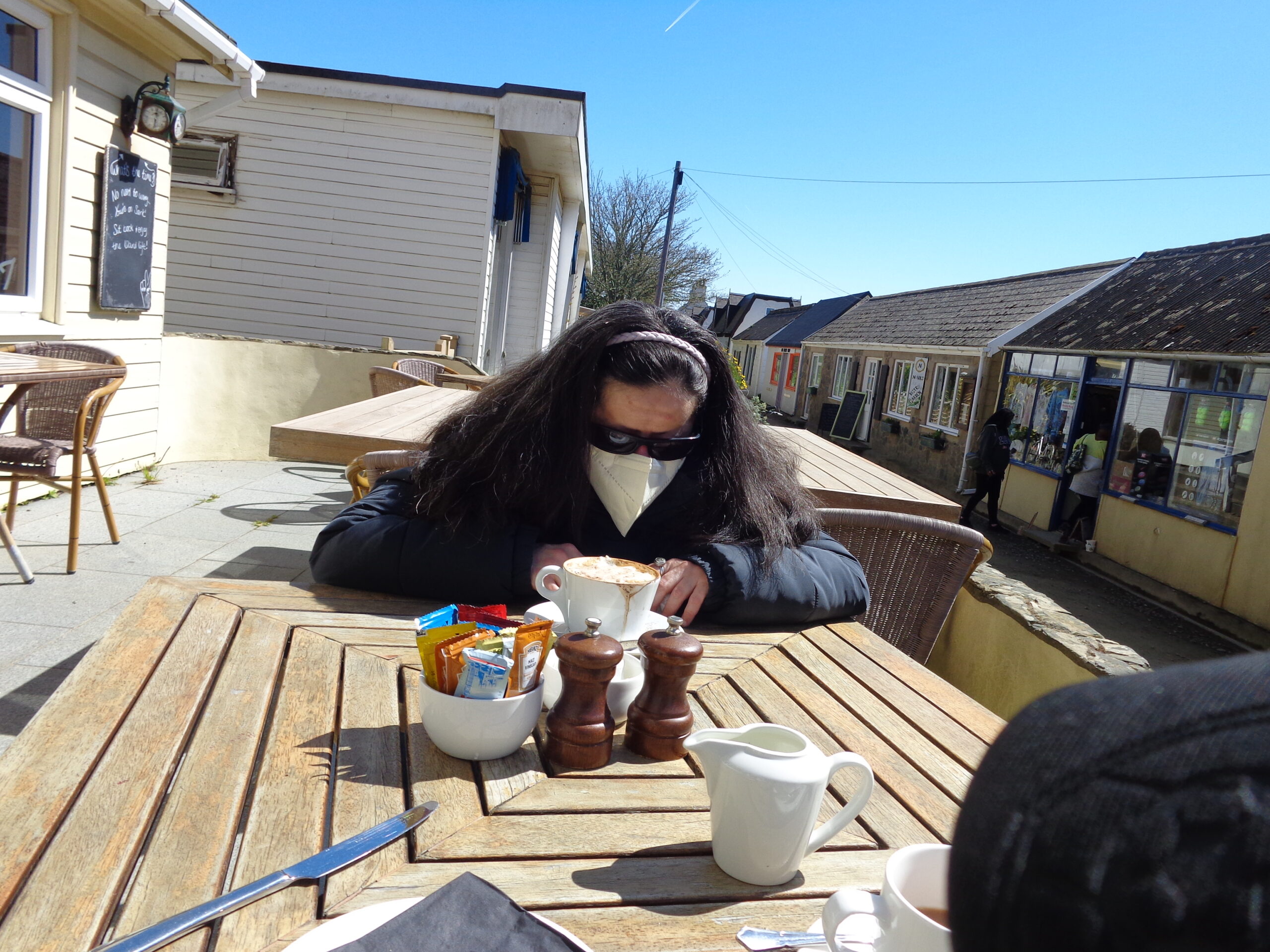
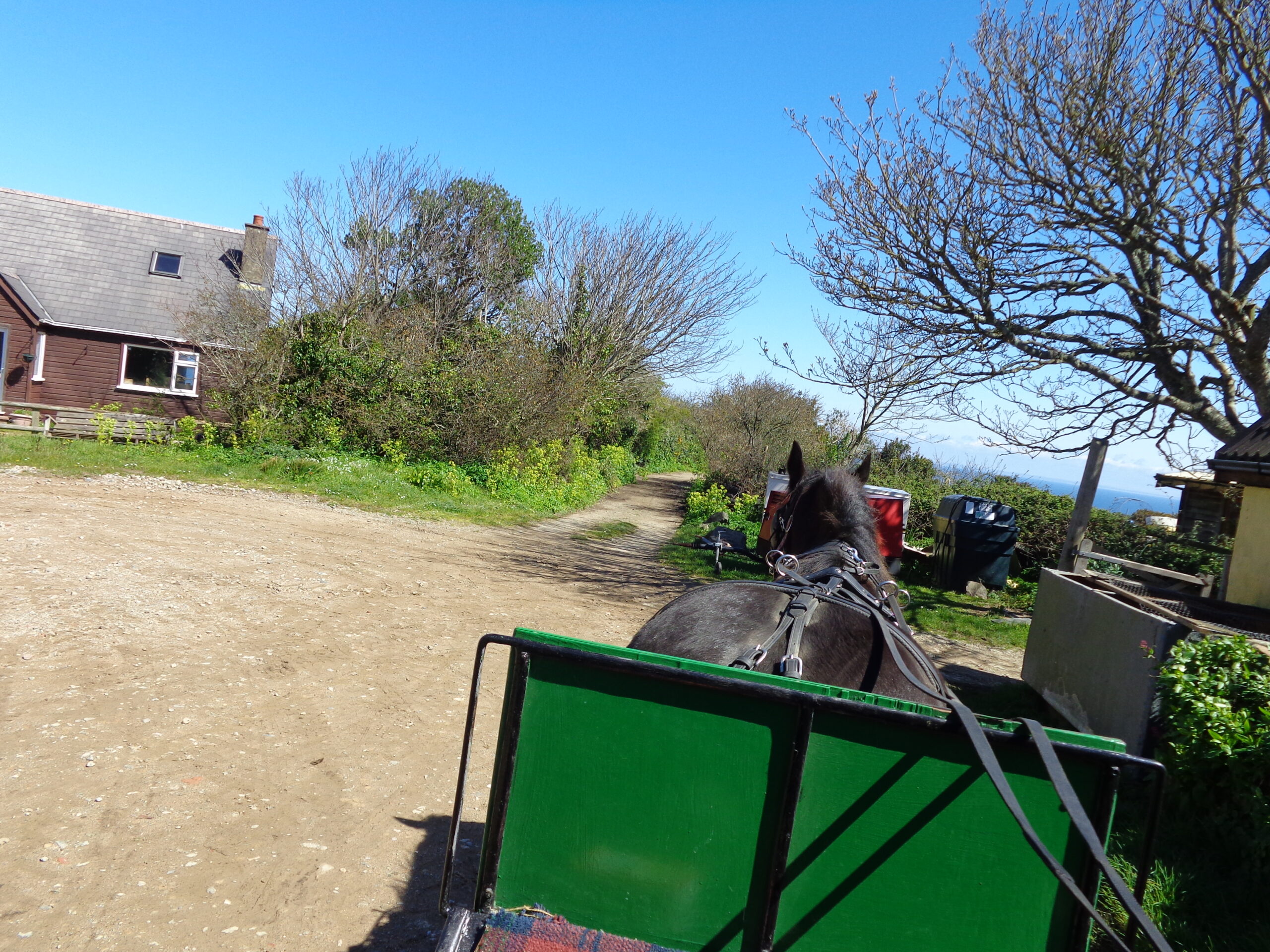
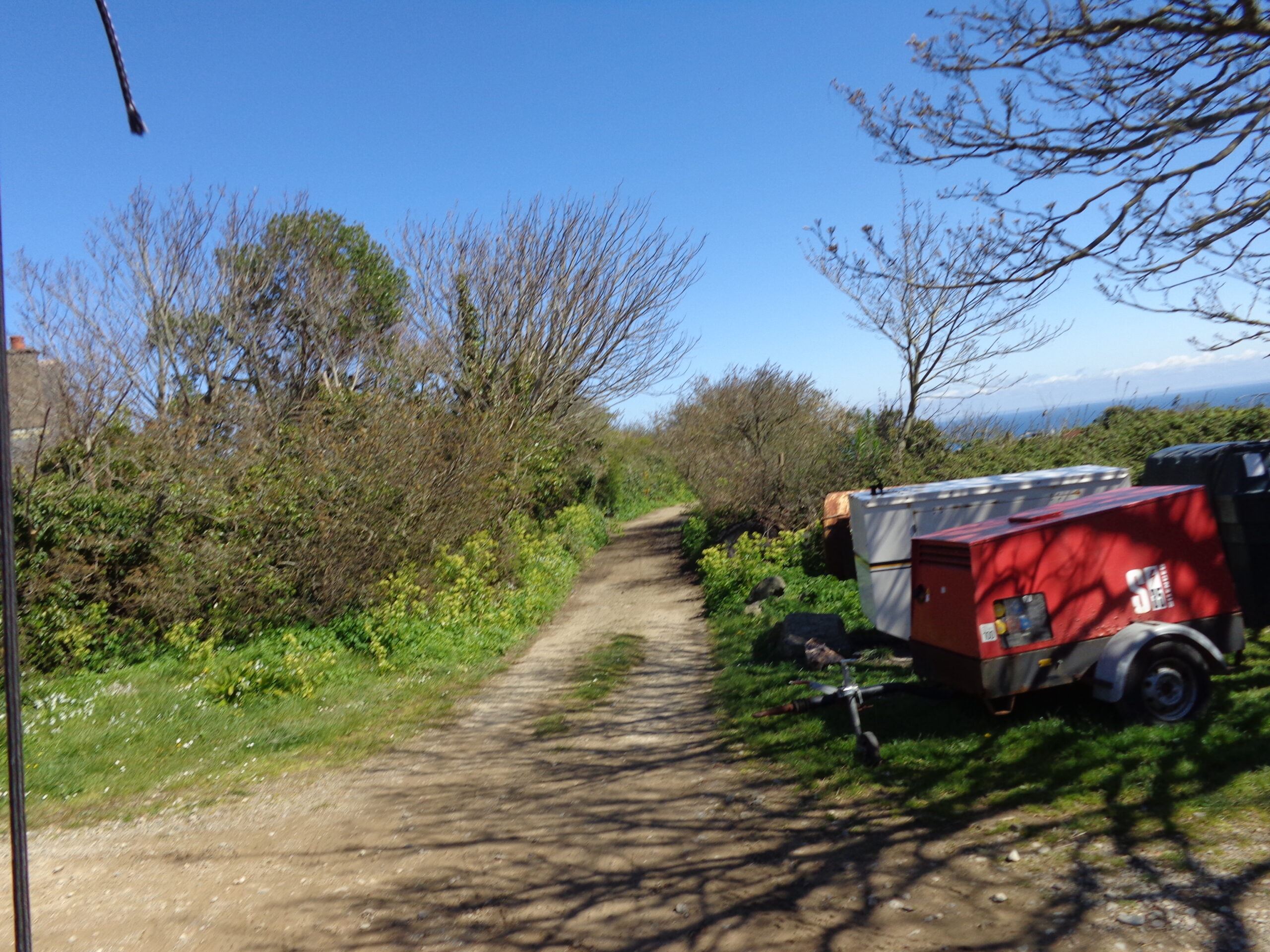
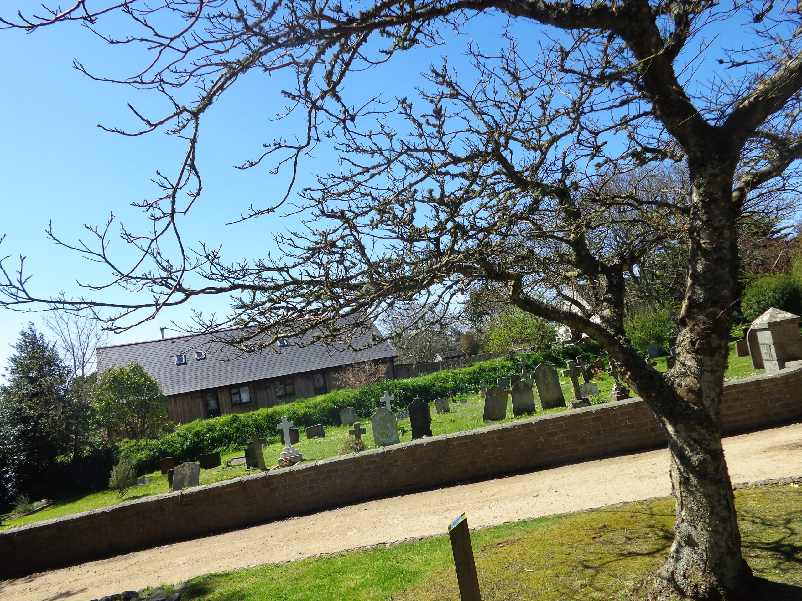
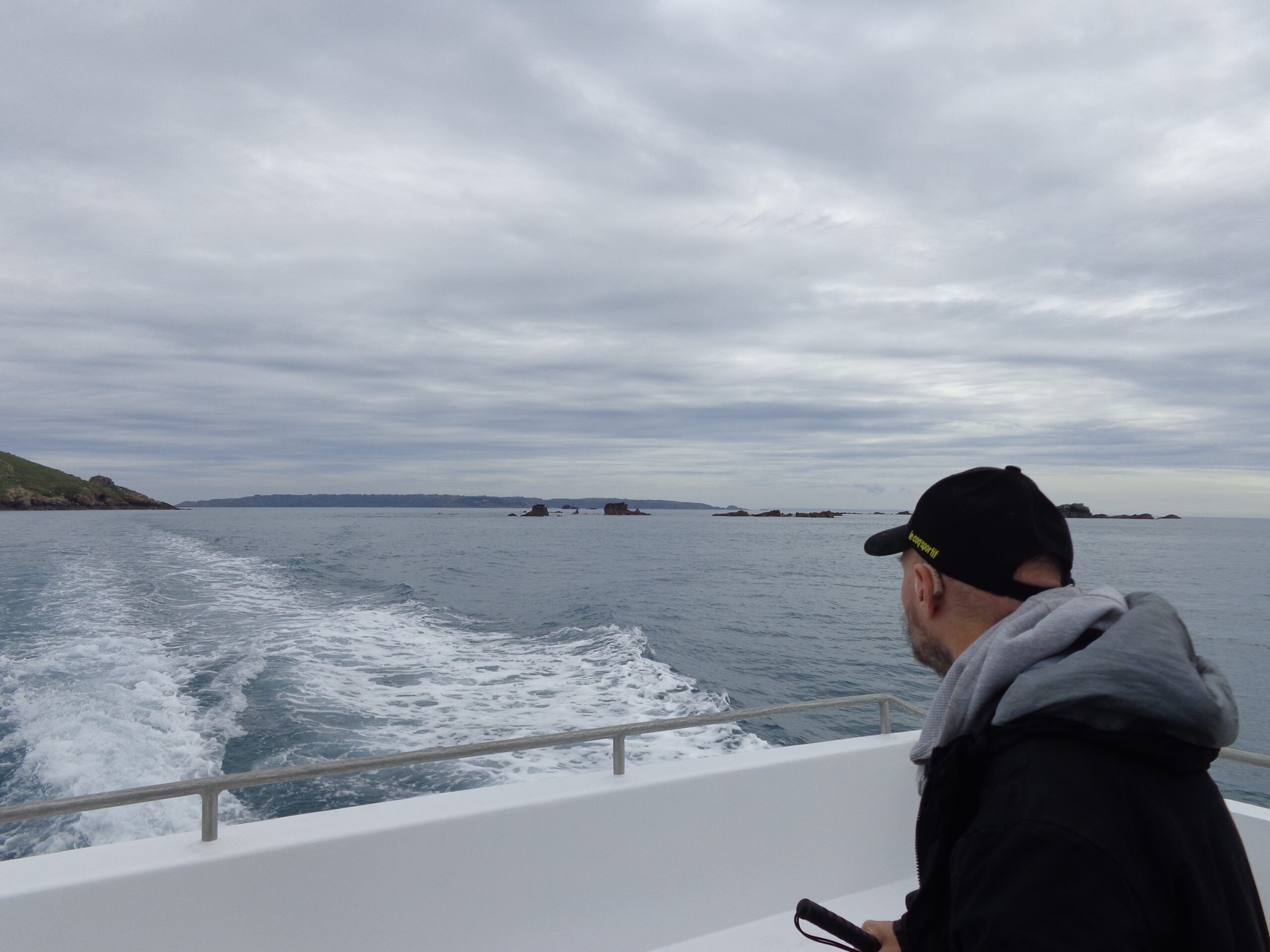
Tatiana enjoying a cup of coffee at a cafe on The Avenue, which is the main street in Sark. The photo shows small single storey buildings many housing shops and other businesses.A horse and carriage trotting down an unpaved lane on Sark. Tony and Tatiana are out-of-view in the carriage at the back. Sark Carriages, run by Michelle Perree, and based at Le Grand Fort Farm is the Island’s longest established horse and carriage service, offering regular horse and carriage tours around the island. Other companies may be available.View from the horse and carriage heading down a lane lined with trees and bushes. To the right the sea is visible is the distance.Passing by the graveyard located next to St. Peter’s Church. St. Peter’s is Sark’s parish church and the only Church of England church on the island.Tony on the ferry returning to Guernsey from Sark. Various islands and rocks can be seen. The more distant island to the right is probably Sark and the closer land is probably the island of Herm along with surrounding small islets and rocks.The ferry entering the harbour at St. Peter Port, Guernsey, after sailing back from the island of Sark.
Alderney
Monday, 17th April 2023
Alderney is the northernmost of the inhabited Channel Islands. It is part of the Bailiwick of Guernsey, a British Crown dependency. It is 3 miles (5 km) long and 1.5 miles (2.4 km) wide with an area of 3 square miles (8 square km) making it the third-largest of the Channel Islands. Alderney had a population of 2,167 according to the 2023 census. It is 20 miles (32 km) to the north-east of Guernsey but only 10 miles (16 km) from the Normandy coast.
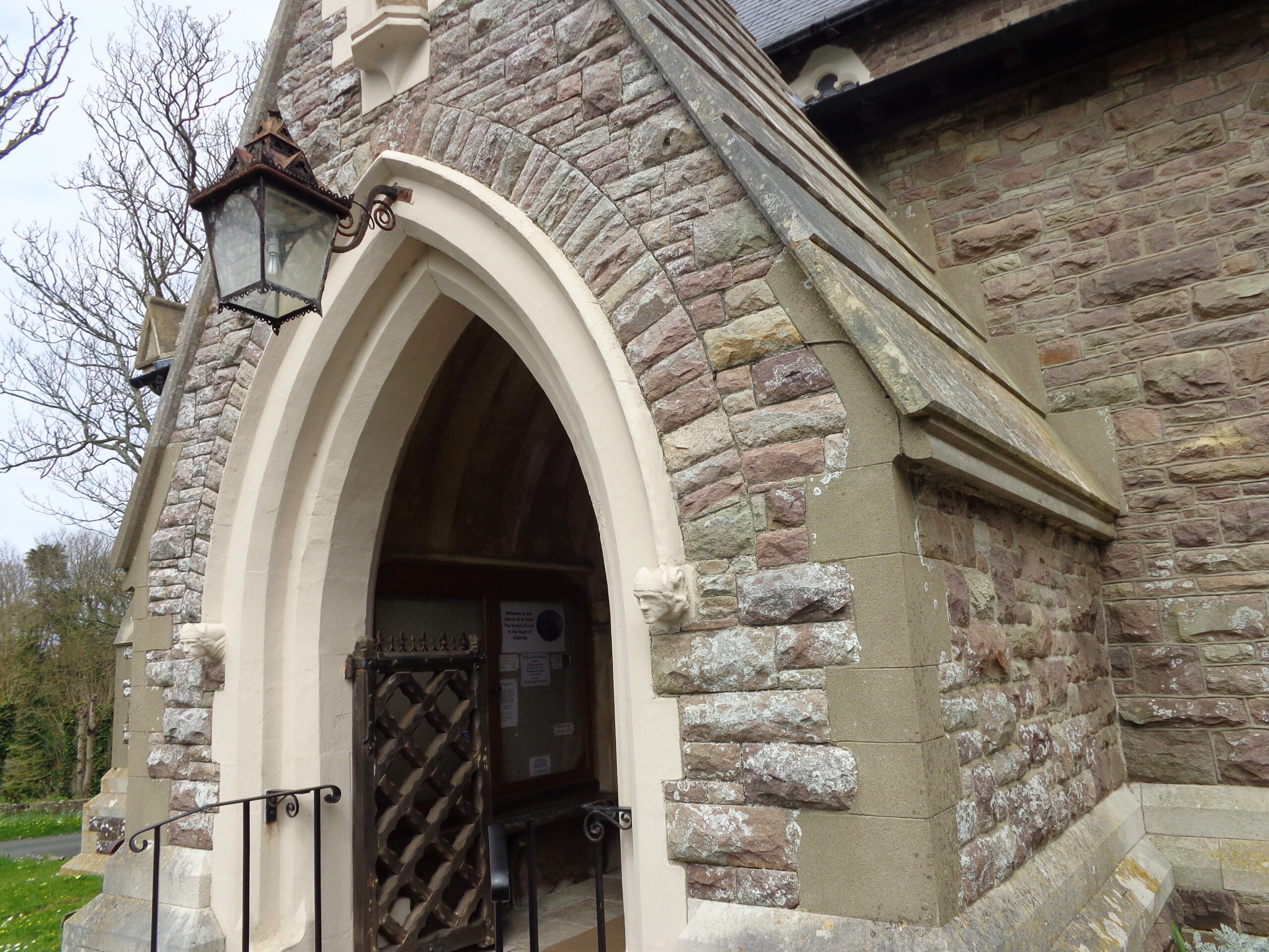
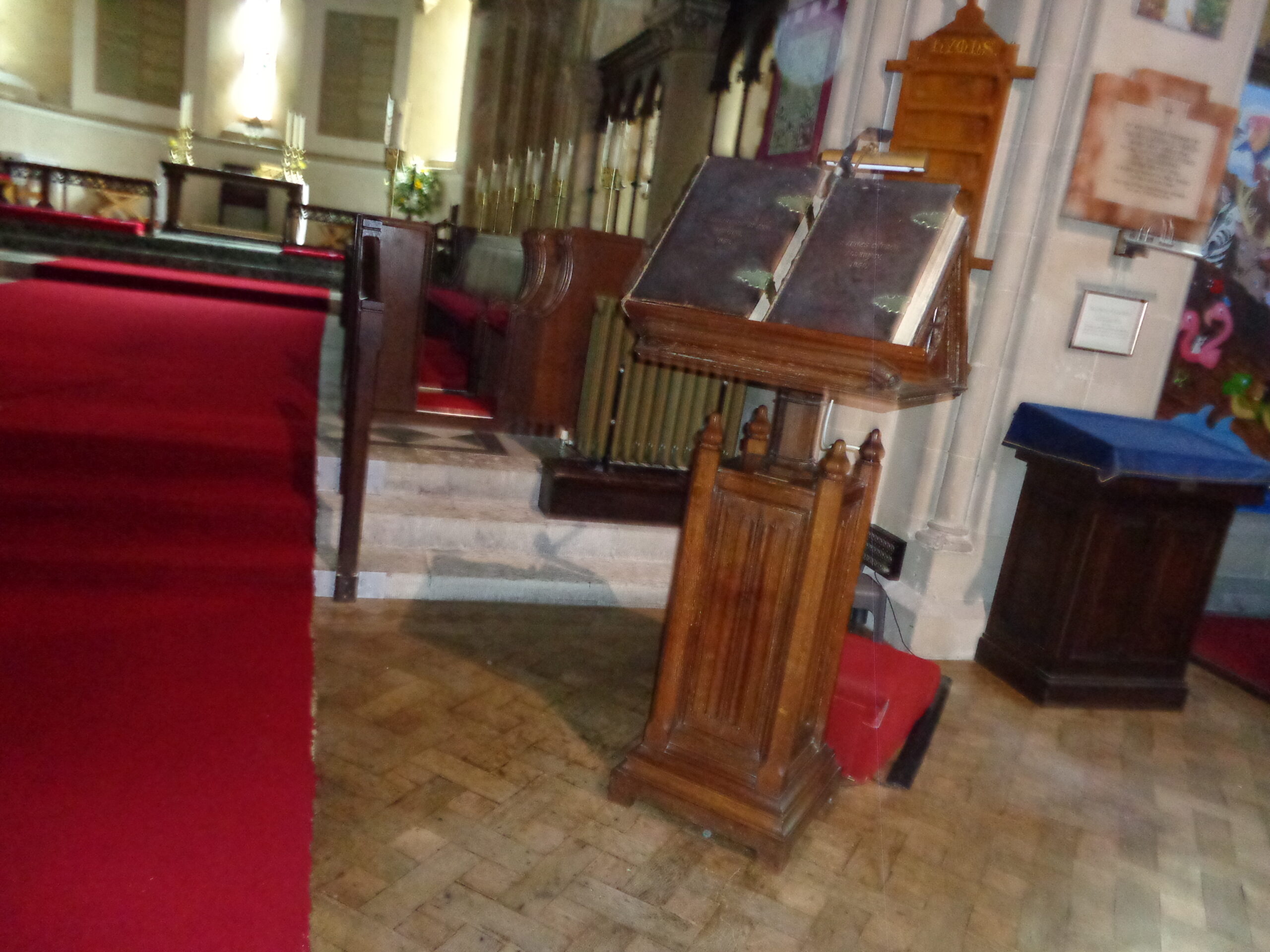
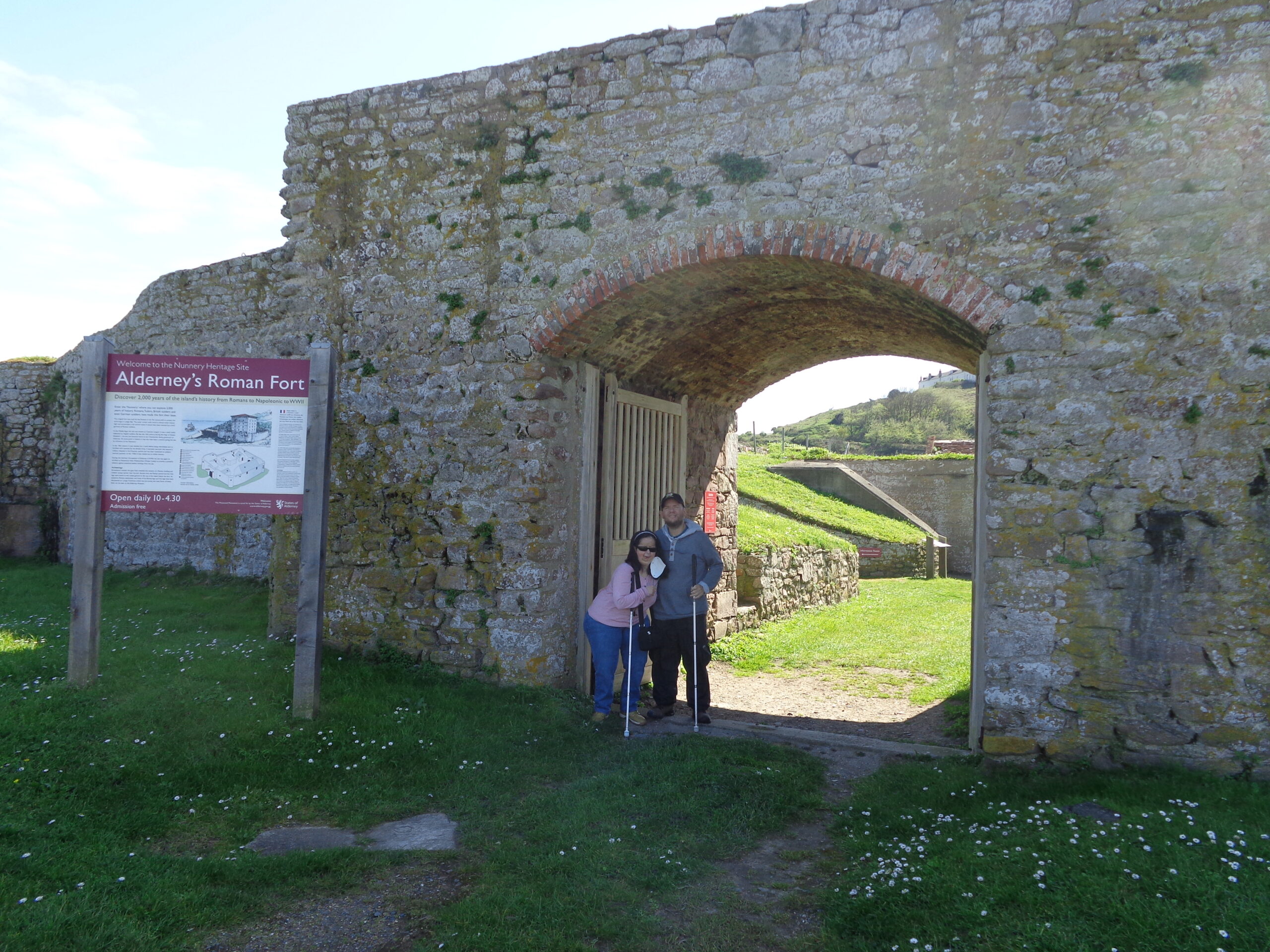
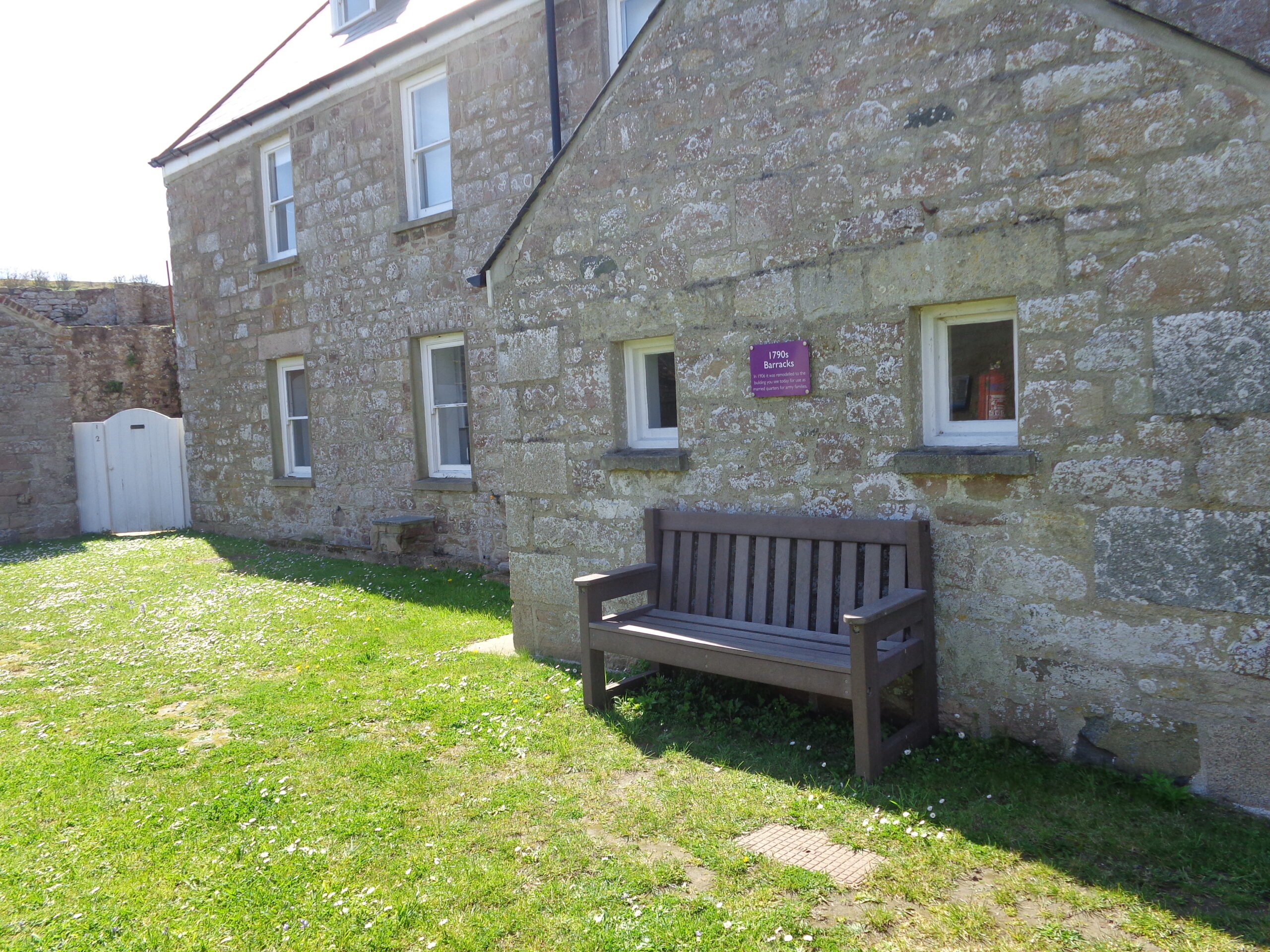
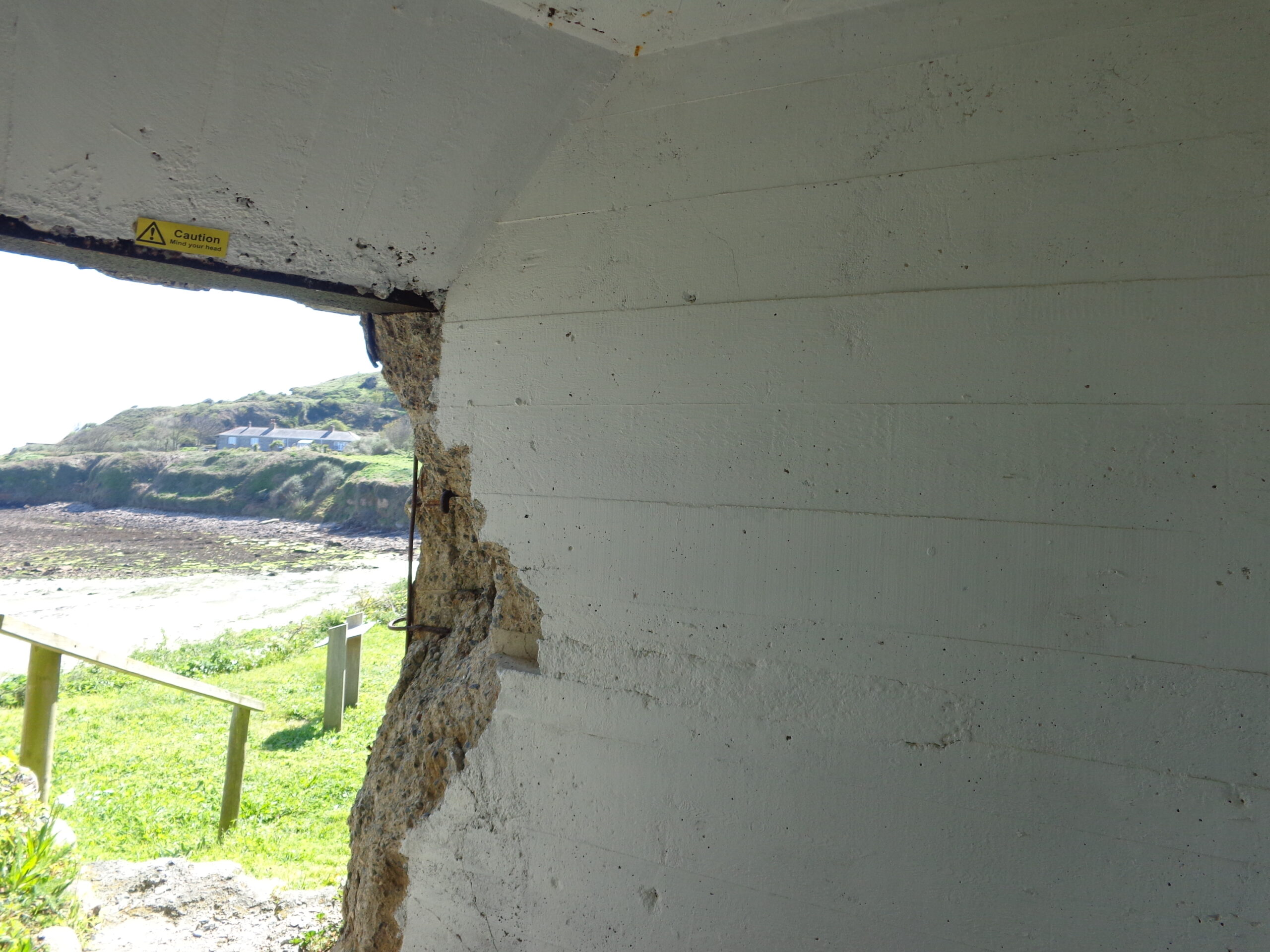
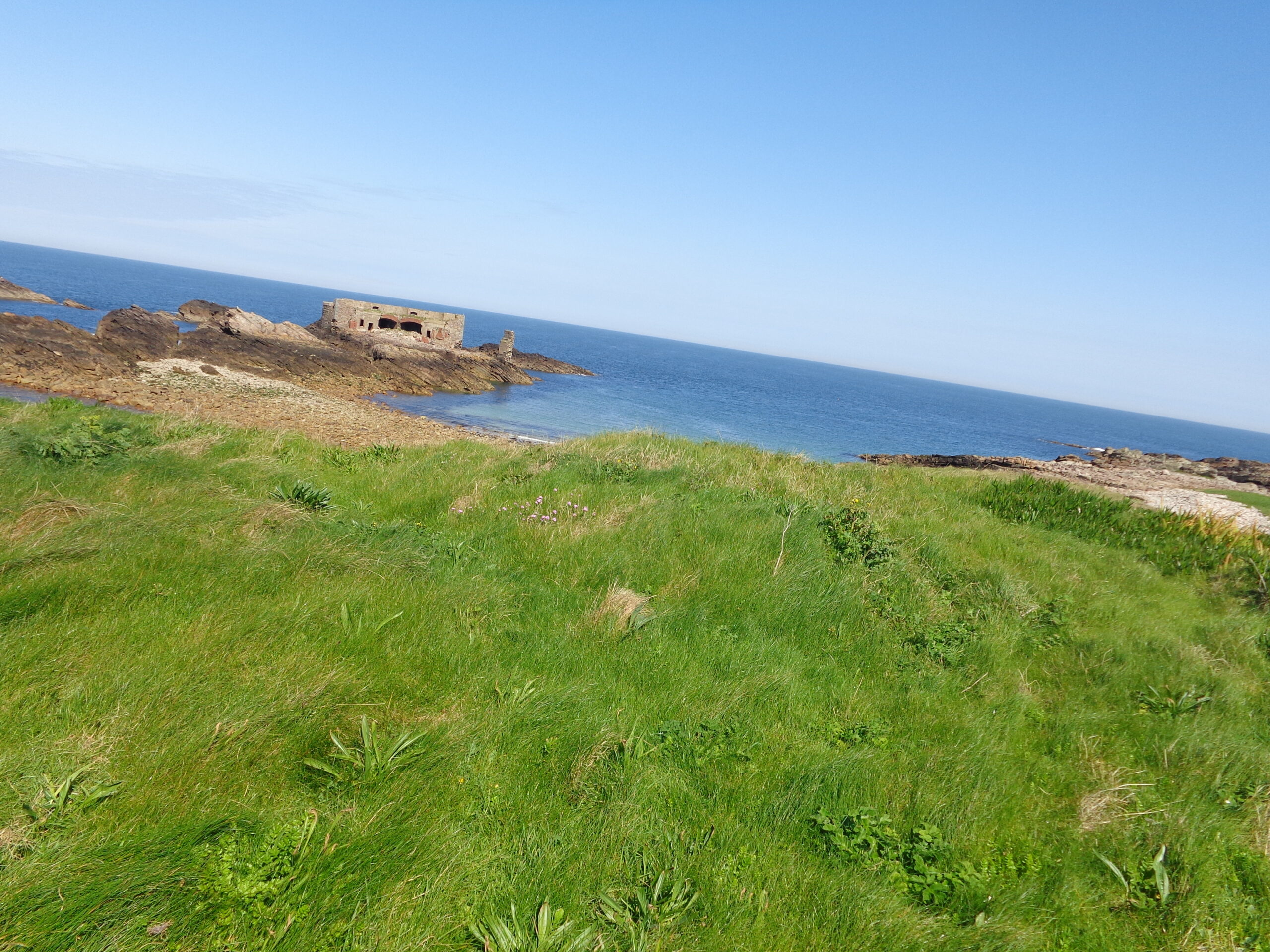
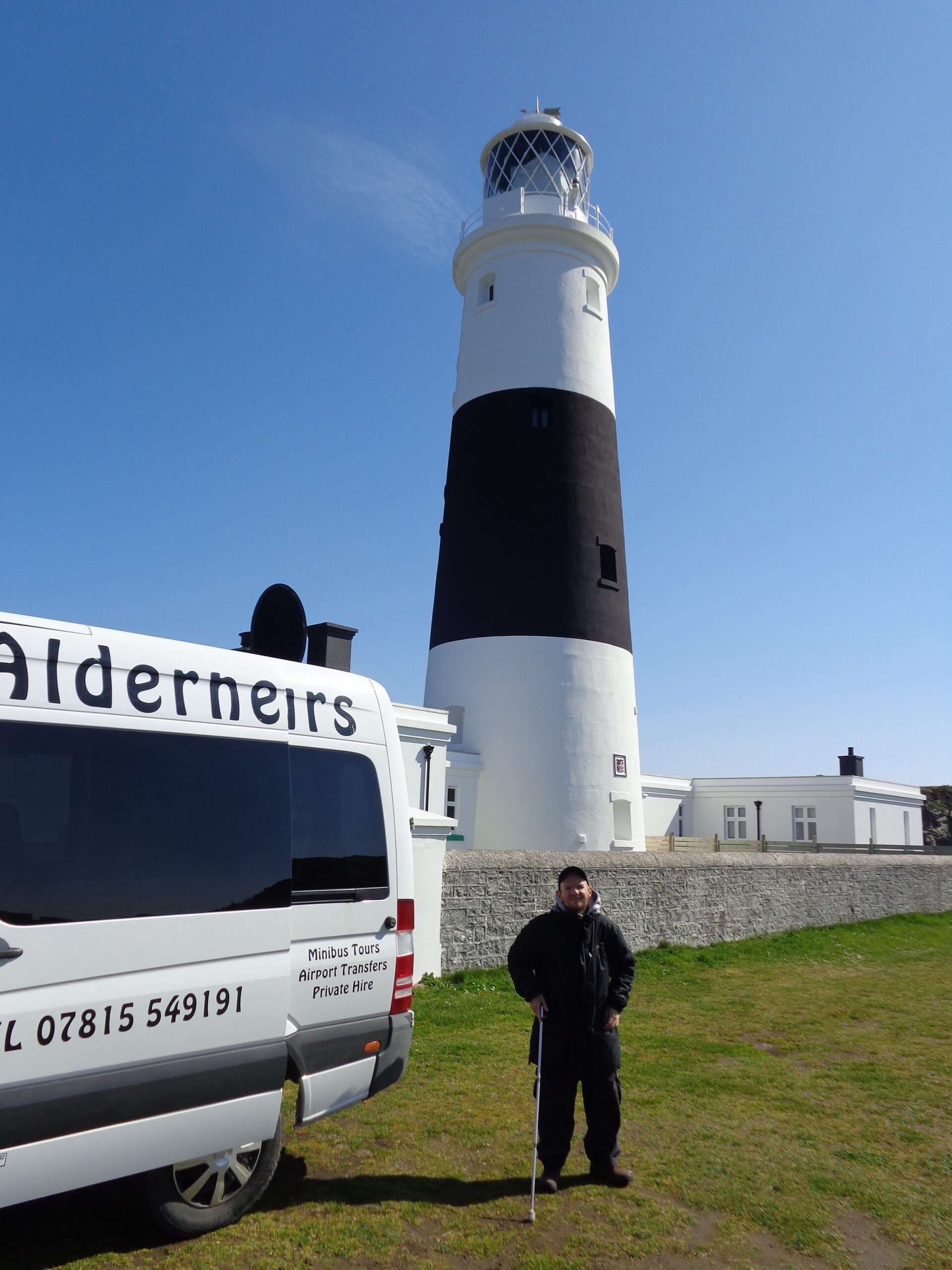
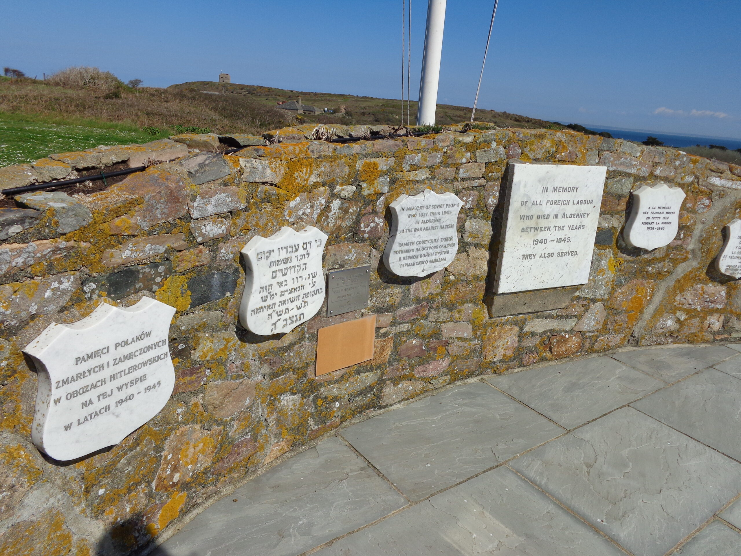
The entrance to St. Anne’s church on Alderney’s main street (Victoria Street). There is a stone porch with a Gothic-arched entrance gate. A metal lantern hangs above the arch. The church is dedicated to St. Anne, the mother of the Virgin Mary. The present church was designed by renowned Victorian architect George Gilbert Scott and was consecrated in 1850. This partially replaced an older church dating back to the 12th or 13th centuries. The clock tower of the old church was retained. The building is surrounded by a churchyard, which dates back to at least the 7th century, and a chapel is thought to have existed here from the same date.Inside St. Anne’s church looking towards the altar. A wooden lectern is in the foreground. There are two large leather-bound books, presumably Bibles, on the lectern.Tony and Tatiana in the substantial stone entrance gate to Alderney’s Roman Fort known locally as The Nunnery. The fort is thought to have been built in around 350 AD. It covered 40 square metres (430 sq ft) with rounded corners where bastions were built. Built of stone and Roman concrete, the south, west and north curtain walls are still standing. Parts of the east, north and south walls remain of the tall tower that once stood inside the walls.Barracks built at the Roman fort in the 1790s. This stone building was remodelled in 1906 for use as married quarters for army families.Inside a concrete gun emplacement facing Longis Bay and close to the Roman fort. Built by the German military during World War Two.View out to sea with Longis Bay and Fort Ile de Raz in front. Fort Ile de Ra is one of a series of forts built in the mid-19th century to protect Alderney from possible invasion by the French. The stone fort is on an islet linked to Alderney itself by a causeway. The fort was intended to protect Longis Bay, a harbour, and Essex Castle, which served as a military hospital. The name of the fort comes from The Race, which is the straight between Alderney and France. The fort did not see action in any battles or wars.Alderney Lighthouse (also known as Mannez Lighthouse) located at Quesnard Point on the North-East coast of the island. The conical granite lighthouse is 32 metres (105 ft) in height. It was constructed in 1912 to protect shipping from the dangerous waters of the Alderney Race and the numerous rocks surrounding Alderney. It was electrified in 1976, and automated in 1997, when the last resident lighthouse keeper left. The lighthouse is painted black and white. Tony is standing in the foreground next to a minibus.The Hammond War Memorial. A memorial to foreign slave labourers who were brought to Alderney by the Nazis during WWII and who died due to maltreatment. The photo shows six stone and one metal plaque attached to a stone wall. The memorials are written in English, Russian, Hebrew, Polish, French, and Spanish. The English plaque reads: “In memory of all foreign labour who died in Alderney between the years 1940-1945. They also served.” The memorial was built by local residents on their return to the island after World War Two. A smaller metal plaque was added by surviving Russian labourers in 1990.Ferry leaving Braye Harbour, Alderney, on the evening of Monday, 17th April, sailing to Guernsey. The harbour wall can be seen through the window.
German Occupation Museum, Guernsey
Wednesday, 19th April 2023
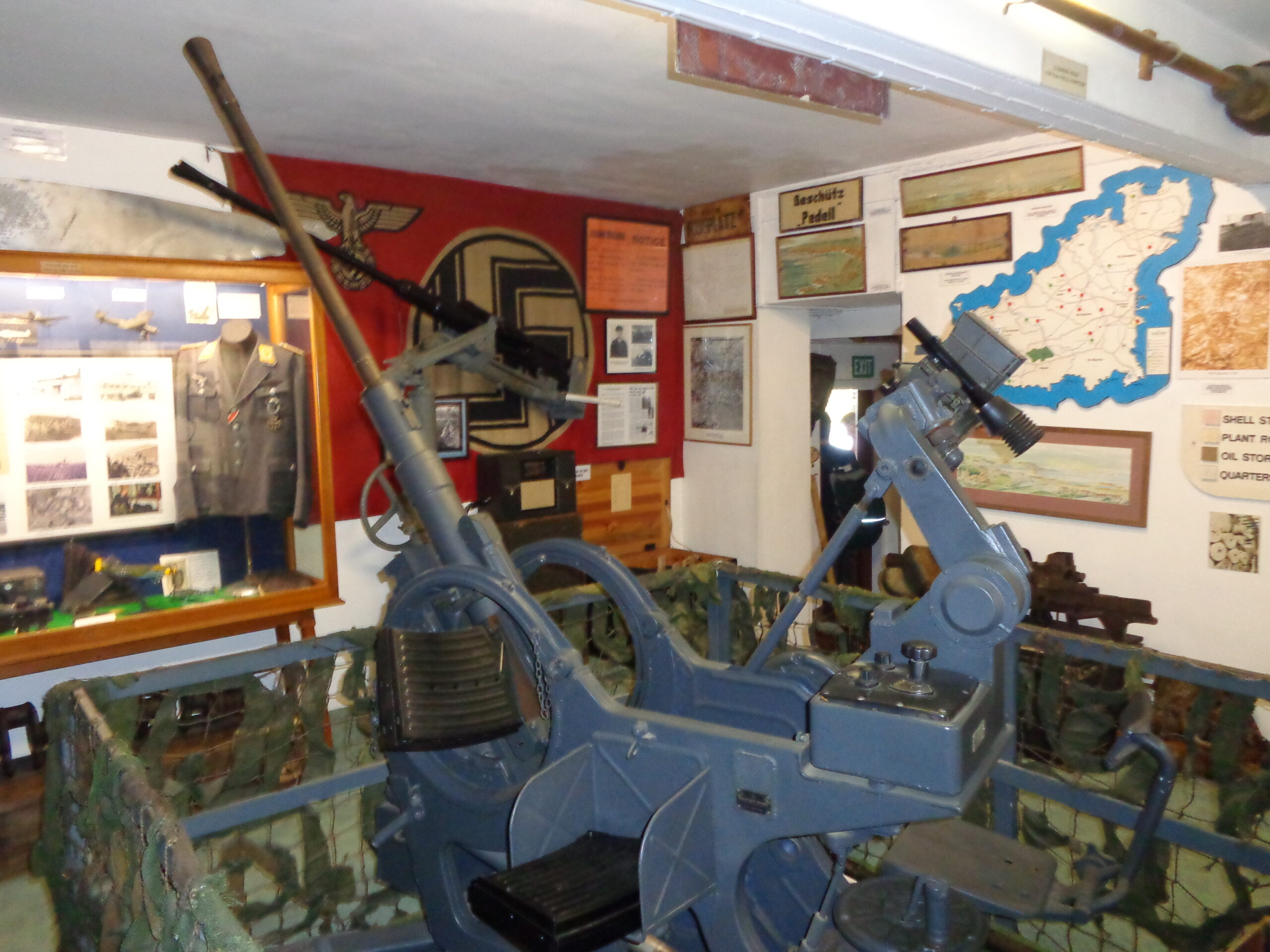
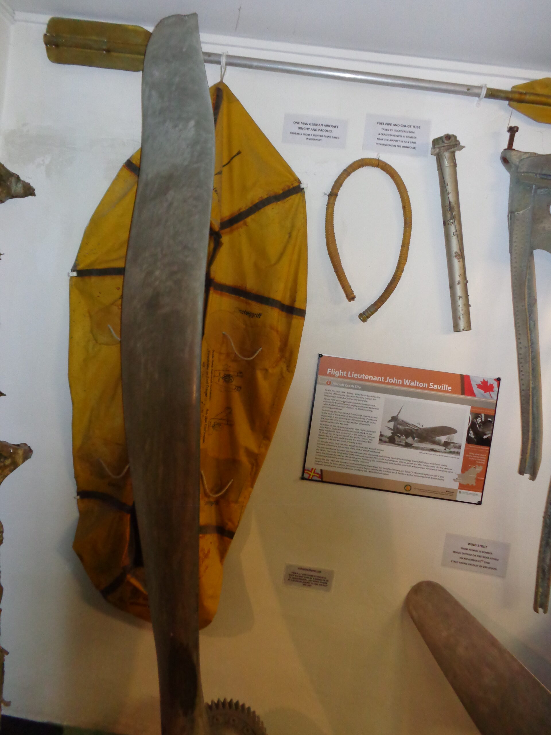
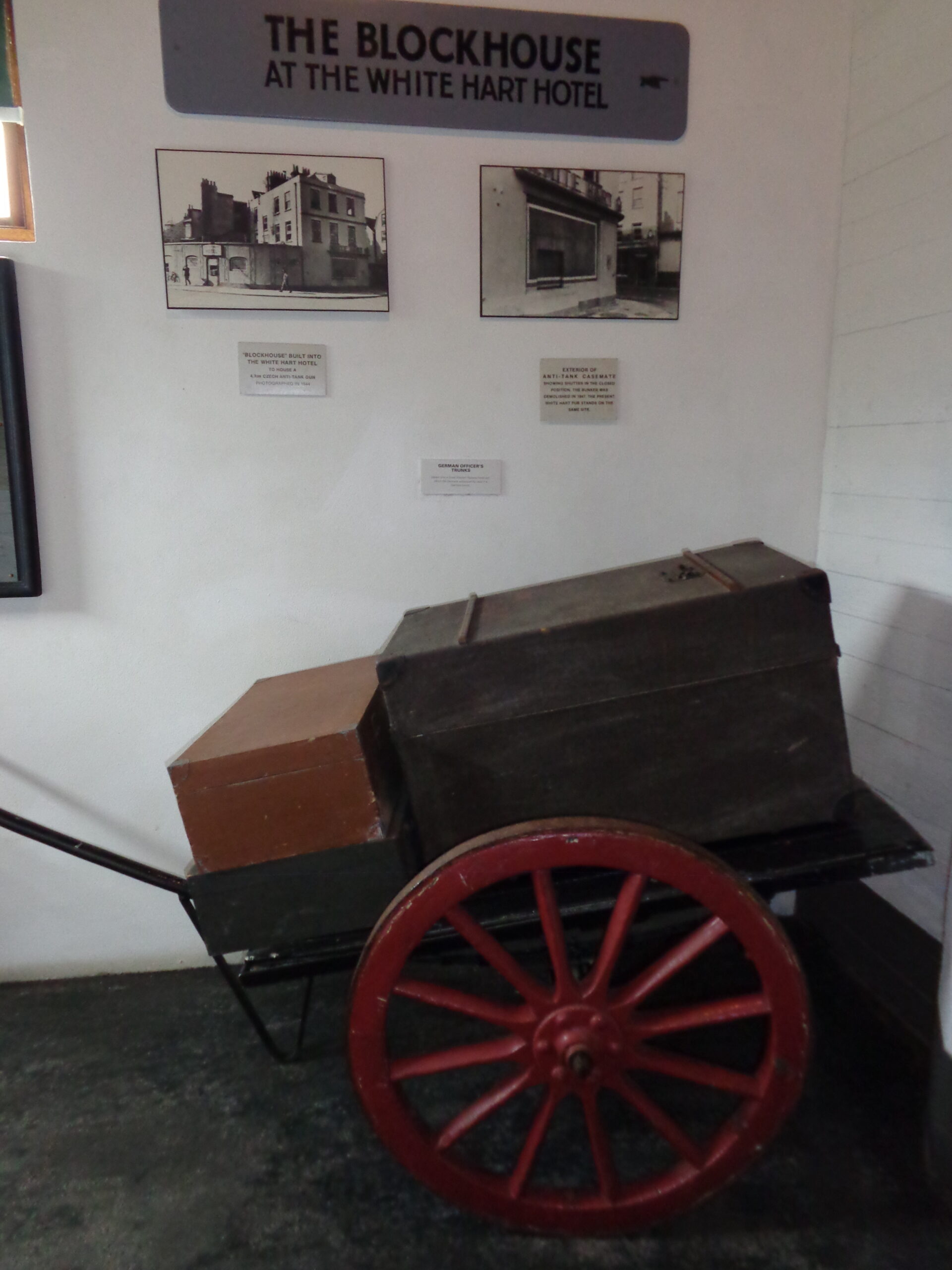
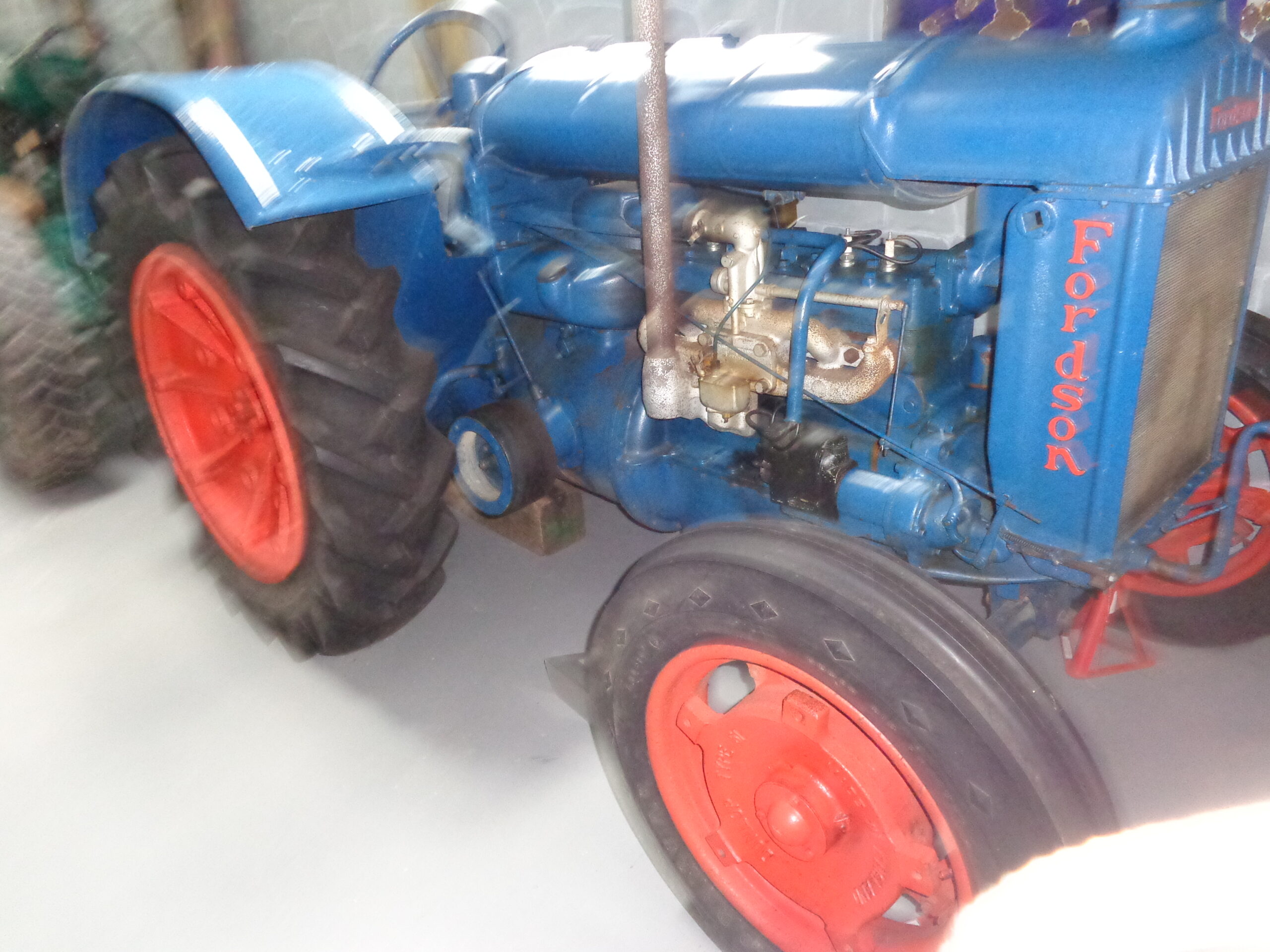
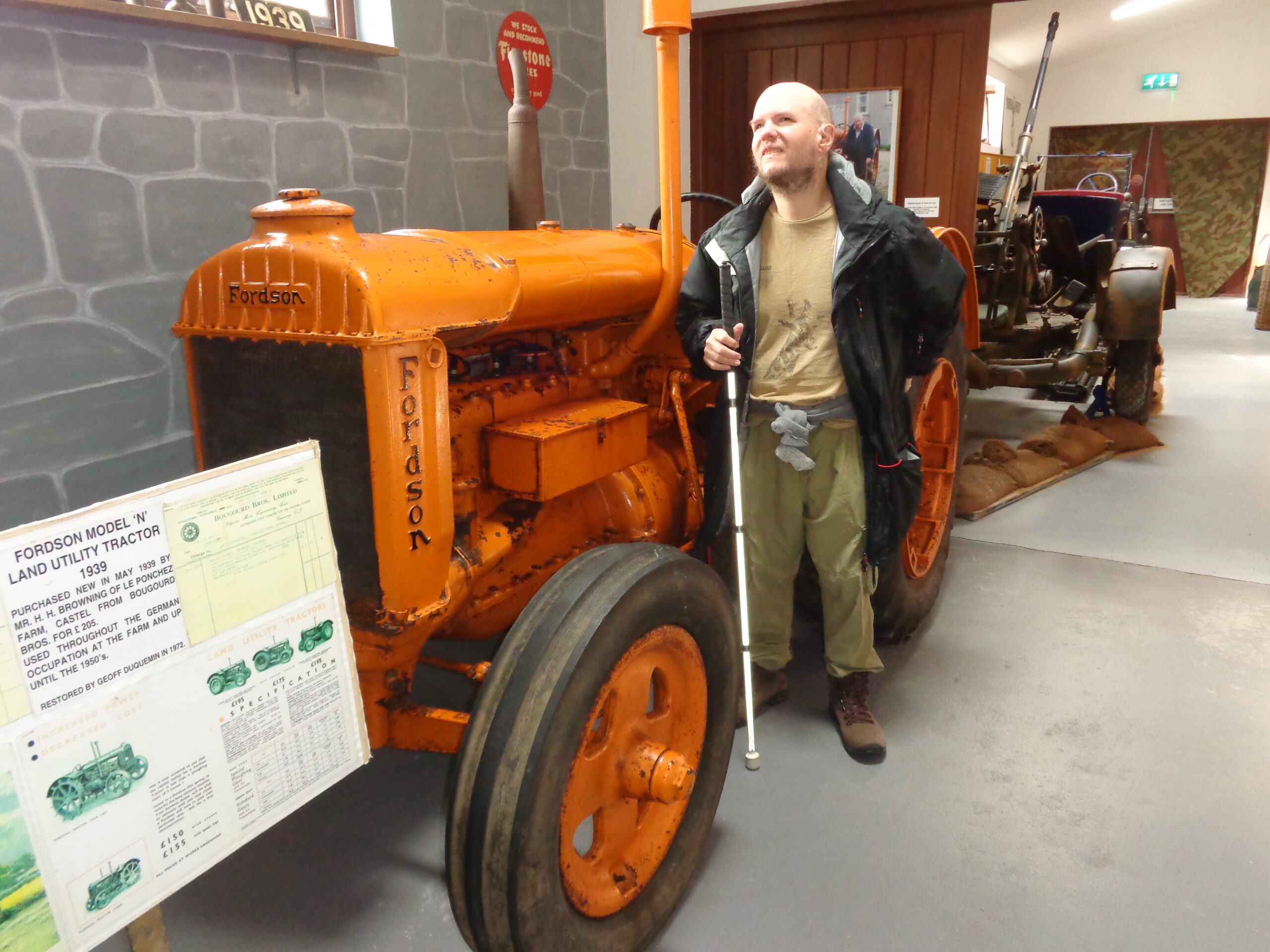
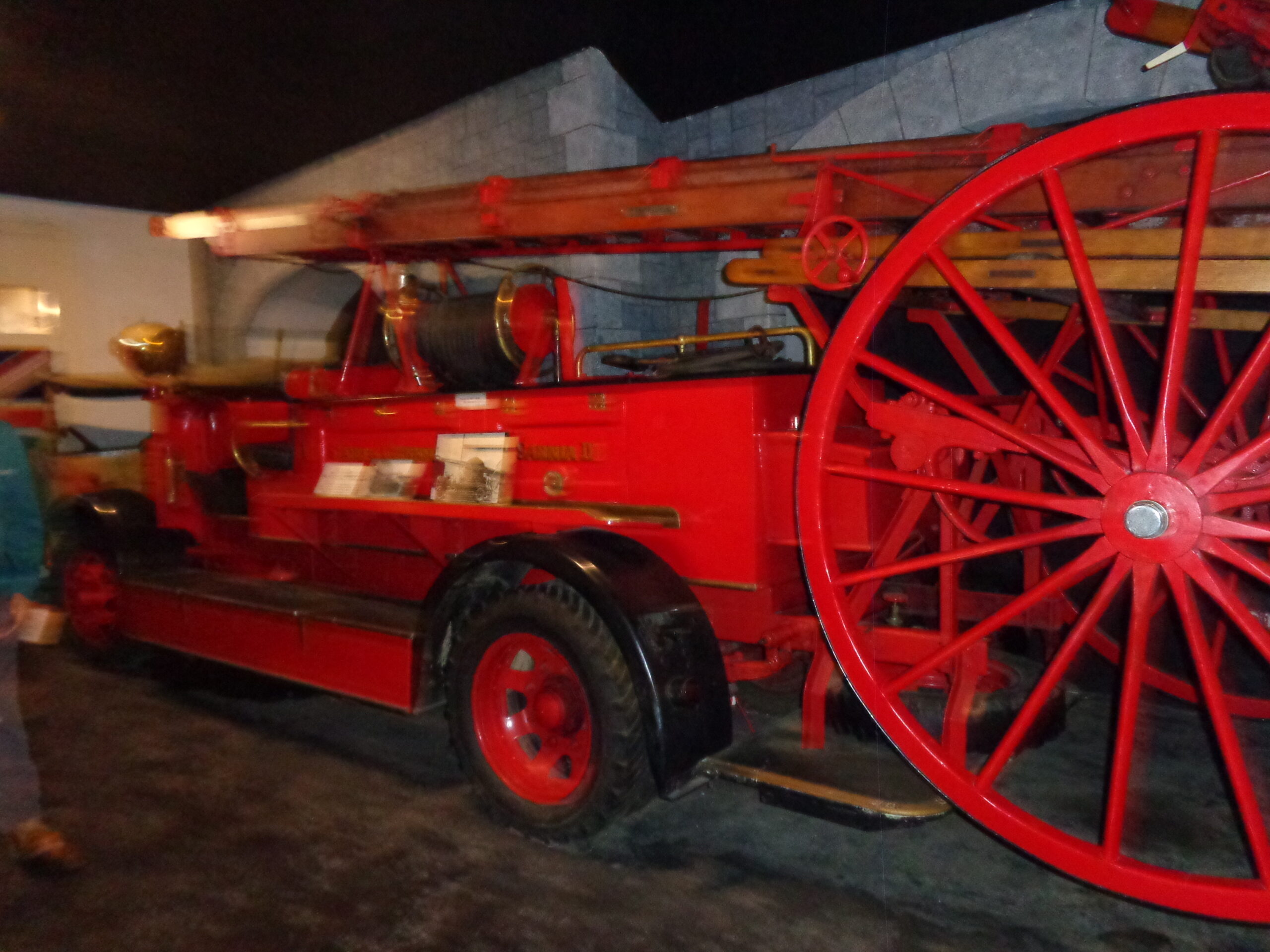
World War Two anti-aircraft gun inside the German Occupation Museum. The German Occupation Museum contains a large collection of artifacts related to the German occupation of the Channel Islands from 1940 to 1945. It is located in the south of Guernsey close to the airport.A collection of items displayed on a wall inside the German Occupation Museum. They include a one-man dinghy and paddles. According to the information board these were probably taken from a fighter plane based in Guernsey. There is also a fuel pipe and gauge tube, which were taken by islanders from a German Heinkel bomber, which crashed near Guernsey airport in 1940.A pair of German Officers’ trunks (suitcases) displayed on a wooden hand cart. There are also two black and white photos from 1944 showing a “blockhouse” built into the White Hart Hotel, St. Peter Port. This was a defensive structure to house an anti-aircraft gun.A blue Fordson tractor at the German Occupation Museum. The tractor was probably used on Guernsey before and during World War Two.Tony standing by another orange Fordson tractor. According to the information board this is a Model ‘N’ land utility tractor purchased in 1939 for £205 and used at a local farm through the German occupation and on until the 1950s.A red fire engine at the German Occupation Museum.