
Related pages
Also see Tony’s Antarctica videos here.
28th January – Ushuaia, Argentina, Beagle Channel
The Beagle Channel is a strait separating the islands of the Tierra del Fuego archipelago in the extreme southern South America. The Beagle Channel is approximately 240 km (130 miles) long and is approximately 5 km (3 miles) wide at its narrowest point. The channel is named after the British ship HMS Beagle during its first hydrographic survey of the coasts of the southern portion of South America (1826-30).
 View of the southern Argentinian city of Ushuaia from the cruise ship. The ship, called the MV Ushuaia, took Tony to Antarctica.
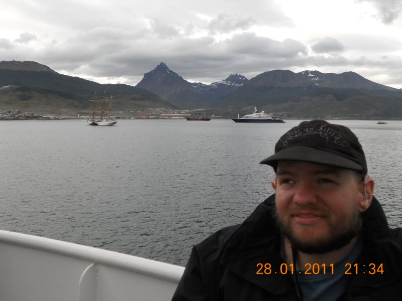 Tony on the deck of the MV Ushuaia. View of the Martial Mountains away in the distance.
29th January – Drake Passage
The Drake Passage or Mar de Hoces (Sea of Hoces) is the body of water between the southern tip of South America at Cape Horn, Chile and the South Shetland Islands of Antarctica. It connects the south-western part of the Atlantic Ocean (Scotia Sea) with the south-eastern part of the Pacific Ocean and extends into the Southern Ocean. This large body of water receives its English language name from the 16th century English privateer, Sir Francis Drake.
 Tony on the bridge of the MV Ushuaia, steering the ship!
 Tony out on the deck with the sun shining on the Drake Passage behind.
 Tony socialising with fellow passengers in the bar, two guys from Greece – a similar age to Tony.
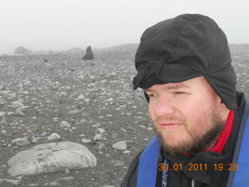
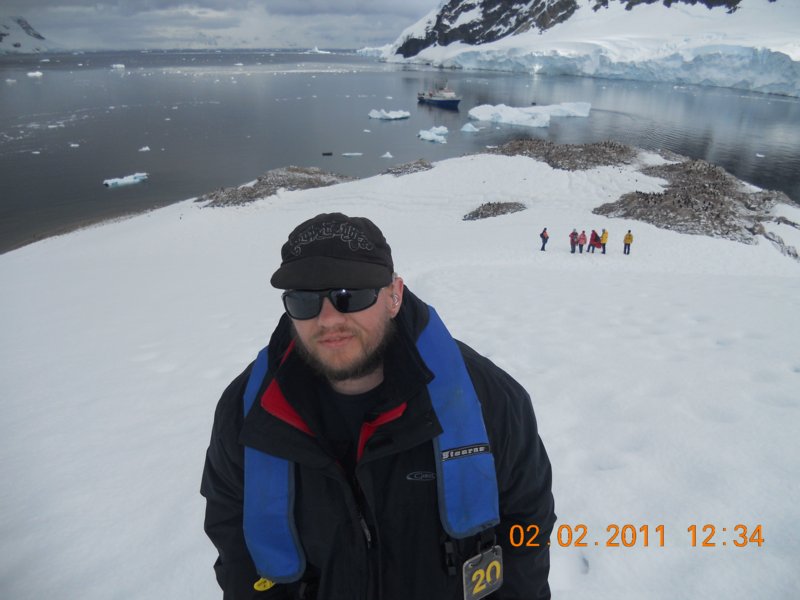
30th January – Drake Passage, Half Moon Island – South Shetland Islands
The South Shetland Islands are a group of Antarctic islands lying approximately 120 km (73 miles) north of the Antarctic Peninsula. The archipelago is comprised of 11 major islands and several smaller ones. Half Moon Island is a tiny crescent shaped island, located in the MacFarlane Strait, to the eastern end of the South Shetlands.
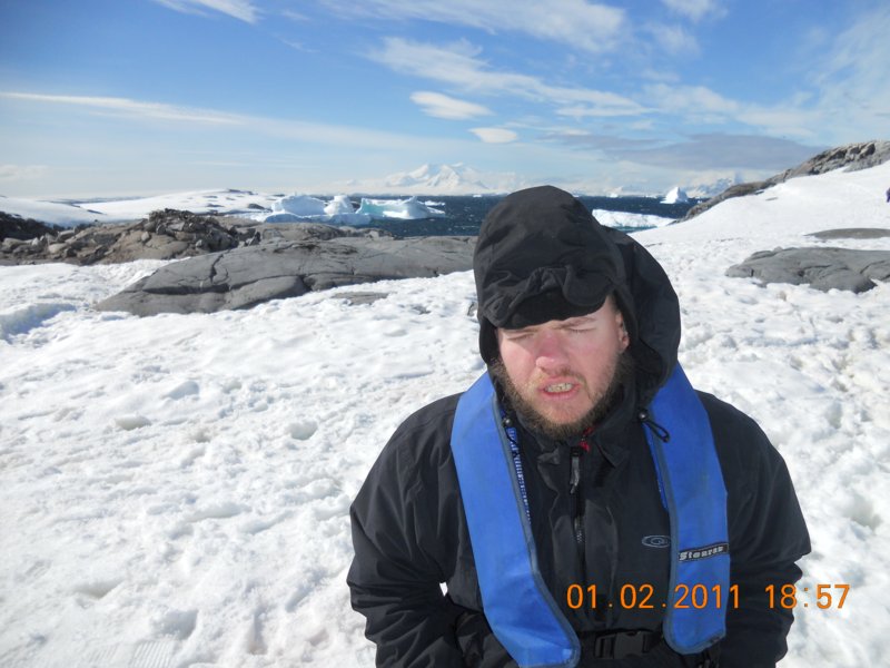
 Tony putting on Wellington boots, life jacket and warm clothing in the cabin, preparing to go to Half Moon Island.
 Tony ready to go.
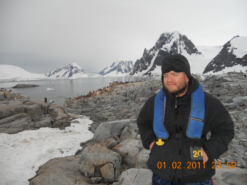
 Tony on Half Moon Island. Behind is a rocky outcrop where the penguins make their nests.
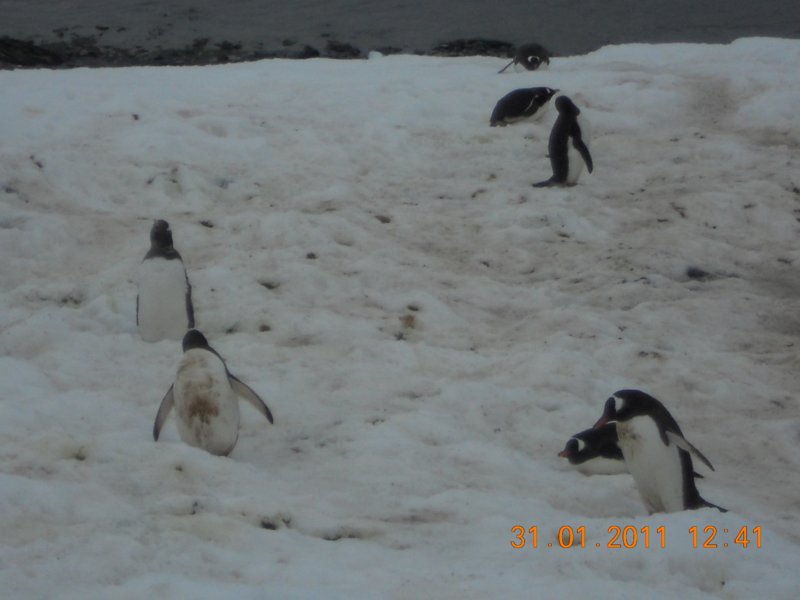
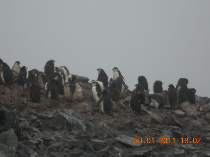 Penguins on the rocks, Half Moon Island.
 Tony with fellow passengers looking at the penguins on the rocks. The snow is a reddish colour due to the penguin poo (or possibly snow algae).
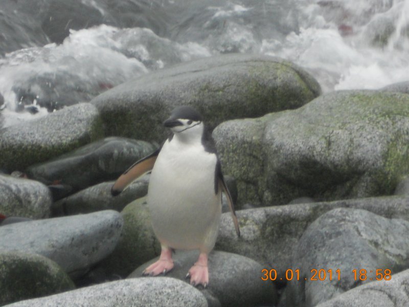
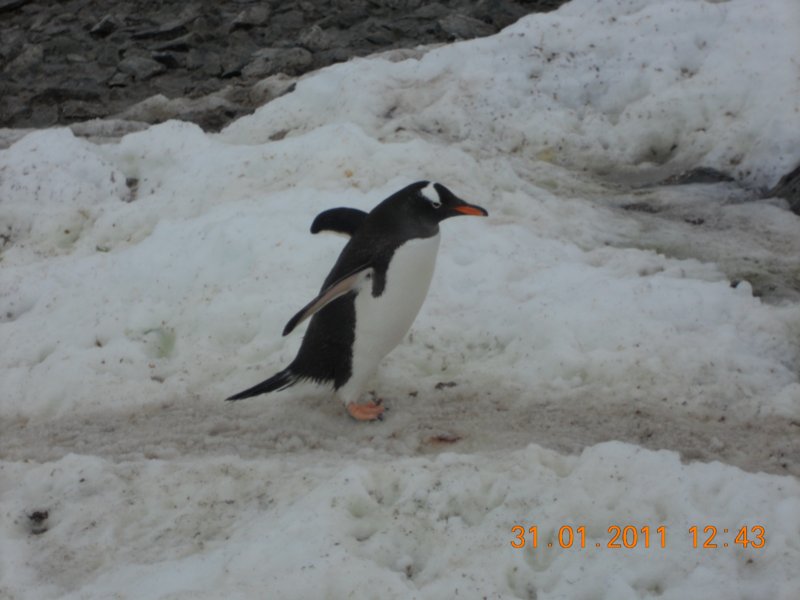
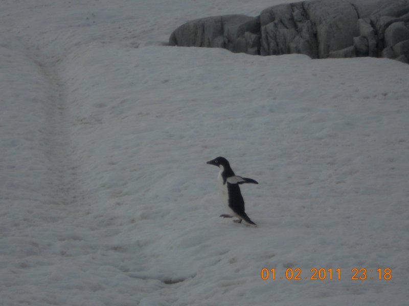
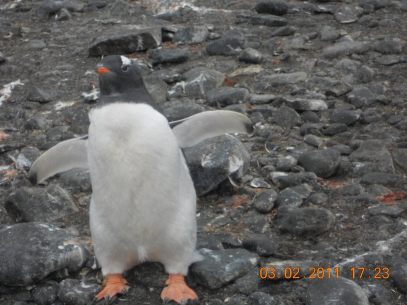
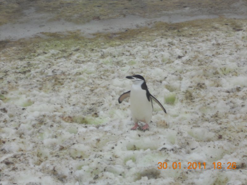 Chinstrap penguin on the ice.
 Chinstrap penguin again.
 Tony on the ice on Half Moon Island, in conversation with a fellow passenger from America.
 Tony holding a shell.
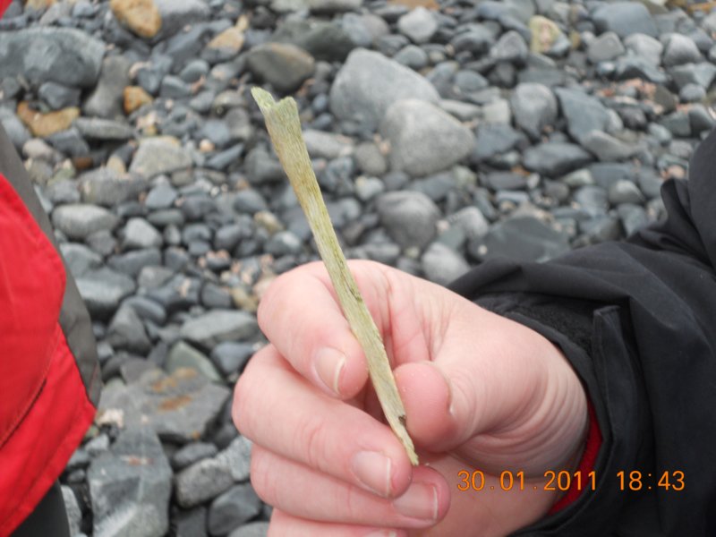 Tony holding a short piece of wood or twig.
 Tony holding a Penguin feather?
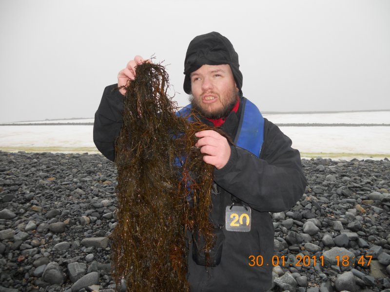 Tony holding some Antarctic seaweed.
 Chinstrap penguin on rocks by the sea.
 Chinstrap penguin again.
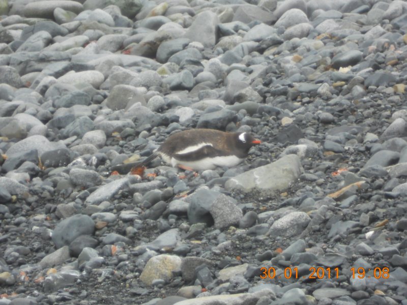 Gentoo penguin lying on a rocky beach.
 Tony on the rocky beach.
 Small hole in the ice, penguin poo around the edge.
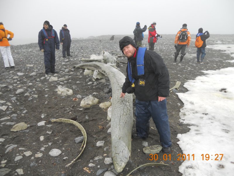 Tony touching a long and large whale bone, it is quite old and weathered.
 View of the rocky barren landscape. Tony in the foreground.
 An Antarctic fur seal.
 Tony the discoverer, holding a long curved shaped rib bone from a whale. Whale bones are found scattered over the beach on Half Moon Island.
 Tony with two fellow passengers, still holding the rib bone.
 Tony holding the same rib bone triumphantly aloft.
 A Weddell seal lying on the beach.
 A pair of seals away in the distance.
 An Antarctic skua.
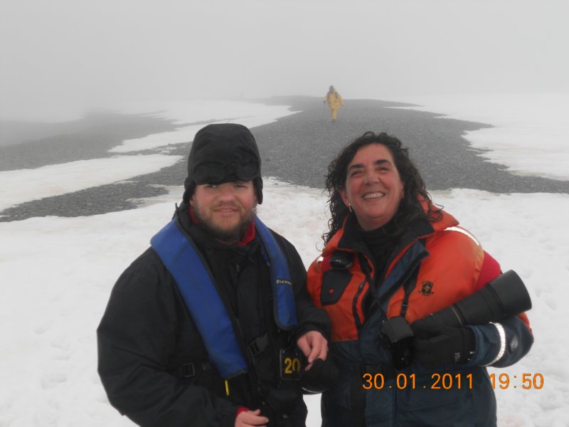 Tony on the rocks and ice of Half Moon Island with Cecilia from Argentina, one of the scientists assigned to the cruise.
 Tony with arms held aloft.
 Tony inside the Argentine scientific station, Cámara, located on Half Moon Island.
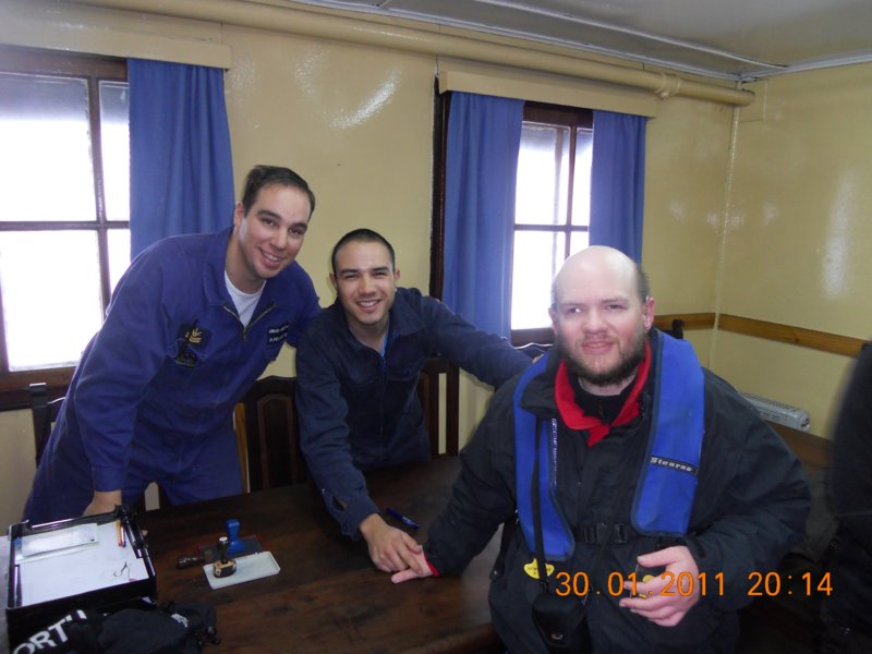 Tony with two of the Argentine scientists from the Cámara Scientific Station.
 Tony with fellow passengers and staff at the Cámara station.
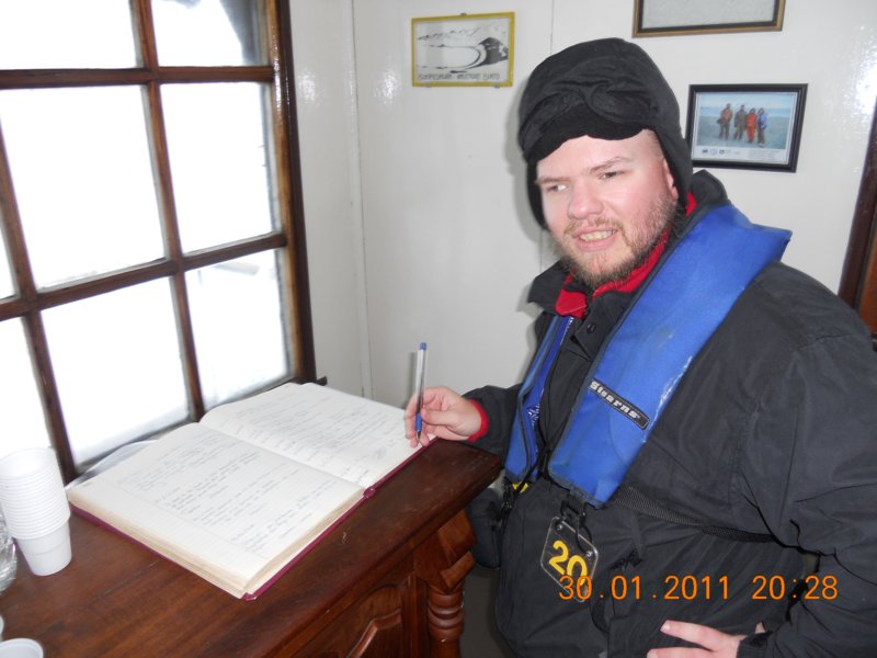 Tony about to sign the guest book.
 Tony with fellow passengers returning to the ship in a Zodiac inflatable boat from Half Moon Island.
 Side of the MV Ushuaia as seen from the Zodiac boat.
 Zodiac boat alongside the MV Ushuaia.
 Tony cleaning off penguin poo from boots and trousers on the stern deck of the MV Ushuaia.
31st January – Danco Island – Brown Station-Skontorp Cove
Danco Island (Isla Dedo) is a small Antarctic island, 1.6 km (1 mile) long. It lies in the southern part of the Errera Channel, off the west coast of Graham Land. Danco Island was charted by the Belgian Antarctic Expedition under Adrien de Gerlache, (1897-99). The island was named after Belgian Geophysicist Emile Danco, a member of the Belgian Antarctic Expedition, who died in the Antarctic in 1898.
 Tony on the deck as the ship passes along the Errera Channel. Away in the distance are rugged snow-covered islands.
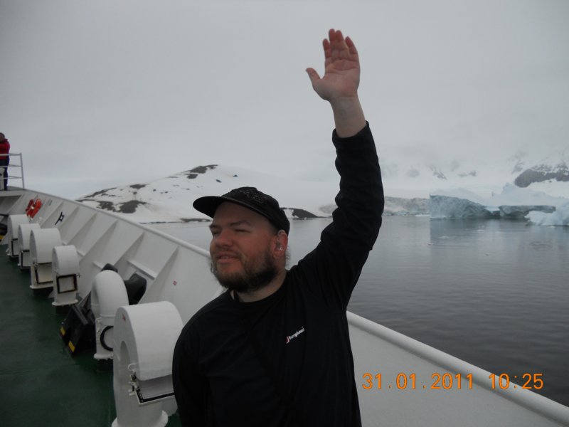 Tony waving.
 Thumbs up from Tony as the ship travels through the Errera Channel.
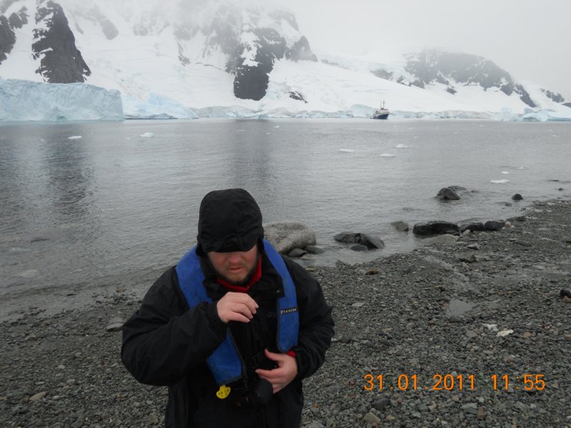 Tony on the beach on Danco Island, located in the southern part of the Errera Channel.
 Tony walking uphill from the beach through the snow on Danco island.
 On the rocks below Tony, a Gentoo penguin colony can be seen, many parents with chicks.
 A closer view of Gentoo penguins nesting on rocks.
 Tony sitting on a rock; view of the rocks and ice of the surrounding landscape.
 The MV Ushuaia anchored off Danco Island; icebergs visible behind.
 A Gentoo penguin lying on the snow.
 A small group Gentoo penguins.
 A single Gentoo penguin waddling along.
 Tony with the Gentoo penguin colony in the near distance.
 Close-up of Gentoo penguins sitting on the rocks.
 A group of Tony’s fellow passengers trekking uphill through the snow.
 Tony holding a broken penguin’s egg.
 More Gentoo penguins on the rocks and snow.
 Tony sitting on a block of ice with a female fellow passenger.
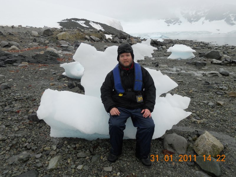
 Tony touching a washed up block of ice on the beach. These blocks of ice have fallen off a nearby glaciers and are often in interesting shapes.
 ‘Tony’s love seat’!
 Tony sitting on a different ice seat.
 Tony standing by another curiously shaped piece of ice on the beach.
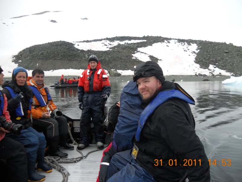 Tony with other passengers in the Zodiac heading back through the icebergs to the MV Ushuaia.
 An iceberg floating near the cliffs of Danco Island.
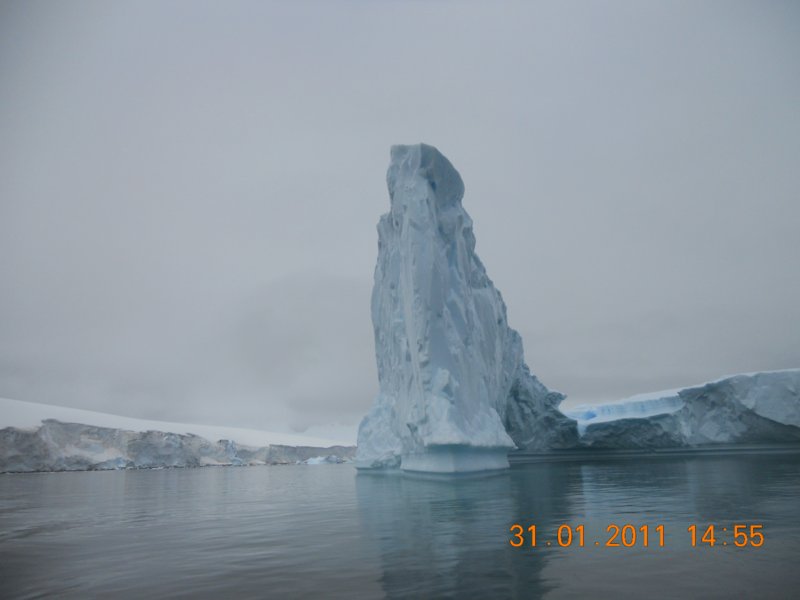 A towering pinnacle of ice seen from the Zodiac.
 Tony in the Zodiac.
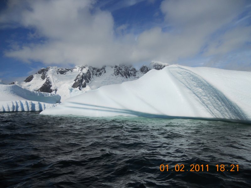
 Passing an iceberg, in colour it has a distinct bluish tinge.
 Another view of the bluish coloured iceberg.
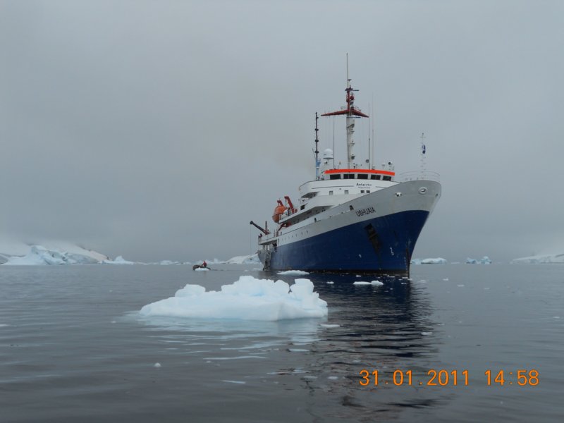 Approaching the MV Ushuaia.
 Tony by a window inside the ship.
 The ship passing a curvy-shaped iceberg.
 View from the stern of the ship – iceburgs approaching.
 An iceburg with a distinctive blue line across it.
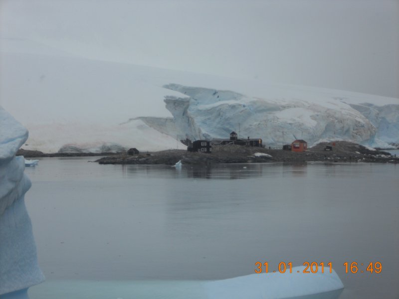 The ship approaching the Argentine scientific base, Almirante Brown, located at Paradise Bay.
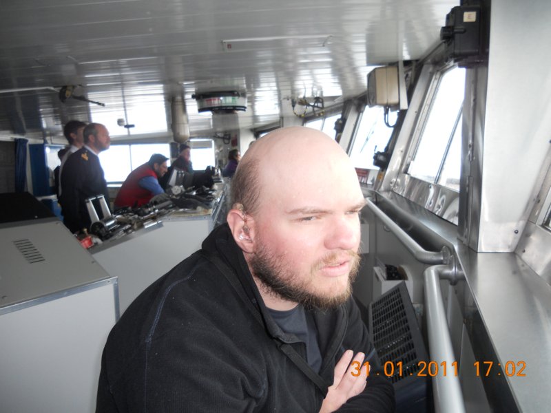 Tony looking out the window from the ship’s bridge.
 A pair of seals on a floating sheet of ice.
 View from the very front of the ship: Icebergs and the land of the Antarctic continent beyond.
 A seal on a small floating island of ice.
 Tony on the deck on the ship. The sun shining on the sea behind.
31st January (continued) – Paradise Bay (Continent)
Paradise Bay is a harbour in west Antarctica, it is one of only two ports used for cruise ships to stop on the continent, the other is Neko Harbour. Paradise Bay is situated near Danco Coast, a portion of coast on the west side of the Antarctic Peninsula. Whalers frequented this harbour, taking advantage of its sheltered waters. The Argentine scientific base, Almirante Brown Antarctic Base, is located on the banks of Paradise Bay. The scientific base is named after Admiral Guillermo Brown, father of the Argentine Navy. This base is occupied only in the summer season.
 Tony landed on the ‘White Continent’ at the Almirante Brown Antarctic Base.
 Tony outside a hut at Almirante Brown Antarctic Base. In front there is a sign post showing cities and their distances in nautical miles.
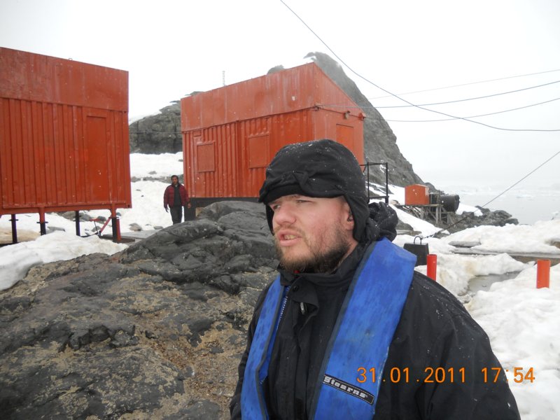 View of huts and other equipment at the Almirante Brown base.
 Tony at Paradise Bay. View of the bay and snow covered rocky cliffs beyond.
 Tony with a fellow passenger at Paradise Bay.
 Tony looking contemplative.
 Tony walking through the snow above Paradise Bay.
 Tony in a Zodiac for a ride around Skontorp Cove.
 Tony with other passengers in the Zodiac.
 Approaching a group of crabeater seals on a floating platform of ice. The ice has a pale blue tint to it.
 A closer view of the crabeater seals.
 A group of passengers looking at the seals in another Zodiac boat.
 An iceberg with striking patches of blue colouration.
 Tony in the Zodiac. Ice and a rocky cliff behind.
 Tony and a view of the sea full of small floating pieces ice and snow covered cliffs beyond.
 More crabeater seals stretched out on the ice.
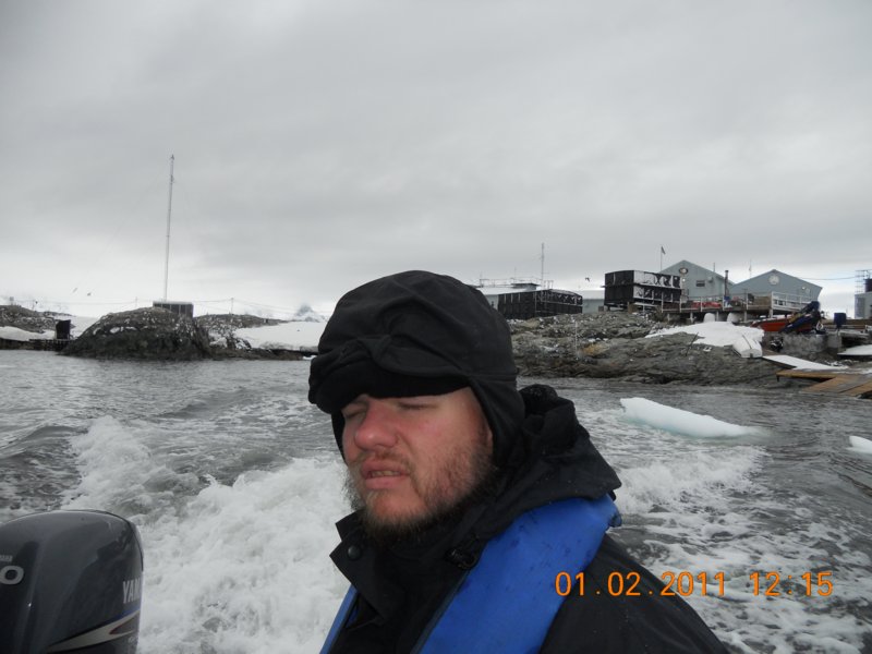
 Tony back on the deck of the MV Ushuaia.
 A Union Jack signed by many people, pinned to a wall, on the MV Ushuaia.
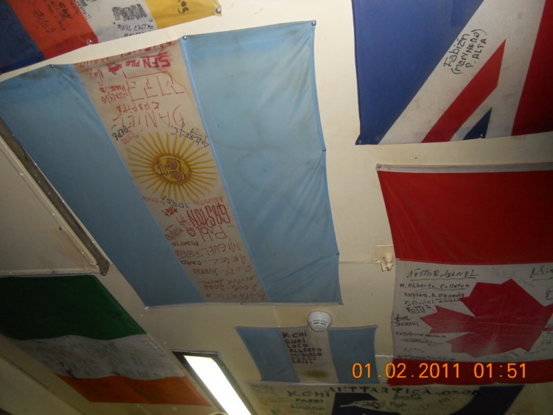 More signed flags of various countries.
1st February – Lemaire Channel, Vernadsky Station – Wordie House – Argentine Islands
The Lemaire Channel is a strait off Antarctica in between Kiev Peninsula (part of the mainland’s Graham Land) and Booth Island. The strait is squeezed by steep cliffs which hem in the iceberg filled passage, which is 11 km (7 miles) long and just 1,600 metres (1 mile) wide at its narrowest point. The channel was named for Charles Lemaire, Belgian explorer of the Congo, by Gerlache during his 1898 Antarctica Expedition.
Once across this narrow channel, which could be rough, we headed to Vernadsky Station. Vernadsky Research Base, is a Ukrainian Antarctic Station at Marina Point on Galindez Island in the Argentine Islands, Antarctica. The British established Base F in 1947 on nearby Winter Island, the main hut was named Wordie House after Sir James Wordie – a member of Sir Ernest Shackelton’s Emperal Trans-Antarctic Expedition (1914-17).
 Approaching the Vernadsky Research Base in a Zodiac.
 Landing at the Vernadsky base. The Ukraine took over the base from the British in February 1996, which was sold by the UK for a symbolic 1 pound.
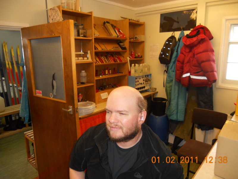
 Tony and other passengers inside a Vernadsky base building. Removing outdoor clothing.
 Tony walking along a corridor inside the base.
 Tony inside a room, looks like a laboratory.
 A seismometer.
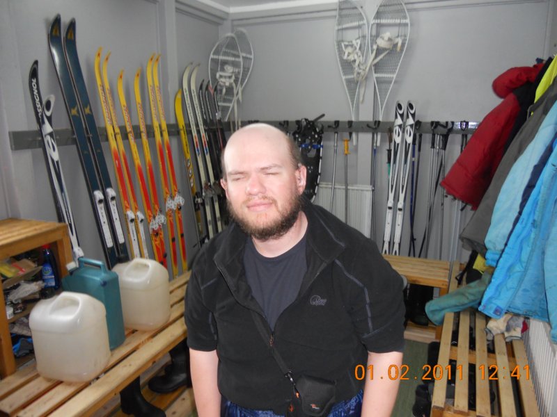 Tony in a room with skis and other outdoor equipment.
 Tony by the pool table in the upstairs lounge bar.
 Tony at the lounge bar – considered the World’s most southern bar!
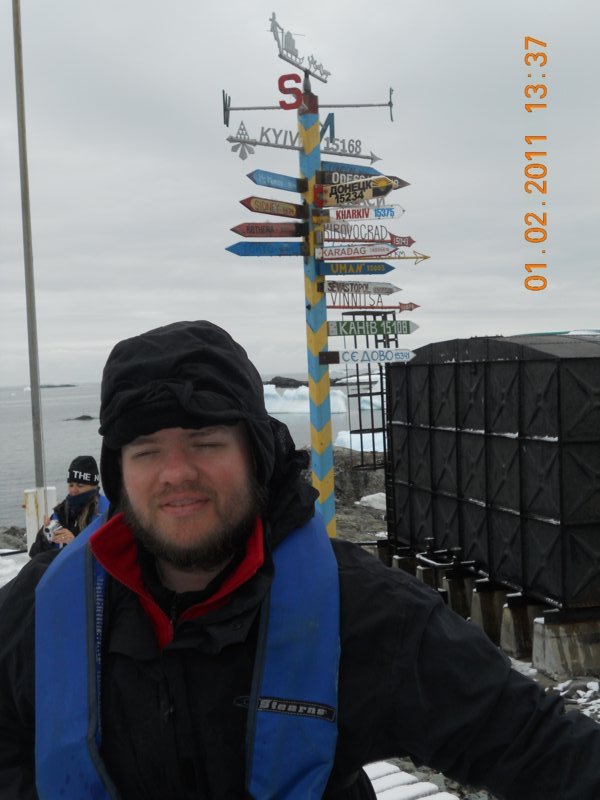 Tony by a sign post pointing to several distant cities with distances in kilometres. Many of the cities are located in Ukraine.
 Tony standing on a path at the base. There is snow piled up higher than the top of Tony’s head at either side.
 Above Tony a storage tank, part of the Vernadsky station.
 Back in the Zodiac with other passengers heading to the Wordie House.
Wordie House has been restored and is a designated Historic Site and Monument No. 62 – the base was moved to adjacent Galindez Island in 1954 where the main hut was named “Coronation House” (Queen Elizabeth II of Great Britain had only recently been crowned, hence the name). The base was later named Faraday.
 Tony outside the Wordie House.
 Tony in a restored room inside the Wordie House. Shelves with old scientific instruments.
 An old stove.
 ‘Sun Reflectant Cream’ and shoe polish on a shelf.
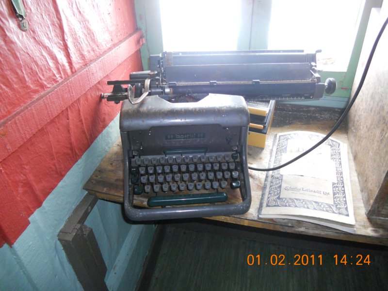 A desk with an old typewriter.
 Close-up of the desk.
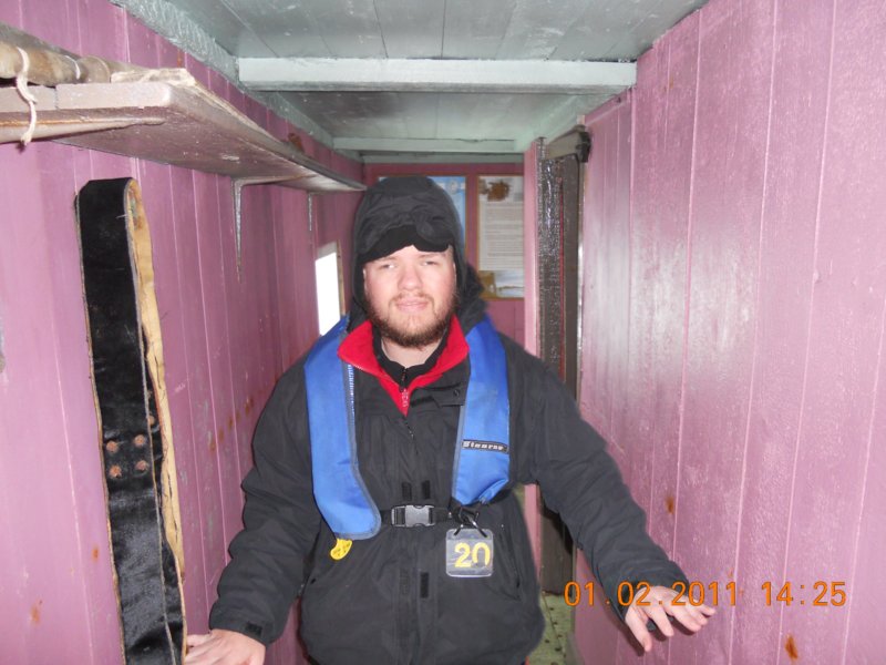 Tony in a corridor, Wordie House.
 ‘Antipoys Breathing Apparatus’.
 Restored kitchen. Tony touching a kettle on the stove.
 Old food containers on a shelf.
 Tony wearing headphones while examining an old radio transceiver.
 Old dart board.
 Bedroom with old clothing.
 Tony in a workshop or store room at the Wordie House.
 View of an iceberg with a series of blue lines running down it. Lemaire Channel.
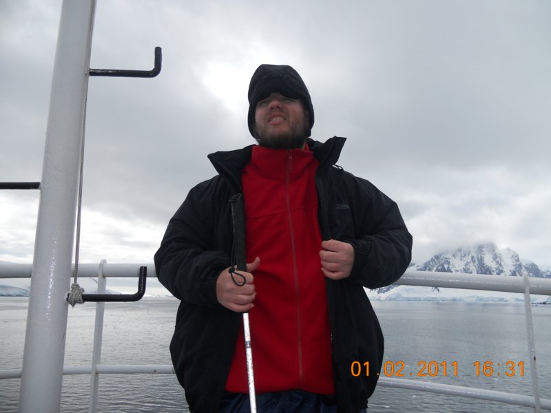 Tony back on the deck of the M.V. Ushuaia.
1st February (continued) – Iceberg Alley-Port Charcot, Booth Island
Port Charcot is a bay, 2.4 km (1.5 miles) wide, indenting the north shore of Booth Island, part of the Wilhelm archipelago. The bay was charted by the French Antarctic Expedition (1903-5) under Dr. Jean-Baptist Charcot and named by him for his father. Charcot established the expedition’s winter base at Port Charcot in 1904.
This area is often called ‘Iceberg alley’.
 Fellow passengers with Tony in a Zodiac viewing a massive iceberg, Iceberg Alley (Port Charcot).
 Another view of the iceberg.
 An enormous towering pinnacle of ice, part of the same iceberg.
 Another view of the ice pinnacle as well as other wonderful shapes weathered into the ice.
 Tony touching an iceberg.
 Another interestingly shaped mass of ice. Rugged and rocky Booth Island is visible beyond.
 A Blue-eyed Shag sitting on an iceberg.
Booth Island (Wandel Island) is a rugged Y-shaped island, 8 km (5 miles long) on the west coast of the Antarctic Peninsula, in the north-eastern part of Wilhelm archipelago. Discovered by a German expedition under Eduard Dallman (1873-74). It was probably named for either Oscar Booth or Stanley Booth or both, members of the Hamberg Geographical society at that time.
 Tony on Booth Island. He looks cold!
 Tony outside the remains of Charcot’s 1904 base. It was a well built stone magnetic hut – the penguins have now moved in!
 Tony with Cecilia from Argentina.
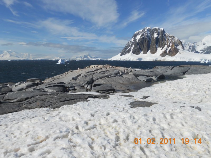 The rocky sea shore of Booth Island. Penguins can just be seen up on the rocks.
 Tony resting on a rock; a pair of Gentoo penguins can be seen on the ridge of rock alongside.
 Gentoo Penguins nesting on the rocks. A Snow Petrel can also be seen.
 More groups of Gentoo Penguins nesting on the rocks. Chinstrap and Adelie Penguins were also seen, all with chicks at different stages of the breeding cycle.
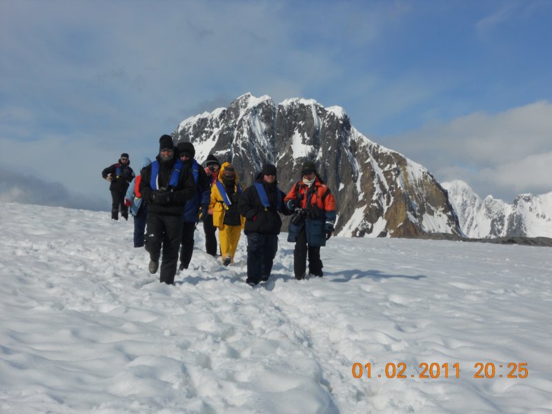 Tony part of a group walking through the snow on Booth Island.
 The M.V. Ushuaia anchored in Charcot Bay.
 Heading back to the ship in the Zodiac – icebergs floating in the distance.
 Passengers sitting on the deck of the M.V. Ushuaia. A tall rocky island can be seen in the distance, located in or near the Lemaire Channel.
1st February (evening) – Petermann Island
Petermann Island is a small island just off the west side of the Antarctic Peninsula, a short distance south of Booth Island and the Lemaire Channel. It is 2 km (1.2 miles) long. The low, round island is home to the World’s southernmost colony of Gentoo Penguins. The island was discovered by a German expedition (1873-74), who named it Petermann, after the 19th century German Geographer, August Petermann.
Photos taken in good light as the sun set.
 Approaching the rocky shore of Petermann Island: Gentoo penguins and a seal (probably an Antarctic Fur Seal) visible.
 A young Adelie penguin walking alone on the snow.
 A group of Adelie penguins.
 Tony, behind a penguin colony of the rocks (Adelie penguins and maybe some Gentoo ones too).
 A young Adelie penguin lying on the snow.
 An Adelie Penguin feeding a chick. Penguin chicks were seen chasing their parents around, begging for food due to the time of year, biologists call this ‘the beggin chase’.
 Tony on Petermann Island. Behind him a view of the rocky ice-covered coastline.
 A Gentoo penguin lying of its belly.
 Close-up of an Adelie penguin.
2nd February – Neko Harbour (continent)
Neko Harbour is an inlet on the Antarctic Peninsula, at Andvord Bay, situated on the west coast of Graham Land. Neko Harbour was discovered by Belgian explorer Adren Gerlache in the early 20th century. It was named for a Norwegian whaling boat the Neko, which operated in the area 1911-24.
 Tony and fellow passengers in the Zodiac heading to Neko Harbour.
 Tony with a group in a snow field. They are on a steep slope, heading up to a vantage point.
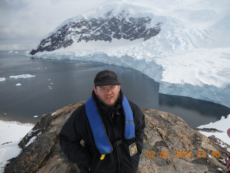
 Tony at the top of the slope overlooking the bay and glacier below.
 Tony with fellow passengers.
 Tony on the snow covered ridge. Behind him a good view across the icy sea.
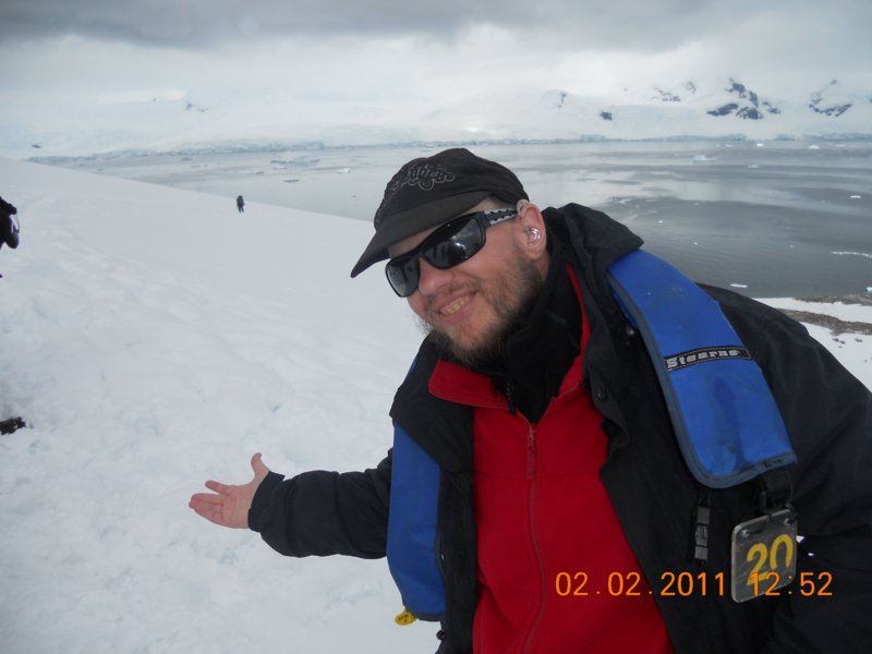 Tony gesturing: this way / after you!
 A group photo with a spectacular backdrop of the bay down below.
 Tony standing in front of a rock with another very picturesque view of the bay below.
 Tony close-up.
 Tony in the snow, falling down again!
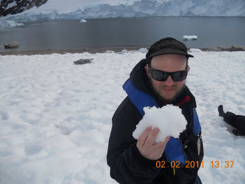 Tony holding a lump of snow.
 A Weddell seal on its back in the snow.
 A colony of Gentoo penguins on rocks above the beach, many with nests and chicks. Many of the penguins are unafraid of people and will greet groups arriving on the landing beach.
 Close-up of a Gentoo penguin with a chick.
 Tony standing on the sea shore, his boots just in the water.
 Some of Tony’s fellow passengers preparing to take a real Antarctic bath in the cold water of the bay: the sea temperature was just 1.7 degrees Celcius!
 A male passenger in the icy water.
 Tony with other passengers, watching those who had decided to take an icy dip in the water.
 The MV Ushuaia anchored in the bay.
 A few Gentoo penguins sitting on the beach.
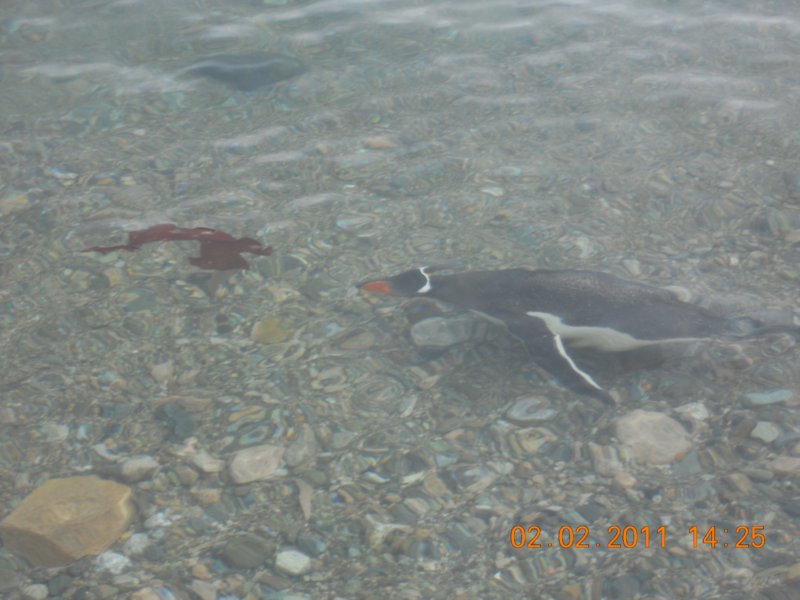 A Gentoo penguin swimming in shallow water.
 In the Zodiac returning to the ship.
2nd February (continued) – Whales in Andvord Bay
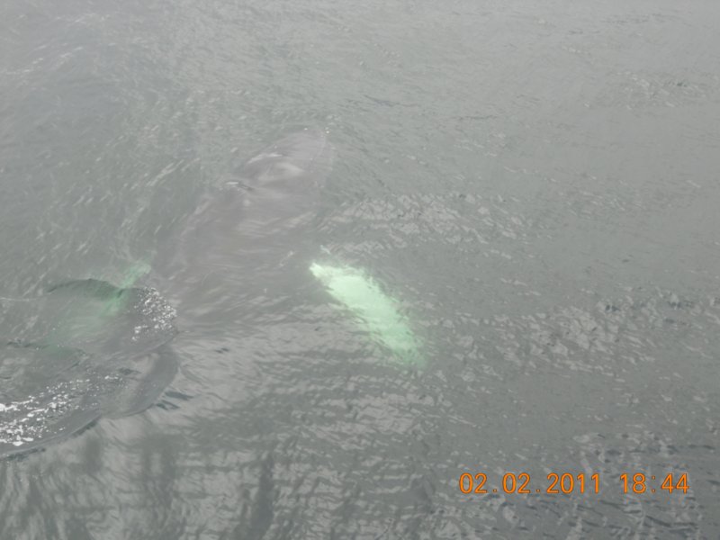
 The fin of a Minki whale viewed from the deck of the ship. Four Minki whales were seen, one of them breaching – an uncommon behavior for this species, great sound/sight.
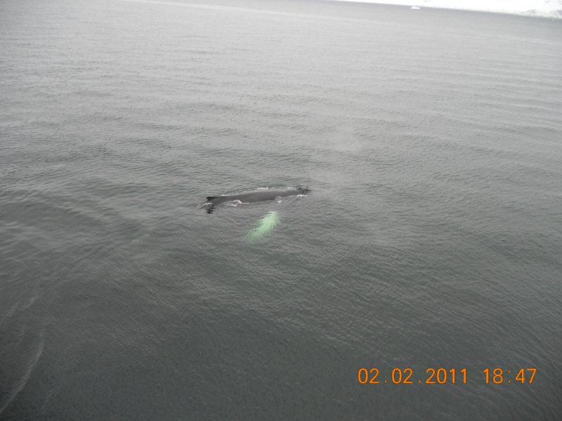
 The tail of a Minki whale.
 A Humpback whale, just below the water, very close to the ship.
 Humpback whale, still near the ship, fin and back now above the water.
 Another view of the Humpback whale.
 On the deck, looking towards the bridge. Passengers looking out for whales.
 Fellow passengers with cameras and binoculars watching the whales.
2nd February (continued) – Foyn Harbour, Wilhelmina Bay
 Zodiac cruising at Foyn Harbour: this is an anchorage site located between Nansen and Enterprise islands, in Wilhelmina Bay, off the west coast of Antarctic Peninsula. The harbour was named by whalers after a whaling factory ship, Sven Foyn, which was moored here (1921-22). Sven Voyn was a Norwegian whaler who invented the explosive harpoon in the late 19th century.
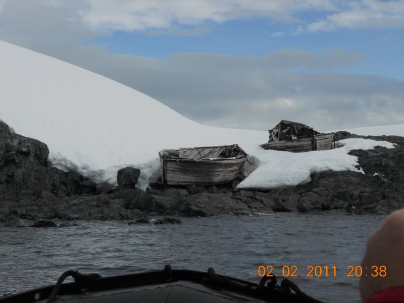 A pair of old wooden rowing boats on the rocks – seen from the Zodiac.
 The Governoren, a wrecked Norwegian whale factory ship. It was destroyed by fire (27th January 1915) during its second season.
3rd February – Telefon Bay, Deception Island
Deception Island is a ring-shaped island in the South Shetlands, off the Antarctic Peninsula, it is 12 km (7.5 miles long). It is a caldera of an active volcano, which last erupted in 1970. It has one of the safest harbours in the Antarctic.
Its last eruption caused half the volcano’s caldera to collapse, allowing the sea to rush in, creating the sheltered bay, Port Foster – approximately 9 km (5.6 miles) long and roughly 6 km (3.5 miles) wide. A narrow opening in the caldera’s walls, just 230 metres (755 feet wide) called Neptune’s Bellows, lets vessels enter the port.
 Tony on the deck of the MV Ushuaia. Next stop, Deception Island.
 Tony in Telefon Bay with two fellow passengers. Telefon is a small bay on the north-west side of Port Foster, surmounted by Telefon Ridge.
 Tony standing in front of Telefon Ridge. The ridge is made up of layers: some predominantly white with ice and others almost black due to the dark volcanic rock and sediment.
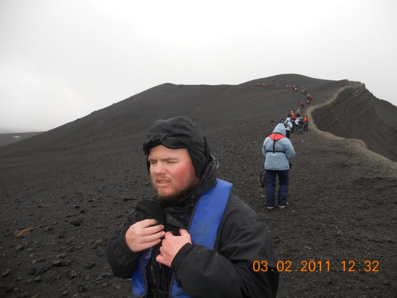 Tony following a long line of fellow passengers around the caldera ridge. A good view of the unusual dark and rocky landscape.
 Tony on the ridge; a view into the caldera below with its dark coloured rock and relatively little ice.
 A group photo with fellow passengers and MV Ushuaia crew and staff.
3rd February 2011 (continued) – Hannah Point, Livingston Island
Livingston Island is an Antarctic island in the South Shetland Islands archipelago, in western Antarctica, lying between Greenwich Island and Snow Islands. It is separated from the nearby Antarctic Peninsula by Bransfield Strait. Livingston is approximately 73 km (44 miles) long. Hannah Point is a point on the south coast of Livingston Island. Liverpool Beach is where tourists land to begin the walk through the penguins, the beach extends between Ustra Peak in the north and the tip of Hannah Point. The point is named after the British sealing vessel Hanna, wrecked in the vicinity (1820) while operating in the South Shetlands.
 Gentoo penguins and a seal on Liverpool Beach.
 Close-up of a Gentoo Penguin chick.
 Tony on a rocky beach. A group of penguins behind, predominantly noisy Chinstrap penguins hurrying about.
 A closer view of the Chinstrap penguins.
 More penguins, most are Chinstrap, but the group also encountered their 4th different penguin species – the Macaroni penguin – nesting among the Chinstrap.
Tony and the rest of the group now headed up hill on the ‘tourist walk’, a narrow path in between the large, loud penguin colony with penguin poo all around and snow and mud also on the rough, rocky ground. It was extremely windy and raining/snowing.
 A Gentoo penguin feeding a chick.
 Descending on to Liverpool Beach at the end of the walk. View of penguins and elephant seals, which were heard calling out. Nesting petrals were also encountered.
4th February – Drake Passage, returning to South America
Seabirds of the Southern Ocean were observed, including Cape Petrels, Giant petrals and Black browed albatross. No photos.
5th February – Drake Passage, mouth of the Beagle Channel
Photos taken on the Ushuaia in the dining room and later the farewell party on the lower back deck.
 Smartly dressed waiters/waitress – all from Chile.
 Tony with a lady passenger.
 Tony with Cecilia from Argentina.
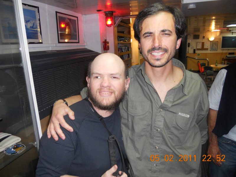
 Tony with Leandro, his Argentine guide during the cruise.
 Tony with a fellow passenger.
 Tony with a lady passenger and a waitress. The waitress’s name is Lara.
7th February – Back in Ushuaia
 Hostel Cruz de Sur foyer/reception area. Tony with Leandro his Argentine guide from the MV Ushuaia and hostel staff, Vicky and her boyfriend, the hostel manager – both are Argentinian.
Also see Tony’s Antarctica videos here.